BOU AVENUE
Mount Charles Stewart SE2
On 17 August 2025, Rafal (Raff) Kazmierczak
invited me to join him for a sufferfest ascending Mount Charles Stewart's
southeast outlier, SE2, near Canmore, Alberta. Raff probably got
the idea for this trip from either
Devan Peterson or
Ephraim Roberts who separately scrambled up the outlier earlier in
the spring. Although technical difficulties are few, the ascent
entails a long approach via Cougar Creek and a soul-sucking grovel up a
steep gully on the south side of the outlier. Admittedly, I did
zero research for this trip and had no clue about length or elevation
gain. Raff estimated that it would probably be about a 10-hour day,
but he also neglected to take into account that he was dragging my sorry
old butt with him! In any case, I welcomed the opportunity to spend
a long day catching up with Raff since we had not done an outdoor trip
together in quite some time.
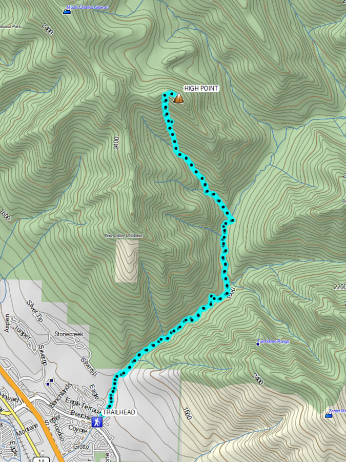
Starting from the Cougar Creek trailhead
(51.08664, -115.32649), Raff and I hiked the wide trail along the creek
for about a kilometre before climbing over a dam that was constructed in
the wake of the historic floods of
2013. On the far side of the dam, we settled into a long and
often tedious walk up Cougar Creek which included numerous annoying
crossings and a lot of the same monotonous scenery. About four
kilometres past the dam, we turned left to go up a side drainage with
much of the same characteristics as Cougar Creek but drier. We
eventually reached a split where we veered right and began climbing a
gully which is deceptively steeper than it appears. The gully rises
about 600 vertical metres--nearly half the elevation gain of the entire
trip--in a little over a kilometre. Raff was much more adept at
scrambling up the loose rubble here than me, and he seemingly zoomed
right up the gully without breaking a sweat. To be honest, I am
probably getting a little long in the tooth for this sort of scrambling
by brute force, and as such, it took me a good three hours to muddle my
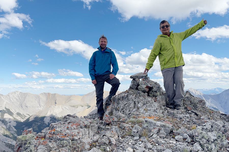
way up the gully. By the time I topped out at a high col, I was
pretty spent and could barely keep my balance as I plodded up the
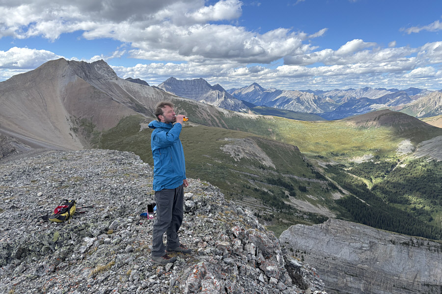
remaining easy terrain to the high point of the outlier. Raff had
already been waiting patiently there for quite awhile, but despite the
lateness of the day, he was not in any hurry to descend and allowed me to
take a half-hour break to recharge myself.
When we finally commenced our descent, Raff
and I simply backed out the way we came. The gully had a few
sections we could surf, but mostly it was just a long, knee-jarring
stumble down ankle-breaking rubble--not fun! Once we returned to
the split, we could relax a little since we had put the worst part of the
whole route behind us, but that did not make the remainder of the descent
any shorter or less tedious. As we descended the rest of the side
drainage, it felt like it would never end. The subsequent march out
Cougar Creek was similarly long-winded, and although our growing fatigue
certainly slowed us, I think we were a little more efficient with all the
creek crossings on the way out. After stumbling back to Raff's car
at the trailhead in the dark, we drove to the A&W in Canmore for a late
dinner before heading home.
A big dziękuję bardzo goes out to
Raff for doing all the driving on this day.
 |
Raff approaches the new dam which is
supposed to mitigate future flooding along Cougar Creek. |
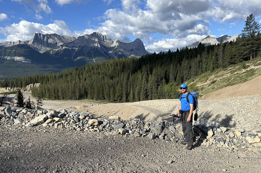 |
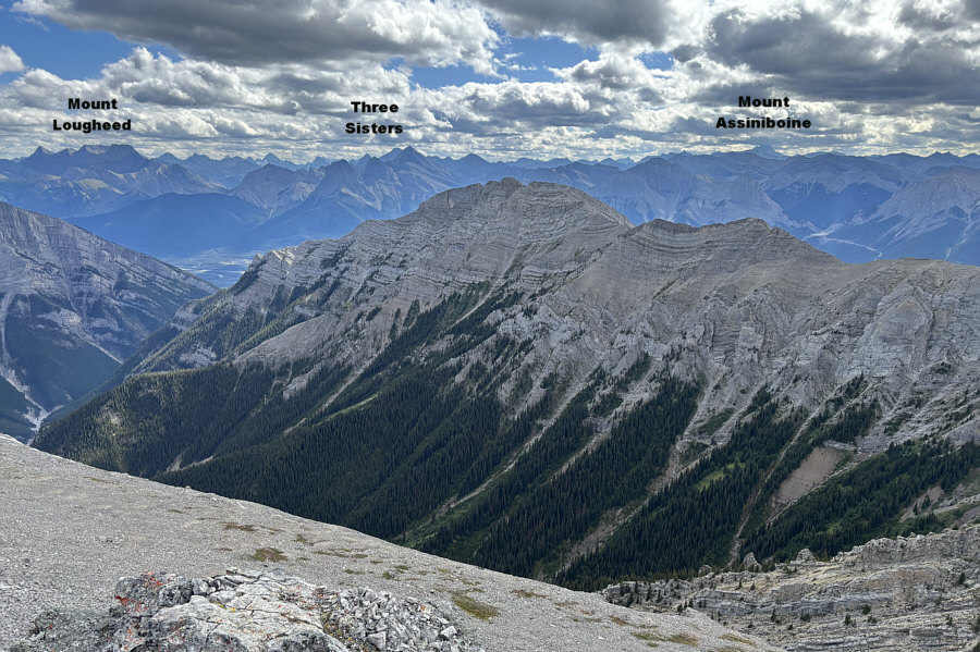
On his way up the dam, Raff is
enjoying the view of familiar peaks across the Bow Valley. |
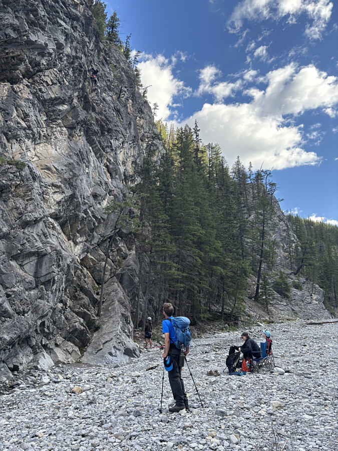 |
Raff pauses to watch some rock
climbers scale a cliff. |
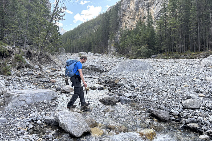 |
Continuing up the canyon requires
multiple crossings of Cougar Creek. |
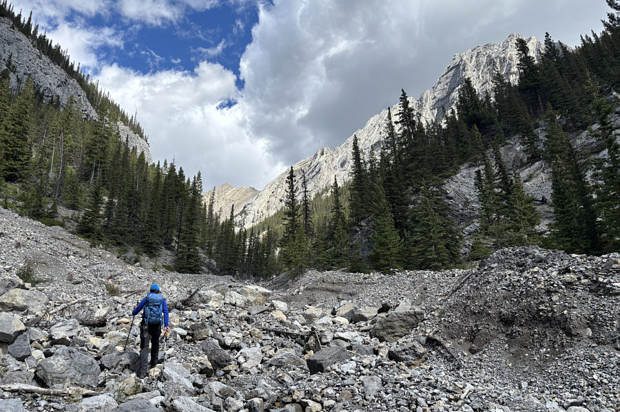 |
A little more than five kilometres
from the trailhead, Raff turns left to go up a side drainage. |
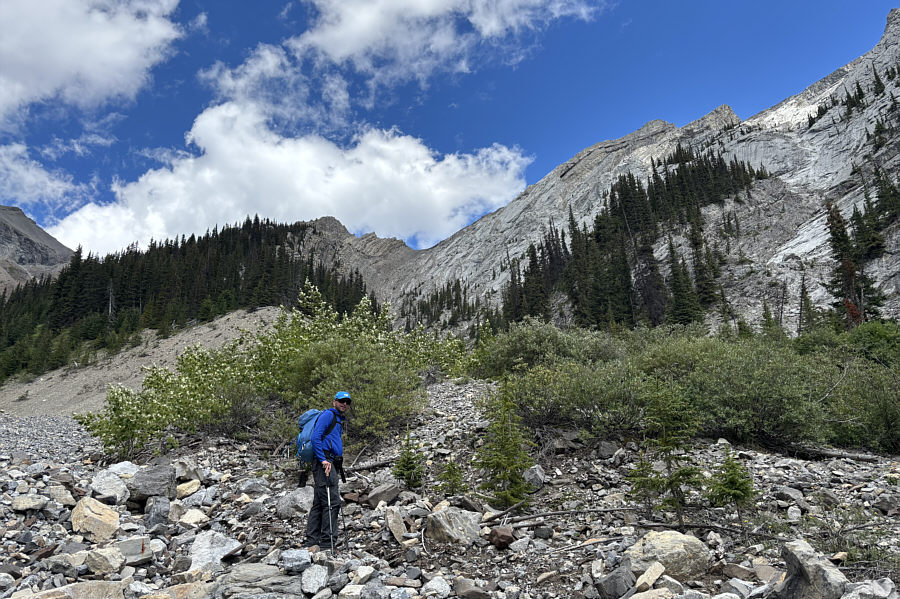 |
Raff takes the right-hand gully at a
split about 1.7 kilometres up the side drainage. |
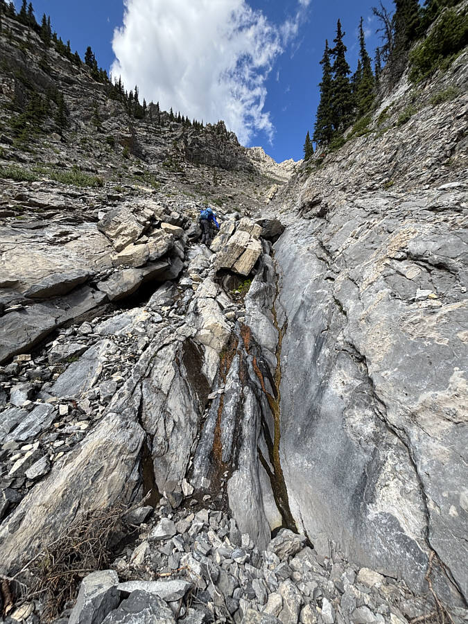 |
Raff scrambles up some water-worn
slabs as the gully gets steeper and begins to narrow. |
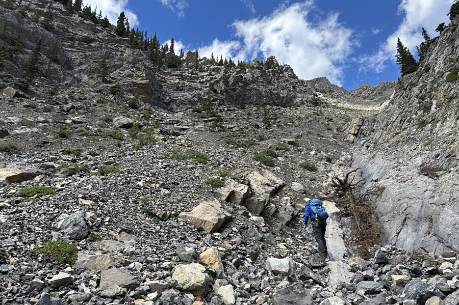 |
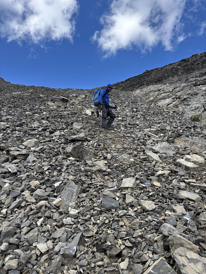
Raff begins ascending the steepest and
loosest part of the gully. At this point, there is still
another 500 metres of elevation gain remaining in the ascent. |
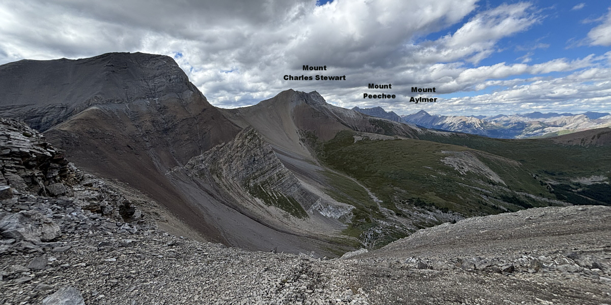
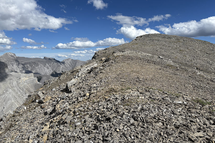
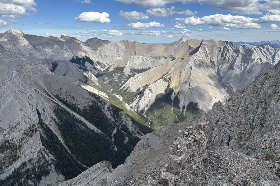
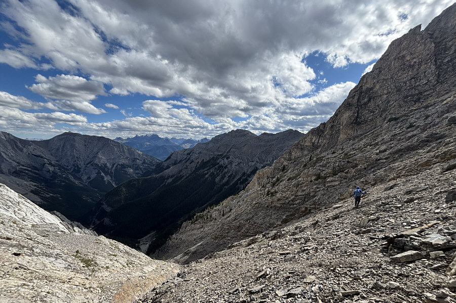
The col at the top of the gully grants far-reaching
views to the north.