BOU AVENUE
High Noon Hills And Sandy McNabb Hills

On 22 March 2025, Kevin Caron, Shelley Milutinovic, Zosia Zgolak and I hiked both High Noon Hills and Sandy McNabb Hills located in, respectively, Alberta's Kananaskis Country Public Land Use Zone and Bluerock Wildland Provincial Park.  Both sets of hills are unofficially-named but make for great hiking objectives especially during winter or shoulder season since the area typically does not get a lot of snow.  Multiple hiking routes are described in Gillean Daffern's Kananaskis Country Trail Guide, but we also drew some of our inspiration from Bob Spirko's eventful 2017 trip report.  Our plan was to do a big clockwise loop by going over High Noon Hills first followed by a traverse of Sandy McNabb Hills.

Starting from the Sheep River Administration & Information Centre's parking lot (50.63842, -114.50336; toilets available), Kevin, Shelley, Zosia and I walked eastward along the shoulder of Highway 546 for about 1.3 kilometres to an unmarked pullout for High Noon Hills.  We abandoned the highway here and soon made a left turn after passing through a fence opening.  We immediately picked up a good trail which climbs gently up the west end of High Noon Hills.  This trail led us past a viewpoint with a bench to a similarly scenic high point on a grassy hilltop.  This hilltop is the highest of the High Noon Hills that is open to public access.  As noted by Spirko in his 2016 ascent of High Noon Hills, there is a slightly higher hill to the east, but its high point sits on private property and is technically off limits unless access permission is obtained from the landowner.  Regardless, we were quite content to enjoy the fine views from the grassy hilltop without visiting the higher hill to the east.
Watch out for passing cars! 
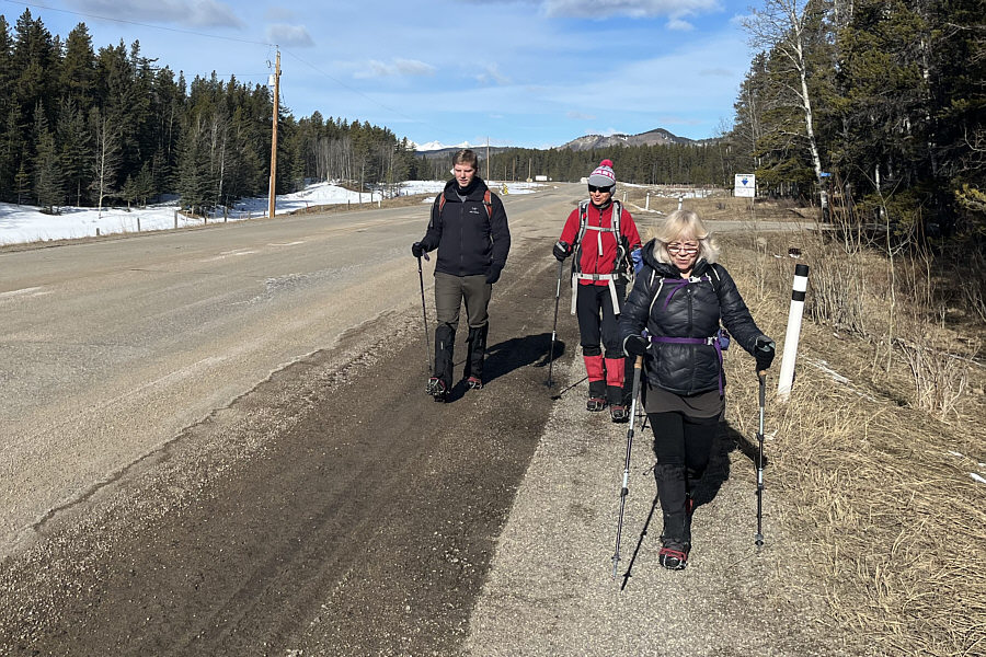
Kevin, Zosia and Shelley start the trip by hiking along the shoulder of Highway 546.
With more snow, this would be a nice ski slope! 
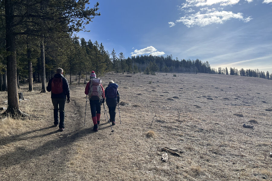
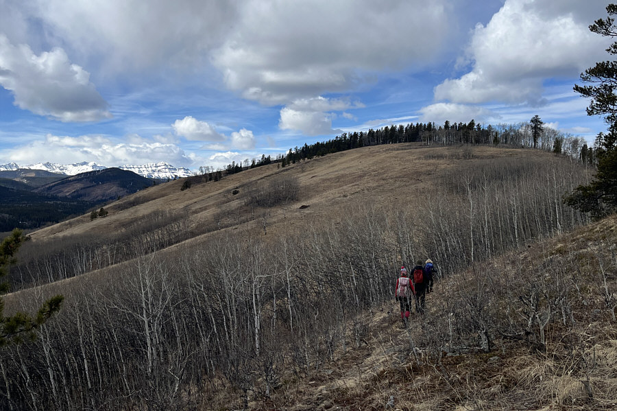
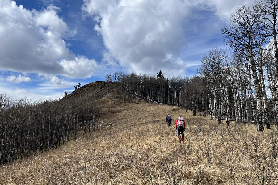
After leaving the highway, the group follows a good trail up the west end of High Noon Hills.
It's about a 30-minute walk from the highway to get here. 
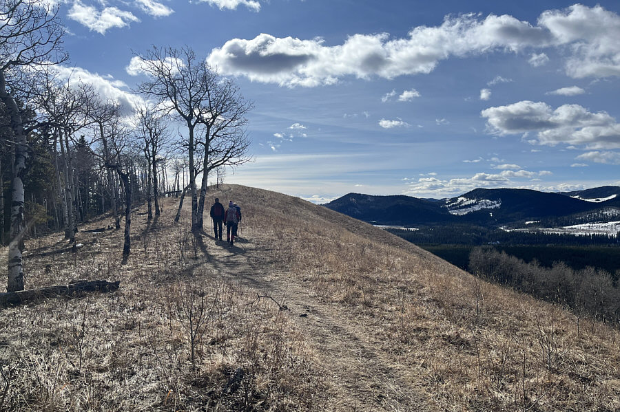
The good trail ultimately leads to this grassy hilltop.
Highest point of the hike already!

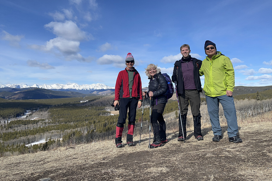
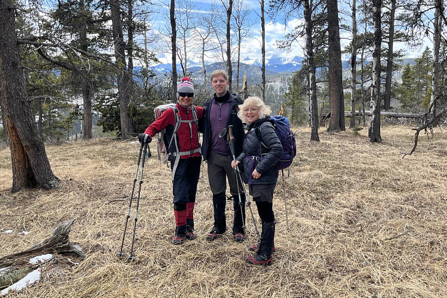
Zosia, Shelley, Kevin and Sonny stand on the grassy hilltop (1518 metres) which is the highest of the High Noon Hills that is completely accessible to the public.

After a brief stop on the grassy hilltop of High Noon Hills, Kevin, Shelley, Zosia and I descended the continuation of the trail to the south.  We soon arrived at a T-intersection, and I made a navigation error here by taking the right-hand trail which would have led us inadvertently back to the highway.  Fortunately, we did not go far before I realized my mistake, but instead of backtracking to the T-intersection, we basically went off-trail and dropped down into the valley bottom to cross Long Prairie Creek.  We had some trouble climbing up a steep and slippery embankment on the south side of the creek, but once we got past this obstacle, the terrain flattened out considerably.  Despite some lingering snow and a couple of annoying barbed wire fences, off-trail travel was generally easy as we made our way through forest to the southwest.  We eventually popped out of the forest onto an open grassy bench overlooking Sheep River, and we decided to stop here for an extended break.  Just as we were making ourselves comfortable, a large group of equestrians arrived, and we chatted at length with them while admiring their docile steeds.

When we resumed hiking, Kevin, Shelley, Zosia and I headed westward along the open bench, but we somehow missed the turnoff to climb up Sandy McNabb Hills and ended up on a bypass trail.  Once again, it was easy enough to make a course correction, and we simply climbed straight up an open slope to connect with the correct trail that runs more or less along the crest of the ridge comprising Sandy McNabb Hills.  We actually had to leave this trail to tag the true high point which is disappointingly nestled in trees.  Continuing beyond the high point, we went over a subsidiary bump and then dropped down into a dip before climbing one last hill at the west end of Sandy McNabb Hills.  There was a man who was sitting atop this last hill for so long that we had speculated from afar that perhaps he was either a cairn, a bench or some wild animal.  We had a nice long chat with the man before leaving him in peace and retreating to the dip.  From there, we turned north and easily followed a series of cross-country ski trails back to the highway where we only had to walk a short distance on pavement to finish our loop.
See any Prussian carp? 
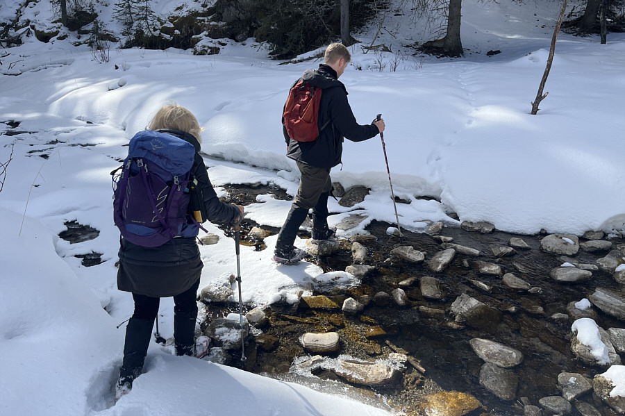
Shelley and Kevin carefully rock-hop across Long Prairie Creek.
I miss all-you-can-eat ribs at Tony Roma's! 
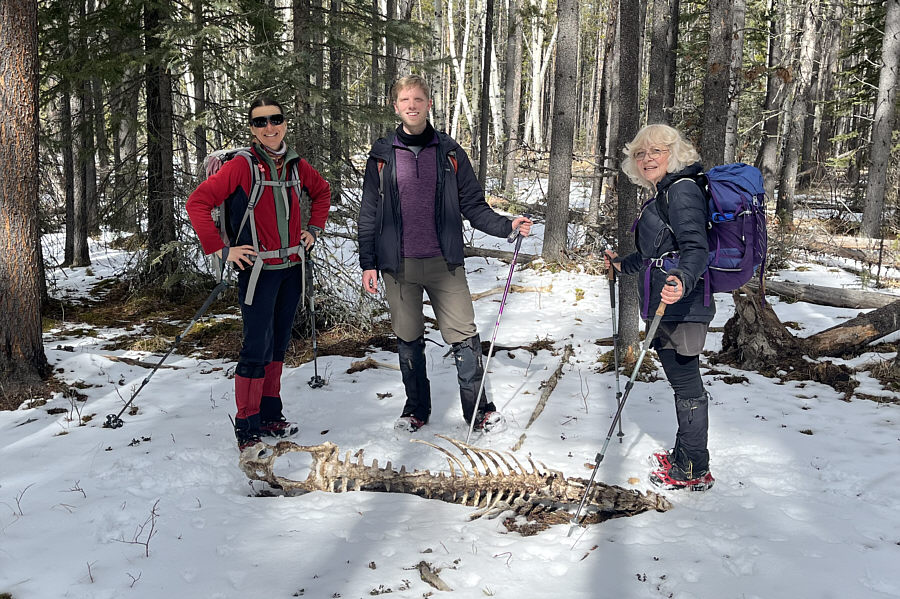
The group stumbles across the carcass of some ungulate.
Need a hair cut? 
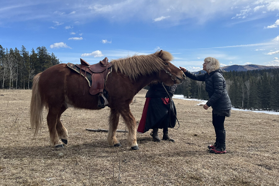
Shelley pets a friendly Icelandic horse.
Watch your step--lotsa cow patties here! 
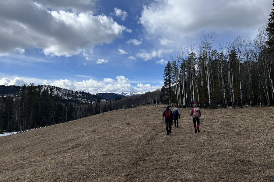
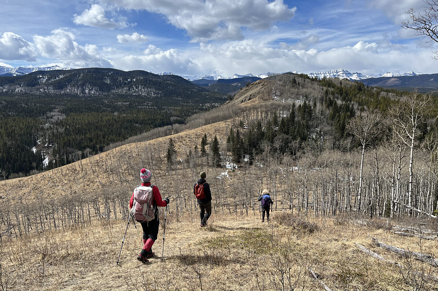
The group turns westward along an open bench.
More potential ski slopes here...if only there was snow! The group approaches the highest point of Sandy McNabb Hills.
Meh...another mostly viewless foothills high point. 
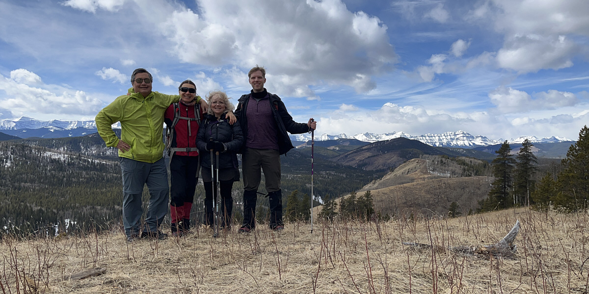
Zosia, Kevin and Shelley stand on the approximate high point (1515 metres) of Sandy McNabb Hills.
 

Now that's more like it!

There are better views from this subsidiary bump located about half a kilometre west of Sandy McNabb Hills' high point.


How do you like Zosia's cool toque? The group drops into a dip before climbing up the last hill of the day.
What's on top of the last hill--a cairn, a bench, an animal, a person, or Bigfoot? The group ascends the final section of ridge before the top of the last hill.
Thank you anyway, Zosia! 
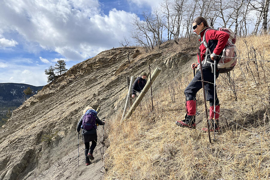
While Zosia holds apart the barbed wire, Shelley and Kevin decide to simply walk around the end of the fence.  Note the man sitting at the top of the hill.
 

We've come a long way, baby!

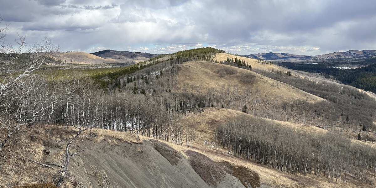
This is looking eastward from the last hill toward the rest of Sandy McNabb Hills (centre) and High Noon Hills (distant left).


Well done, everybody! 
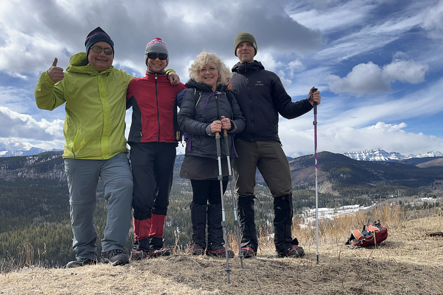
Sonny, Zosia, Shelley and Kevin pose atop the last hill.
A most enjoyable loop hike! 
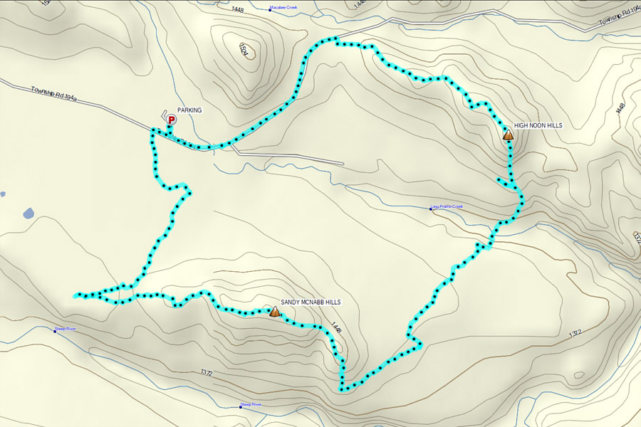
Total Distance:  9.7 kilometres
Round-Trip Time:  5 hours 1 minute
Cumulative Elevation Gain:  277 metres

GPX Data