BOU AVENUE
Mickinnick
Zosia Zgolak and I hiked up an unnamed hill
located just northwest of Sandpoint, Idaho on 22 December 2025.
Probably because the popular
Mickinnick
Trail climbs most of the way up,
peakbagger.com
has attributed to the hill the unofficial name "Mickinnick". While
the Mickinnick Trail is well-documented online, I could find no
information--even from peakbagger.com--regarding the last hundred metres
or so of ascent from trail's end to the hill's actual high point.
As far as I could tell from satellite imagery and topographical map data,
the terrain near the top did not seem to be technically difficult, but we
would not know for sure until we got there.
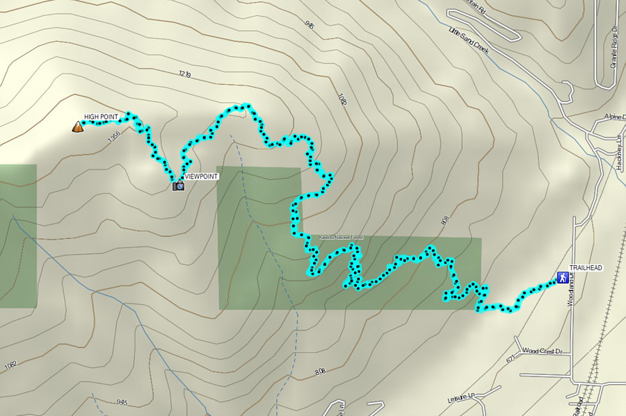
From the signed trailhead (48.31082,
-116.56842), Zosia and I followed the well-maintained Mickinnick Trail
which starts with a preliminary flat section before rising steadily up
the eastern slopes of the hill via seemingly endless switchbacks.
While the climb was pleasantly gentle, the trail did feel a bit
long-winded at times. As we climbed higher, we encountered
increasing amounts of snow courtesy of a fresh dump just the night
before, but thankfully, the trail was already mostly broken for us by
previous hikers. It took us about three hours to reach trails end
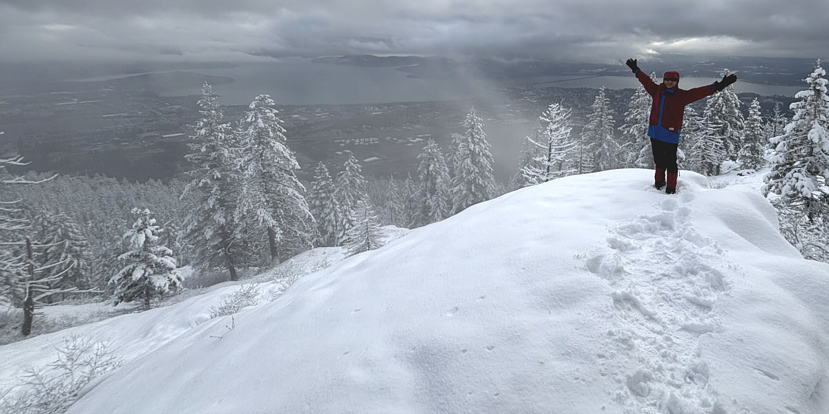
which is marked by a scenic viewpoint and bench, but from there, we were
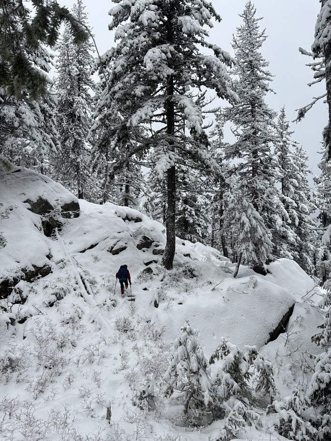
on our own to find a way up to the high point. Behind the bench, we
followed what appeared to be a beaten path, but it was hard to tell under
calf-deep snow. The remainder of the ascent was a real adventure in
route-finding as there are some big rock outcrops to circumvent and a few
annoying dips to get across. We lost the beaten path a few times
only to find it again later, but for the most part, we simply tried to
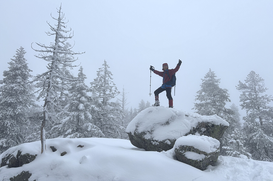
keep moving to whatever looked like higher ground. The actual high
point is on a large boulder in a glade, and scrambling up it was a bit
awkward because of the snowy conditions.
With little reason to linger after tagging
the high point of Mickinnick, Zosia and I promptly retraced our steps
down the hill. A few steep sections required some care to descend,
but otherwise, we did not have much trouble backtracking to the bench at
trail's end. From there, we settled into a long but uneventful walk
down Mickinnick Trail and eventually made it back to the trailhead by
sunset.
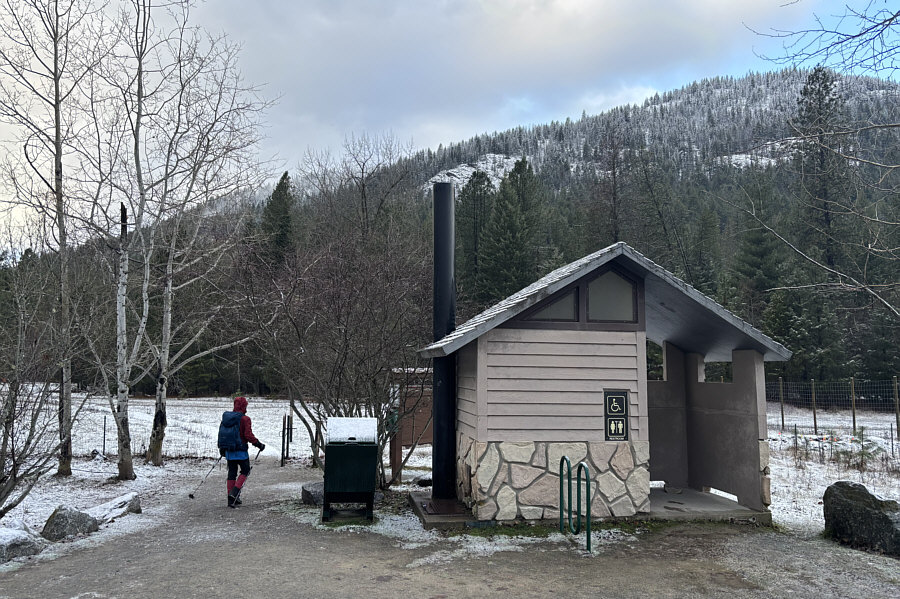 |
Zosia passes a vault toilet at the
trailhead with "Mickinnick" visible in the background. |
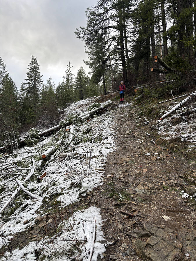 |
Despite some overnight precipitation in the area, the lower parts of
Mickinnick Trail are still relatively snow-free. |
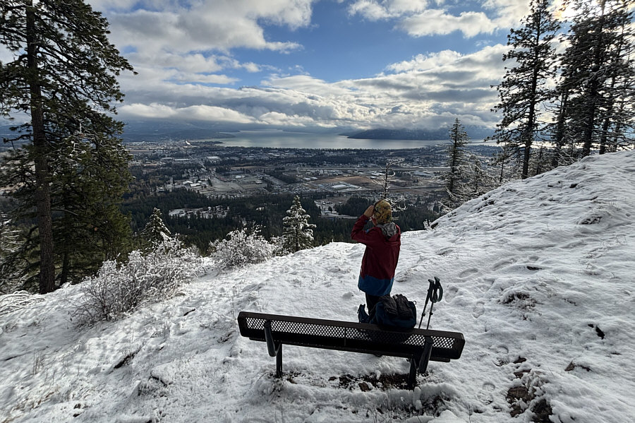 |
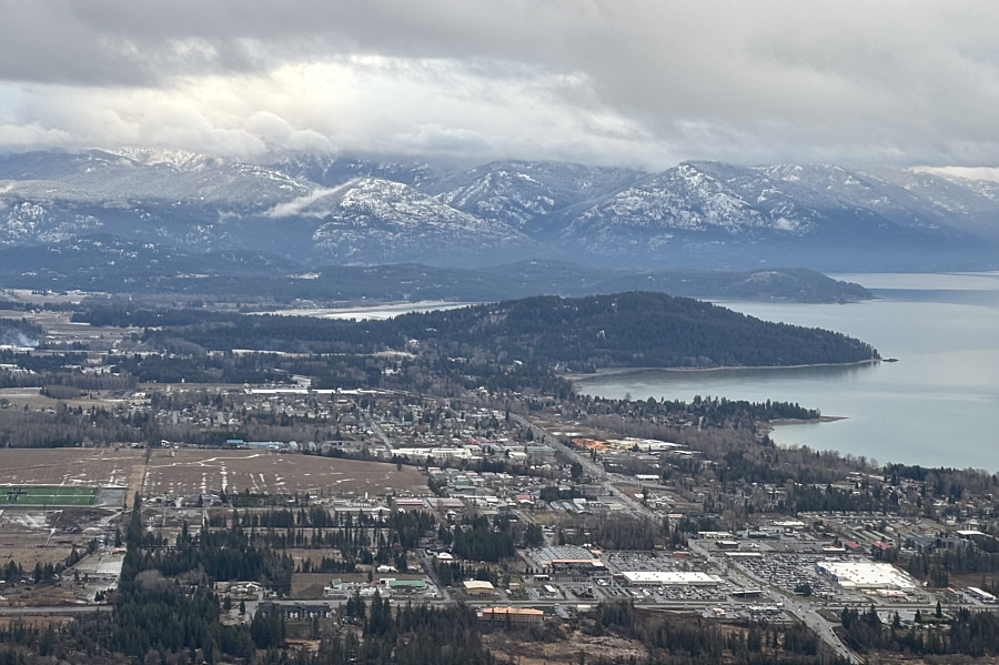
Zosia gets a glimpse of Sandpoint and
Lake Pend Oreille from this trailside bench located partway up the
hill. |
 |
Higher up, the trail is covered by
increasingly more snow. |
Zosia reaches a viewpoint at the end of the official
trail.