BOU AVENUE
Mount Rohr
Zosia Zgolak and I climbed Mount Rohr near
British Columbia's Duffey Lake on 7 July 2025. Our original plan on
this day was to hike to Marriott Meadows as described in Jack Bryceland's
guidebook 103 Hikes in Southwestern British Columbia, but his
throwaway blurb about an alternative trip to Mount Rohr piqued my
curiosity. After a quick online search, I convinced Zosia to switch
objectives since the terrain on the way to Mount Rohr would be similar to
that for Marriott Meadows with the additional lure of a named summit.
Although the summit sits right on the western boundary of Duffey Lake
Provincial Park, the normal ascent route via the valley northwest of the
mountain is entirely outside the park. As such, there are little or
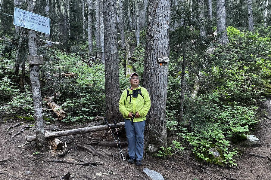
no backcountry restrictions, and many people elect to camp at
unofficially-named "Rohr Lake" and break the trip up over two or three
days. Loathe to haul heavy backpacks, we would opt to do the ascent
as a day trip.
From Highway 99 (Duffey Lake Road), turn north onto an unsigned 2WD
gravel road 26.4 kilometres east of the junction with Main Street in
Mount Currie (Chevron gas station) or 63.9 kilometres west of the
junction with Seton Lake Road in Lillooet ("Welcome to Lillooet" sign).
Drive 220 metres and pass a parking pullout on the right. Drive
another 650 metres and park in a second pullout with toilet on the left.
The gravel road is quite rough, but most normal vehicles should be able
to make it this far. Vehicles with high clearance could conceivably
go further past a split (take the left-hand road) for about 1.4
kilometres to road's end at the actual trailhead.
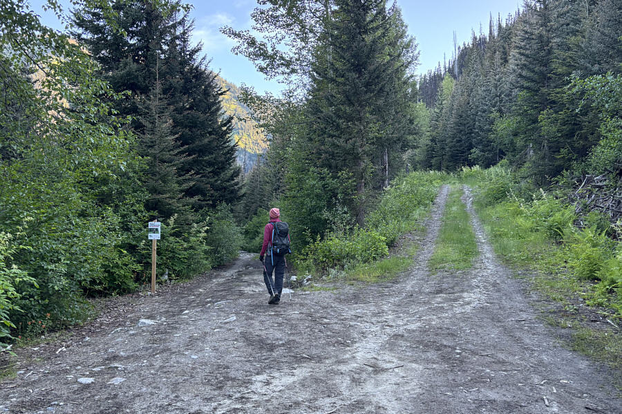
After camping the previous night at the second pullout, Zosia and I set
off early on foot along the remainder of the access road, and the
numerous rough spots and mud holes we passed seemed to justify our
decision to leave our car behind (we still saw a jacked-up Mitsubishi
Delica parked near the trailhead). The signed turnoff to Rohr Lake
is about 800 metres beyond the trailhead, but the trail here is quite
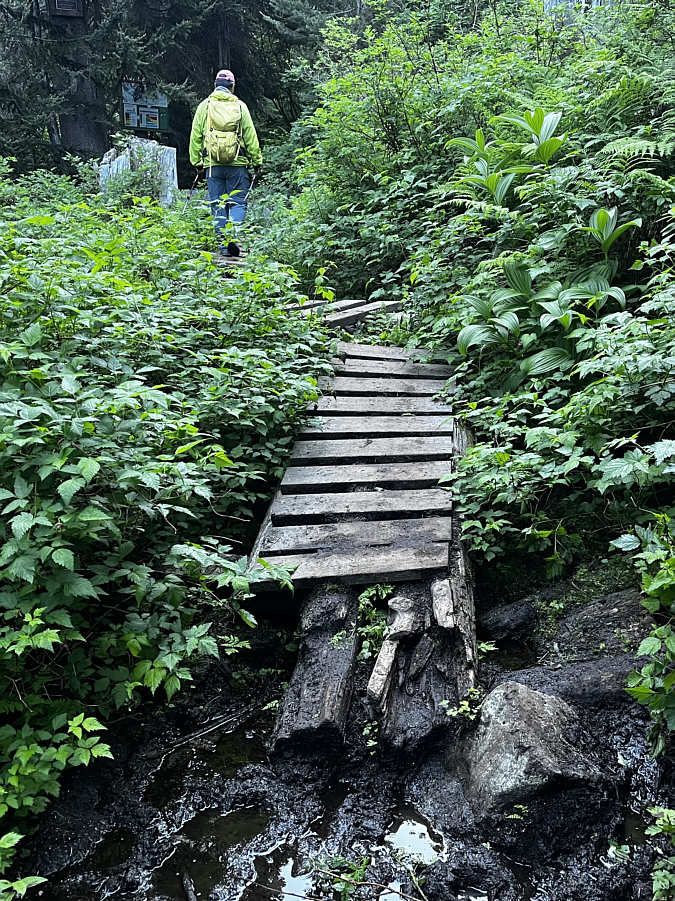
boggy and rather tedious to hike. Existing boardwalks help, but
there is not enough of them. Beyond the turnoff, the trail to Rohr
Lake was just as bad if not worse with the added challenges of elevation
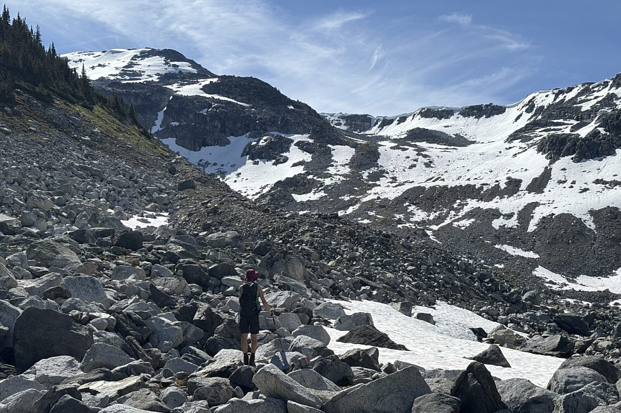
gain and occasional deadfall. We eventually entered a swampy but
partially open amphitheatre, and from there, we began climbing up the
headwall guarding Rohr Lake. At this point, the trail is little
more than a flagged route which mostly follows a watercourse spilling
over slick boulders. About halfway up, we briefly lost the route
before making a rising traverse to climber's left followed by a steep
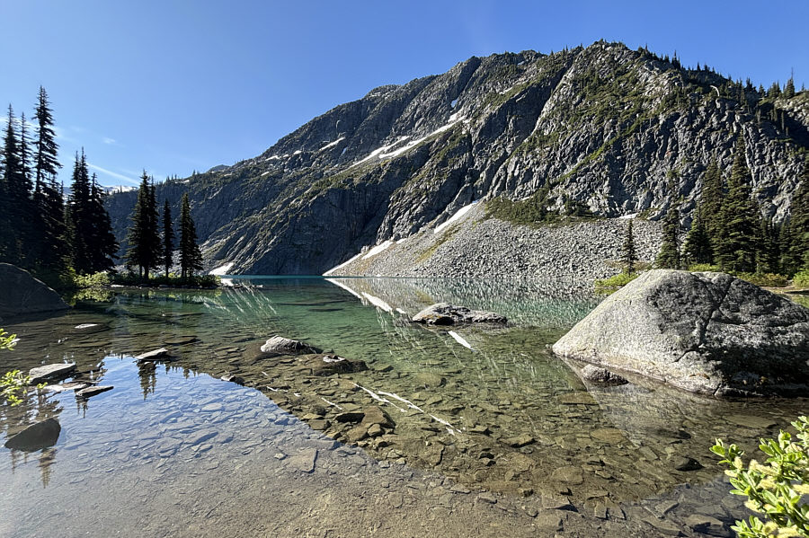
final push to the brim of the lake. After the difficult ascent of
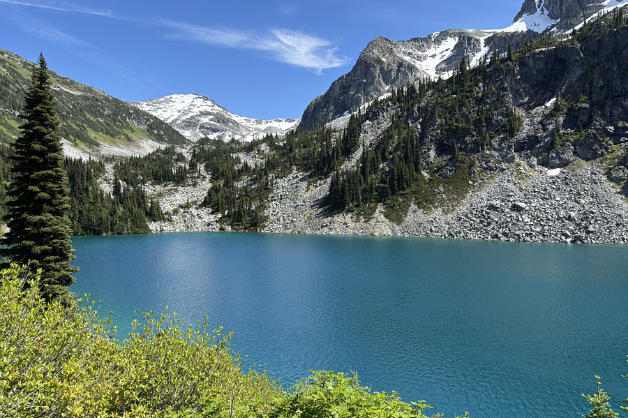
the headwall, Rohr Lake was a good place to stop for a short break.
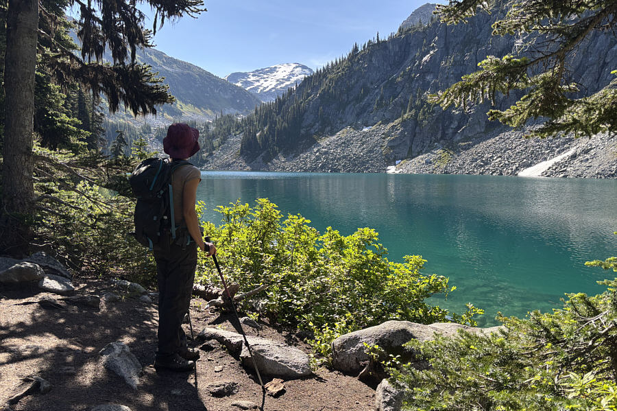
When we resumed hiking, Zosia and I headed
eastward along the north shore of Rohr Lake. The numerous paths
here can be a bit confusing to navigate, but it is best to initially stay
low and stick close to the shoreline. Eventually, the multiple
paths resolve into a single clear-cut trail which begins to climb away
from the lake. At one point, we ran into a large group who were
striking camp, and a couple of them who had ascended Mount Rohr the day
before assured us that they had no issues with the snow that we could
already see on the upper
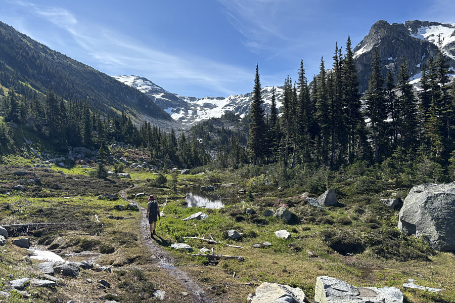
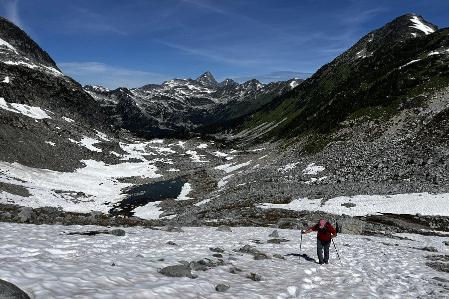
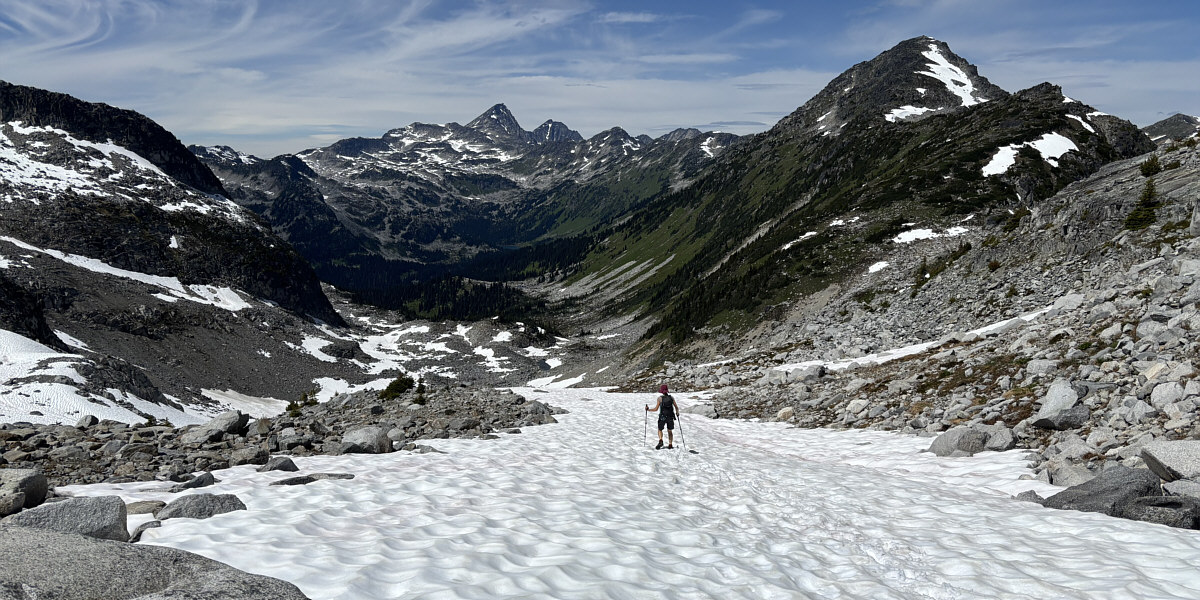
mountain. The hike in the upper valley beyond the lake was very
pleasant, and we made good progress here. Further up the valley, we
began encountering more boulder fields, but plenty of cairns helped guide
us efficiently through this tedious terrain. There were also many
lingering snow patches toward the head of the valley, and while we
managed to avoid a lot of them, the snow was generally supportive anyway
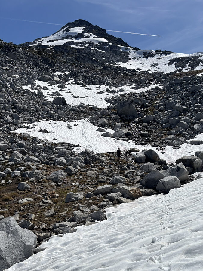
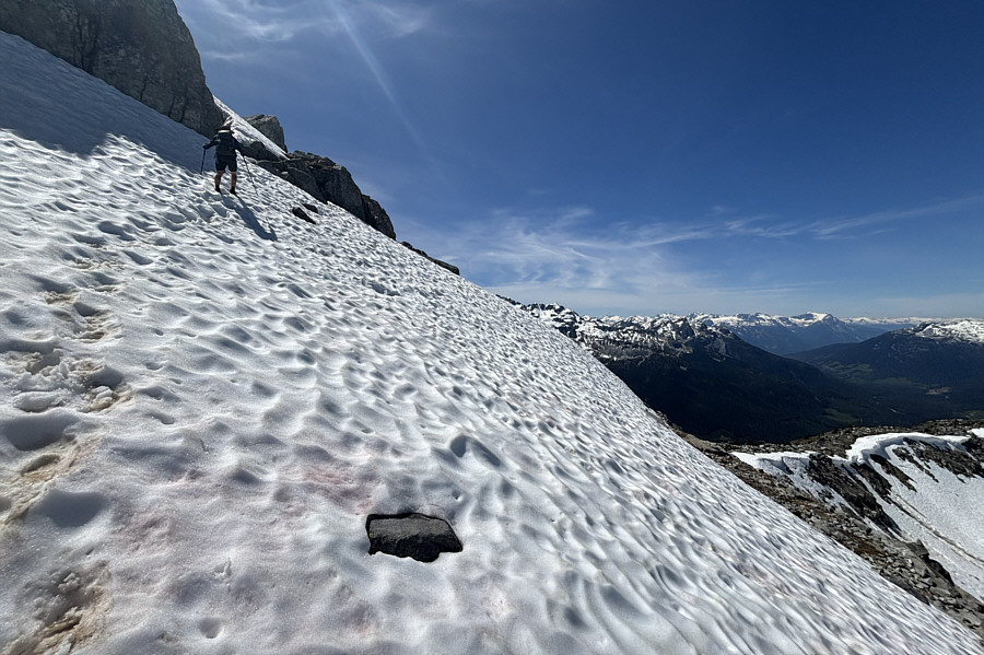
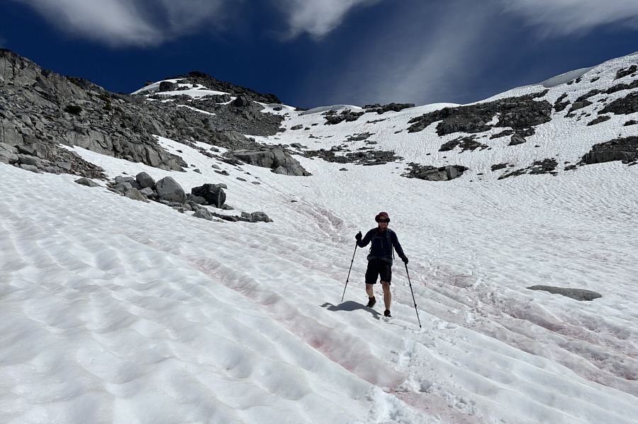
when we walked on it. The biggest challenge for us on the upper
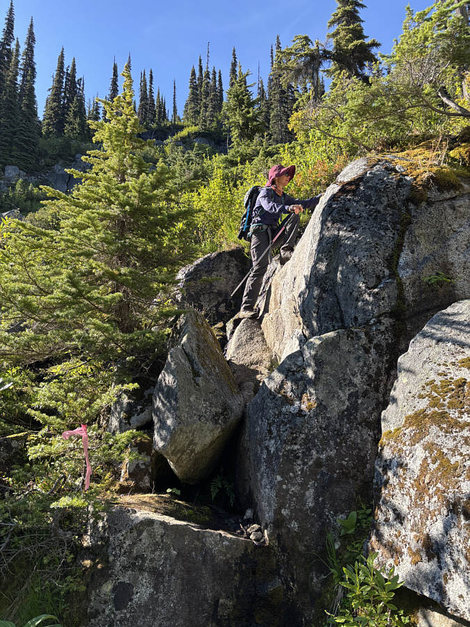
mountain was gaining the crest of the west ridge. The terrain below
the crest is steep, and it was a little unnerving to climb up the
unavoidable snow patches here without an ice axe. Instead of
following some old footprints in the snow, I led us up a somewhat sketchy
rock step which was a bit awkward to surmount. Once past this
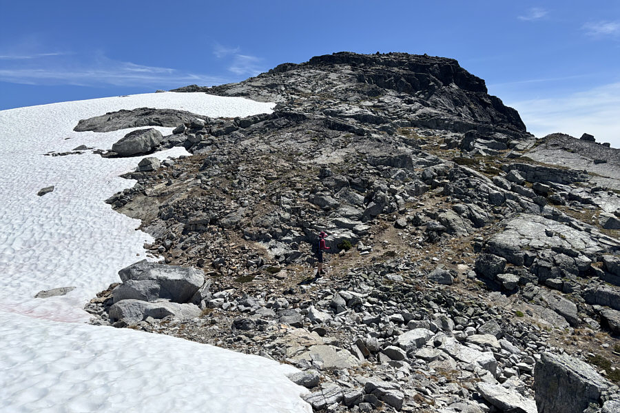
obstacle, we had no further difficulties hiking up the west ridge to the
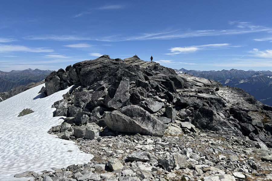
summit.
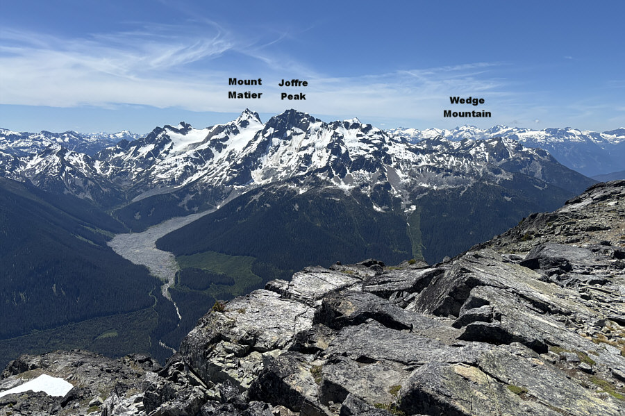
The summit panorama was extraordinary on
this day, and Zosia and I spent a full hour there before commencing our
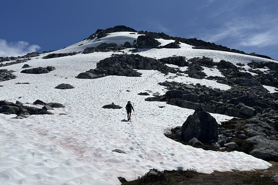
descent. Avoiding the sketchy rock step, we followed the crest of
the west ridge further down to where the aforementioned footprints came
up. The snow slope was still alarmingly steep here, but at least we
had the benefit of the footprints to help anchor our footing.
Thankfully, we made it down the steepest section without a slip, and as
the angle of the slope began to lessen, we could relax a bit and start
boot-skiing down the numerous snow patches we had passed on the way up.
In fact, we ended up boot-skiing quite far which saved us a lot of
tedious downhill walking and made the subsequent hike back to Rohr Lake
seem shorter. The descent of the dreaded headwall required a lot of focus
because of the wet conditions, but we both made it to the bottom safely.
Unfortunately, I did not fare as well descending the muddy trail to the
first junction. I slipped on a wet log and banged my left elbow
quite badly while landing on my back. My elbow was bloodied and
bruised, but I now suspect that I might have even suffered a minor bone
fracture. The cut on my elbow would heal in a few days, but the
pain would persist for at least a couple more weeks. I was quite
sullen after this mishap, but once we made it back to the trailhead and
put the boggy mess of a trail behind us, my mood improved with each step
we took back to our parked car.
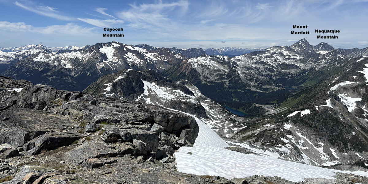
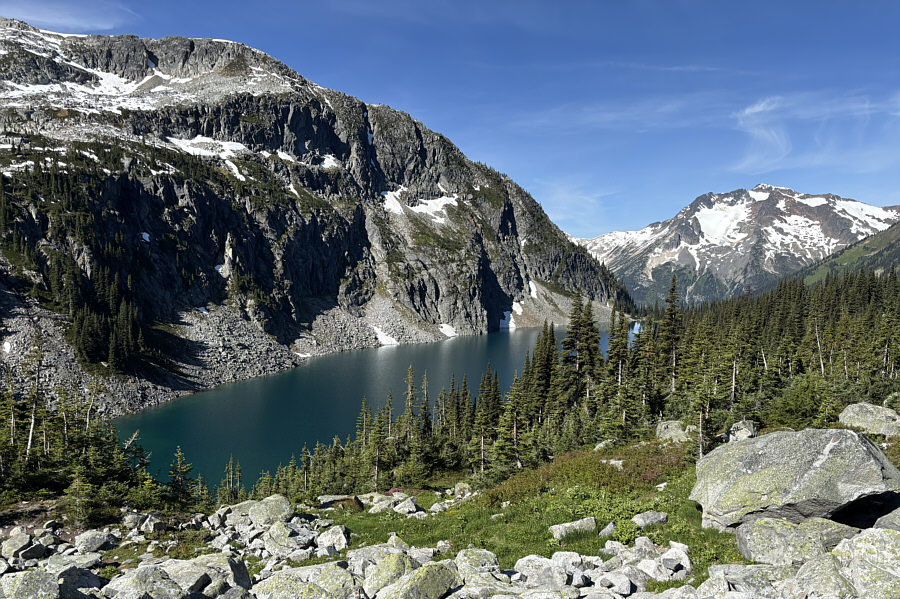
Rohr Lake is visible down in the valley in this view to
the northwest.
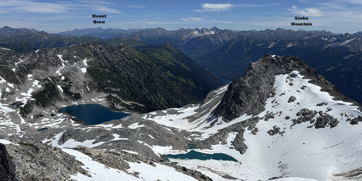
The deep blue lake in the bowl to the northeast is
probably seldom visited. A small chunk of Duffey Lake is also
visible at right in the valley.
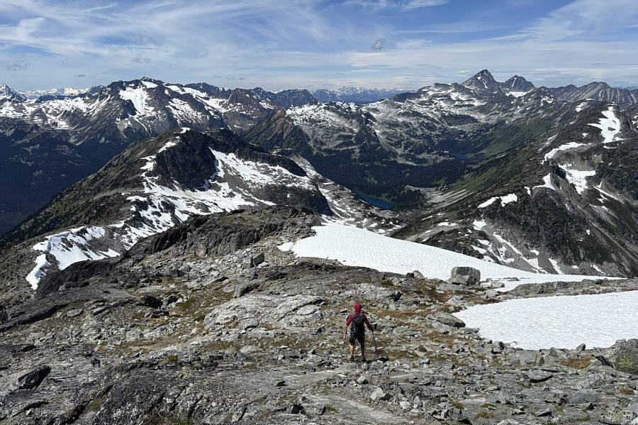 |
Zosia descends the west ridge of Mount
Rohr. |
 |
Zosia takes advantage of lingering
snow patches to boot-ski down the mountain. |
Zosia continues to boot-ski down into the upper valley.
 |
Here is a final look at Mount Rohr
from Rohr Lake. |
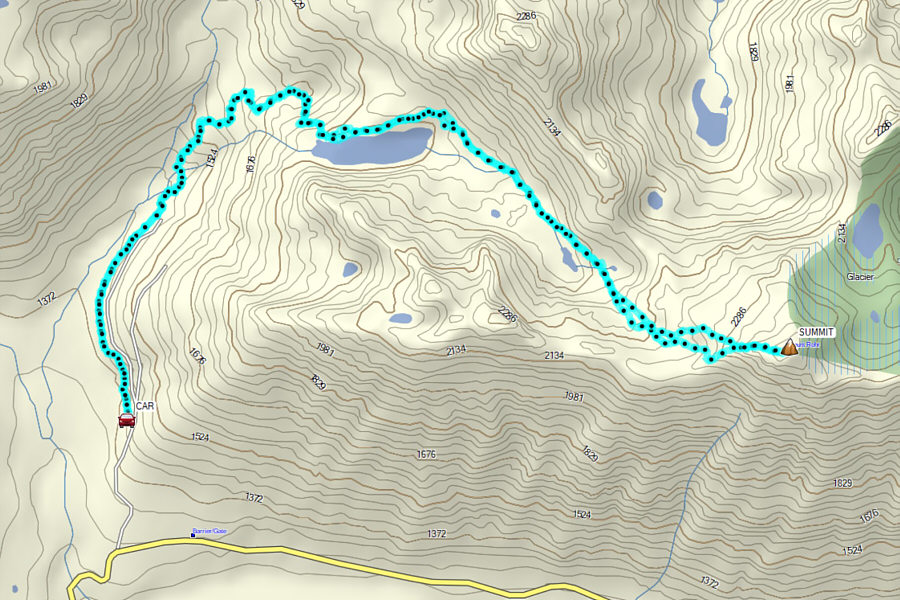 |
Total Distance: 16.5 kilometres
Round-Trip Time: 10 hours 18 minutes
Cumulative Elevation Gain: 1065 metres
GPX Data |