BOU AVENUE
Three Brothers Mountain (First Brother And Second Brother)
On 2 July 2025, Zosia Zgolak and I hiked up two of the three distinct peaks that comprise Three Brothers Mountain in British Columbia's E.C. Manning Provincial Park.  The highest peak, unofficially known as "First Brother", has an excellent trail running all the way to its summit, and a good description of the hike can be found in Jack Bryceland's guidebook, 103 Hikes in Southwestern British Columbia.  "Second Brother" is an easy off-trail ascent starting from the west end of First Brother's summit ridge and requires minimal extra effort.  "Third Brother" is also technically easy but its ascent entails a significant elevation drop and at least a couple extra kilometres of hiking.  There is even an officially-named Fourth Brother Mountain a few more kilometres beyond Third Brother, but not wanting to turn this into a pointlessly gruelling outing, we would leave both Third and Fourth Brothers for another day.

From Highway 3, turn north onto Owl Way at the 4-way intersection near Manning Park Resort about 42.0 kilometres east of the park's western portal sign (marmot) or 15.7 kilometres west of the park's eastern portal sign (bear).  Immediately turn left onto Blackwall Road.  Note that Blackwall Road is seasonally closed during winter and usually does not open for public motorized access until Canada Day.  Drive 8.1 kilometres on pavement to Cascade Lookout (viewpoint) beyond which the road becomes 2WD gravel.  Drive another 6.0 kilometres to the parking lot for the lower trailhead, or continue for an additional 600 metres to the parking lot for the higher trailhead (toilets available here).

Starting from the higher trailhead, Zosia and I were already treated to nice views as we gradually descended the trail along what is known as Lone Man Ridge.  After dropping down a well-constructed staircase, we intersected the trail coming from the lower trailhead and then continued descending for the next 2.7 kilometres to a backcountry campground along Buckhorn Creek.  We crossed the creek on a good bridge and then began climbing steadily for the next 1.5 kilometres before finally breaking out of the trees into sub-alpine meadows.  For the next three kilometres, we enjoyed fabulous hiking through rolling meadows with far-reaching views, and it is easy to see why this is one of the park's most popular trails.  Upon reaching a signed junction, we turned right to follow a trail up to the west end of First Brother's southwest ridge.  The trail continues along the ridge all the way to the summit which is marked with a signpost and a large cairn.  We wandered just a little past the summit before stopping for an extended break.
That's a big dip between us and the peaks! 
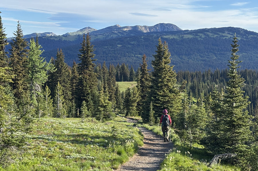
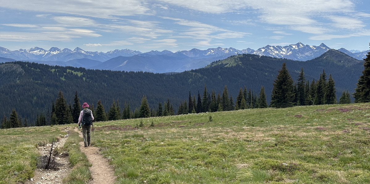
Early in the trip, Zosia gets a good view of Fourth Brother Mountain (far left) and the three distinct peaks of Three Brothers Mountain.  The ridge she is walking on has an official name--Lone Man Ridge.
Why not just build an escalator here? 
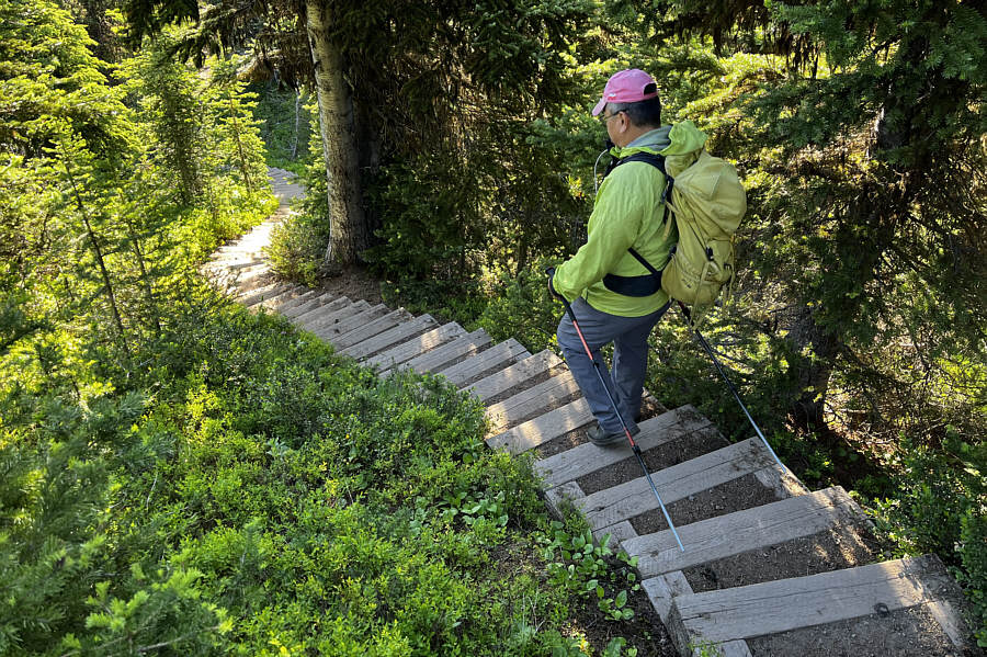
Sonny carefully descends a staircase along Lone Man Ridge.

Photo courtesy of Zosia Zgolak

Quite literally, the low point of the hike! 
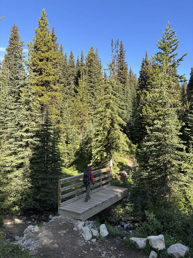
Zosia crosses Buckhorn Creek near its namesake backcountry campground.
The start of a really enjoyable walk through sub-alpine meadows! 
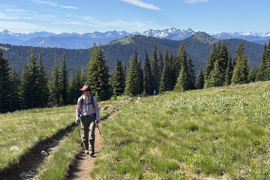
Zosia emerges from the forest with Lone Man Ridge (centre) and Blackwall Peak (right) visible behind her.  The tall snowy mountain on the horizon between the two is Mount Winthrop which is on the US side of the border.
These meadows would be great for ski touring! 
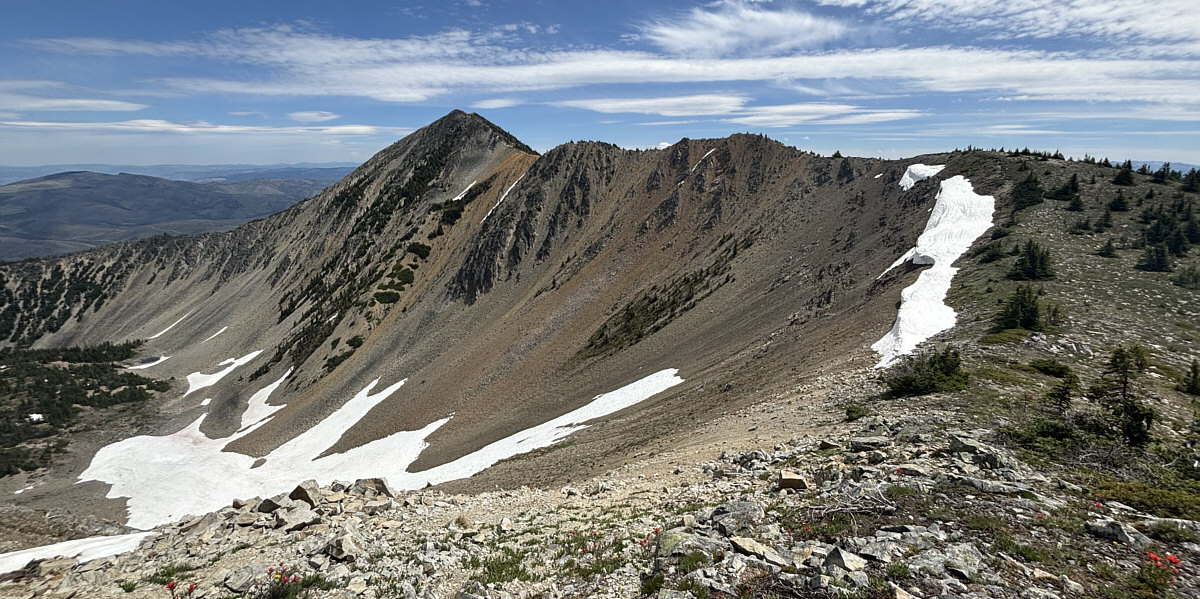
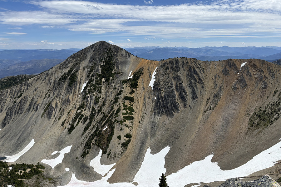
Zosia pauses in the meadow for a look at Second Brother (centre) and First Brother (right).
Why so serious? 
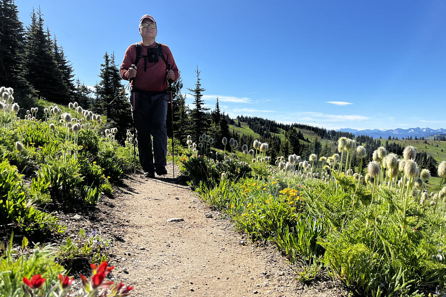
Sonny marches past a bunch of pasque flowers that have gone to seed.

Photo courtesy of Zosia Zgolak

Looks great so far! 
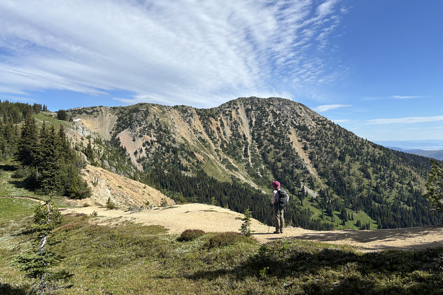
Zosia gets her first clear view of First Brother's south face.

All I see is a great ski slope!

Here is a more complete view of First Brother's southwest ridge.


Looks like a nice finale to the ascent! 
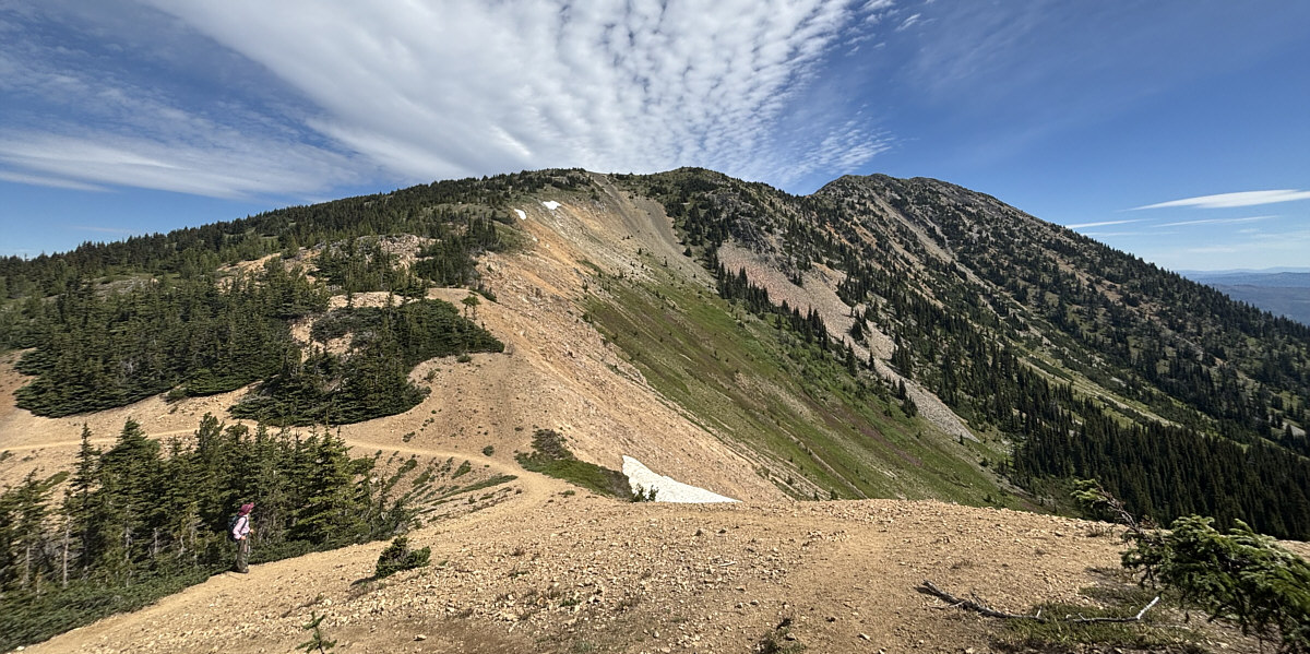
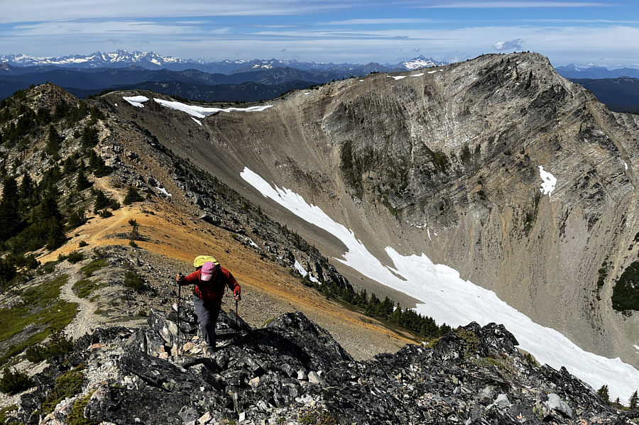
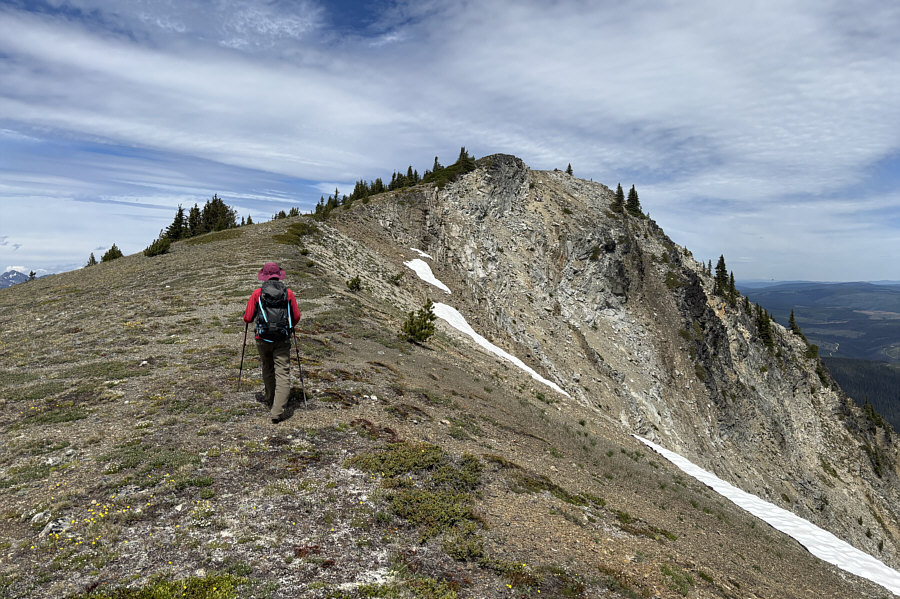
Zosia gains the crest of First Brother's southwest ridge.
Surprisingly colourful ridge! 
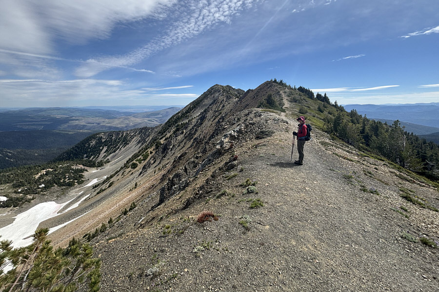
Second Brother dominates the background as Sonny ascends the southwest ridge of First Brother.

Photo courtesy of Zosia Zgolak

And thanks to the breeze, there are no swarms of ladybugs here! 
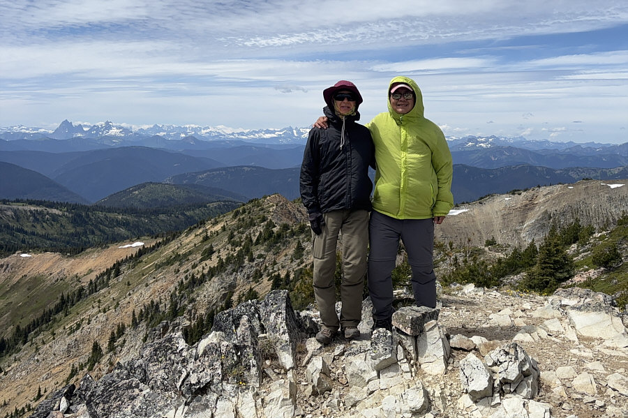
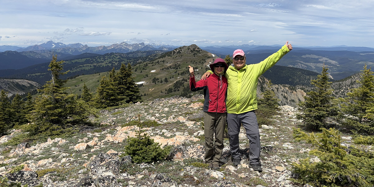
Zosia and Sonny stand on the summit of First Brother (2270 metres), the highest peak of Three Brothers Mountain.
We'll save Big Buck Mountain for a return visit in the future. 
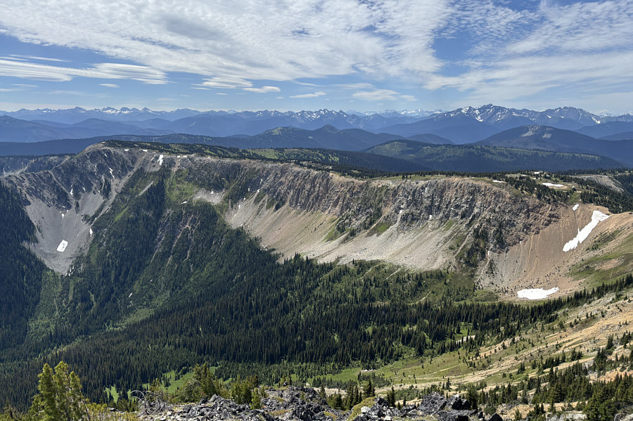
The view to the south is dominated by the connecting ridge to Big Buck Mountain (far left).
When we resumed hiking, Zosia and I backtracked to the west end of First Brother's southwest ridge and then left the trail to head north toward Second Brother.  Other than a slight initial dip, the off-trail hike to the top of Second Brother was very easy.  There, we met a Brazilian hiker living in Vancouver, and we enjoyed a nice chat with him while taking another lengthy break.

For our return, Zosia and I headed back the way we came and side-sloped around the west end of First Brother's southwest ridge before re-joining the established trail.  A second round of glorious meadow-walking was followed by a descent back to the backcountry campground where we re-crossed Buckhorn Creek.  The climb back up Lone Man Ridge to the trailhead was a bit annoying but not overly strenuous.  When we finished the hike, we had dinner at some picnic tables near the parking lot before driving back to the highway and out of the park.
This would also be an easy ski traverse. Zosia is about to drop into a slight dip along the connecting ridge to Second Brother.

Possibly still enough snow to ski?

Here is a view of First Brother's northwest face from the connecting ridge to Second Brother.


Easy stuff. Zosia approaches the top of Second Brother.

We'll come back for Third Brother on another day...maybe on skis!

Zosia and Sonny stand on the summit of Second Brother (2250 metres) with Third Brother visible behind them.  The big peak on the horizon at far left is Mount Outram.


The tarns are probably seldom visited. 
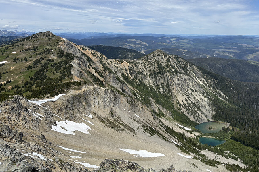
A couple of unnamed tarns sit in a bowl to the north of Second Brother.
It's actually quite a beautiful peak from this angle! 
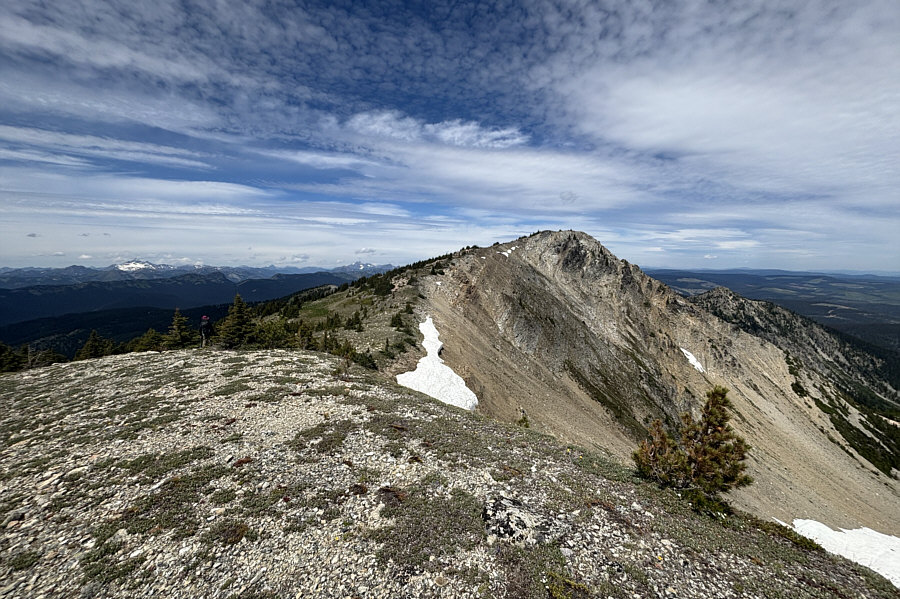
Here is one last look at First Brother from the top of Second Brother.

Sigh...it's always annoying having to climb up at the end of the trip!

Zosia begins to drop down to Buckhorn Creek on her way back to the trailhead on Lone Man Ridge (right).


A deservedly popular hike through glorious sub-alpine meadows. 
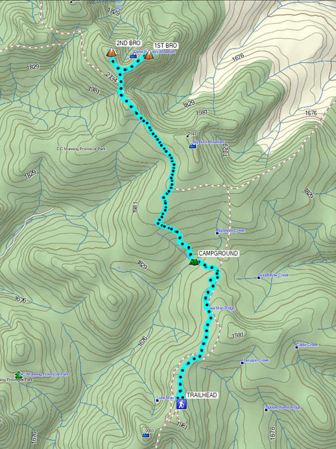
Total Distance:  21.5 kilometres
Round-Trip Time:  9 hours 37 minutes
Cumulative Elevation Gain:  774 metres

GPX Data