BOU AVENUE
Yeoward Mountain
One of the hazards of planning on the fly
during a hiking vacation is that a poorly-researched outing can have
devastating consequences. Such was the case on 11 July 2025 when
Zosia Zgolak and I ascended Yeoward Mountain located in the Monashee
Mountains about 20 kilometres southeast of Cherryville, British Columbia.
The mountain is probably more frequented in winter by cat-skiers, but a
summertime trip should have been little more than a straightforward walk
up any number of logging roads that approach the summit from various
directions. The only useful hiking
report
that I could find online describes an approach from the west side of the
mountain, but I was subsequently disappointed to learn from the
Recreation Sites and Trails BC
website that a bridge along the access road was wiped out.
Scrambling for an alternate approach, I chanced upon another route going
up a drainage in the basin southeast of the mountain and reaching the
summit via the east ridge. This route shows up in
OpenTopoMap
and is likely copied from one published in
AllTrails albeit with no accompanying route description. Zosia
and I had been traveling through areas with little or no cellular
reception, and in my haste to pick this alternate route, I had neglected to scrutinize it further or check satellite
imagery for better options. We would simply place all our faith on
the map's dotted line.From
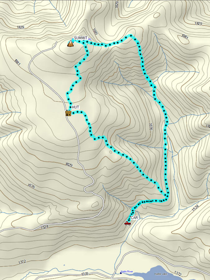
Highway 6 near Lost Lake Rest Area (34.6 kilometres east of Cherryville
or 47.6 kilometres west of Needles Ferry Terminal), turn north onto
Keefer Lake Road (2WD gravel). Ignoring all side roads, drive 10.1
kilometres to a junction with a road branching left just before Keefer
Lake Road turns south to cross a bridge over Kettle River. Although
we did not go this way, the branching road eventually leads to a cut
block (50.13087, -118.39251) where, according to satellite imagery, a jeep
track continues up the south side of the mountain all the way to the
summit. For our starting point (not recommended), we crossed Kettle
River and continued driving another 3.7 kilometres before veering left at
a junction to re-cross Kettle River (right leads to Keefer Lake Lodge).
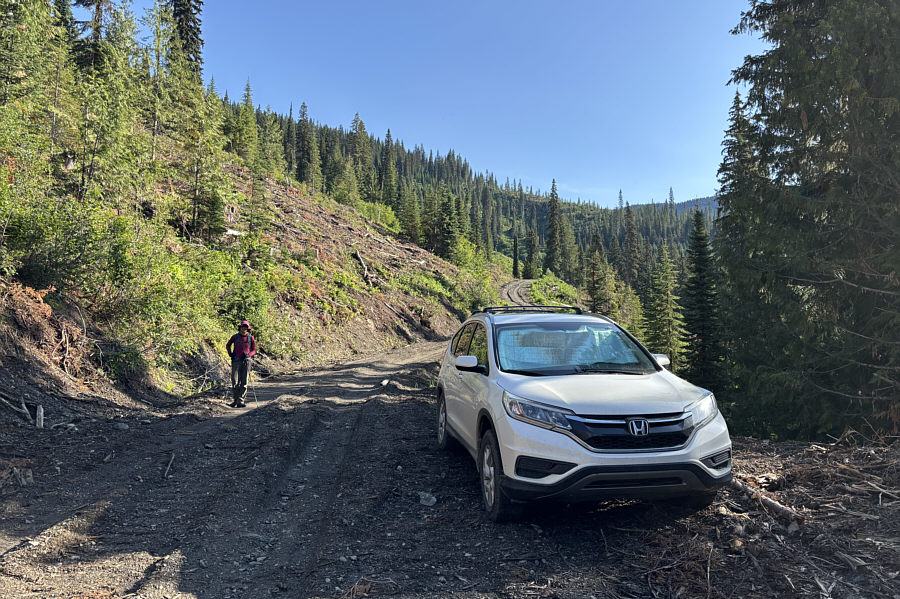
About 240 metres past the junction, we turned left onto a logging road
which crosses Keefer Creek, and then we drove for another 900 metres
before parking next to a roadside wood pile (50.13748, -118.36084).
From where we parked, Zosia and I walked up
the continuation of the logging road for about 875 metres before reaching
a junction (50.14130, -118.35209) with an overgrown road climbing very
steeply up the slope to the north. This overgrown road is also
marked on OpenTopoMap, but it is incomplete and ends somewhere at an
elevation just below the 1950-metre contour line. The overgrown
road also looked painfully steep to ascend, but I filed it away as a
potential alternate route for our descent. About 1.1 kilometres
further, we reached the end of the logging road but continued following a
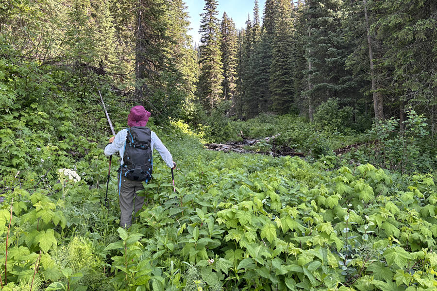
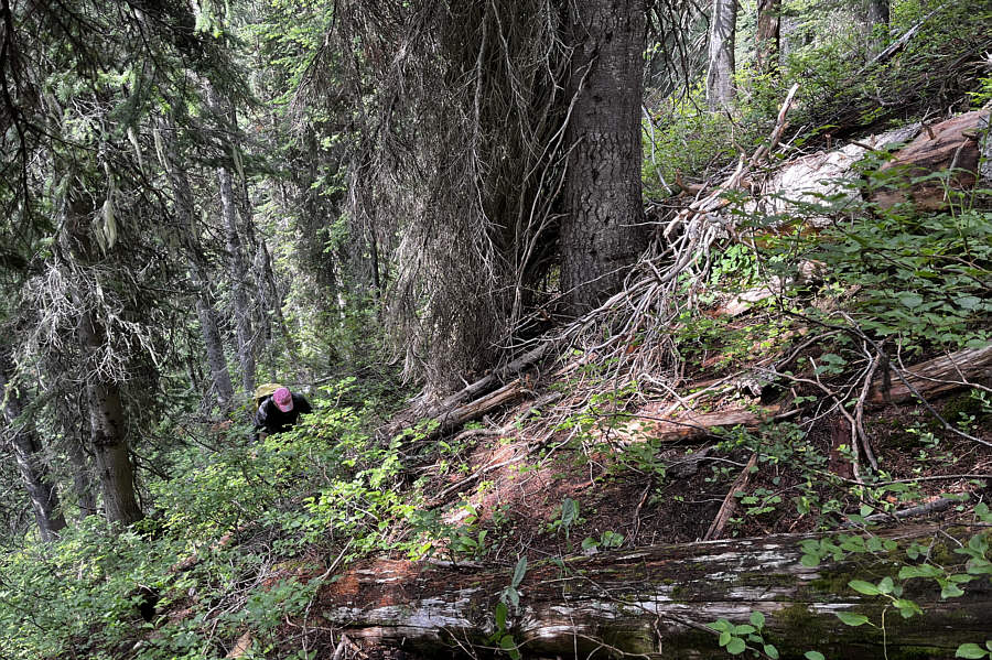
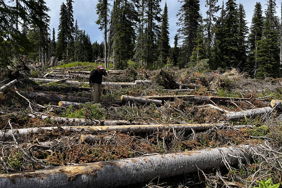
drainage (Keefer Creek) into the southeast basin. Almost
immediately, something was amiss as we found ourselves thrashing through
increasingly thick vegetation and tedious deadfall. Other than some
bits of flagging, signs of human passage were nonexistent, and it slowly
dawned on me that we were likely following either a skier's down-track
or some poor devil's miserable bushwhack. That Zosia did not utter
a single complaint is a great testament to her patience and high
tolerance for suffering, but this was one instance where she probably
should have smacked me for choosing such an awful route. To be
fair, she is as stubborn as I am about not giving up on an ascent, but we eventually reached a point where continuing or retreating
along the drainage became equally unbearable. Instead, we abandoned
the drainage and simply grinded up the adjacent forested slope.
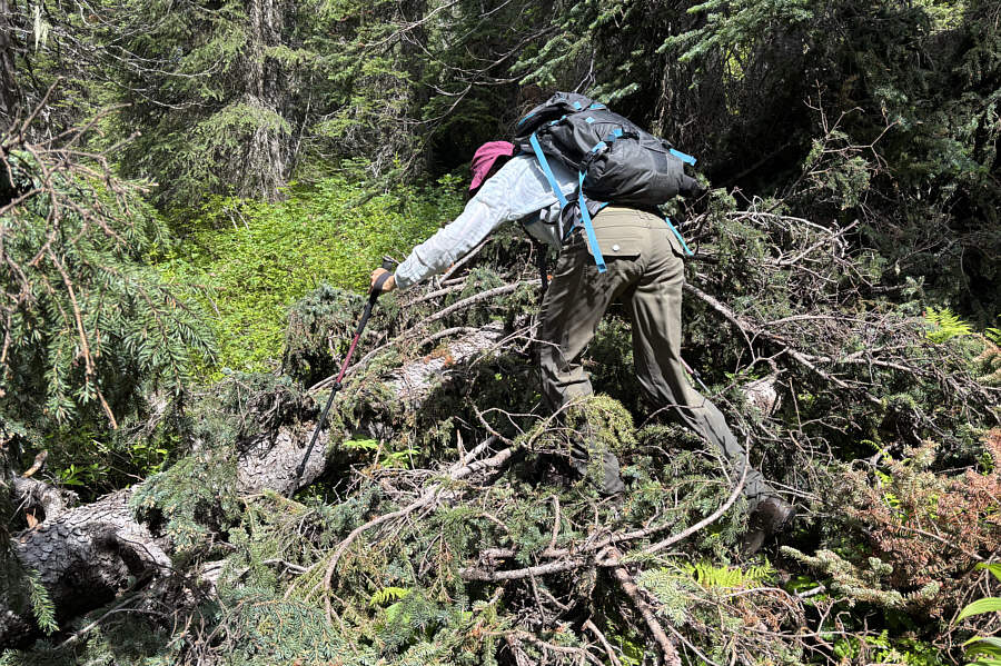
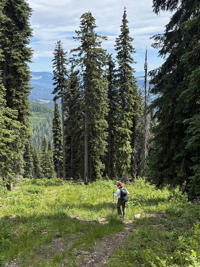
Like the many steep uphill bushwhacks Zosia
and I have both endured in the past, this was another one that is best
forgotten and never to be repeated. It took us a dispiritingly long
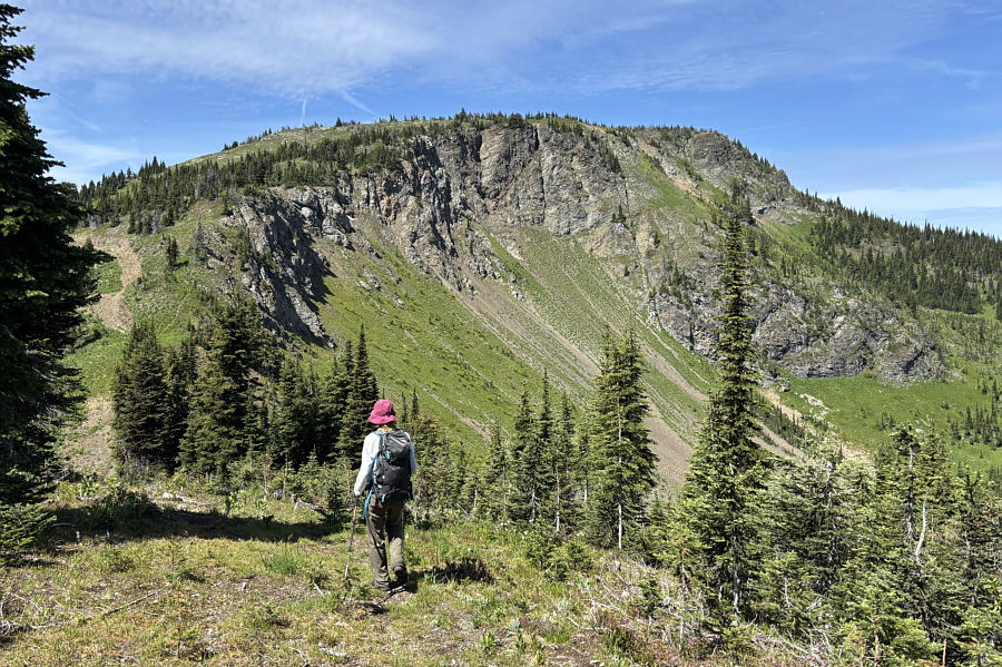
100 minutes or so to climb 375 metres to the crest of Yeoward Mountain's
east ridge where we finally broke out of the trees and stumbled onto a
cat track. Turning westward, we followed the cat track across a
short dip and then up to the summit plateau where we intersected a jeep
track--the very same one I describe in the driving directions--coming
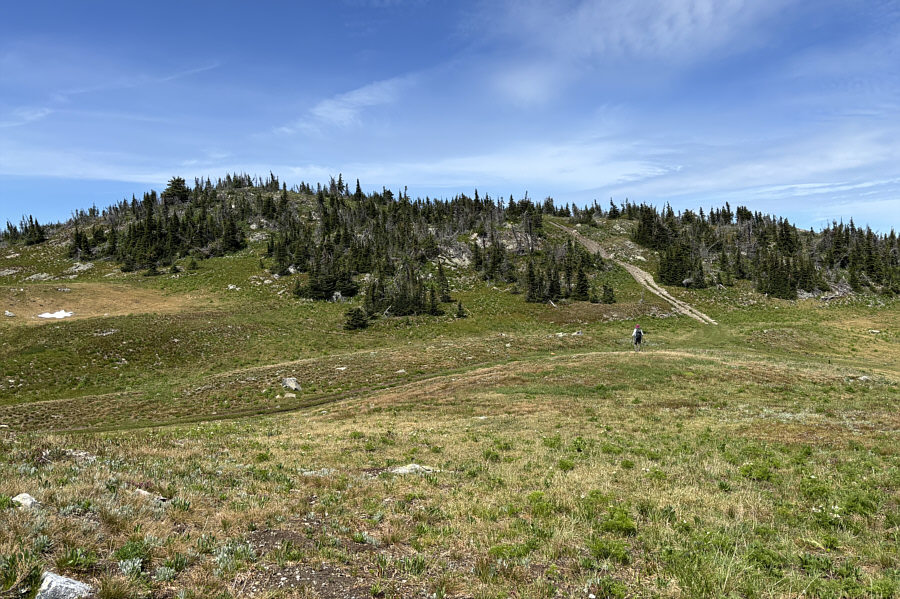
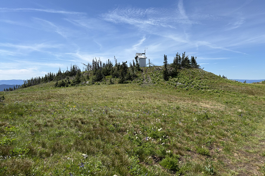
from the south. The jeep track winds past several humps on the
summit plateau, but the highest one is topped with a biffy-like building
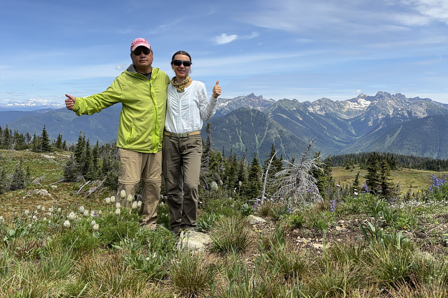
and a collapsed antenna. We dutifully tagged the summit before
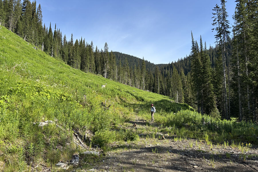
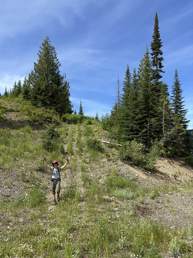
heading to another hump with better views for a break.When we resumed hiking, Zosia and I descended the jeep track
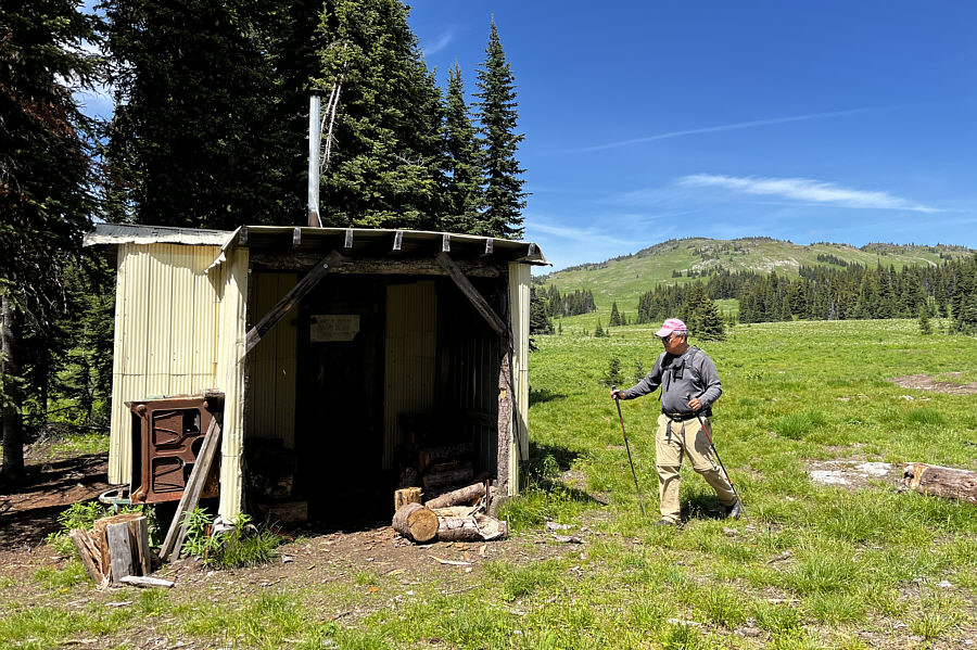
southward into a vast rolling meadow--presumably a glorious place for ski
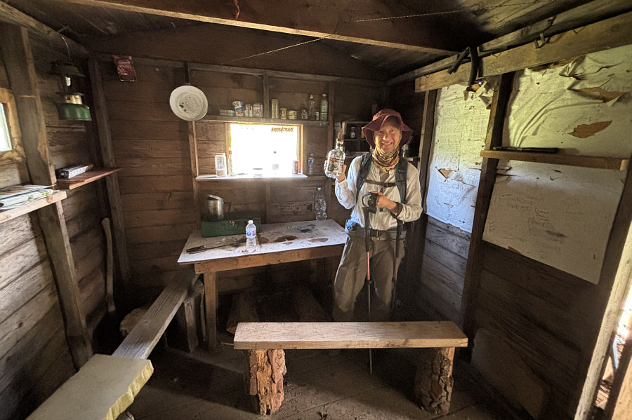
touring in winter. The jeep track passes a rustic hut at the edge
of the meadow, and we stopped there to poke around a bit before
continuing our descent. Because we had no idea where the jeep track
would lead us--it is completely unmarked on all maps except for BC
Basemap which I did not consult until well after our trip--we abandoned
it to try and connect with the aforementioned overgrown road. We
followed a beaten path eastward from the hut and subsequently hiked
off-trail until we intersected the road as marked on my GPS map.
Disappointingly, we found a logged corridor rather than an actual road,
and although we could still follow it downhill, the uneven footing in the
slash made for less than pleasant walking.
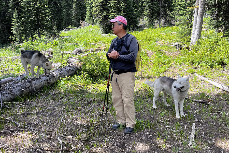
At one point while we were still quite high up the mountain, we
surprisingly met two collared dogs wandering in the bush. Although
we shouted a few times, their owner was nowhere in sight. The dogs
approached us but generally stayed beyond our reach. When we failed
to offer them any snacks, they promptly lost interest in us and
disappeared back into the bush. After this "wildlife" encounter, we
muddled through an exceptionally tedious stretch of logging slash, but
just when we thought the misery would never end, the slash cleared up to
reveal the overgrown road we had been expecting all along. Though
steep, the overgrown road was very straightforward to descend, and we
ultimately reconnected with the logging road we started on and walked
back to our parked car without further issues.
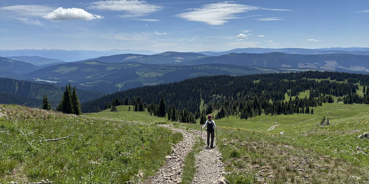
Zosia follows the jeep track southward in hopes of
finding a better way down the mountain.