For our return, Zosia and I backtracked a bit to the north and picked up a road which turned out to be an extension of the original road we started on. We simply followed this road all the way back to the four-way junction and subsequently to our car.
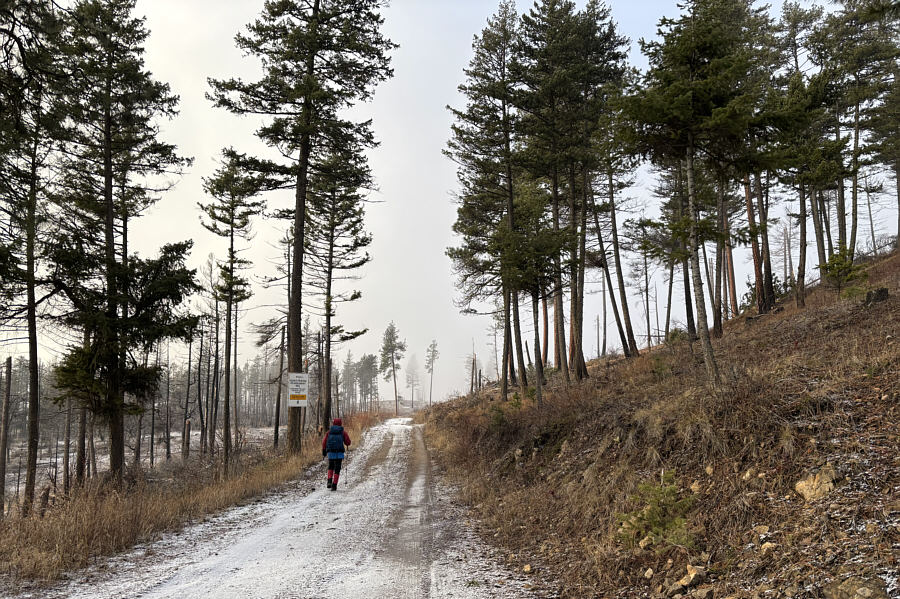 |
Zosia enters the Westbank First Nation Community Forest (sign). |
 |
Zosia reaches a junction with a road leading to the top of Mount Drought's north summit. |
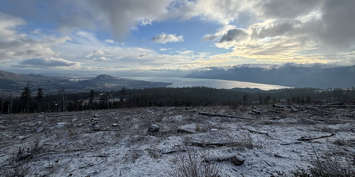
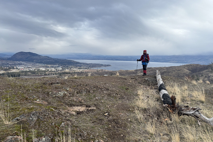
This clear cut along the eastern slope of Mount Drought's north summit grants far-reaching views of Mount Boucherie (left) and Okanagan Lake.
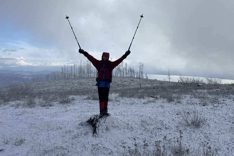 |
Zosia stands on Mount Drought's north (true) summit (1021 metres). |
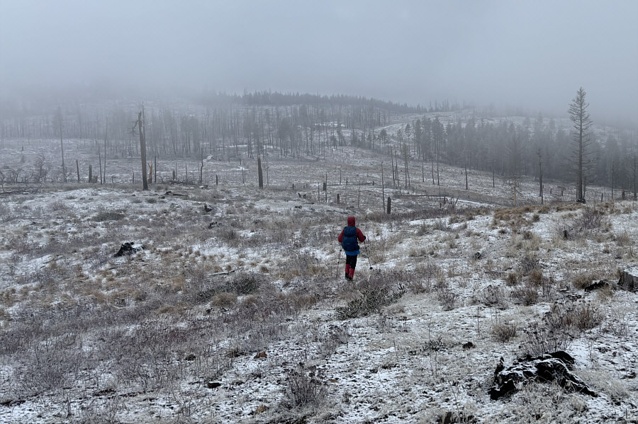 |
Zosia descends the south side of the north summit en route to the south summit which is somewhere in the mist at left. |
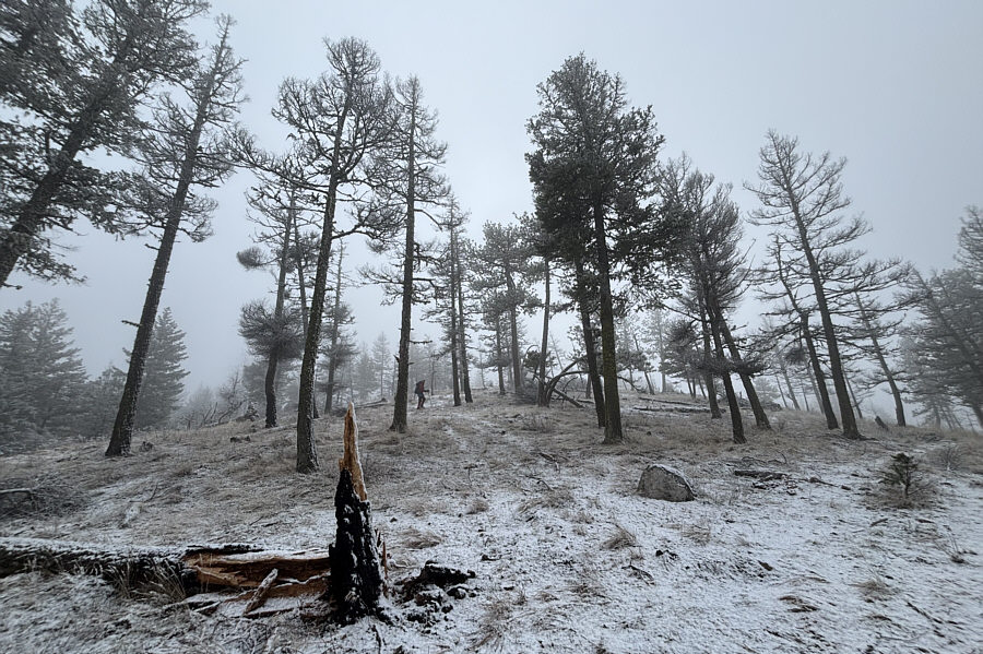 |
A double-track leads to the top of the south summit. |
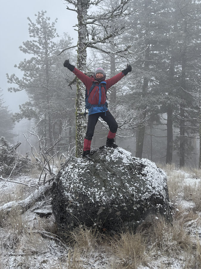 |
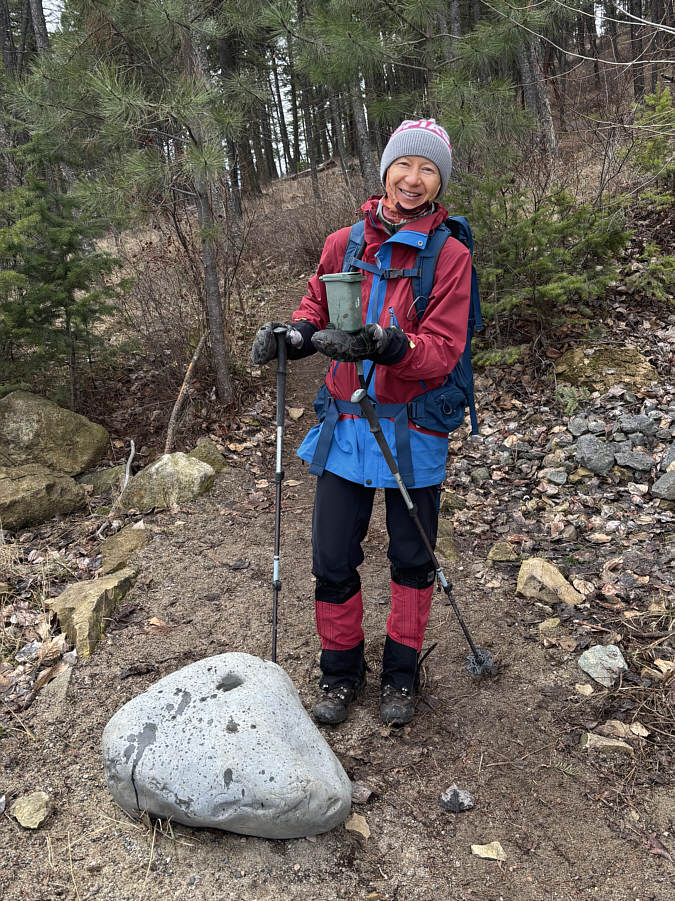
This rock is the highest point (1011 metres) on the south (gazetted) summit of Mount Drought. |
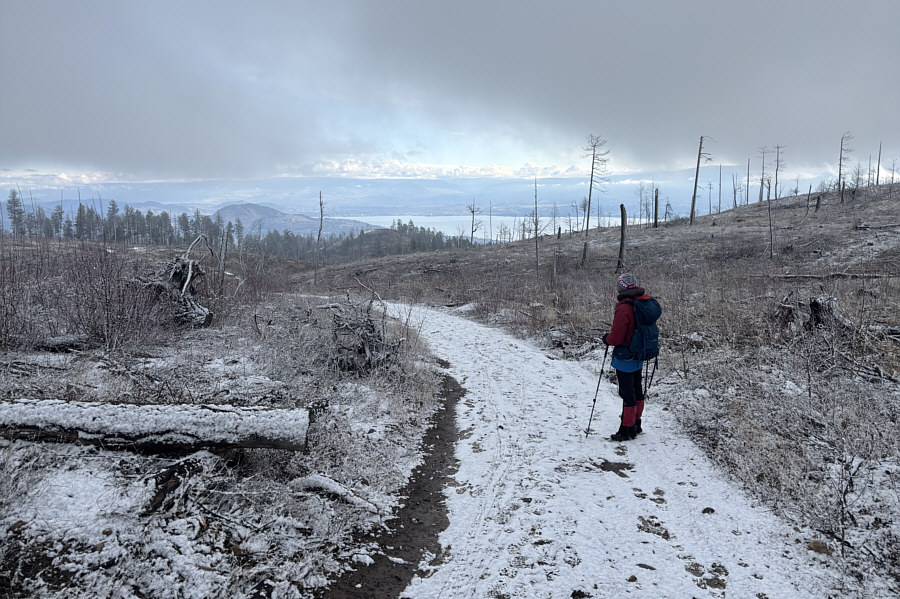 |
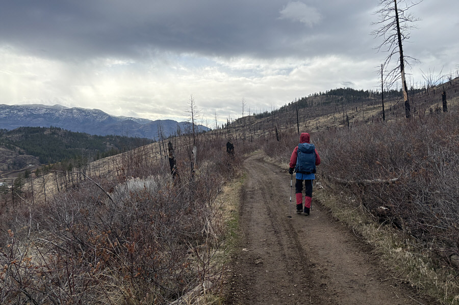
Zosia picks up a road which will lead her back to her starting point. |
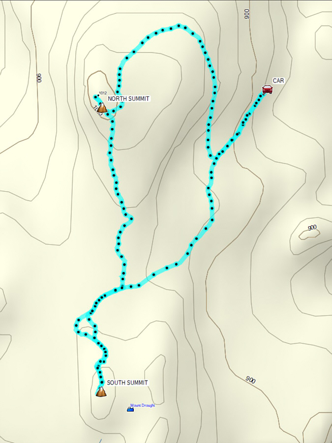 |
Total Distance: 4.8 kilometres Round-Trip Time: 1 hour 51 minutes Cumulative Elevation Gain: 134 metres |
From Highway 97 in West Kelowna, take the exit to Glenrosa Road. Drive northwest for 750 metres and go straight at a traffic circle. Drive another 1.0 kilometre and turn left onto McIver Road. Almost immediately, make another left turn onto Yorkton Road. Drive 220 metres and turn right onto Bellcourt Road. Drive 300 metres and park in a cul-de-sac at road's end.
From the end of the cul-de-sac, Zosia and I followed a trail which heads uphill through a brief stretch forest before intersecting a dirt road near a dilapidated bench. Turning left, we followed the road southward for about 775 metres to a split where we stayed left. We then crossed a short dip before reaching a viewpoint with unobstructed views of West Kelowna. From there, we headed westward and climbed steadily up the continuation of the road until we reached a four-way junction on the crest of an unnamed ridge. Turning left (south) again, we ascended a partially-forested hill which turned out to be the highest point of the hike. OpenTopoMaps shows a trail which descends partway down the south ridge of this hill, and we followed suit thinking that we would see the so-called "Eye of the Needle". The last bit of the trail is little more than a steep and loose sheep path which ends at an unobstructed viewpoint, but disappointingly, we did not see anything remarkable other than a highway interchange below us. Perhaps the geological feature has collapsed and no longer exists, but in any case, I do not think that this second viewpoint justifies the extra effort to reach it including having to re-ascend 90 metres to return to the top of the hill.
After taking a short break near the top of the hill, Zosia and I backtracked to the four-way junction and then continued straight to another high point to the north. This second high point is not as high as the first hill but boasts a superior view of the entire area. From there, we spotted a third high point further north which even had a picnic table on top. This enticed us to go check it out, but when we dropped into the intervening dip and began climbing up the other side, we were dismayed to run into a Private Property No Trespassing sign. Oh well, as the legendary Meat Loaf once opined, Two out of three aint bad. Back at the dip, we turned eastward and descended another road which ultimately led us back to the previous split at our original dirt road. The remaining walk back to the cul-de-sac was uneventful.
 |
At the trailhead for "The Eye Of The Needle" hike is the world's smallest recycling bin. |
 |
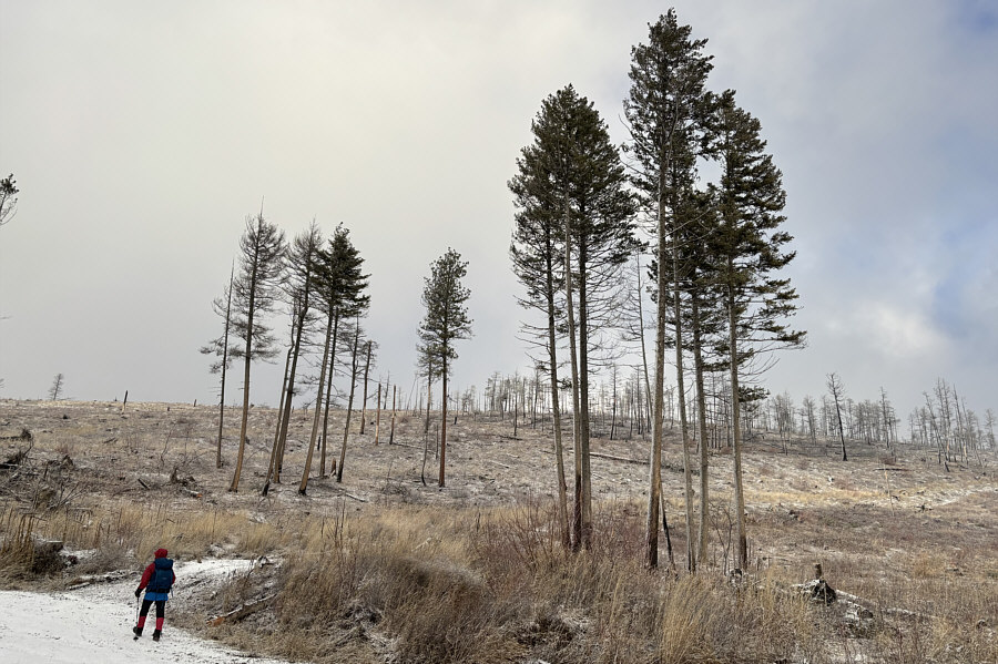
Zosia follows a dirt road heading toward the hill at right. |
 |
Zosia reaches a scenic viewpoint (VP1) with Mount Boucherie visible at far left. |
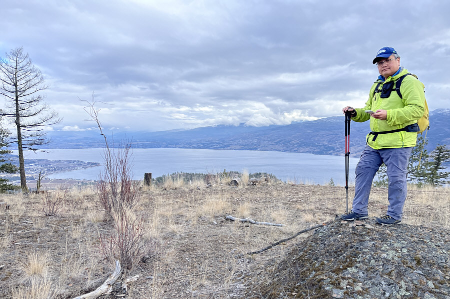 |
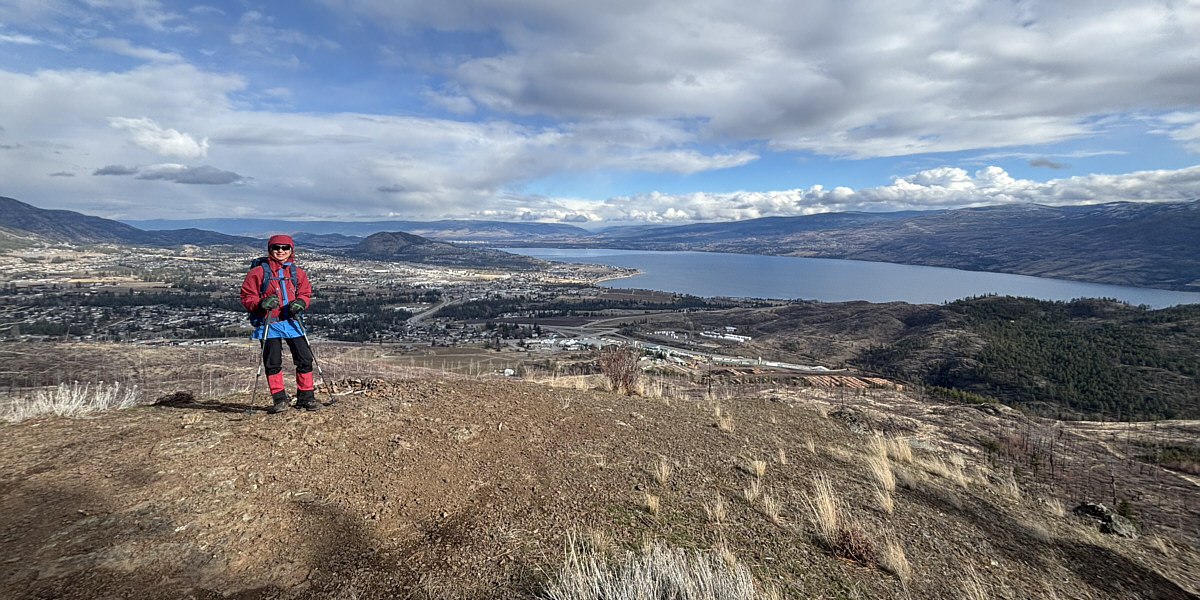
Sonny stands on the highest point (HP1;
796 metres) of The Eye Of The Needle hike. Photo courtesy of Zosia Zgolak |
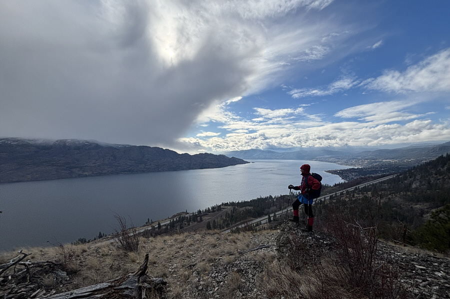 |
Dropping nearly 90 metres on the south side of HP1, Zosia reaches this second scenic viewpoint (VP2) but is still wondering why this hike is called The Eye Of The Needle. |
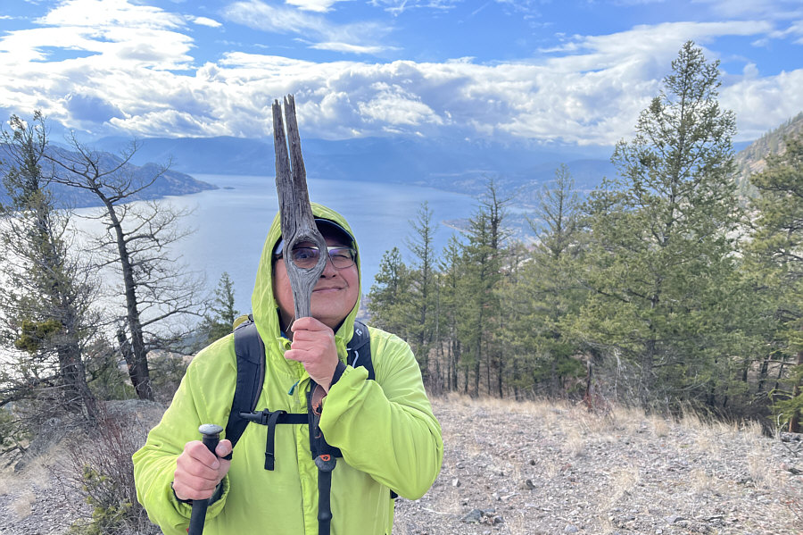 |
Sonny finally finds The Eye Of The
Needle! Photo courtesy of Zosia Zgolak |
 |
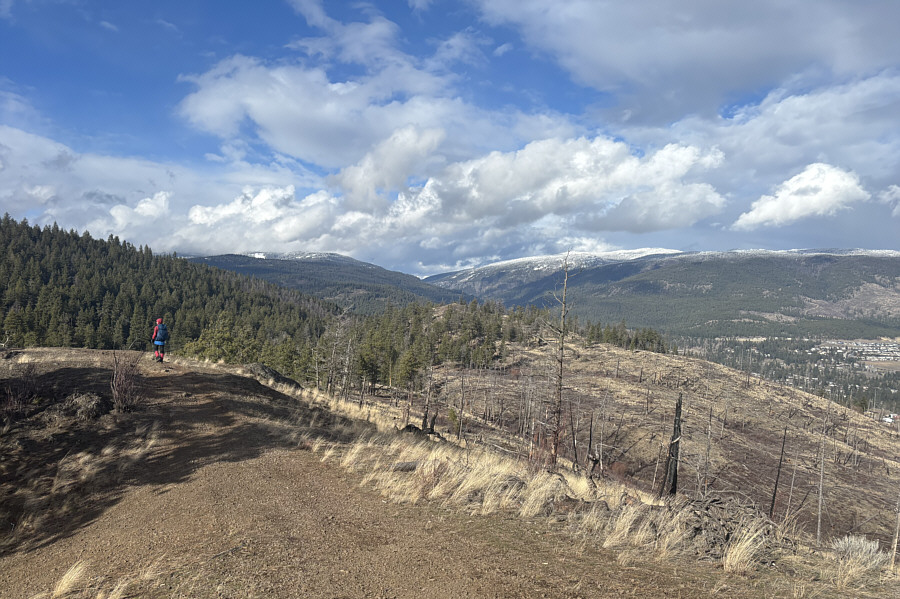
Descending HP1, Zosia sets her sights for another high point (right of centre) to the north. |
Zosia stands atop the second high point (HP2; 788 metres).
 |
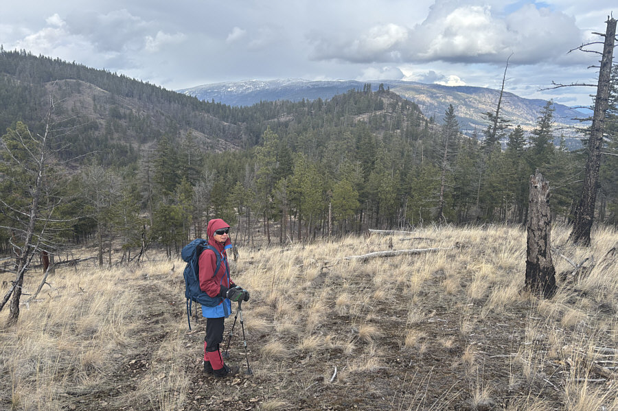
Leaving the top of HP2, Zosia continues northward to yet another high point (centre). |
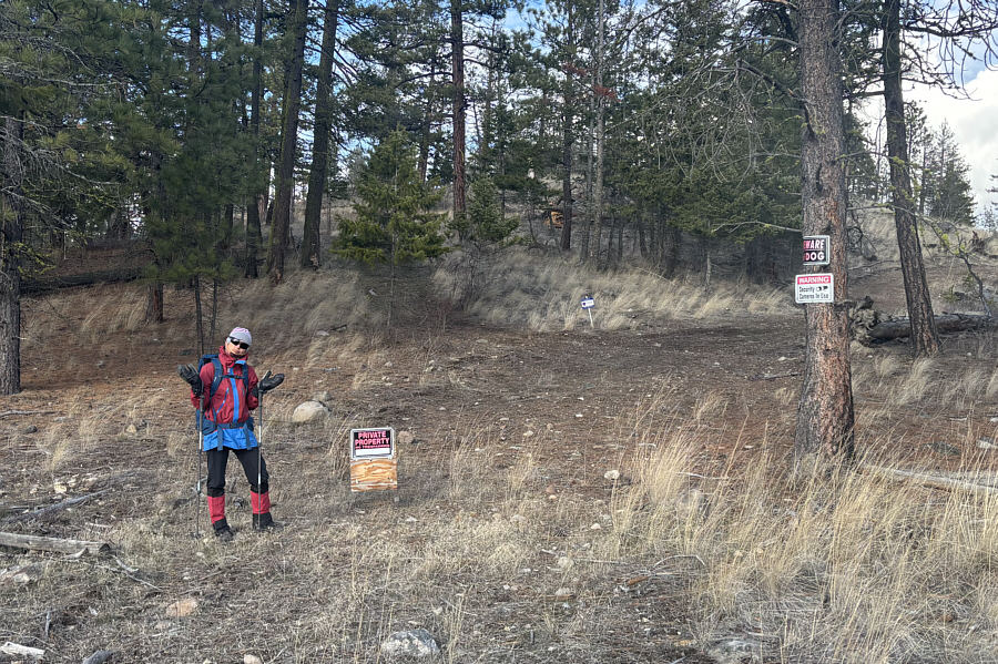 |
Unfortunately, the third high point is off-limits to the public. |
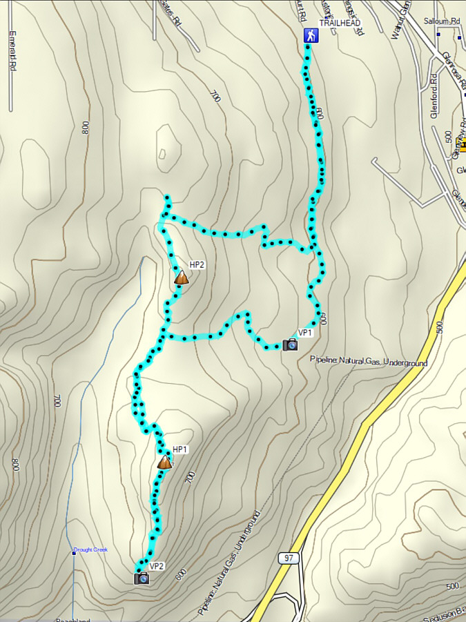 |
Total Distance: 7.8 kilometres Round-Trip Time: 3 hours 45 minutes Cumulative Elevation Gain: 309 metres |