BOU AVENUE
Mailbox Peak

Departing Kirkland, Washington on 9 April 2026, Zosia Zgolak and I stopped near North Bend to hike up unofficially-named Mailbox Peak.  Like many of the other trail-accessible peaks in this area, Mailbox Peak is exceedingly popular and is likely ascended year-round.  The summit can be accessed via two different trails--a newer one that switchbacks gently up the northwest slope and an older one--dubbed the "Old Trail"--that basically pushes straight up the west ridge.  Figuring that it would be a monstrous ascent either way with about 1200 metres of elevation gain, we opted to try the shorter but steeper Old Trail.

From I-90 near North Bend, take Exit 34 and head north on 468th Avenue for 750 metres before turning right onto Middle Fork Road.  Drive 1.5 kilometres and keep left at a split (right is also okay but is a one-way road).  Drive 2.0 kilometres and turn left at a T-intersection (one-way road joins in from the right).  Drive 500 metres and either park in a pullout here or turn right and drive an additional 240 metres to the upper parking lot for Mailbox Peak Trailhead (vault toilet available).  Note that a Discover Pass is required to park in the upper parking lot.

Starting at the upper parking lot, Zosia and I backtracked a little along the access road to a gated gravel road splitting off at a bend.  About 140 metres up this gravel road, we passed the marked start of the newer trail, and another 400 metres further, we reached a sign board at the start of the Old Trail.  This trail rises fairly gently for the first few hundred metres, but then it begins to climb in earnest.  For the next several hours, we grinded up an unrelentingly steep trail with no views whatsoever.  The ascent is as much a mental test as a physical one as it is easy to despair when facing such an uninspiring uphill slog that never seems to end.  With that said, the trail was still astoundingly busy for the middle of a work week as scores of people going up passed me with regularity.  About three quarters of the way up, the Old Trail crosses and then merges with the newer trail, and shortly past this junction, we finally broke out of the forest onto a huge talus slope.  Although we still had more than 200 metres of elevation gain left, just having far-reaching views here felt like a small victory after all the previous drudgery.  The remainder of the climb, though uncomplicated, felt especially wearisome for me, and while Zosia still looked fresh, I was running on fumes by the time I staggered up to the summit cairn.  The summit was quite crowded when we arrived, and we had to drop a bit down the ridge on the far side to find some solitude for our lunch break.  The unobstructed views of resplendent Mount Rainier helped alleviate some of my fatigue, but I was already dreading the long descent as I tried to choke down some food.

Much of the crowd at the summit had dissipated by the time Zosia and I commenced our descent.  We faithfully retraced our steps all the way down the mountain, but my feet were definitely hurting most of the way.  I constantly fell behind Zosia who waited patiently for me to catch up numerous times.  Surprisingly, we ran into quite a few people still on their way up despite the lateness of the day.  The sign board at the start was a sight for sore eyes and feet, but even the final easy walk down the road to the parking lot felt long and painful.  At the end, I did not really feel any great sense of accomplishment; I was just happy I survived Mailbox Peak!
The sign warns about how tough an ascent this is, and it ain't lyin'! 
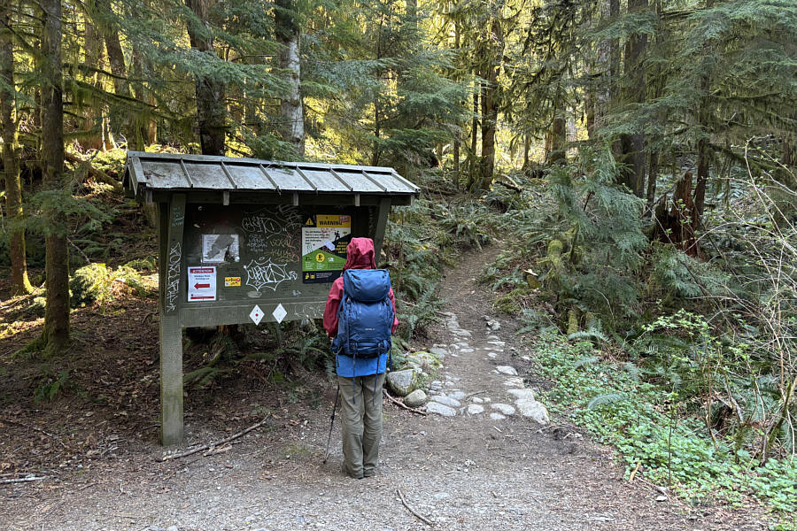
Zosia reads an information sign board at the start of the "Old Trail" going up Mailbox Peak.
A most dispiriting ascent... 
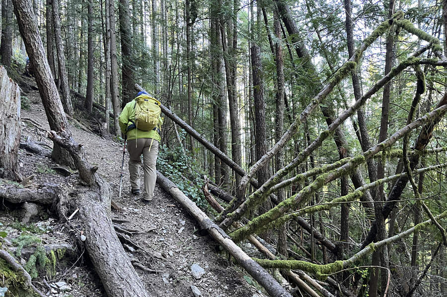
The Old Trail is mostly easy to follow but is unrelentingly steep.

Photo courtesy of Zosia Zgolak

Still more than 200 metres of ascent left from here...ugh! 
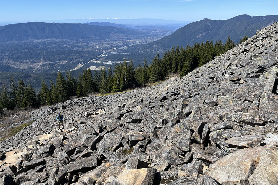
After more than three hours of climbing, Sonny finally breaks out of the forest onto an open talus slope.

Photo courtesy of Zosia Zgolak

I'm already running on fumes here! 
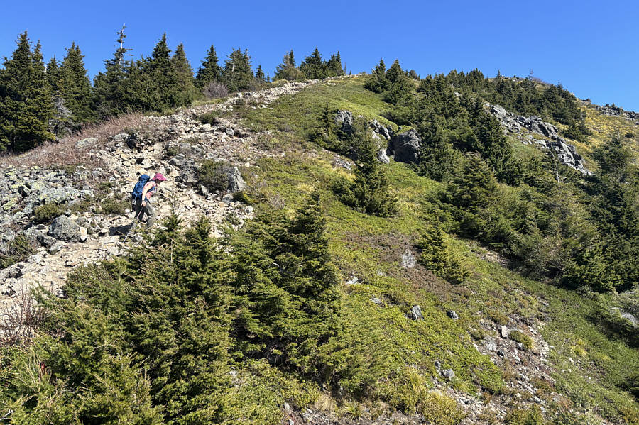
Zosia makes her way up the last section of trail before the summit.
We were really blessed to see Rainier so often on this road trip! 
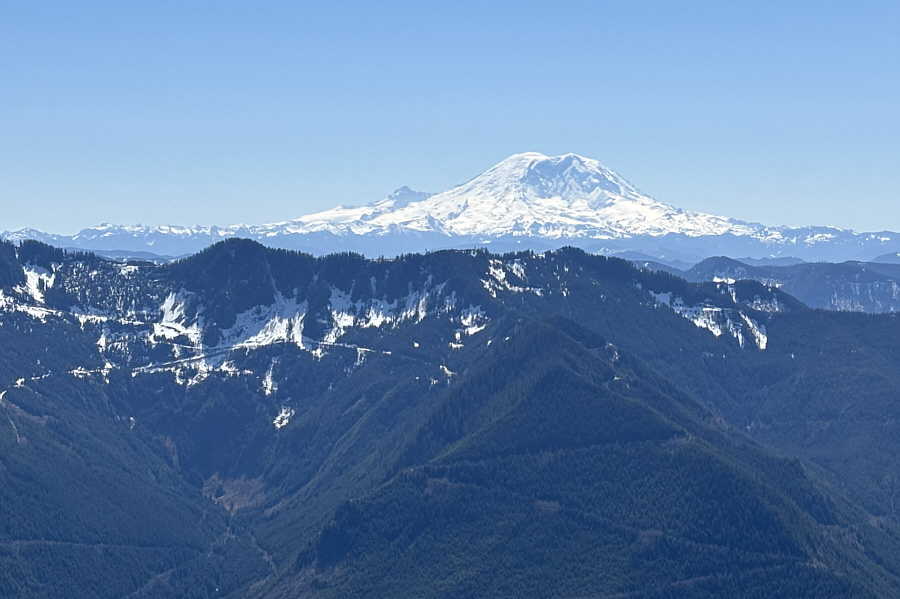
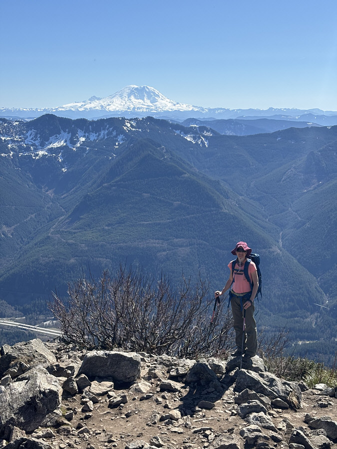
Mount Rainier looks resplendent about 68 kilometres to the south.

You can also spot West Tiger Mountain just right of centre.

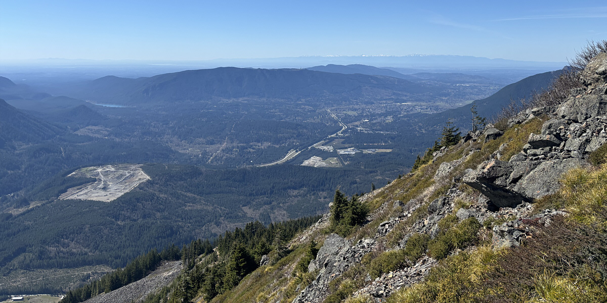
In this view to the west from near the top of Mailbox Peak, Rattlesnake Lake and Rattlesnake Mountain are the most obvious landmarks across the valley.


Somebody even put a Banff Sunshine Village sticker on the mailbox! 
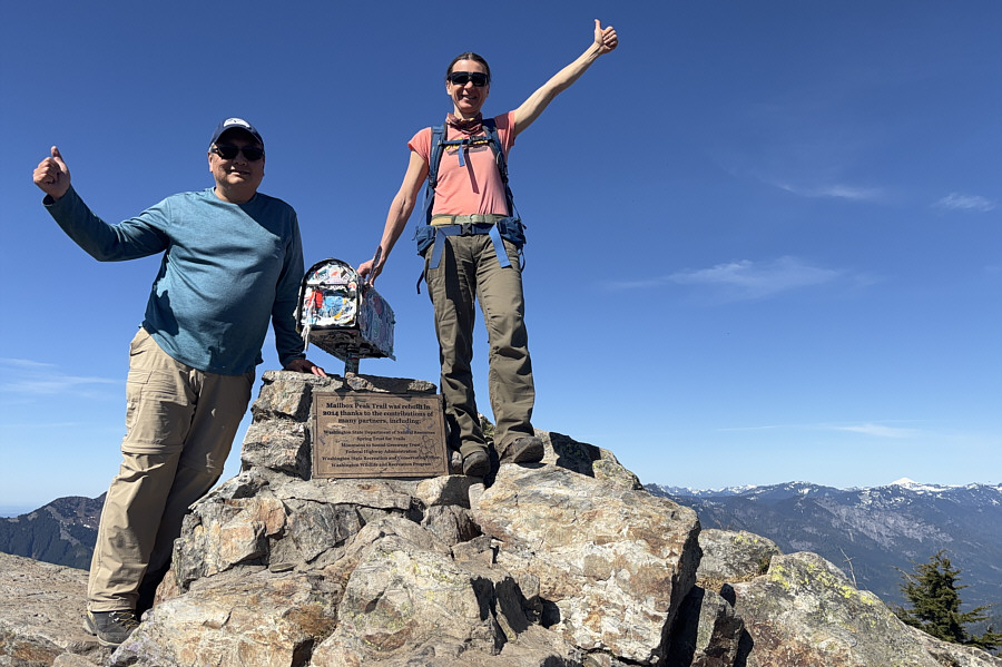
Sonny and Zosia stand on the summit of Mailbox Peak (1479 metres).

Russian Butte looks intriguing...but it's a real adventure to get there, I think.

Here is the view to the north across Middle Fork Snoqualmie River valley.


The crowds finally thinned out enough on the summit to get this shot of Zosia by herself. Here is one last look at Mount Rainier from the summit of Mailbox Peak.
It's been almost 8 years since Zosia and climbed Mount Teneriffe--boy, do I feel old! 
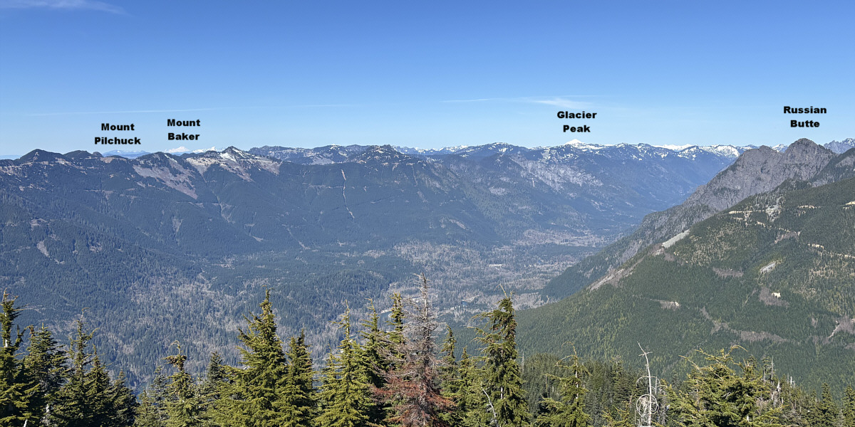
Two familiar peaks are visible to the northwest.
I'm gettin' too old for this sh*t! 
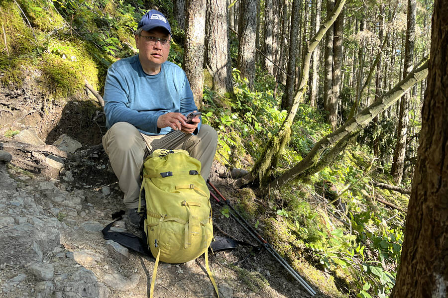
Partway down the mountain, Sonny considers calling for help to rescue his tired ass.

Photo courtesy of Zosia Zgolak

It's crazy that there are still people climbing up the peak at this late hour! 
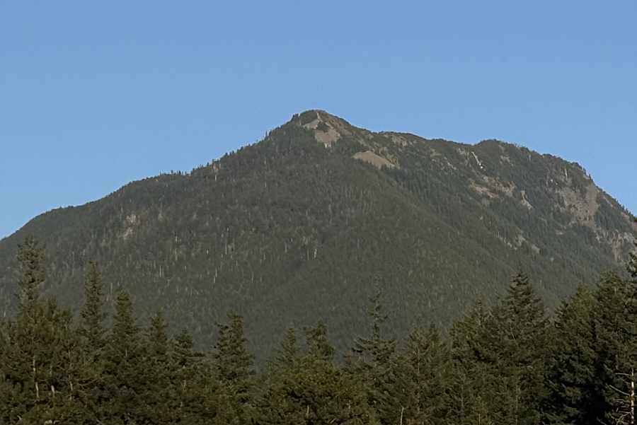
Here is a view of Mailbox Peak from a gas station at the east end of North Bend.
The Grouse Grind of North Bend, WA. 
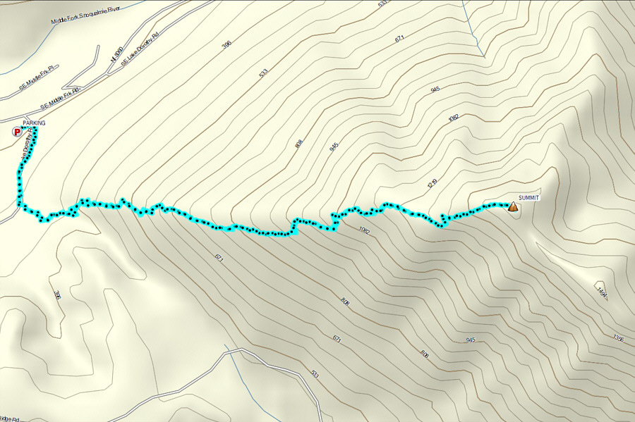
Total Distance:  12.1 kilometres
Round-Trip Time:  8 hours 50 minutes
Cumulative Elevation Gain:  1197 metres

GPX Data