BOU AVENUE
Mounts Warspite And Invincible
Many of the peaks in Peter Lougheed Provincial Park are named in honour of British sailors or warships involved in the Battle of Jutland in 1916.  Two such peaks are Mounts Warspite and Invincible near Kananaskis Lakes.  According to Place Names Of The Canadian Alps (by Boles, Laurilla and Putnam, 1990, Footprint Publishing), HMS Warspite was a dreadnought that sustained heavy damage in the battle but managed to survive and remain in service for another 30 years.  HMS Invincible was a battle cruiser that was sunk with the loss of nearly the entire crew of over a thousand men.

My original plan was to stash a bike at the Mount Black Prince day use area, drive to the Peninsula day use area, hike up the old gypsum mine road, scramble up Mount Invincible (easier said than done!), traverse over to Mount Warspite, descend via Warspite Lake, retrieve my bike and ride along the highway back to my car.  Unfortunately, access to the gypsum mine road was closed on 10 August 2003 due to bear activity in the vicinity.  Instead, I began my trek at the Mount Black Prince day use area and hiked past Warspite Lake en route to scrambling up Mount Warspite.  From there, I followed the connecting ridge southeast over two minor bumps (GR268155 and GR271151) to Mount Invincible.
Warspite Puddle
Here is Warspite Lake or what's left of it below Mount Black Prince.
Cool and refreshing!
Warspite Cascades is a good spot to rest on the way up to the hanging valley north of Mount Warspite.
Things get serious.
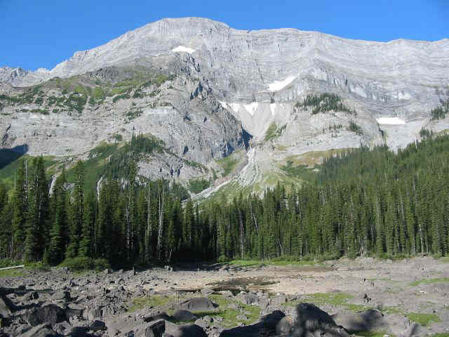
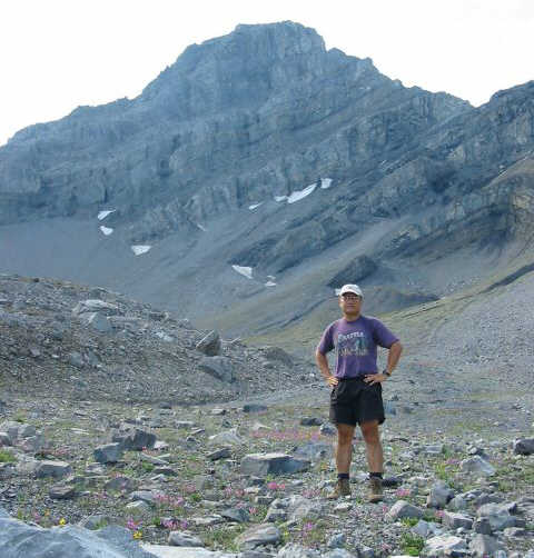
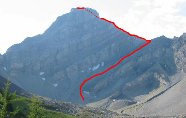
At the head of the hanging valley is Mount Warspite.  Click here for a view of the scrambler's access route which runs up a ramp below the snow patches to the col at  upper right.
This is bloody tiring!
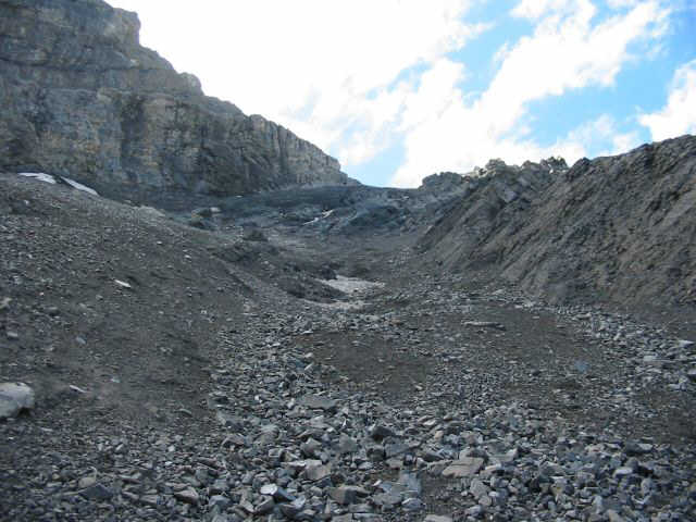
This is looking up the ramp.  Notice the treadmill rubble.  Rockfall is a real hazard in this area.
Doesn't look that bad...
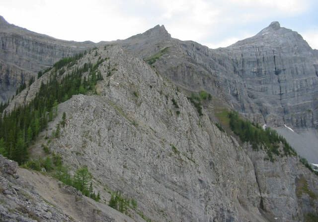
From the col, the route follows roughly the crest of the ridge until just below the big towers at the top.  From there, it circles around to the right and heads up easier terrain.
Piece O'Cake!
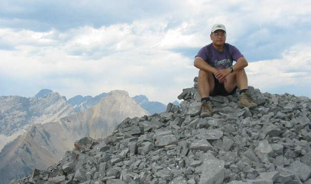
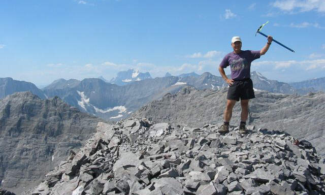
This is the 2850-metre summit of Mount Warspite.  The peak on the horizon with the snow patch is 3422-metre Mount King George.
Should I stay or should I go?
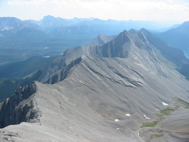
The connecting ridge to Mount Invincible is distinguished by two minor bumps, GR268155 at left and GR271151 at centre.
Lookit da views!
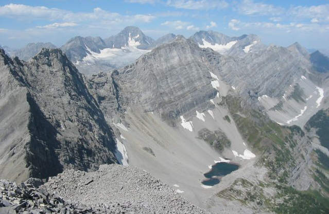
The view northwest of Mount Warspite includes Mount Sir Douglas, the Haig Glacier, Mount Black Prince and Black Prince Lakes.
Delightful ridge walking!
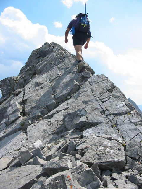
Sonny approaches the  top of GR271151 which is a bit more challenging than GR268155 and offers a taste of what's to come on Mount Invincible.
No turning back now!
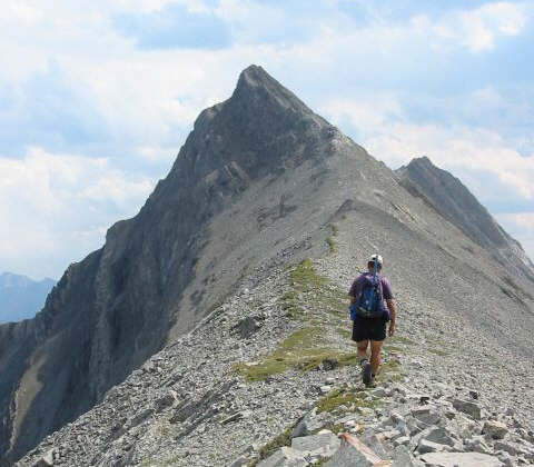
Sonny approaches the northwest ridge of Mount Invincible.
Reaching the summit of Mount Invincible proved to be a little more challenging than Mount Warspite.  Near the top, I had to traverse across the west face before climbing up an exposed buttress.  It took me two hours to get from one summit to the other.  Interestingly enough, Mount Invincible's summit canister (a copper pipe) still housed the same booklet left by Fred Crickard (from Halifax) and Bob Higgins (from Salisbury, England) who made the first ascent of the peak on 12 June 1957.  If the subsequent register entries are any indication, this peak has received very few visitors over the years.
Interesting.
This is the crux of Mount Invincible's northwest ridge.  I traversed over to the rubble at far right before ascending the right skyline.
Okay, let's go home.
Sonny sits on the 2730-metre summit of Mount Invincible.  Mount Warspite is visible in the background.
For my descent, I retraced my steps back to the knob at GR268155.  A northeast-trending ridge descends from here toward the Mount Black Prince day use area--a shortcut, or so I thought.  While taking this route saved me from having to traverse over Mount Warspite again, it entailed some difficult and exposed downclimbling, a long and nasty bushwhack, and an icy ford of Smith-Dorrien Creek.  My car was certainly a sight for sore eyes after a round-trip time of 11 hours.
What was I thinking?!
This is looking back up the ridge where I descended.  At top centre is GR268155, and at top right is Mount Warspite.