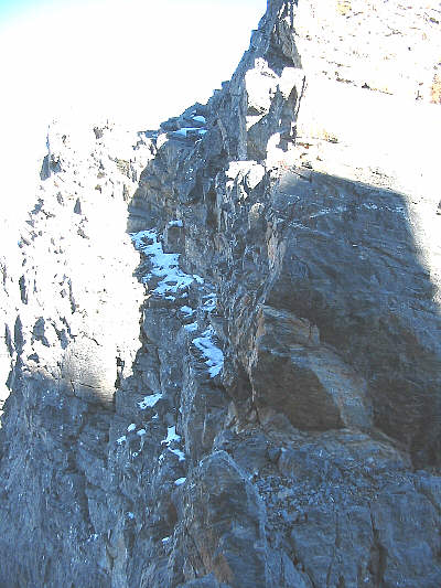
The ascent of the north summit was straightforward and trouble-free--mostly a long slog up the Burgess Pass trail and up a scree-filled gully. Getting to the south summit was much more interesting. Although the connecting ridge between the north and south summits looks like a logical route choice, Kane suggests descending into a scree-filled basin before scrambling up a steep, narrow gully to regain the connecting ridge. Reluctant to give up hard-won elevation, I decided to tackle the ridge directly. I soon discovered the reason for Kane's roundabout route: two pinnacles guarding the ridge. I easily bypassed the first pinnacle on the left (east) side, but when I reached the second pinnacle, I saw that the only way to get by this obstacle was to traverse an uncomfortably narrow ledge along the right (west) side. The exposure is severe here, and to make matters worse, a light dusting of snow rendered the ledge dangerously slippery. I weighed my options for a few moments and finally decided that the traverse was worth the risk. I moved very cautiously and slowly across the ledge. All the while, I tested every handhold and foothold before committing any weight to them. Consequently, it took me about ten minutes to traverse the five metres or so of the ledge. Once I got through, I breathed a huge sigh of relief and continued up slabs toward a cairn visible on the summit ridge. The summit ridge itself has some narrow and exposed sections, but these are more fun than scary. About an hour after leaving the north summit, I was standing on the south summit.
On the descent, instead of going back across the exposed ledge, I
turned right just before the pinnacle and dropped down Kane's
steep, narrow gully to the basin below. From there, I had to climb
a bit and contour eastward to regain my initial ascent gully. A
long and uneventful walk down the mountain had me back at my car after a
round-trip time of just over seven hours.
|
|
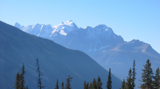
The view south from the lower slopes of Mount Burgess include Mount Vaux (covered by the Hanbury Glacier) and Mount Hurd. |
|
|
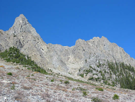
Access to the upper reaches of Mount Burgess is via the gully at centre. |
|
|
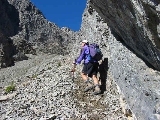
While ascending the gully, it's best to stick close to the walls where the scree is not as loose. |
|
|
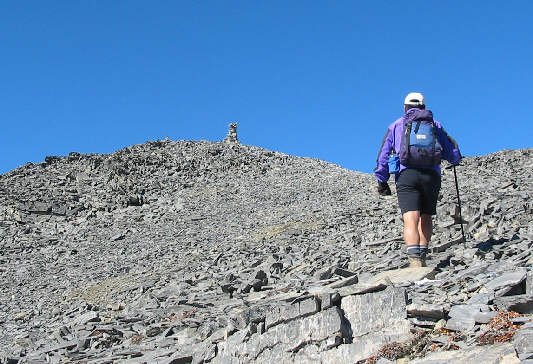
Sonny approaches the cairn on the north summit. |
|
|
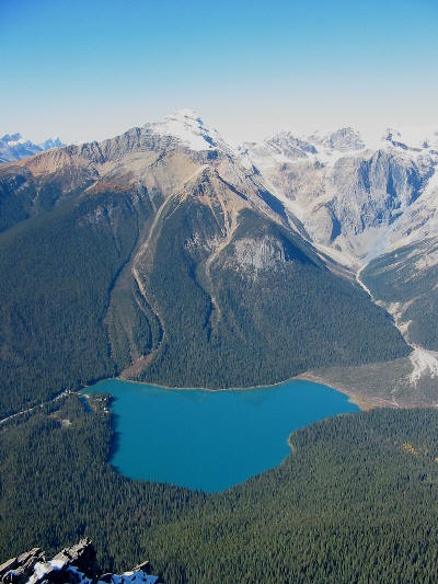
The north summit grants a fine view of Mount Carnarvon and Emerald Lake. |
|
|
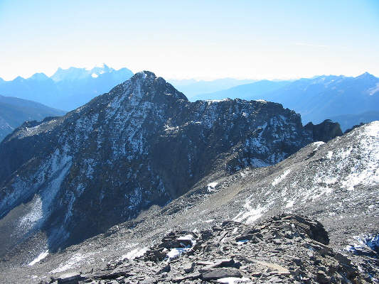
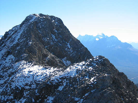
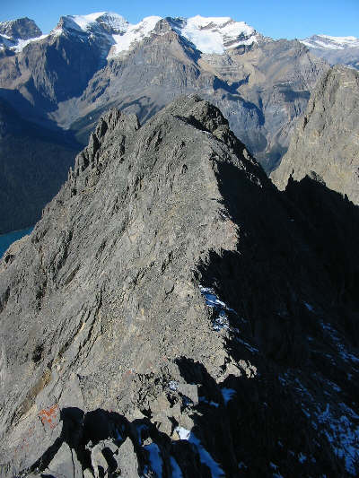
The north summit also grants a fine view of the higher south summit. The connecting ridge between the north and south summits is visible just right of centre. |
|
|
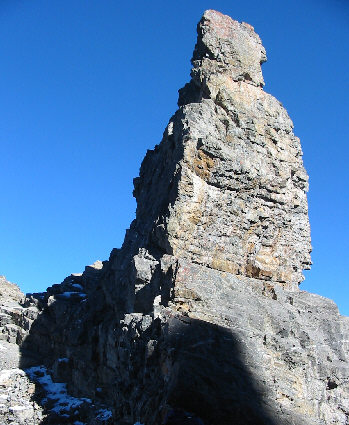
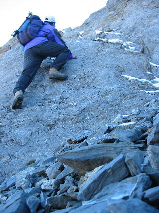
This is looking back (northward) at the second of two pinnacles guarding the connecting ridge between the north and south summits. This pinnacle can be bypassed by traversing the exposed ledge (snowy and in shadow) at bottom left. Click here for a better view of this ledge. |
|
|
The scramble up to the summit ridge is very enjoyable. |
|
|
The summit ridge has a few narrow sections which require some care and focus. |
|
|
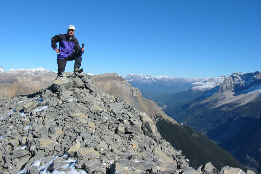
Sonny holds up the register canister on the 2599-metre south (highest) summit of Mount Burgess. |
|
|
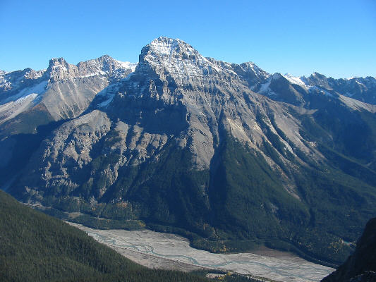
The south summit grants an unobstructed view of Mount Stephen. |
|
|
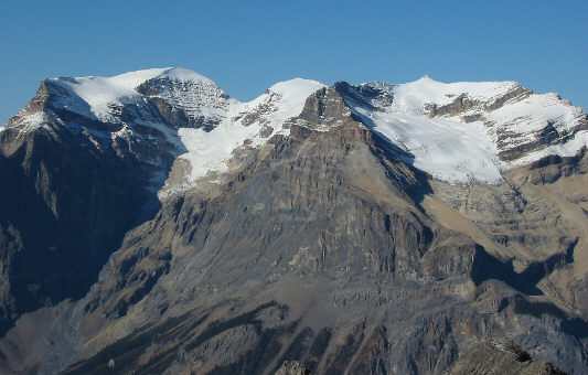
The view to the north is dominated by the President, the Vice President, and the Emerald Glacier. |
|
|
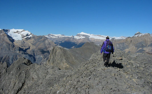
Sonny begins his descent. On the horizon from left to right are the Vice President, Mount Gordon, Mount Balfour, and Wapta Mountain. The north summit of Mount Burgess is visible in the middle foreground just below Mount Balfour. |
|
|
This is looking back down the summit ridge. |
|
|
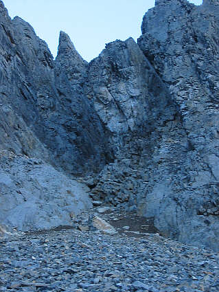
This is the mouth of the narrow gully which Alan Kane suggests using to access the south summit. The gully bypasses the pinnacles guarding the connecting ridge. |