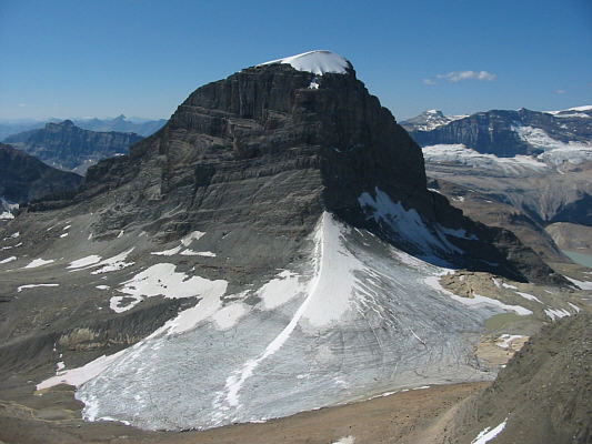
Higher up, I was surprised to see four people coming over the ridge crest. At first, I thought they were scramblers returning from Mount Daly, but upon closer scrutiny, I surmised (I didn't really get a chance to talk to them) that they were hiking out from Scott Duncan Hut. When I reached the ridge crest, I saw another group of four--also likely hiking out from the hut--heading down the next valley over. From the ridge crest, I also got my first good look at Mount Daly and the "small pyramid" as described by Alan Kane. Kane advocates descending into the basin to avoid crossing Niles Glacier, but the thought of having to lose and regain that elevation was unsavoury for me. Judging by tracks in the snow, I could tell that the people from Scott Duncan Hut had crossed the glacier safely, and it didn't look like there were any crevasses. I took a calculated risk and decided to cross Niles Glacier. The crossing was remarkably easy, and I was soon contouring around the "small pyramid" to reach the base of Kane's "cone of tedious rubble". This slope was steep and horribly loose, and it's a miracle that I even managed to get up it. In contrast, Kane's so-called crux was laughably easy to ascend, and I was soon climbing up easy rubble and snow on the upper mountain.
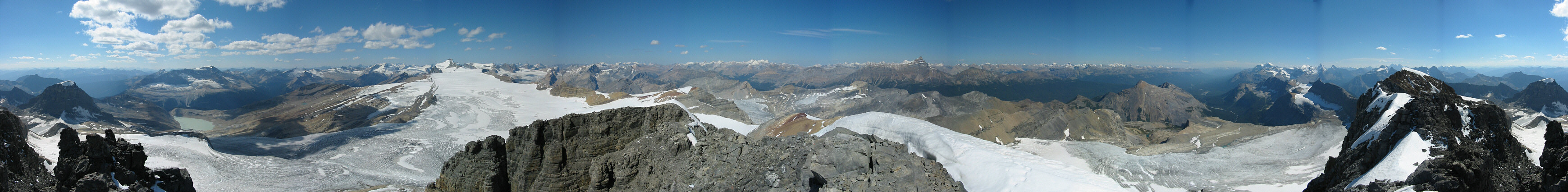
After an eternity of plodding, I finally reached the first of two summits described by Kane. This first summit was buried under a huge snowcap, but I had little trouble getting over it. I then continued along the somewhat exposed connecting ridge to the second summit which has a cairn and register. The entire ascent had taken me a whopping 7.5 hours! However, the summit views were exceptional on this day and more than worthy of the major effort invested.
I left the summit at 4:00 PM and basically retraced my steps all the
way back out. Some cairns and flagging tape made it easy to find
and descend the crux. The "cone of tedious rubble" worked to my
advantage on the descent, and a second crossing of Niles Glacier was just
as easy as the first time. I lost a bit of time when I had to
backtrack and relocate my sunglasses which I inadvertently dropped
somewhere along Sherbrooke Creek. Otherwise, a long but uneventful
hike had me back at the trail head by 9:20 PM--far later than I had
anticipated.
|
|
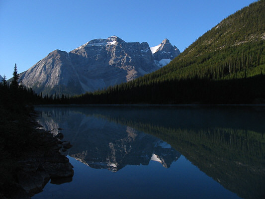
An unnamed peak and Cathedral Crags are reflected in Sherbrooke Lake. |
|
|
A good trail starts from a big cairn at the right edge of Niles Meadow and eventually heads up to the ridge adjoining Mount Niles. |
|
|
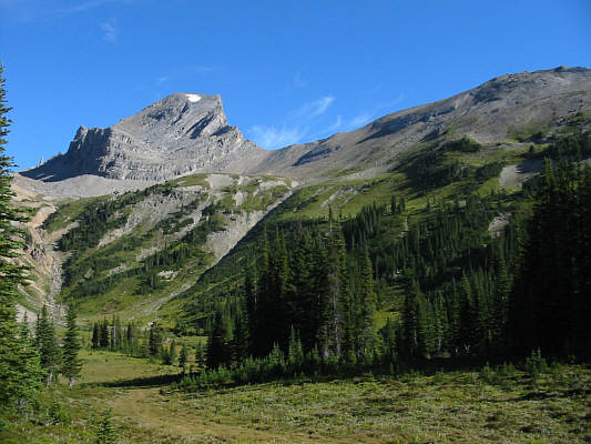
This unnamed peak southwest of Mount Niles looks as if its south ridge has been torn out. |
|
|
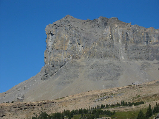
The views start to open up high above Niles Meadow. |
|
|
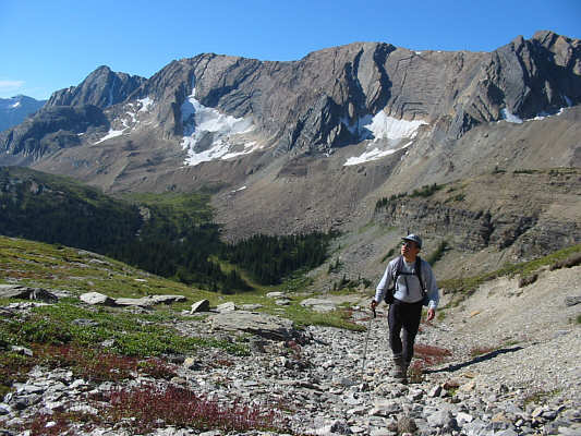
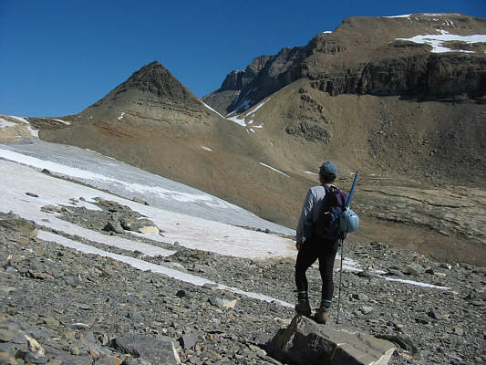
Sonny gets a good look at the "small pyramid" and Mount Daly. |
|
|
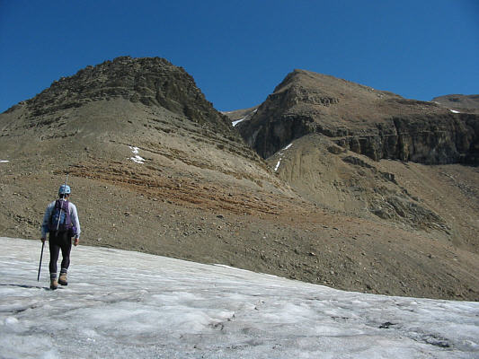
Sonny cautiously crosses Niles Glacier. He would eventually contour around the right side of the "small pyramid". |
|
|
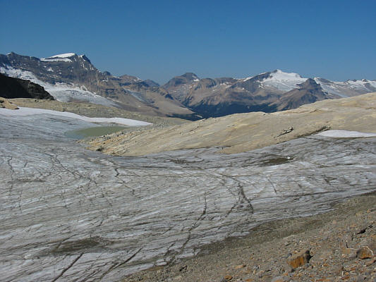
This is looking west across Niles Glacier to numerous peaks in Little Yoho Valley. |
|
|
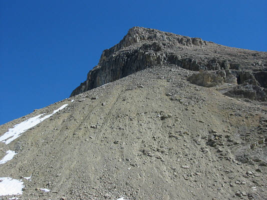
This is the "cone of tedious rubble" and by far the worst part of the entire ascent. |
|
|
This is a more complete view of Mount Niles and Niles Glacier from the slopes of Mount Daly. |
|
|
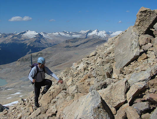
Sonny climbs up more rubble. |
|
|
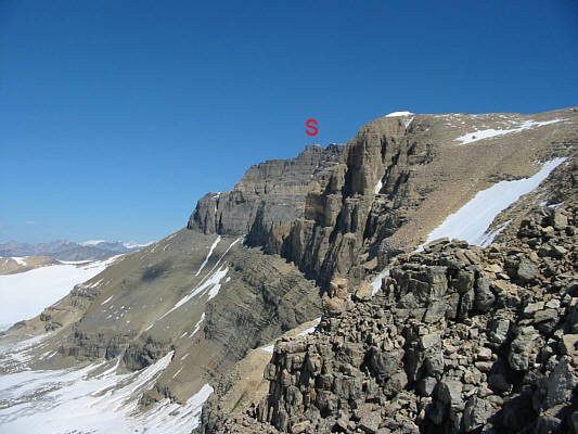
The summit (S) is still awfully far away. |
|
|
The east face of Mount Daly looks even more magnificent from up close. |
|
|
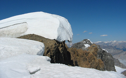
A huge cornice overhangs the first summit. The second summit is visible in the distance. |
|
|
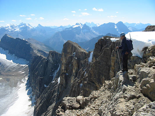
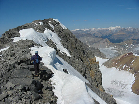
Sonny makes his way along the connecting ridge between the two summits. |
|
|
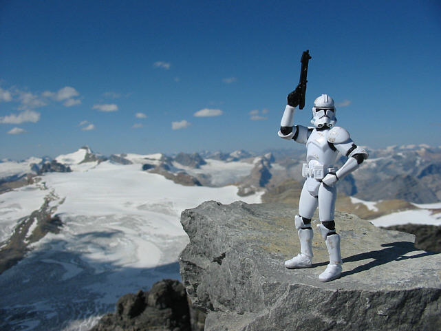
Sonny holds up the register at the north summit. Click here to see a 360-degree panorama. |
|
|
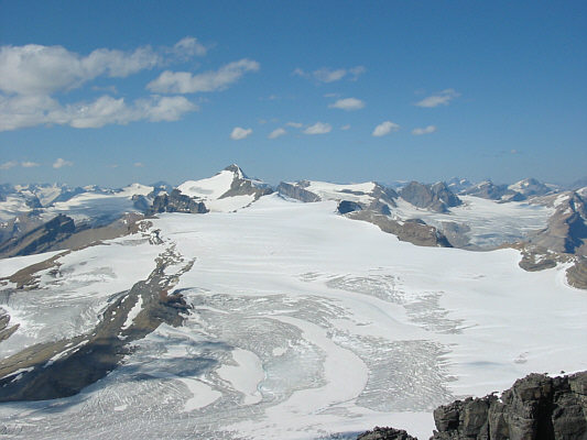
Mount Balfour and Waputik Icefield dominate the view to the northwest. |
|
|
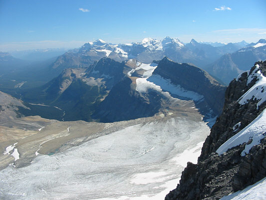
The view southeast includes Bath Glacier and all the big peaks in the Lake Louise area. |
|
|
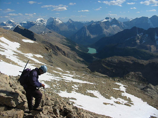
Sherbrooke Lake is a definite eye-catcher (so are the Goodsir Towers at right on the horizon), but Sonny is more preoccupied with the next rock he will step on during his descent. |
|
|
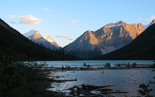
In this view looking south from the north end of Sherbrooke Lake, the last light of day hits the tops of distant peaks (Mount Victoria and Mount Huber at left). |