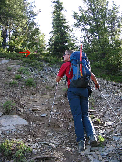


At 10:33 AM, we were surprised to see a man wandering above us not far from the fossil beds. Although he was carrying an ice axe and appeared to be ascending the mountain, he seemed a little dazed and confused. We asked him a few questions but never got a single straight answer. Vern politely pointed out to the man that he was in a restricted area without a permit and subject to a fine of up to $25,000 and/or a 1-year prison term. Suddenly, the man asked if he could join us for the rest of our ascent. Vern and I reluctantly agreed, but we warned him that we were not responsible for him if he was caught by park wardens. As we skirted around the fossil beds, we could see trilobite fossils everywhere we stepped. It was awfully tempting to pick up a souvenir, but Vern and I remained true to the conditions of our permit and continued up the steep trail without stopping. Just as we got past the fossil beds, Vern and I noticed that our new companion had turned around and was heading down. We figured that either he was scared off by Vern's talk about fines and jail or he was intimidated by our 'climbing prowess' as we blew by him and left him in the dust.
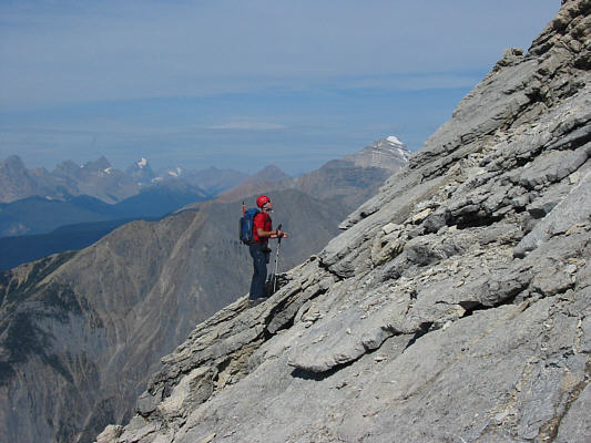
Vern and I soon reached the "wide shoulder" as described by Alan Kane and carried on up through a gully to a broad rubble slope. This rubble slope seemed interminable. I would look up after every dozen steps or so, and the top seemed to only get further and further away. When we finally reached the base of some serious-looking cliff bands--the start of Kane's "last 125 m of elevation gain"--Vern and I had some fun tackling a steep gully directly in front of us (the normal route circumvents this gully to climber's right). Further up, we met a couple of scramblers down-climbing the crux (pictured in Kane's guide). They started at 7:00 AM and hadn't bothered getting a permit either, but at least they weren't acting evasively. Vern and I traversed much of the summit ridge below the crest on the south side before finally scampering up to the summit at 1:52 PM. An awkward ladder on the side of the summit's repeater station allowed us to climb a few extra metres to add to our total height gain for the day.
Leaving the summit at 2:42 PM, our return trip was highlighted by a
thrilling walk along the crest of the exposed summit ridge as well as a
leap across a short gap at the base of the crux. Otherwise, we had
an uneventful descent and made it back to the trail head by 5:57 PM.
|
|
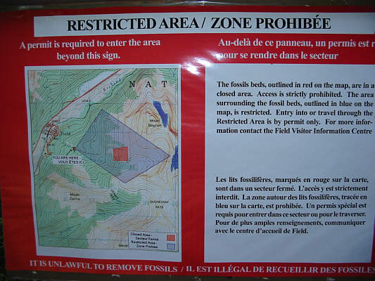
This sign shows the extent of the restricted (blue) and prohibited (red) areas of the Mount Stephen fossil beds. |
|
|
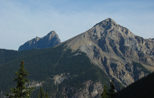
A clearing along the trail allows this unobstructed view of Wapta Mountain (left) and Mount Field. |
|
|
Vern looks around for fossils on the way up. Note the "dazed and confused" guy in the bushes ahead. |
|
|
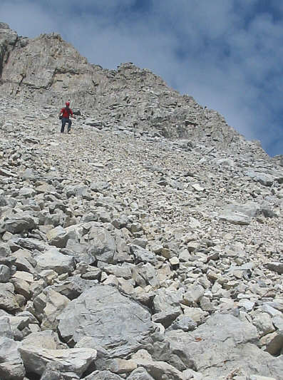
This is looking up the rest of the ascent route from the "wide shoulder". |
|
|
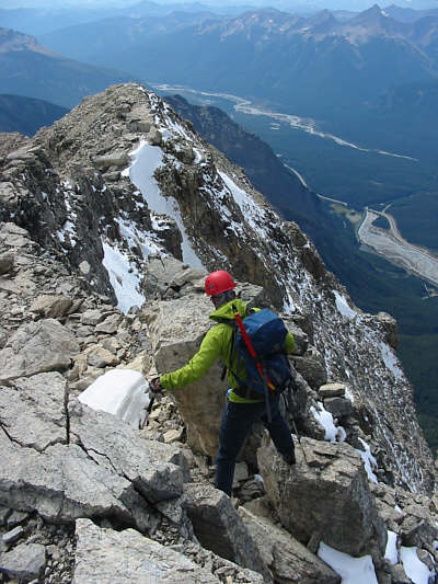
Vern scrambles up some down-sloping slabs. In the distance to the right of Vern is Mount Carnarvon. |
|
|
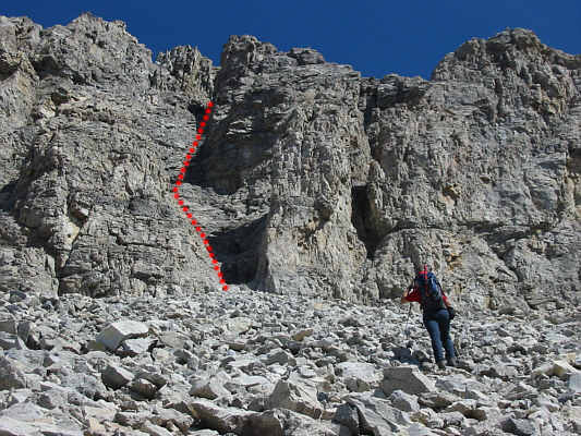
This is the base of the "last 125 m of elevation gain". While the normal route goes around to the right, Vern and Sonny would head straight up the gully as marked. |
|
|
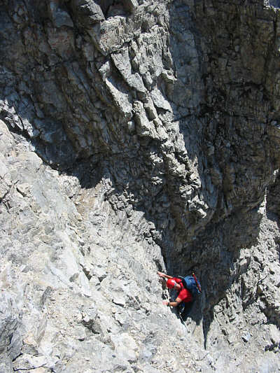
Vern climbs up the gully. |
|
|
Near the top of the gully, Vern rethinks the wisdom of following Sonny blindly. |
|
|
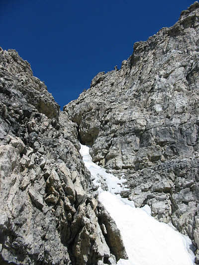
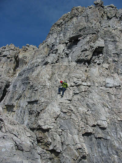
The crux is the rock band just above the top of the snow chute. |
|
|
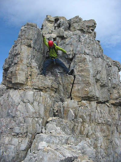
Vern stretches out across the short gap that he and Sonny would later leap on the descent. |
|
|
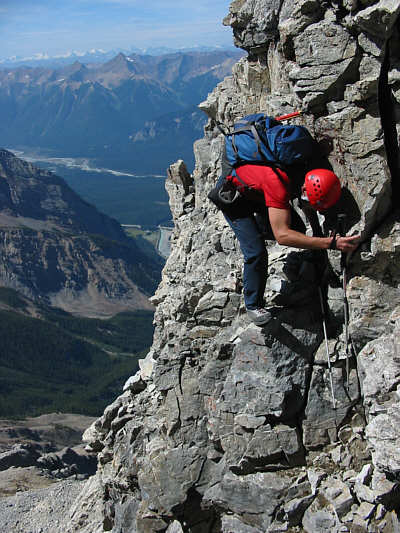
After getting above the crux, Vern can see the repeater station at the summit. |
|
|
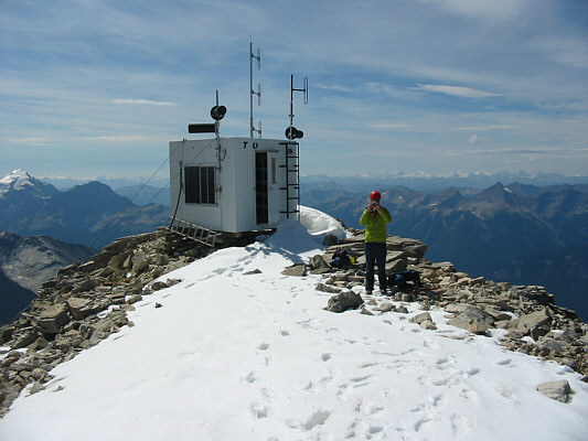
Vern takes a photo on the 3199-metre summit of Mount Stephen. |
|
|
Sonny and Vern hold up their ice axes beside a cairn near the summit. |
|
|
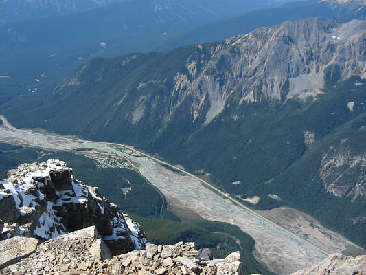
This is looking down on both the town of Field and Mount Burgess (upper right). |
|
|
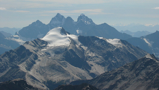
Looking south, snow-clad Mount Owen isn't quite high enough to eclipse the Goodsir Towers. |
|
|
To the southeast, the two pointy peaks are Hungabee Mountain (left of centre) and Deltaform Mountain. Snow-capped Mount Ball is also visible in the distance at far right. |
|
|
Vern takes shelter from the cool breeze and peruses the summit register. |
|
|
Vern negotiates around a couple of blocks on the exposed summit ridge. |
|
|
Vern descends a tricky spot on the summit ridge. |
|
|
Vern descends the crux. |
|
|
Vern finds a rare stretch of scree surfing while descending the broad rubble slope. |
|
|
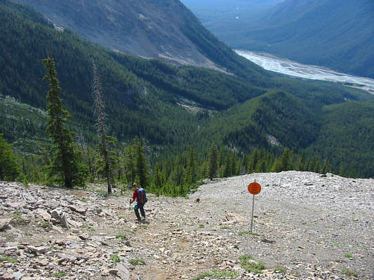
The forbidden zone (fossil beds) is to the right. |
Be sure to check out Vern's excellent photos of this same trip here.