BOU AVENUE
Commonwealth Peak
Not wanting to let a stretch of great weather go to waste, I headed out after work to Peter Lougheed Provincial Park on 28 June 2006 and scrambled up Commonwealth Peak.  After slapping copious amounts of bug repellent on myself at the trailhead, I biked up the trail to Burstall Pass for about twenty minutes before parking my bike and heading down to the boggy flats west of Burstall Lakes.  I switched from boots to sandals here and proceeded across the swamp toward an obvious avalanche slope on the far side.  Several of the braided channels of Burstall Creek were deceptively deep, and I nearly went for a dunk at one point.  There were also patches of woody undergrowth that were just high enough to leave numerous scratches on my bare legs.  The worst parts though were the long stretches of partly submerged grass.  I felt like I was being sucked down into the bog with each step, and the water, though only ankle-deep, was painfully cold on my sandaled feet.  Thankfully, this misery was short-lived, and less than fifteen minutes after starting across the swamp, I was changing back into my boots at the foot of the avalanche slope.  As per Alan Kane's route description, I stuck to the left side of the avalanche slope and found a reasonably good route up through the trees to the rocky gully above.  In spite of all the bug repellent I was wearing, the mosquitoes were persistent throughout the ascent and prompted me to keep moving up steadily.  A long scree slog up to the col was followed by another long scree slog up to the short wall just below the summit.  I reached the summit cairn just after sunset and quickly performed all my requisite summit chores before heading back down.  The aforementioned scree facilitated a quick descent to tree line, and despite the growing darkness, I managed to find my way down through the trees without any problems.  After a second miserable crossing of the swamp, I retrieved my bike and cruised back to the trailhead (round-trip time of 4.5 hours).
Get used to that squishy feeling! 
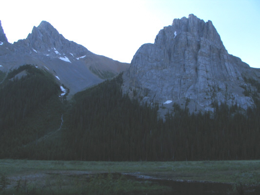
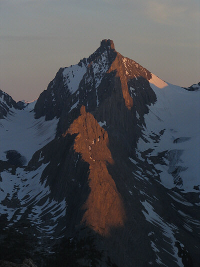
This is looking across the flats to Pig's Tail (left) and Commonwealth Peak (right).
Those peaks all have a much nicer approach. 
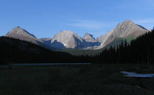
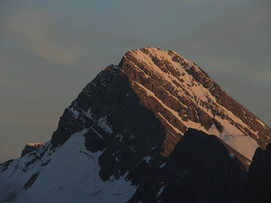
The late day sun shines on (L to R) Mount Galatea, Gusty Peak, The Fortress and Mount Chester.
Doesn't look so bad from up here... 
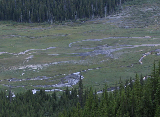
This is the flats of Burstall Creek as seen from the avalanche slope.
Looks like an easy scramble along the right side. 
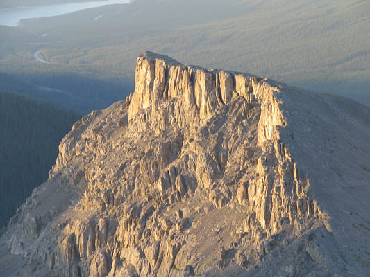
This is Commonwealth Peak's spectacular northern outlier as seen from the col.
I tried to stick to the left edge of the scree ramp most of the way up. 
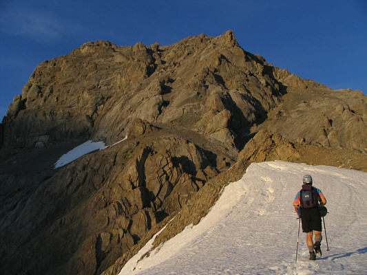
From the col, Sonny heads toward the upper part of Commonwealth Peak.
This is like a David Copperfield stunt:  How to make a mountain vanish! 
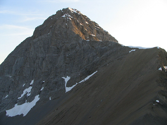
Pig's Tail is hidden somewhere here in front of Mount Birdwood.
Yet another striking nipple! South of Commonwealth Peak, Mount Robertson is flanked by French (left) and Robertson (right) Glaciers.
One of the great attractions of this area. The last rays of sunshine illuminate Mount Sir Douglas.
This might be a good summer to scramble up Mount Assiniboine... 
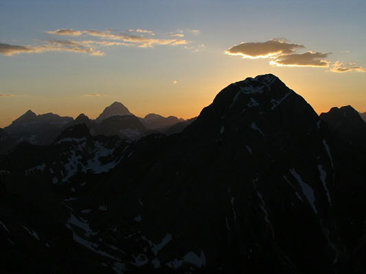
The sun disappears behind Mount Smuts.  Further in the distance at left is Mount Assiniboine.
After the swamp, the bushes, and the scree, this section is a treat! 
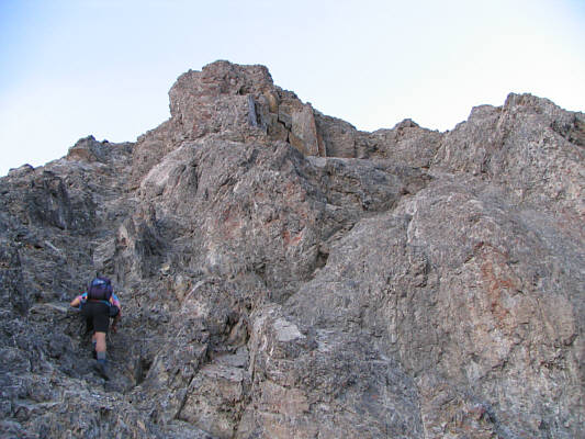
Sonny scrambles up the final wall before the summit.
This evening peak-bagging thing ain't so bad! 
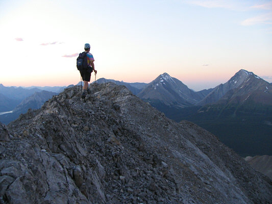
Sonny takes the last few steps before the summit.  In the distance are The Tower and Mount Galatea (far right).
It's 10:05 PM! 
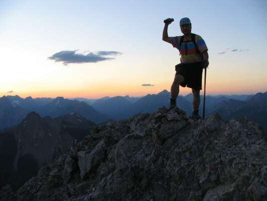
Sonny holds up the register canister on the 2775-metre summit of Commonwealth Peak.
I always crack up when I hear the name "Nestor".  Anyone remember Nestor Pistor?? This is the view north to Old Goat Mountain, Mount Nestor, and Spray Lakes Reservoir.
Beauty, eh? 
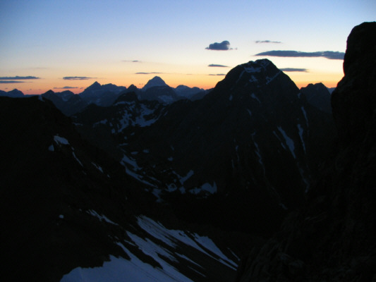
The peak in the foreground is Mount Shark.  Silhouetted in the distance are Mount Ball and a few of the Wenkchemna Peaks near Moraine Lake.
I took this photo from the scree ramp above the col at 10:32 PM. 
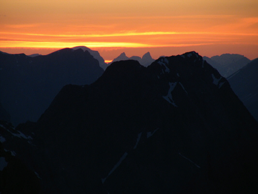
Twilight descends on the Canadian Rockies.
I didn't even bother locking it! 
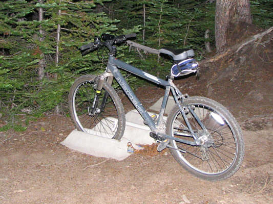
Sonny's bike is his quick ticket back to the trailhead.