BOU AVENUE
Gwillim Lakes And Lucifer Pass
Although Kelly Wood and I had originally planned on meeting some friends in Yoho National Park on 11 August 2006, bad weather forced us to change our vacation plans, and instead, we drove out to the West Kootenay region of British Columbia to do some camping and exploring.  After finding a pleasant campground at Little Slocan Lakes Recreation Site (about 30 kilometres northwest of Nelson, BC), we visited the Gwillim Lakes basin in Valhalla Provincial Park on 12 August 2006.  It took us about 2.5 hours to hike the well-maintained trail to the basin.  Ripe huckleberries all along the trail were hard to resist.  At the basin, Kelly relaxed near the backcountry campground while I scrambled for another 2 hours up to a high col known as Lucifer Pass.  Numerous peaks and ridges in the area looked tempting to bag, but unfortunately, I was short on time and simply rejoined Kelly for the hike out.  The area is beautiful enough to warrant another visit though, and I hope to return in the near future to explore the area more thoroughly and perhaps even scramble up a couple of peaks.
There's lots to see (and eat) along the trail! 
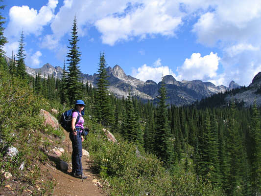
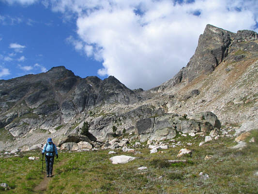
Kelly hikes the well-maintained trail leading to Gwillim Lakes.  Drinnon Pass is at right.
There's a backcountry campground at the south end of Drinnon Lake. 
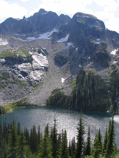
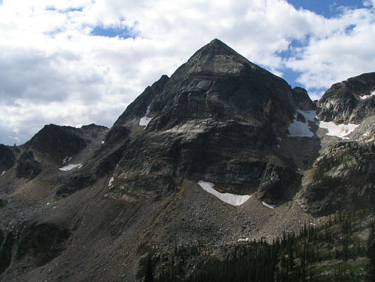
Drinnon Peak (2584 metres) towers above Drinnon Lake.
There's another backcountry campground here. 
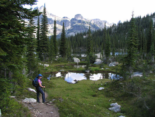
Drinnon Pass is a charming place in its own right.
Where the heck are the lakes?? 
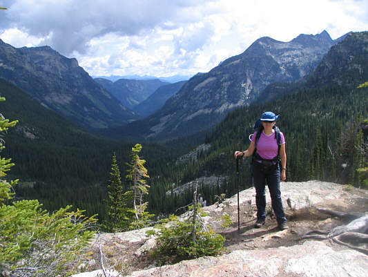
Kelly stands on a rock outcrop overlooking Gwillim Creek valley.
This is a really cool trail! 
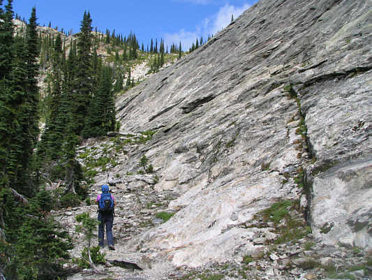
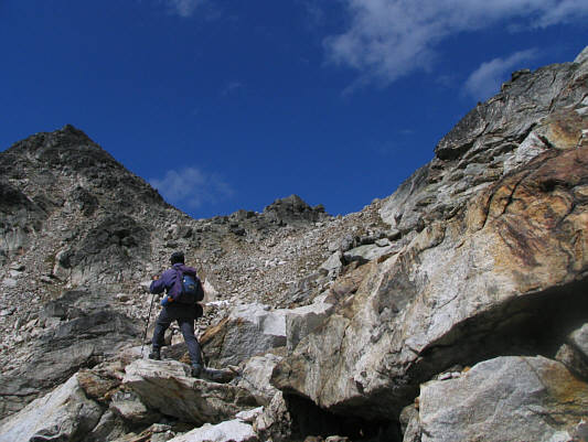
Kelly hikes up beside some impressive slabs just before Gwillim Lakes basin.
Apparently can be scrambled from the northwest (right). 
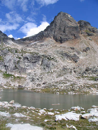
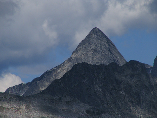
This is Gregorio Peak (2605 metres) as seen from near the entrance to Gwillim Lakes basin.
Both peaks are also apparently scrambles. 
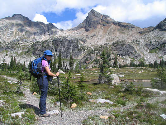
Kelly enters Gwillim Lakes basin.  Directly ahead is Lucifer Pass which separates Black Prince Mountain (2773 metres) on the left from Lucifer Peak (2726 metres) on the right.
The scramble route goes up the right skyline ridge. 
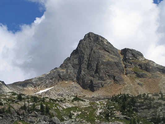
Here is another look at Lucifer Peak.
Eep! 
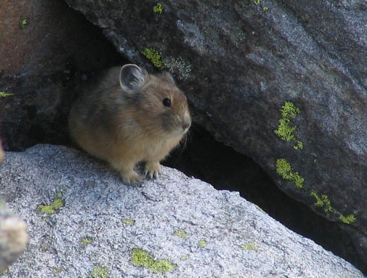
A curious pika pokes its head out to see who or what is making such a racket outside.
The backcountry campground is on the far side of this lake. 
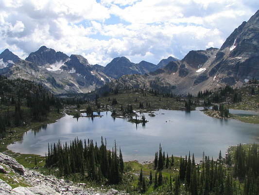
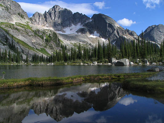
This is probably the largest of the lakes in the basin.
Lucifer Peak is just begging to be climbed! This is one of two tarns on a high plateau halfway between the campground and Lucifer Pass (left).
A good place to kick back and relax! This is looking across the other tarn on the high plateau.  Drinnon Peak is at centre.
Some route-finding helps but isn't absolutely necessary. Sonny scrambles up big boulders toward Lucifer Pass.
Dang.  I shoulda gone 'round the other side and scrambled up this thing! Lucifer Peak looks most impressive from Lucifer Pass.
Still kicking myself for not going after Lucifer Peak! 
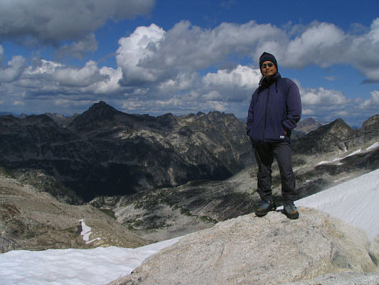
Sonny stands at the crest of Lucifer Pass (2585 metres).
A little underwhelming but may merit some exploration in the future. 
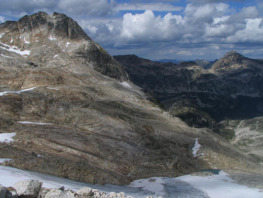
The view north of the pass includes Urd Peak (2679 metres) at distant far right.
Very nice. 
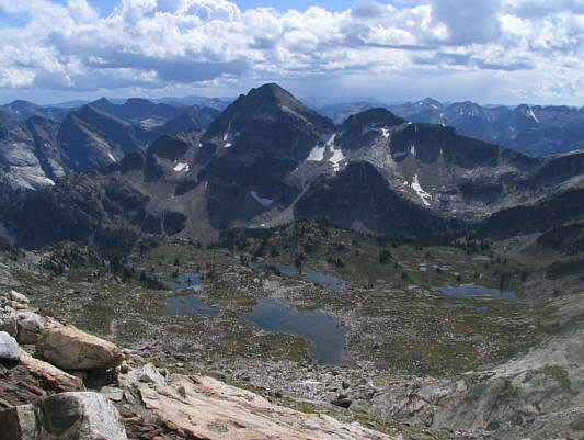
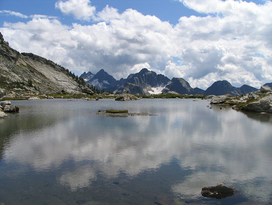
The view south gives a nice overview of the entire Gwillim Lakes basin as well as Gregorio Peak.
Their whistles can be quite piercing. A hoary marmot hides behind a few blades of grass.
Looks like a pretty easy scramble from this angle. Here is a closer look at the upper slopes of Lucifer Peak.
I'll be back.  This was a good scouting trip! Kelly begins hiking back to the trailhead.
Might even be nicer than the one at Little Yoho campground... The outhouse at Gwillim Lakes basin looks pretty fancy.
Not sure if this is a scramble or not... This is Asgard Peak (2825 metres), one of the most striking mountains in the area.
The large tarn here is also known as Wicca Lake. Drinnon Peak is dramatically reflected in one of the ponds near Drinnon Pass.