BOU AVENUE
Utopia Mountain
After spending a quiet night at the Snaring River Overflow Campground in Jasper National Park, Kelly Wood and I packed our tent and made a quick stop in Jasper townsite before heading to Miette Hot Springs on 2 July 2006.  While Kelly relaxed all day at the nearby picnic area (she had lots of books to keep her occupied), I scrambled up nearby Utopia Mountain.  Following Alan Kane's route description, I had one route-finding hiccup right at the beginning when I mistakenly turned up an overgrown trail running alongside a tiny creek.  Thankfully, it didn't take long for me to realize that something was amiss, and I quickly backtracked to the main trail and continued hiking until I found a much more obvious fork in Sulphur Creek (some bridges here).  After a tedious thrash along the right-hand fork, I grinded my way up the steep, overgrown animal trail leading to tree line and a grassy slope.  Near the top of this slope, I picked my way through a weakness in the cliff band guarding the first of three ridges comprising Kane's route.  An easy hike up this first ridge led to a tiresome slog up a rubble slope to gain the second ridge.  This second ridge provided the best scrambling of the day--lots of hands-on stuff with good rock and modest doses of exposure.  Although I was disheartened to see another rubble slope beyond the second ridge, this one was surprisingly easy to ascend, and I was soon plodding along the third (summit) ridge.  After traversing a false summit, I scrambled up a short rock wall to reach the true summit.  I spent about half an hour there getting baked by the hot sun before I retraced my steps back to the top of the second ridge.  Here, I turned down the "wide gully of grey scree" described by Kane in hopes of a quick descent to the creek.  Unfortunately, there were only a few short stretches of good, surfing scree--probably a testament to the lack of traffic on this mountain.  I angled left onto grassy slopes toward the bottom (sending some sheep scurrying in the process) and eventually worked my way down a drainage into the main creek.  Another tedious thrash down the creek was followed by an easy cruise back to Miette Hot Springs (round-trip time of less than 8.5 hours).  Despite the warm weather, Kelly and I both enjoyed a nice soak in the hot springs before spending the night at the Pocahontas Campground (we lucked out and found an unoccupied campsite). 
Looks like an alternate reality for Banff's Cave and Basin.  Creepy, eh? Kelly stands near the ruins of the old aquacourt at Miette Hot Springs.
That thrash through the trees was hardly what I'd call 'utopia'! 
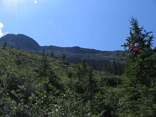
Some flagging marks where the steep animal trail emerges from the trees onto open slopes.  The route eventually gains the crest of the skyline ridge.
You know it's hot when Sonny is wearing his muscle shirt! 
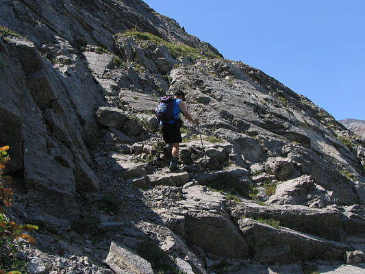
Sonny finds a weakness in the cliff band guarding the first ridge crest.
A token flower photo. A columbine breaks up some of the monotony of rocks on this mountain.
I prefer the ridges over the rubble. Sonny continues up the first ridge and would eventually head up the rubble at far right to gain the second ridge.
Best scrambling of the day coming up! 
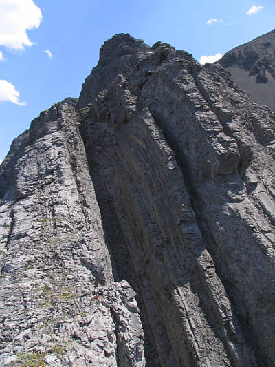
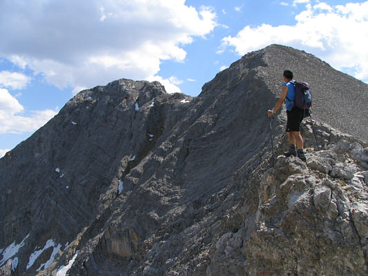
This is looking up the second ridge.  The "wide gully of grey scree" described by Kane can be seen at right.
Really awesome section of scrambling here! 
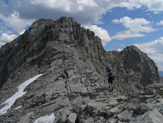
The route goes up the left rib and crosses the top of the chute before continuing further along the ridge crest.  This is probably the crux of the ascent.
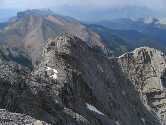
I spotted a lot of people at the top of Sulphur Ridge.  I wondered if they could see me. Sulphur Ridge dominates the view to the northeast.
<Groan.> 
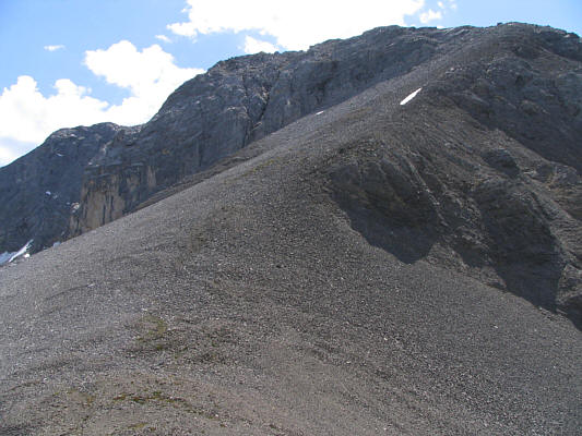
Beyond the top of the second ridge is another rubble slope.  This one leads to the summit ridge.
There's something primeval about the spiral shape... Sonny finds some evidence that this mountain may have once been under the ocean.
The false summit on the right sports no less than 3 survey markers. 
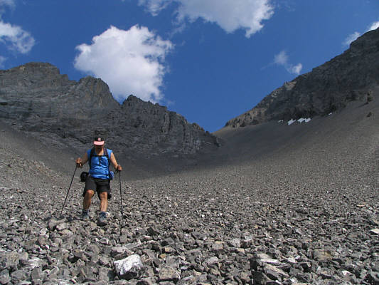
Sonny contemplates the final trudge to the true summit (left).
I should have used those snow patches to cool my head. This is the intervening section between the false and true summits.
Not much of an obstacle, really. Sonny scrambles up the last obstacle before the summit.
Is it ever bloody hot up here today! 
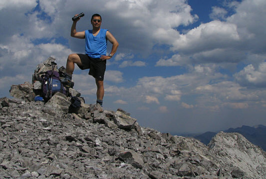
This is the 2562-metre summit of Utopia Mountain.
This mountain is quite popular with the locals from Hinton, Alberta. This is looking back at the false summit and summit ridge.
Has anyone traversed Ashlar Ridge? 
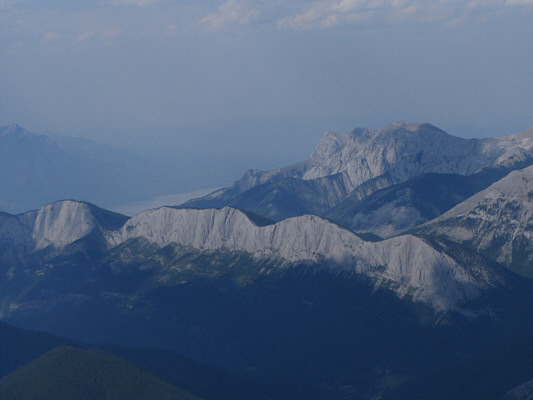
The view north includes Ashlar Ridge and Roche à Perdrix.
A GR-bagger's paradise! To the southeast are numerous unnamed peaks.
The scree here is not particularly good for surfing. 
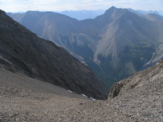
This is looking down the "wide gully of grey scree".  At upper right is Mount O'Hagan.
Roberto Pavesio apparently bypassed all the fun scrambling on the ridge and ascended this gully!  Yikes! Sonny descends the tedious grey scree.
While the rest of the herd had already bolted, this lamb didn't move for so long that I almost thought it was dead. 
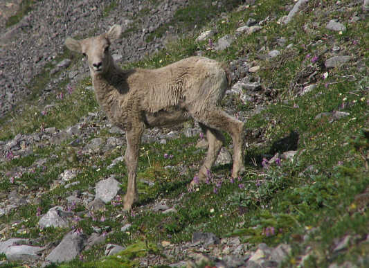
This lamb is a bit startled by Sonny's noisy descent down the slope.
Ahhhhh!  That tasted really good!  Thanks go to Ken Takabe for this great idea. 
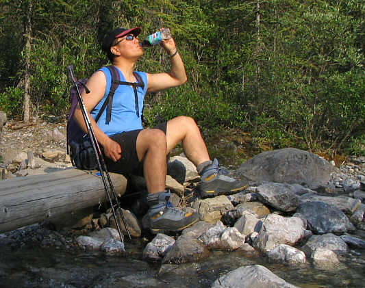
Sonny thoroughly enjoys the Diet Pepsi (with lime) that he stashed in the creek earlier in the day.
Not likely to be on anybody's list of favourite scrambles... This is Utopia Mountain as seen from the road just outside Miette Hot Springs.