


On my first attempt, deep snow hampered my upward progress even below tree line. This time, most of the lower mountain was dry, and I had no serious problems in getting up to the main avalanche slope just past some huge boulders. I soon reached snow line and predictably sank to my knees after the first few steps. This was short-lived though, and the snow conditions improved enough to hold my weight until I reached the lowest of the runout zones--essentially a sea of big, tumbled snowballs. I put on my crampons here to improve my traction and began the long slog upwards. As I had anticipated, hiking up the runout zones proved to be easy--almost too easy. The ascent started to get a little monotonous after awhile, and I would scoot outside the runout zones every so often and post-hole for a bit just to remind myself that monotony beats post-holing any day! At least I had ample time to think of a limerick for the summit register.
An eternity later, I reached the base of the final gully leading to
the summit ridge. I was starting to tire at this point, and this
last section seemed to take just as long to ascend as the rest of the
mountain. The terrain is also increasingly steeper here, and I
chose to veer over to climber's right further up. Cornices on the
summit ridge required some care to negotiate, but I managed to work my
way safely to the summit cairn. I spent about half an hour on the
summit photographing, reading and writing (sounds like stuff I could do
in the comfort of my home) before beginning my descent. Although I
was too chicken to glissade down the steep gully just below the summit
ridge, there were plenty of excellent glissading opportunities further
down. That and a generous amount of plunge-stepping down the
avalanche runout zones had me back at snow line in no time. After
removing my crampons, I quickly descended to tree line and out the
drainage. My round-trip time was 7.5 hours.
|
|
This is Mount Weed as seen from Bow Summit. |
|
|
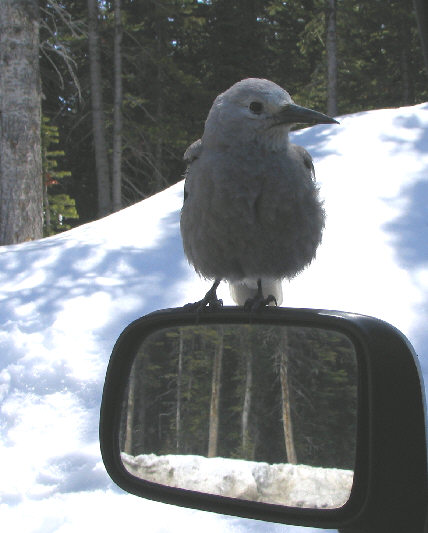
A Clark's nutcracker perches on the side mirror of Sonny's car at Bow Summit parking lot. |
|
|
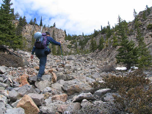
Sonny hikes up the rocky gully above the first rock band. |
|
|
Sonny easily hikes up an avalanche runout zone. |
|
|
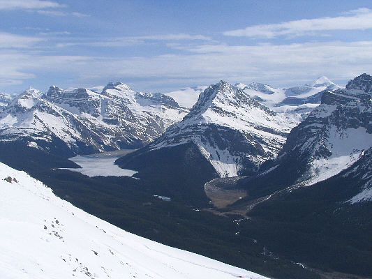
The view to the south helps alleviate some of the monotony in the ascent. At left is Peyto Lake. The snowy peak on the horizon at far right is Mount Baker. |
|
|
Sonny approaches the base of the final gully. |
|
|
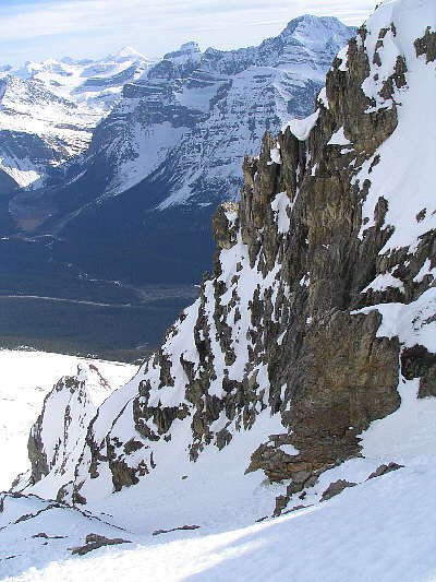
This is looking up the final gully. The summit is at upper left. |
|
|
This is looking back down the final gully. |
|
|
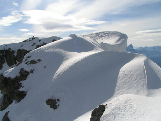
The summit ridge sports some interesting cornices. The summit cairn is visible at left. |
|
|
Sonny takes the last few steps before the top. |
|
|
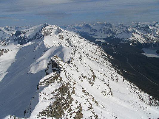
This is the view to the southeast from the summit. Mount Temple is visible slightly right of centre on the horizon. |
|
|
Mount Noyes dominates the view to the north. At left are the Waterfowl Lakes and Mount Sarbach. |
|
|
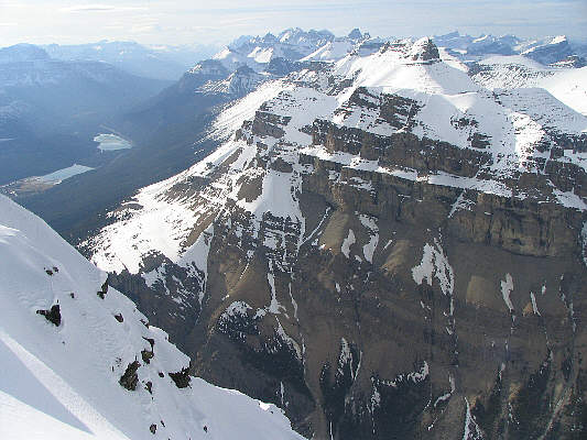
To the east are the multiple peaks of Mount Willingdon. |
|
|
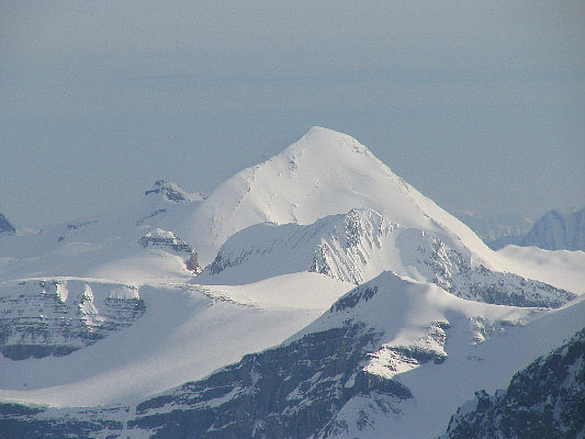
Here is a close-up view of Mount Baker. |
|
|
Sonny poses beside the cairn on the 3080-metre summit of Mount Weed. |
|
|
This is looking back at one of the glissade tracks made by Sonny. |
|
|
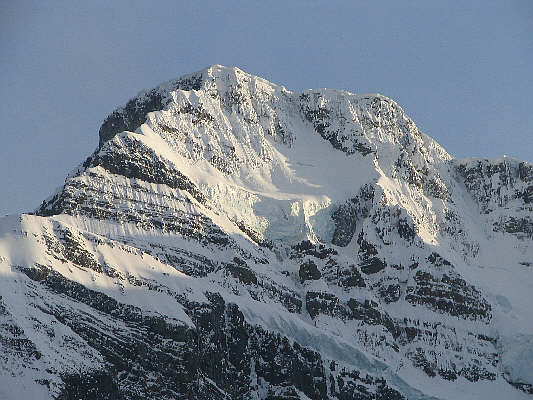
The summit block of Mount Patterson looks brilliant in the late day sun. |
|
|
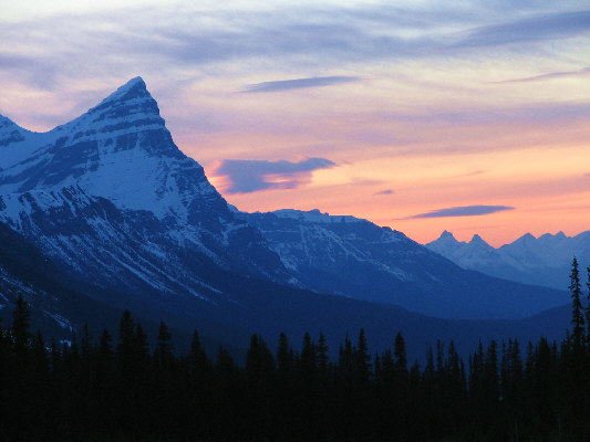
The sun disappears behind Mount Chephren in this view from Bow Summit. |