BOU AVENUE
Yukness Mountain
Wietse Bylsma, Vern Dewit and I headed into the Lake O'Hara region of Yoho National Park on 30 September 2006 to scramble up Yukness Mountain.  Summer access to this region is usually by bus and is tightly regulated by Parks Canada.  Although I had been unable to reserve bus seats for the three of us, we decided to drive to the trailhead anyway and take our chances by going "standby".  Luckily, there were some cancellations, and we managed to get on the early bus ($15.00 CDN per person for a round-trip fare) which took about thirty minutes to travel the twelve-kilometre access road to Lake O'Hara.  Compared to the hassles of getting to Lake O'Hara, our actual ascent of Yukness Mountain was much simpler.  We took West Opabin trail up to Opabin Plateau and followed a pretty good beaten path up the west side of the mountain.  As we traversed below some pinnacles just before the southeast (true) summit, we missed the correct gully and had to backtrack a little to find it.  While going up this gully, I inadvertently knocked loose a rock which smashed one of Wietse's fingers as he scrambled behind me.  I apologized for the mishap and offered him a Band-Aid when we reached firmer terrain.  This was Wietse's second outing with me in as many weeks, and I was now 2-for-2 in nailing him with a rock!  After spending about an hour on the southeast summit, Wietse, Vern and I had a lot of fun scrambling along the connecting ridge to the northwest summit.  From there, we descended loose rubble and worked our way back to Lake O'Hara via East Opabin trail.  Our round-trip time was a very leisurely 8.5 hours, and we celebrated our success with some refreshments at Le Relais day shelter before catching the last bus out.

Be sure to check out Wietse's and Vern's pictures.
Anyone know if Cathedral Mountain is a scramble? 
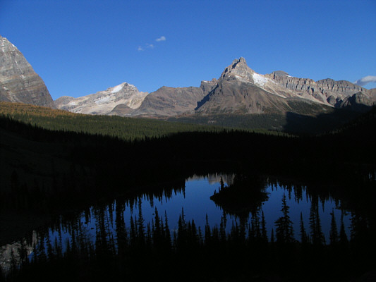
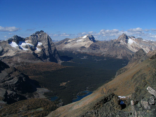
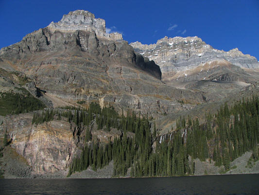
Mary Lake is still in shadow in this view from East Opabin trail.  In contrast, Mount Stephen (left) and Cathedral Mountain are sunlit.
Autumn is one of the best times to visit Lake O'Hara. 
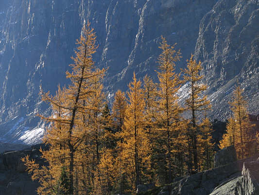
The larches have already turned golden.
I would someday like to return and hike up to Wiwaxy Gap (right). 
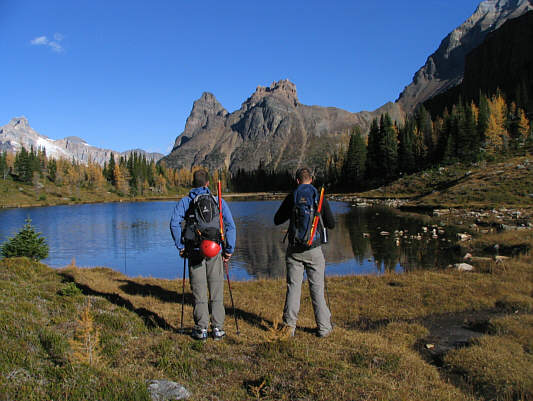
Wietse and Vern look across a tarn at Wiwaxy Peaks.
We bypassed these cliffs on our way down. 
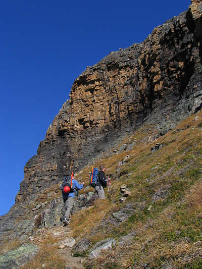
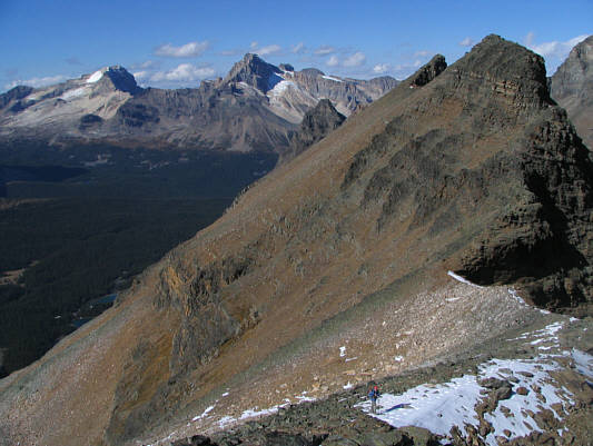
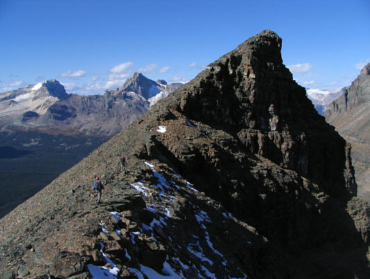
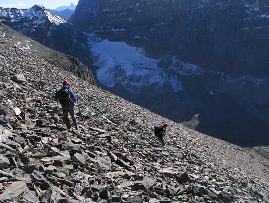
Wietse and Vern follow a beaten path up the west side of Yukness Mountain.
The ascent is mostly a hike up to this point. 
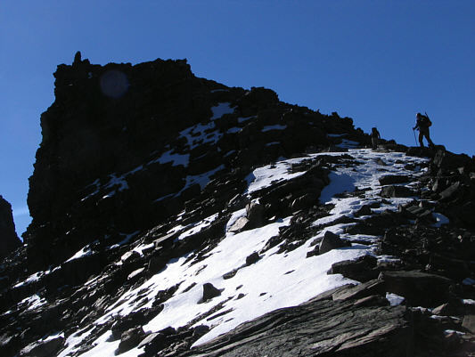
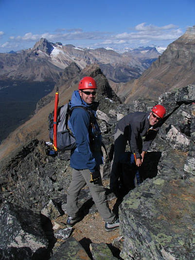
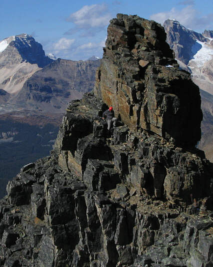
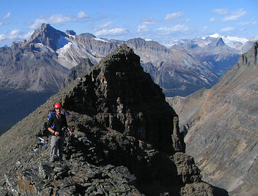
Vern and Wietse climb up the ridge toward a false summit.
This is roughly where we initially missed the gully on our ascent. 
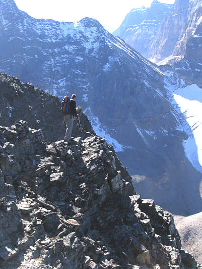
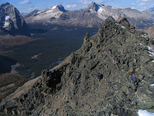
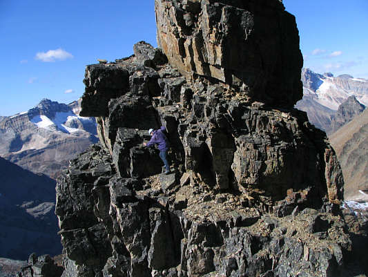
Vern traverses some steep terrain below the southeast summit.  Opabin Pass is visible at upper right.
Wietse has yet to learn NOT to follow me closely! 
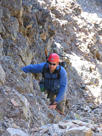
Wietse scrambles up the gully.
This closes out the Field and Little Yoho Valley section of Kane's book for me. 
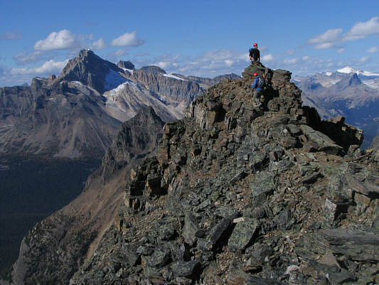
Sonny, Wietse and Vern stand on the 2847-metre summit of Yukness Mountain.
We couldn't have picked a nicer day to be on this summit! The view to the northwest includes (L to R) Odaray Mountain, Mount Stephen and Cathedral Mountain.
People have died just trying to climb up to Abbot Pass. Abbot Pass Hut sits on the crest of its namesake pass.
That northeast ridge looks very impressive! 
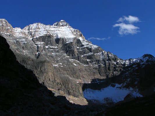
Here is a closer look at Odaray Mountain.
Mount Biddle apparently can be scrambled from the west. 
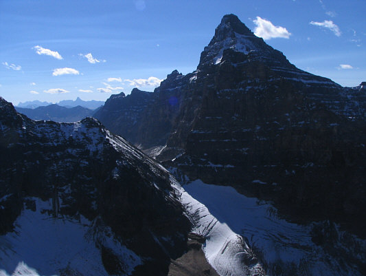
Mount Biddle dominates the view to the south.
That moraine looks sorta like the Great Wall of China. 
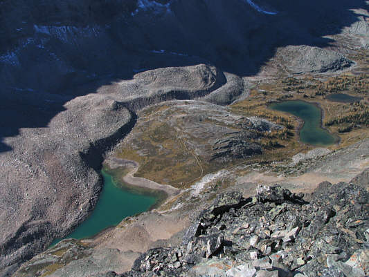
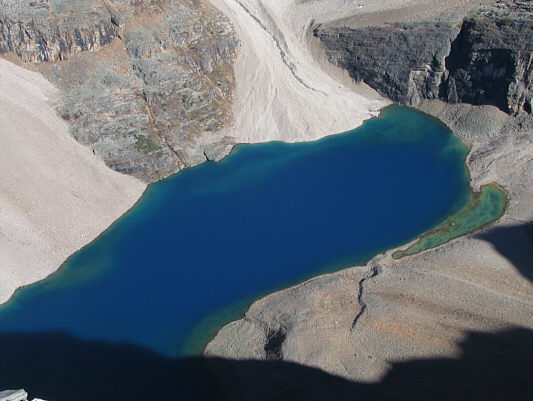
This is an aerial view of Opabin Plateau with Opabin Lake at left and Hungabee Lake at right.
A nice day to climb Mount Victoria...or to lounge on the shores of Lake Oesa! To the north, Mount Huber (left) and Mount Victoria tower above Lake Oesa.
This was Wietse's 22nd summit of the year--not bad for a guy from a country where the highest peak is only 321 metres above sea level (Holland)! Wietse and Vern are all smiles as they prepare to leave the southeast summit.
The pinnacle in the next photograph can be seen here (lower left) although it's not very distinctive. Vern and Wietse begin descending the gully.
Similar to the photo in Kane's book. 
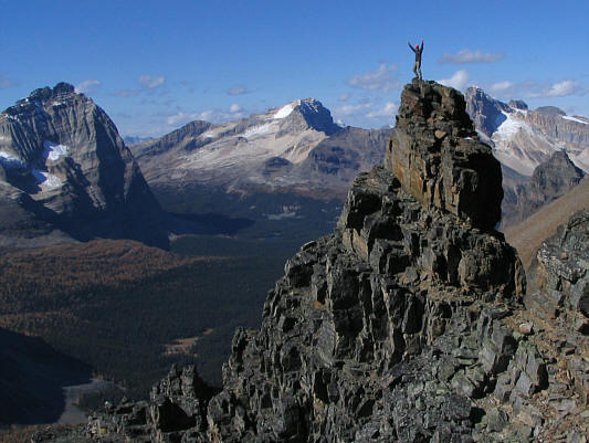
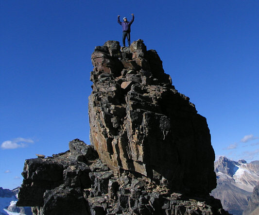
Vern bags a spectacular pinnacle.
Watch your step here! 
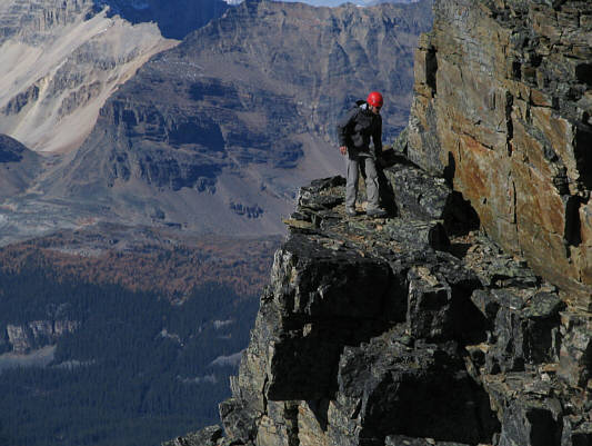
Here is a close-up of Vern descending the pinnacle.
Another fine picture for Vern's wife, Hanneke! The pinnacle is a fun diversion.
Wietse took this photo with my camera. Sonny wants to have some fun too.
Best scrambling of the day! Sonny bags the spectacular pinnacle.
At the bottom, Wietse is making a Slurpee in his water bottle with the snow.  Make sure that snow isn't yellow, Wietse! 
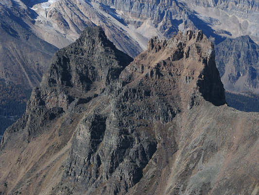
This is looking along the connecting ridge toward the northwest summit which is partially hidden behind an intervening or middle summit.
We bypassed this obstacle on the left before climbing back up to the ridge crest. Vern and Wietse traverse the connecting ridge.
Vern was a little under the weather on this day but still managed to outpace both Wietse and me! Here is an unobstructed view of the northwest summit as seen from the middle summit.
Piece of cake. Wietse and Vern approach the northwest summit.
According to Vern's altimeter, this summit is about 30 metres lower than the southeast summit. Vern and Wietse top out on the northwest summit.
Are we getting tired of looking at Odaray Mountain and Mount Stephen yet? 
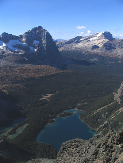
The view northwest includes (clockwise from bottom) Lake O'Hara, Mary Lake, Odaray Mountain and Mount Stephen.
I have fond memories of my trip up Mount Niles in 2004. To the north are Mount Niles and snowy Mount Balfour.
That snow chute at left looks like a good toboggan run! 
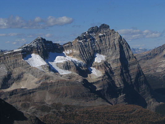
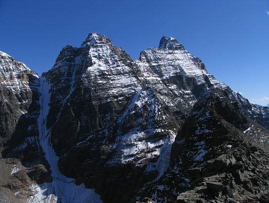
The southeast summit is barely noticeable against the backdrop of Ringrose Peak (left) and Hungabee Mountain.
Wanna go for a dip? Lake Oesa looks beautiful in the afternoon sun.
That scree slope going up to Abbot Pass sure doesn't look fun to climb. 
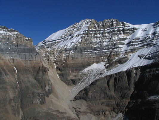
To the east is Mount Lefroy.
Looks pretty technical from this angle... Here are Wiwaxy Peaks as seen from Yukness Mountain's northwest summit.
Not much scree surfing but still an easy descent. Wietse and Vern descend rubble below the northwest summit.
The west ridge (right skyline) is the usual ascent route. Here is one last look at Hungabee Mountain from East Opabin trail.
Photographic opportunities seem to be endless in this area. 
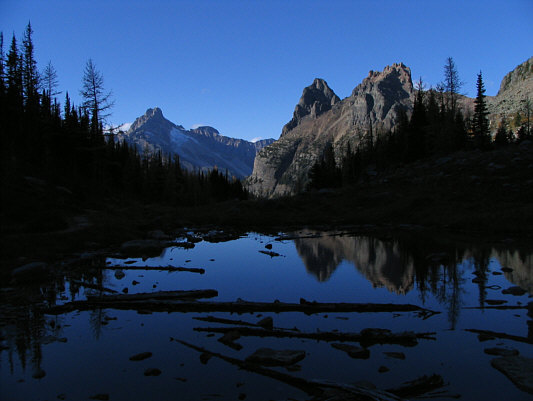
Wiwaxy Peaks are reflected in a small pond beside East Opabin trail.
Wietse does a great imitation of a goat...almost too good... 
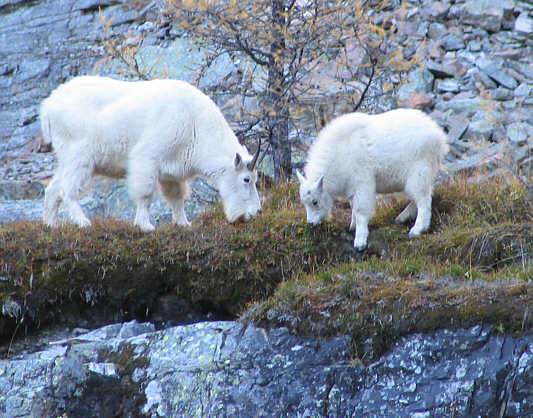
A couple of mountain goats find good eating near East Opabin trail.
Hard to believe that there's a hiking trail way up there somewhere. Here are Mount Huber and Mount Victoria as seen from the shores of Lake O'Hara.
Some benches here make this a nice spot for a break. The late afternoon sun shines between two tree trunks.
A great place to wind down at the end of the day. 
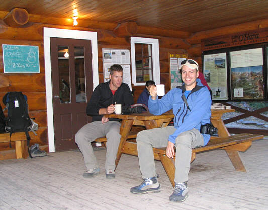
Vern and Wietse enjoy some coffee at Le Relais.
How about a game of poker? 
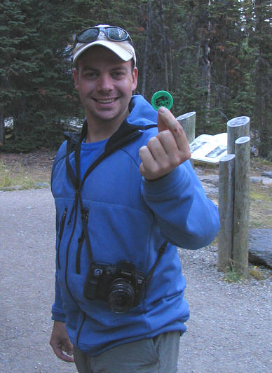
Wietse shows off his bus token (for the return trip).