


During my hike to Black Prince Lakes, I tried to muster every last bit of information I could recall about the ascent route, but other than knowing that I was on the right side of the mountain, I had little else to hang my hat on. When I neared Black Prince Lakes, I could see a grassy ridge running up to the northeast face of Mount Black Prince, and I suddenly remembered one of Antri's photos which showed this same ridge. I took a break on a scenic nub overlooking Black Prince Lakes and studied the impossibly steep northeast face with growing uncertainty. Thoughts of heading home swirled in my head, but I decided that I owed it to myself to at least hike up the easy grassy ridge and take a closer look. When I eventually reached the base of the northeast face, I saw a few possibilities for reaching the summit ridge, but I was keenly aware of how deceiving routes can look from a foreshortened perspective. Nevertheless, I started traversing to climber's left to avoid a large snow patch, and before I started scrambling in earnest, I built a small cairn not so much for route-finding purposes but as a token of reassurance. I made fairly good progress initially and zigzagged up the lower face looking for whatever weaknesses presented themselves to me. As I scrambled higher though, good holds and ledges became scarcer, and one particular rock band (crux) near the top proved to be both challenging and unnerving. After surmounting this obstacle, I had no further difficulties gaining the summit ridge and subsequently the summit.
On descent, I chose to down-climb a little further to skier's left of
where I ascended mainly to avoid the aforementioned rock band.
However, this route was not without its share of challenges. The
crux of my descent was a steep wall about halfway down the northeast
face. Trustworthy holds were miniscule at best, and much of the
rock was down-sloping. My only option was a very narrow and shallow
crack, and I had to descend this facing into the rock. A slip here
would definitely have been catastrophic if not fatal; thus, I took my
time descending and tested every handhold and foothold carefully.
Although this was by far the hardest part of the descent, there were a
few more tricky sections further down, and only when I finally reached my
cairn did I start to breathe easier. With the worst behind me, I
had an uneventful hike back to the trail head (round-trip time of 7.5
hours). While I missed seeing Tiger Woods win the PGA Championship
that day, bagging Mount Black Prince seemed like a major victory to me.
|
|
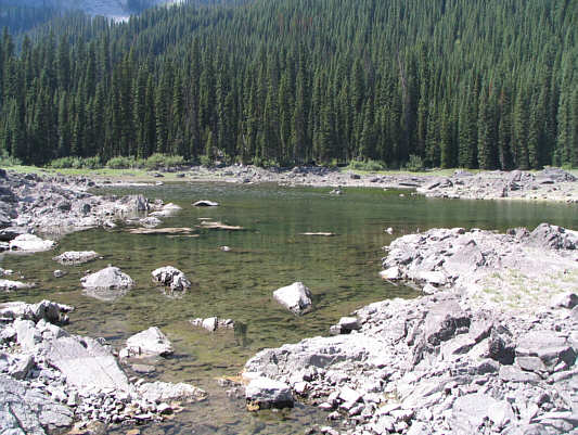
Warspite Lake actually has some water in it on this day. |
|
|
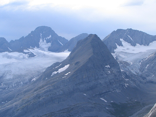
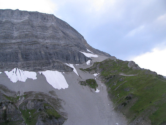
Mount Warspite looks dark and brooding at the head of the hanging valley. |
|
|
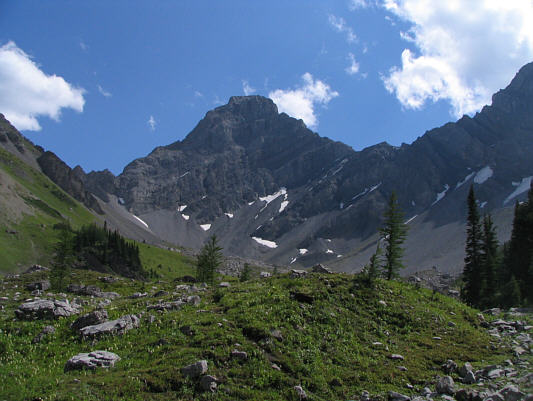
This is the grassy ridge that abuts the northeast face of Mount Black Prince. |
|
|
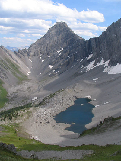
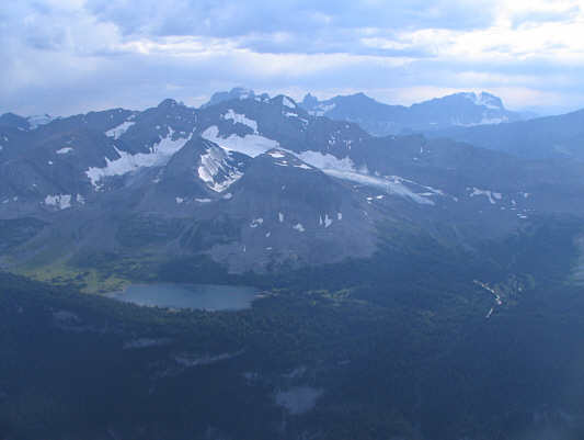
Here is a view of Mount Warspite and Black Prince Lake as seen from further up the grassy ridge. |
|
|
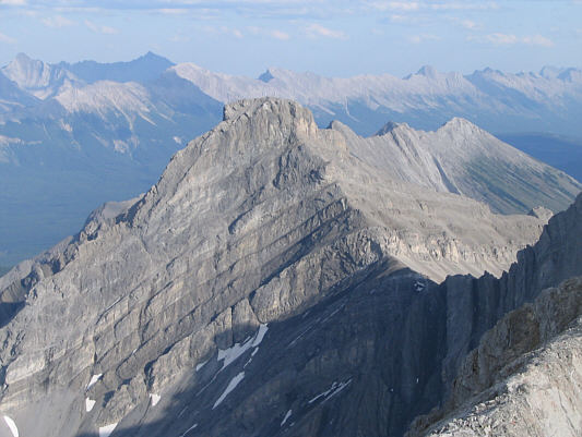
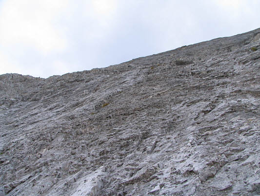
The northeast face of Mount Black Prince looks impregnable. |
|
|
This photo gives a good indication of the steepness of the northeast face. |
|
|
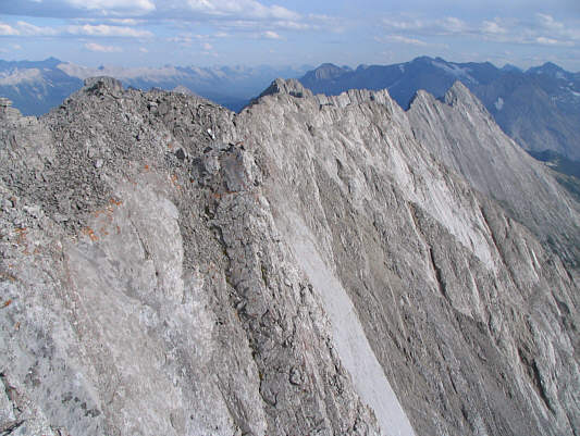
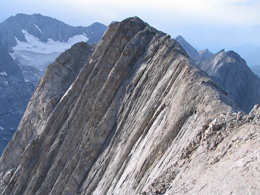
From where Sonny gained the summit ridge, this is looking southwest toward Lawson Lake, Mount Beatty, and Mount King George (on horizon). |
|
|
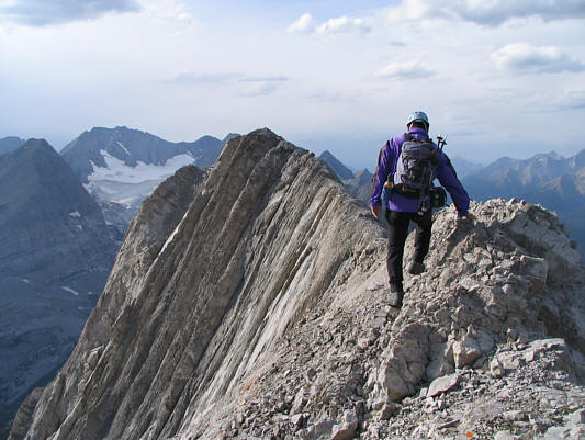
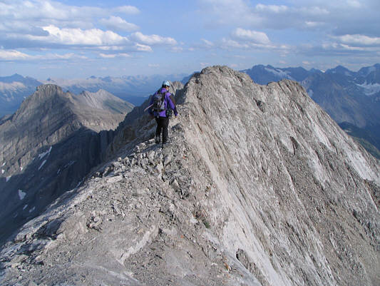
Sonny heads for the summit. |
|
|
The final section along the summit ridge is quite exposed. |
|
|
Sonny holds up the register canister on the 2932-metre summit of Mount Black Prince. Mount Joffre is visible on the horizon. |
|
|
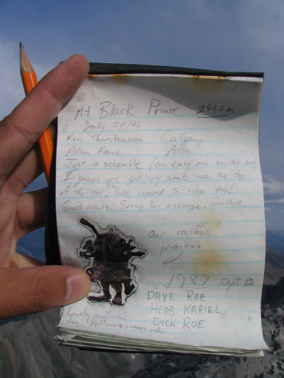
The register placed by Kris Thorsteinsson and Alan Kane in 1986 is still there. |
|
|
This is looking southeast from the summit. |
|
|
To the northwest, Mount Jellicoe is flanked by Haig Glacier and Smith-Dorrien Glacier. In behind are Mount Sir Douglas, Mount Robertson (nearly hidden), and Mount French. |
|
|
This is the view of Warspite Lake (upper left) from the summit of Mount Black Prince. |
|
|
Mount Warspite dominates the view to the southeast. The north and south peaks of Mount Indefatigable are also visible to the right. |
|
|
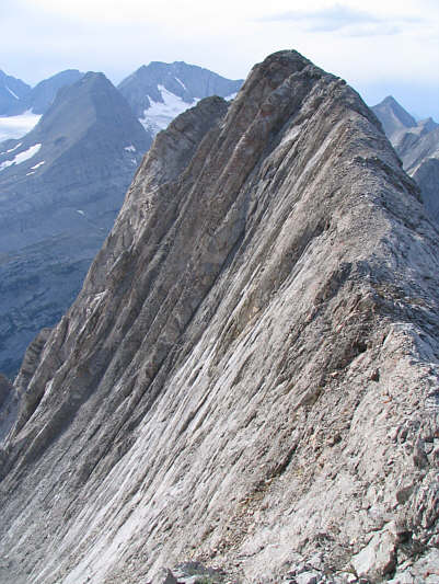
Sonny heads back along the summit ridge. |
|
|
Here is one last look back at the summit of Mount Black Prince. |
|
|
This is looking up from the base of the wall Sonny had to down-climb. |
|
|
Sonny built this cairn near the bottom of the northeast face on his way up. |
|
|
This is a foreshortened view of Sonny's approximate ascent (red) and descent (green) routes on the northeast face. The respective cruxes for both routes are indicated (c). |
|
|
Here is one last look at the northeast face from lower down. |
|
|
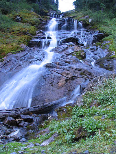
Warspite Cascades has a remarkable calming effect on scramblers after a hard day on either Mount Warspite or Mount Black Prince. |