

After spending the previous night in a motel in Revelstoke, Kelly and I had a leisurely breakfast on the morning of 1 September 2007 before driving north on Highway 23. I actually turned off onto the wrong forestry service road after being distracted by a black bear feeding on a large carcass beside the main highway (the bear quickly disappeared into the forest when we drove by). Unfortunately, I did not realize this mistake until almost ten kilometres up the road, and as a result, we lost some time backtracking to the highway. The correct forestry service road is well-signed, and despite the lengthy drive, we eventually arrived at the trail head none the worse for wear. The eleven-kilometre hike to Standard Cabin--a free public shelter--took us about 4.5 hours, and we were quite astonished to see so many mountain bikers on the Keystone-Standard Basin Trail (challenging singletrack all the way). Even more surprising was the fact that we had the cabin all to ourselves (I had dragged along a two-person tent in case the cabin was fully occupied). Kelly was initially skeptical about sleeping in the public shelter, but she soon warmed up to the idea once she had a good look inside. After dinner, we explored a nearby pond before retiring for the night.
|
|
The trail head (1692 metres) already grants respectable views of the Monashee Mountains to the west. |
|
|
Kelly points at a rather large mushroom beside the trail. |
|
|
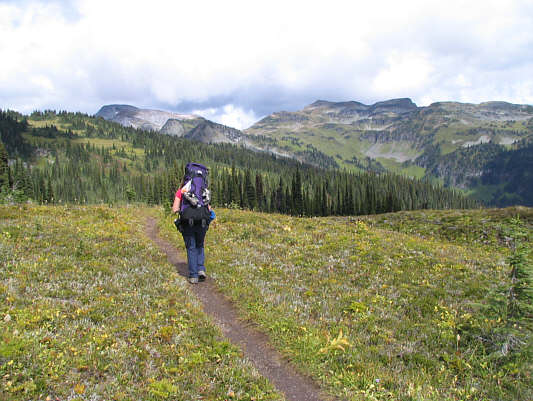
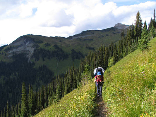
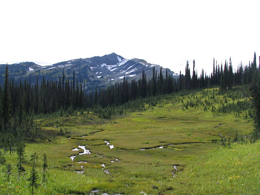
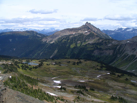
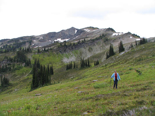
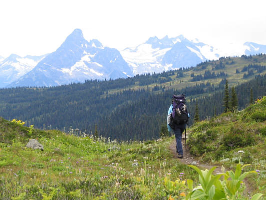
Kelly hikes through one of the area's many subalpine meadows. Keystone Peak is visible at left on the horizon. |
|
|
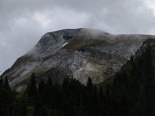
Standard Peak can be seen fairly early along the Keystone-Standard Basin Trail. |
|
|
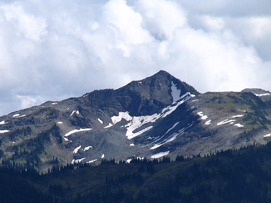
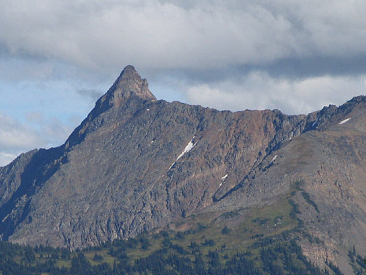
Here is a close-up view of Keystone Peak. |
|
|
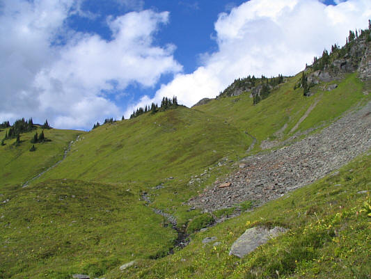
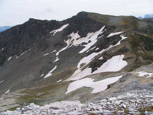
The grassy hillsides of Keystone Basin (actually the headwaters of Mars Creek) invite further exploration. |
|
|
Kelly heads south away from Keystone Peak (upper right). |
|
|
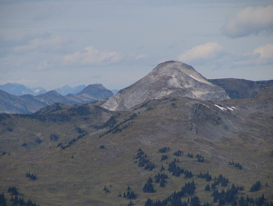
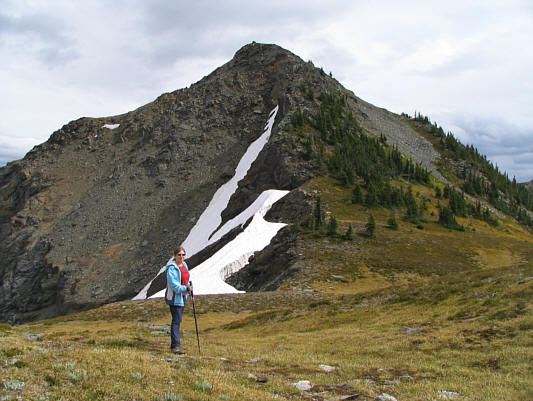
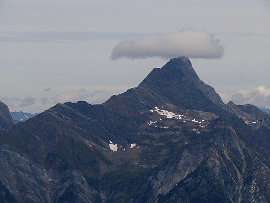
This striking peak is surprisingly unnamed. |
|
|
Kelly enters Standard Basin. |
|
|
Standard Peak seems far removed from Standard Basin. |
|
|
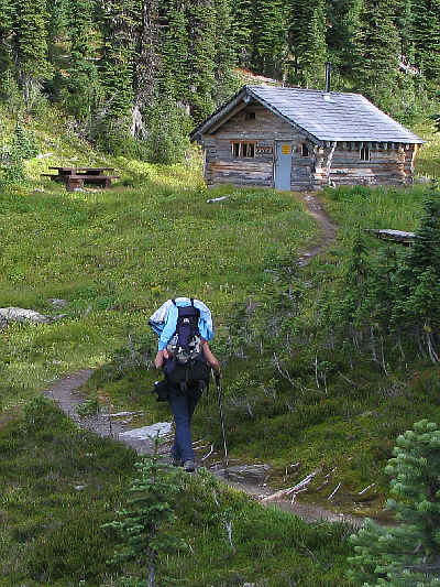
Kelly arrives at Standard Cabin. |
|
|
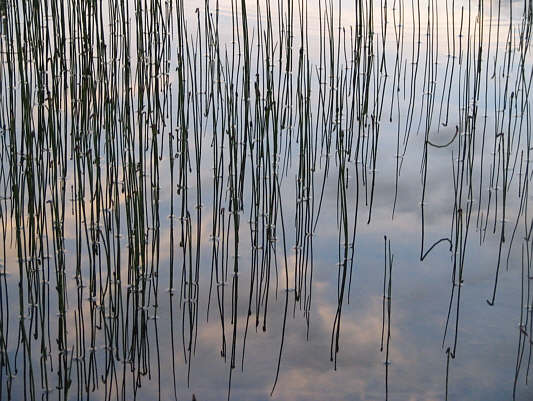
Some reeds are reflected in the pond near Standard Cabin. |
|
|
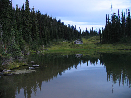
Standard Cabin is also reflected in the pond. |
|
|
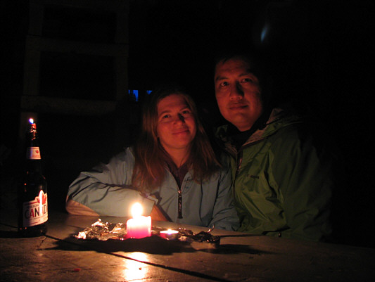
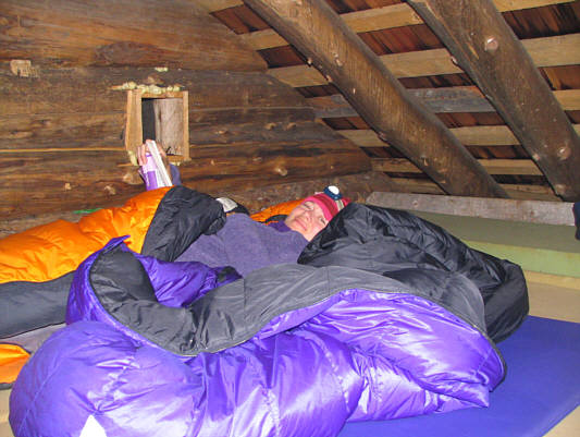
Kelly and Sonny are happy to have the cabin all to themselves for the weekend. |
 |
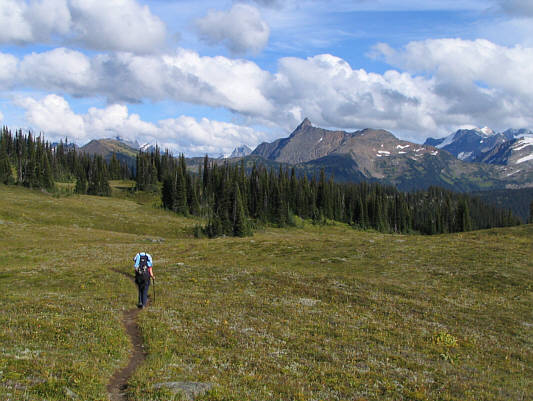
Standard Peak comes into view again along the approach trail from Standard Cabin. |
 |
Kelly works her way toward the north ridge (left skyline) of Standard Peak. |
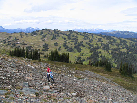 |
Kelly hikes up the broad north ridge of Standard Peak. |
 |
Kelly pauses to admire the view of Pass Peak (2458 metres) at far left and Belcher Ridge (2419 metres) at centre. |
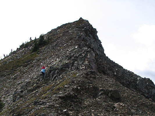 |
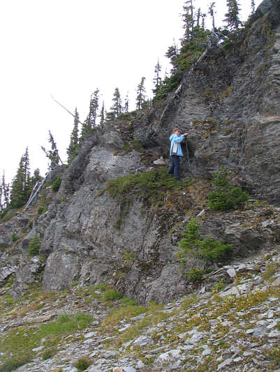
The last part of the ridge before the summit requires a little hands-on scrambling. |
 |
Kelly and Sonny sit on top of the 2311-metre summit of Standard Peak. |
 |
The unnamed peak dominates the view to the northeast. |
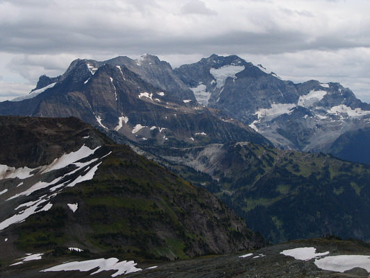 |
To the east are Bridgland Peak (over 2957 metres) and Carnes Peak (3050 metres). |
 |
Hat Peak (2883 metres) is visible to the southwest. |
 |
Keystone Peak is about 9.7 kilometres to the northwest. |
 |
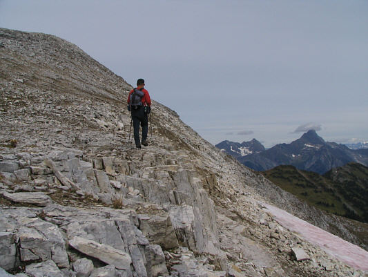
This is looking back at the summit from along the west ridge. |
 |
Kelly scrambles down an exposed cliff band. |
 |
Kelly returns to the meadows after descending the west ridge (right skyline) of Standard Peak. |
 |
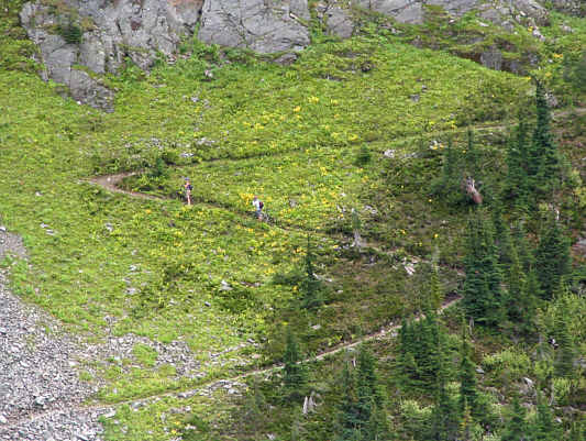
Wildflowers are abundant in this area. |
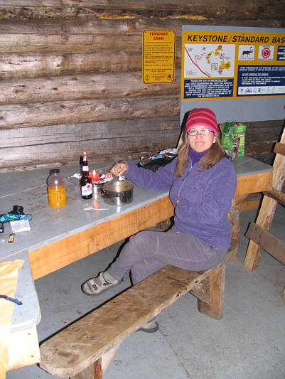 |
Kelly enjoys a candlelight dinner inside Standard Cabin. |
 |
Kelly curls up with a book before drifting off to sleep. |
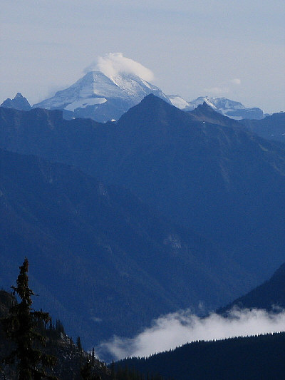 |
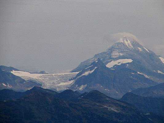
Morning mists persist both in Standard Creek valley and on top of distant Mount Sir Sanford (3522 metres). |
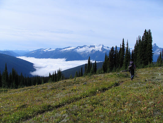 |
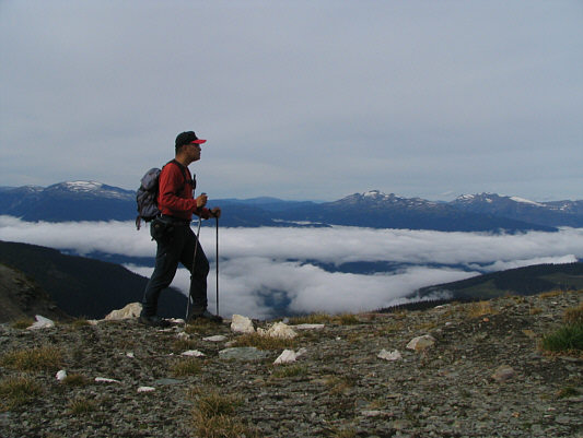
Mist also covers Lake Revelstoke as Kelly hikes back along Keystone-Standard Basin Trail. |
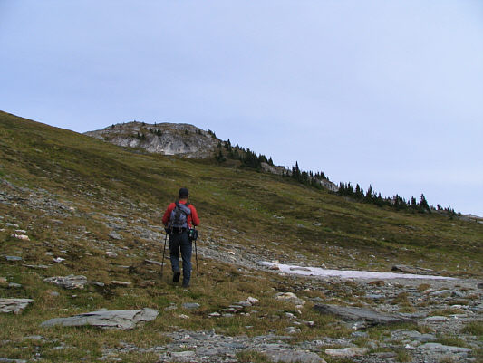 |
Sonny hikes up easy slopes leading to Keystone Peak. |
 |
This is looking west toward the Ratchford Range from a col just south of Keystone Peak. |
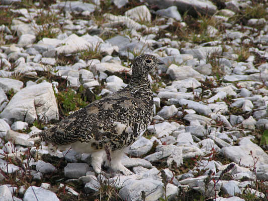 |
A ptarmigan wanders about the upper slopes of Keystone Peak. |
 |
Sonny checks out the east side of Keystone Peak on his way up. |
 |
Sonny plants his foot on the cairn at the 2373-metre summit of Keystone Peak. |
 |
The eye-catcher to the north is Downie Peak (2928 metres). |
 |
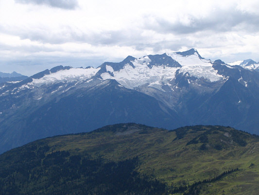
Sir Sanford Glacier and Mount Sir Sanford are visible to the northeast. |
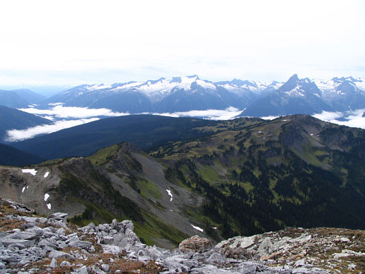 |
Here is the view to the south with the Monashee Mountains dominating the horizon. |
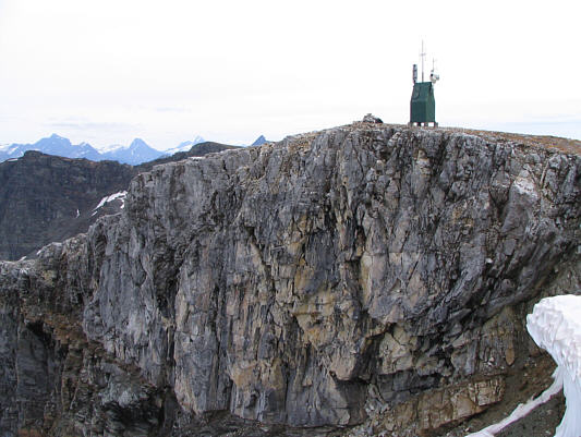 |
A repeater tower stands beside the summit cairn in this view from Keystone Peak's northwest ridge. |
 |
Standard Peak is about 9.7 kilometres to the southeast. |
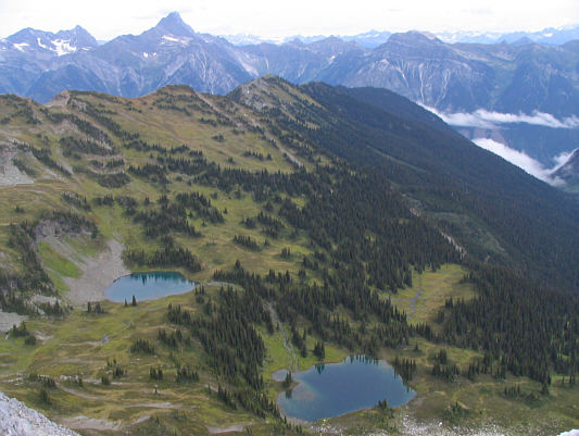 |
A secluded bowl north of Keystone Peak holds two attractive tarns. |
 |
The unnamed ridge to the southeast of Keystone Peak is actually higher (over 2408 metres). |
 |
A couple of intrepid mountain bikers push up some switchbacks along the Keystone-Standard Basin Trail. |
 |
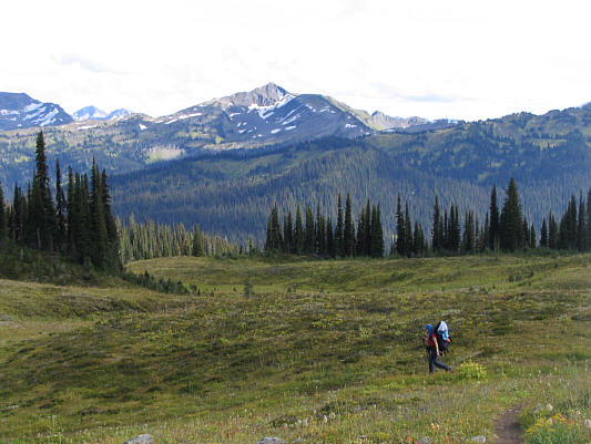
Kelly continues trekking back to the trail head (somewhere behind the ridge in the middle). The striking peak at left is Frenchman Cap (2897 metres). |
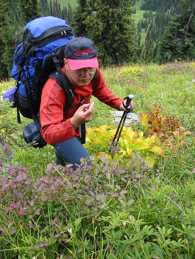 |
Sonny cannot resist stopping to feast
on tasty huckleberries. Photo Courtesy of Kelly Bou |
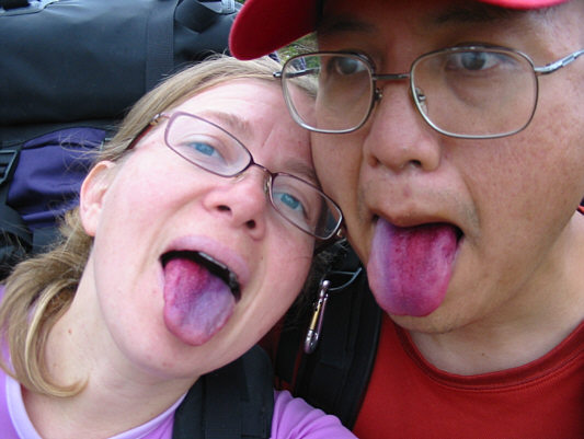 |
Kelly and Sonny show off their
huckleberry-bruised tongues. Photo Courtesy of Kelly Bou |