


It's about mid-morning on 27 OCT 2007. Time to get up. Actually, it was time to get up about 3 hours ago! As I advertised a few days before on the RMB WebBoard, I should already be on the trail going up Redstreak Mountain near Radium Hot Springs, British Columbia, and yet, here I lie in my bed at home in Calgary, Alberta. Oh well, maybe I'll go tag some peak in K-Country today, in which case, I can sleep in for at least another hour...
Alright, no sense wasting the entire morning in bed. I get up, brush my teeth, splash my face with some water--I'm good to go. Despite still feeling a bit stuffed from Dave Stephens' goodbye dinner the night before, I grab some cereal for breakfast and sit down in front of my computer. Check e-mail--no takers on joining me for Redstreak Mountain, but it's my move in an Internet chess game I'm having with a friend in Boston. Check. Check weather--generally cool everywhere but no precipitation. Environment Canada as usual is about 5 degrees more optimistic than the Weather Network. Check live cams--Radium looks dry still and so does Nakiska, but Nakiska looks that way even in mid-winter! About to log on to RMB WebBoard, but check myself. What's the point? Not likely to be any new postings since the previous night, and it would be embarrassing for people to see that I'm logged on when I should be about halfway up Redstreak Mountain. Open up Andrew Nugara's More Scrambles In The Canadian Rockies. Might be the perfect day to bag lowly Limestone Mountain. I grab all my gear, guidebooks, maps, and assemble in the kitchen to collect food and drinks. My wife needs a ride to a 10:00 AM quintet rehearsal. Sorry dear, I gotta go...oh wait, it's already 9:30 AM...okay, I may as well drive her since it's on the way out of town.
Finally on the road heading to the mountains! Wow...everything's plastered with snow in the Rockies. Good thing I brought my crampons and ice axe, but I'm really not in the mood for snow and ice. I drive past the Highway 40 turnoff; Limestone Mountain can wait...maybe a good after-work scramble next spring. I keep driving to Radium. The wonderful scenery and some Chopin and big band jazz from my car stereo help pass the time. Traffic is also surprisingly light. Stopping at the Parks Canada info centre in Radium, I feign interest in a few tourist brochures before heading to the restroom to "refresh" myself. As I leave, I notice the staff laying out a nice spread of food for what appears to be a party. I'm tempted to stick around and forget about scrambling.
I drive to Radium Resort, and although Aaron Cameron and Matt Gunn suggest starting from the clubhouse parking lot in their guidebook, Hikes Around Invermere & The Columbia River Valley, I continue driving along the gravel road on the north side of the golf course as per their route description. The road veers northward to sort of a cul-de-sac. A big ranch gate is at 11 o'clock while another road heads off into the uninviting woods at 3 o'clock. Some "no trespassing" signs beside the 3 o'clock road cause some confusion. An SUV drives by and proceeds through the big ranch gate; I can almost feel the dirty looks the driver is probably giving me. I get scared off and drive back to the clubhouse parking lot to re-read the guidebook description. Seems like I was on the right track. I drive back to the 3 o'clock road and proceed past the ominous signs. What's the worst that can happen? Someone tells me to beat it, and I can then go partake in the festivities at the Parks Canada info centre! The road switchbacks to the left, and I see it leading quickly to someone's house. But an "older road" goes straight just as the guidebook describes. I drive up the "older road" which quickly dead-ends near a small dam at the mouth of a gorge. I park the car and gear up while water spills out noisily from an overflow pipe protruding from the dam. It's 1:00 PM.
Before heading up a faint path on the steep hillside to the left of the dam, I stop to briefly puzzle over the purpose of this wall of metal. I should climb up the ladder and peer over the other side...but I've wasted enough time already. Bloody steep path, and it doesn't look well-traveled. I soon get to a wide swath through the trees. A nearby fallen sign indicates that this is the Kootenay National Park boundary. Turn right. I follow the boundary for a short distance to just before a dip; some flagging marks a trail heading into the trees on the left. Thank goodness I don't have to lose any hard-won elevation. I follow the trail...follow...follow...something's wrong. I'm not gaining much height. I must have missed a turnoff somewhere. Guess I'll just bushwhack up from here. I reach another wide swath through the trees. This looks like the boundary too, but it couldn't possibly be the same one I crossed earlier. Whatever. Again, I follow this "boundary" for a short distance, and there's some more flagging marking a trail heading left into the trees. Strange feeling of deja vu! But this trail starts climbing right away, and there's lots of flagging now. Good thing too, 'cause the trail is barely a scratch in the ground in some places. Might be tough to follow in the dark even with a headlamp. After 1.5 hours of mind-numbing hiking up through the trees, I reach the crest of Redstreak Mountain's undulating west ridge. A lot of trees have been slashed and burned here, and the ground is charred black. Looks ugly. At least I get my first views of the surrounding area including the main mass of Redstreak Mountain. Looks like the bulk of the 1200-metre height gain is behind me.
An easy stretch follows, but it doesn't last long. I drop down...down...down through the trees--significant elevation loss (SEL) part 1. Re-climbing this section on the way back is gonna suck. I bottom out and begin regaining all the lost elevation. An orange cliff band blocks the ridge. I detour to the left and begin SEL part 2. This drop is shorter but steeper than the first one...eeyarghh! I slide out of control down the slippery hillside--the ground feels frozen--and come to a sudden halt when my right leg gets wrapped around a small tree. Whew. Thought I was gonna break a bone or something. I pick myself up. A few dull aches on my legs attest to the fact that I didn't escape completely unscathed. Bushwhack up to the next cliff band, traverse left over a short exposed section, and grind my way up to the crux slabs. Looks easy enough to climb up, but getting back down will be tricky. I continue up and to the left to check out the crux chimney (the "corner system" described by Cameron and Gunn as an alternate route). Looks about as difficult as the slabs but exposure is much more intimidating here. I pack up my trekking poles and tackle the chimney. Actually more challenging than it looks--tenuous holds and loose rock in a few spots. As fun as it was to climb the chimney, I definitely won't be going back down this way! Scramble easily to the top only to see the true summit on another bump further east...with another cliff band blocking the connecting ridge. Sigh. I descend to the connecting ridge and drop even further to the right to circumvent the cliff band--SEL part 3. Well, this one isn't as significant as the other two but definitely is the most annoying considering how close the summit is. As I grovel up the loose scree just below the summit, I startle a small owl which swoops past me to a nearby ledge. It gives me the same dirty looks as the SUV driver. I reach the summit cairn. It's 4:48 PM.
After 15 minutes of snapping photos, I'm on my way down SEL part 3, then up, then down again to the crux slabs. Yep, tricky to descend alright, but compared to the chimney, at least I won't die if I slip here. Actually, the rock is grippy, and a convenient crack even allows a few layback moves. Safely below the crux, I stumble my way down SEL part 2 and quickly climb back up to the orange cliff band. Then down again at SEL part 1 and a long climb back up to the slash and burn site. The sun is quickly disappearing in the west as I descend through the forest. Numerous sections of loose dirt work wonderfully well for glissading. Ah, I see flagging again. Despite the growing darkness, the faint trail is easy to follow. I reach the higher boundary swath and follow it down until it dead-ends at some trees. Now it's getting really dark, but I'm too lazy to dig out my headlamp. Tim Helmer actually bivouacked somewhere in these woods? No thanks. I bushwhack down through the trees...wait, is that water I hear? I must be really close to the trail head. I eagerly crash through the undergrowth and make a beeline for the sound of water.
Suddenly, I realize that I'm in the gorge, behind the dam!
Damn! The gorge is so choked with deadfall that climbing back out
would be a major pain in the butt not to mention that it would then
qualify as SEL part 4. Maybe I can work my way to the dam and
simply climb down the ladder on the other side... The creek is not
much more than a trickle as I follow it out the ever narrowing gorge.
Slip down a steep muddy section. Ack. My gloves are wet.
There's more water here. It's really dark now--practically using my
sense of touch to navigate--but I'm still too lazy to take out my
headlamp. Yikes! I step into a deep puddle which is up to my
shins. Oh well. I can afford to get my boots and even my
pants wet since I'm so close to my car--good thing I brought a change of
clothes...eeeeeyarghhhhhhh!!!! As I take my next step and turn the
corner to see the top edge of the dam filled to the brim, I suddenly sink in the water
almost up to my chest. I panic in the dark and make a hasty
retreat. Getting out through the dam is out of the question.
Adrenaline kicks in, and I hardly notice that my clothes are soaking wet
as I scramble out of the gorge (my camera surprisingly survives the deluge). The steep muddy section is especially difficult to climb up
as the wet ground crumbles beneath my feet. Clawing my way up
through the nasty deadfall, I feel like I'm escaping some elaborate
man-trap. I finally clear the gorge and reprimand myself for the
bone-headed decision to try and go out through the dam. Some more
bushwhacking and I make it back to my car at 7:39 PM. Stupid
mountain. I drive home in a sullen mood. Partly because I
missed a good party at the Parks Canada info centre.
|
|
This is the dam at the mouth of a gorge near the trail head. |
|
|
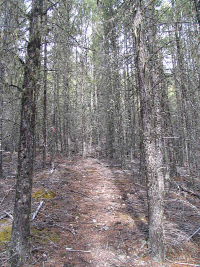
Much of the ascent is along a faint path through the trees. |
|
|
This is the south ridge of Redstreak Mountain as seen from the west ridge. |
|
|
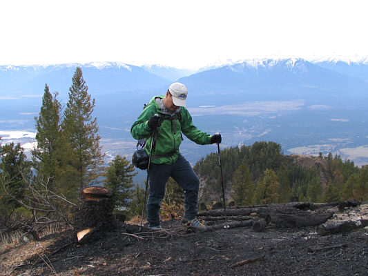
Sonny trudges through a recently burned section of forest on the west ridge. Parks Canada is creating fireguards in anticipation of a prescribed burn on Redstreak Mountain in 2008. |
|
|
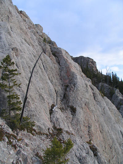
Here is an unobstructed view of the crux on Redstreak Mountain. Sonny's eventual ascent (red) and descent (green) routes are shown. The locations of the chimney (C) and the slabs (S) are also marked. The true summit is not visible here. |
|
|
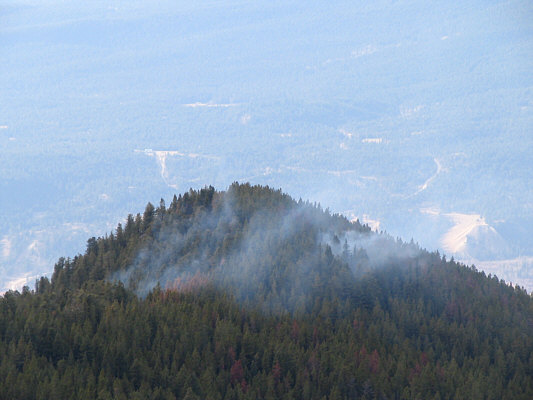
An outlier of the west ridge appears to be burning. |
|
|
Sonny approaches an orange cliff band blocking the ridge. |
|
|
Here is more of the same orange cliff band. |
|
|
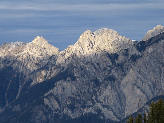
This is looking north toward Mount Berland (2362 metres). |
|
|
The crux slabs are just ahead to the left. |
|
|
Sonny tests the slabs. |
|
|
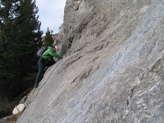
This is the crux chimney that Sonny would eventually ascend. |
|
|
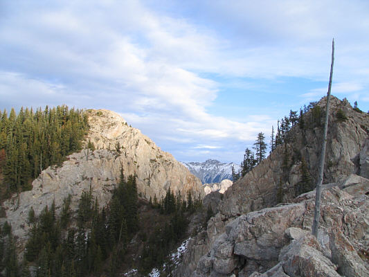
The true summit of Redstreak Mountain (left) finally comes into view. |
|
|
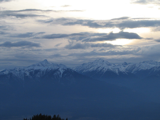
The late afternoon sun lights up some unnamed peaks to the north. |
|
|
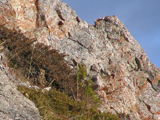
Near the summit, a small owl looks intensely back at its photographer. |
|
|
While standing on the 2118-metre summit of Redstreak Mountain, Sonny contemplates how much daylight he has left. |
|
|
This is looking east toward snowy Mount Sinclair (2662 metres) which is on the horizon just left of centre. |
|
|
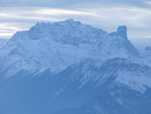
Mount Assiniboine (3618 metres) and Lunette Peak (3398 metres) poke up behind an intervening ridge to the northeast. |
|
|
Far to the west are Mount Farnham (3493 metres ) and Farnham Tower (3387 metres). |
|
|
Not as far to the west is the false summit of Redstreak Mountain. |
|
|
Pinto Mountain (2547 metres) is visible to the south. |
|
|
This is the crack at the crux slabs that Sonny down-climbed with some difficulty. |
|
|
The sun begins to set in the southwest. At left is Mount Nelson (3313 metres), and right of centre is Mount Delphine (3406 metres). |
|
|
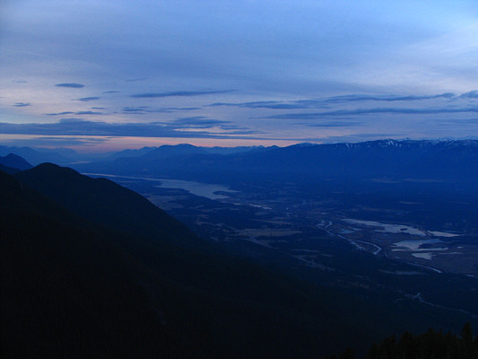
Dusk falls on the Columbia River Valley. |