Photo Courtesy of Dinah Kruze
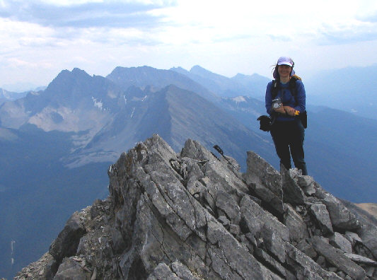
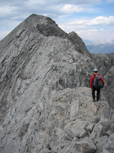
Photo Courtesy of Bob Spirko
Just across the highway from Hector Gorge viewpoint is a gated service road leading to a large gravel pit with a shed nearby. We parked near the gate and proceeded on foot from here. Right off the bat, we had some trouble finding the old road leading to Wardle Lookout, and we wandered around the gravel pit for about half an hour before backtracking and spotting a break in the trees not far from the gate. The old road was quite overgrown and did not look particularly inviting, but it was still easy to follow. Somewhere along this road, I started having a stomach ache that would plague me for the rest of the day. Furthermore, I was stung by a wasp when I stepped over a rotten log. This outing was already turning into an epic for me!
It took us about an hour to reach Wardle Lookout, and to say that the views were disappointing would be the understatement of the year. The lookout site was completely overrun by trees and tall bushes, and only some debris strewn across the ground gave any indication that a lookout tower once stood there. Beyond the lookout site, I was expecting some sort of beaten path, but other than a few short-lived game trails, there was no evidence of human passage up the thickly forested ridge. To their credit, Dinah and Bob still looked fresh after a depressing 2.5-hour bushwhack to tree line. I, on the other hand, was reeling from the effects of my stomach ache and the fact that I had lost my sunglasses somewhere in the trees. We took a short break at a cairn on the open ridge, and I felt a little better after eating some fruit. From there, we had no trouble getting up to the south summit of Mount Wardle.
At the south summit, Dinah and Bob were a bit apprehensive about traversing the exposed ridge to the north (true) summit. Despite my attempts to convince them both to continue up with me, I eventually went alone to the north summit. Dinah, still trying to regain her confidence on difficult terrain after a tough fall two years ago, was quite content to tag just the south summit. Bob actually started descending to a short but very exposed knife-edge (crux), but he decided to turn around because he thought that he would be too slow if the exposure was sustained for a long distance along the ridge. As it turned out, I found that, beyond the crux, the remainder of the ascent was mostly easy scrambling with some mild exposure, and it took me only ten minutes to traverse between the two summits. Although I was looking forward to reading the summit register, it was so thoroughly soaked that all I could do was wring out some water and stuff it back into its PVC canister. Luckily, a party from the previous year left some paper (print-outs of "repeat photographs") in a zip-lock bag, and I signed my name on the back of one of the sheets. When I returned to the south summit, Dinah and Bob had already started descending because they were getting cold. The weather was starting to deteriorate as thunderstorms began approaching from the west.
We retraced our steps back to tree line, but instead of returning to Wardle Lookout, we headed down the steep south side of the ridge and followed a prominent gully most of the way back to the highway. A spectacular thunderstorm rolled into the area while we were partway down the gully. Lightning flashed all around us, and rain rendered our bushwhacking descent wet and slippery. Toward the bottom, it seemed like an eternity before we finally emerged from the trees onto the highway, and we still had to hike for another 25 minutes uphill to return to my car. Dinah, Bob and I must have looked like three drowned rats to all the passing motorists, but we were all just happy to be walking on bush-free pavement for a change. Our round-trip time was 10 hours, and although I felt terrible for subjecting Dinah and Bob to such a grueling trip, I was nevertheless happy to share their excellent company.
Be sure to check out Bob's trip report here.
|
|
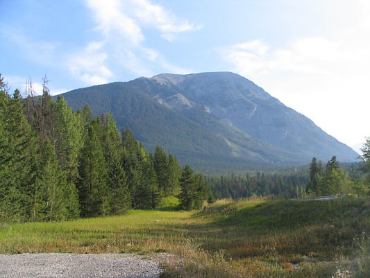
This is Mount Wardle as seen from the parking spot. Dinah, Bob, and Sonny would ascend the left skyline ridge. The summit is not visible here. |
|
|
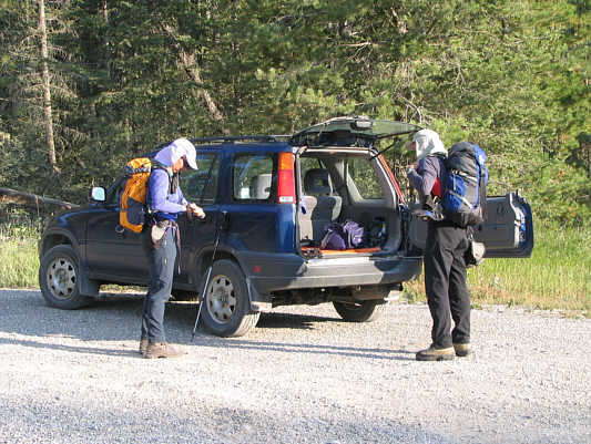
Dinah and Bob gear up beside Sonny's car. |
|
|
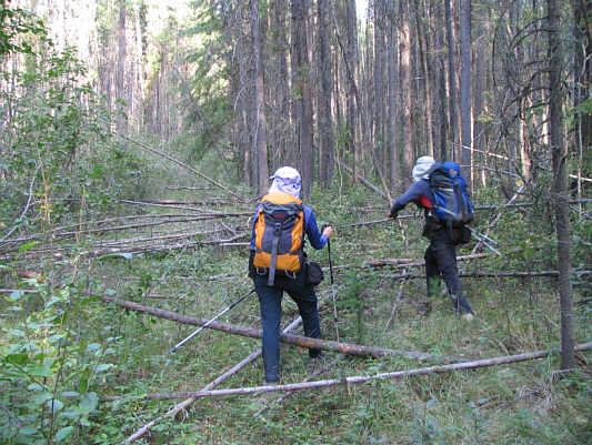
The old road to Wardle Lookout is very overgrown. |
|
|
Bob and Dinah reach the site of Wardle Lookout (1655 metres). |
|
|
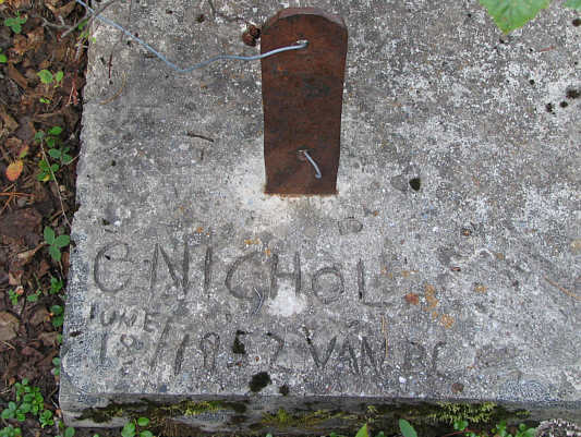
This is an inscription on one of the concrete footings of the former lookout tower. |
|
|
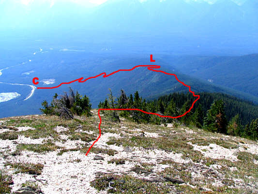
The approximate ascent route is shown. The locations of Sonny's car (C) and Wardle Lookout (L) are also shown. |
|
|
Bob and Dinah take a break beside a cairn on the southwest ridge. The summit of Mount Wardle is visible in the distance just left of centre. |
|
|
Bob and Dinah traverse a short scree slope to reach a connecting ridge. |
|
|
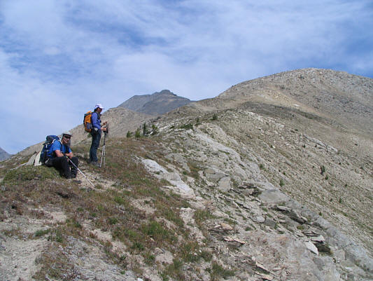
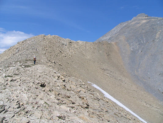
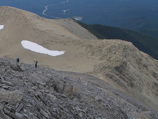
The connecting ridge is mostly easy hiking. |
|
|
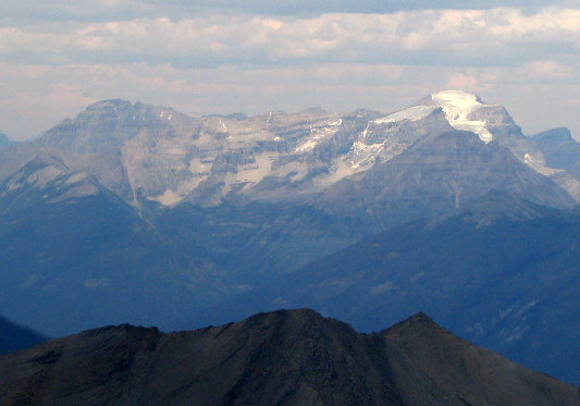
This high col separates Mount Wardle from its southern outlier. Mount Assiniboine is visible on the horizon. |
|
|
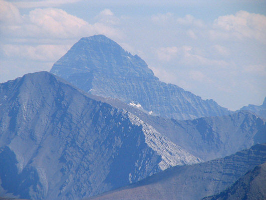
Here is a closer look at Mount Assiniboine. |
|
|
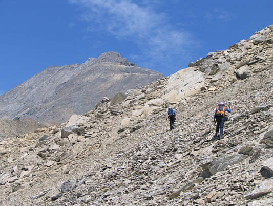
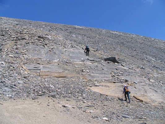
Bob and Dinah start climbing up the final scree slope. |
|
|
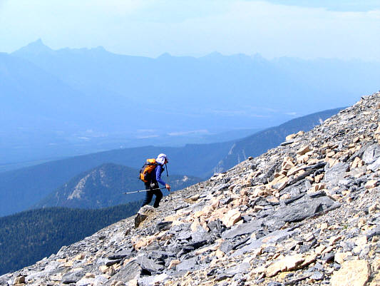
Dinah works her way up the scree slope. The Brisco Range stretches across the horizon to the west. |
|
|
Bob stands above one of many big cliffs on the east side of Mount Wardle. |
|
|
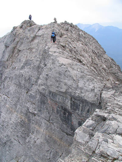
Bob and Sonny contemplate traversing to the north summit. Photo Courtesy of Dinah Kruze |
|
|
Dinah decides to stop at the south summit. Split Peak (2928 metres) is visible at distant left. |
|
|
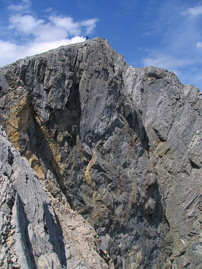
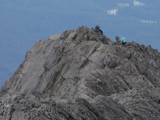
Sonny starts up the exposed
summit ridge. Photo Courtesy of Bob Spirko |
|
|
With Dinah looking on, Bob begins to descend from the south summit. He would stop and turn around at the exposed knife-edge at lower right. |
|
|
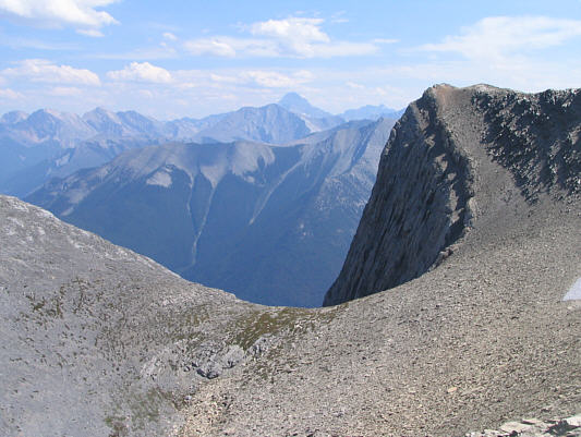
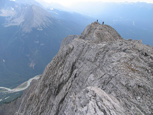
This is looking back at the south summit from partway along the summit ridge. The Vermilion River is almost a vertical mile below. |
|
|
Sonny holds up the register canister on the 2810-metre north summit of Mount Wardle. |
|
|
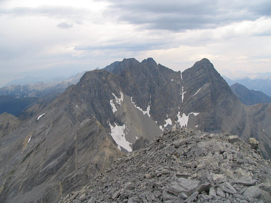
To the north are the spectacular and unofficially named White Tail Peaks (2970 metres). |
|
|
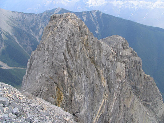
This is the northeast outlier of Mount Wardle. |
|
|
Stanley Peak and Mount Ball are the most recognizable mountains to the north. |
|
|
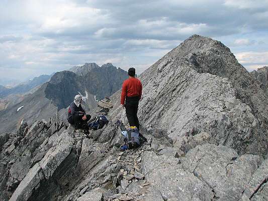
Bob and Dinah wait patiently on the south summit for Sonny to return from the north summit. |
|
|
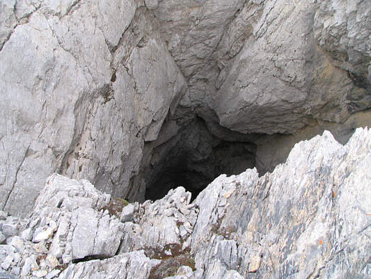
Bob and Dinah begin descending the mountain. There is a bottomless pit (hard to see) at lower centre. |
|
|
This is looking down the bottomless pit--named "Wardle's Hole" by Bob. |
|
|
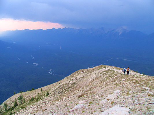
Bob and Dinah hike down the ridge as a storm approaches the area. |
|
|
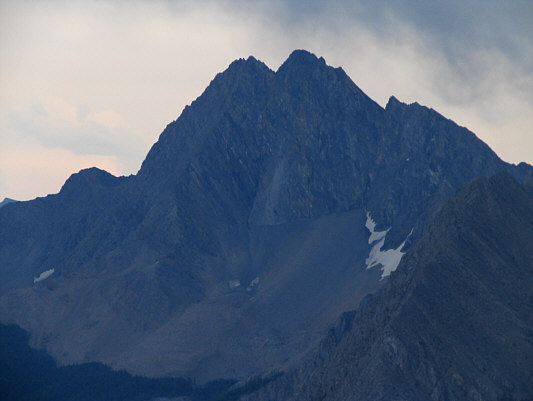
Here is a close-up of Split Peak. |
|
|
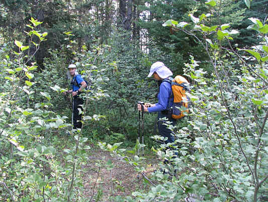
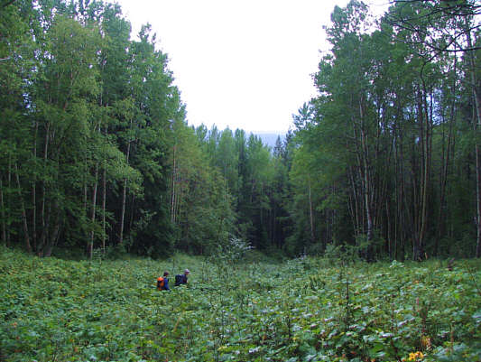
The thick bush almost swallows up Dinah and Bob on their hike out. |
|
|
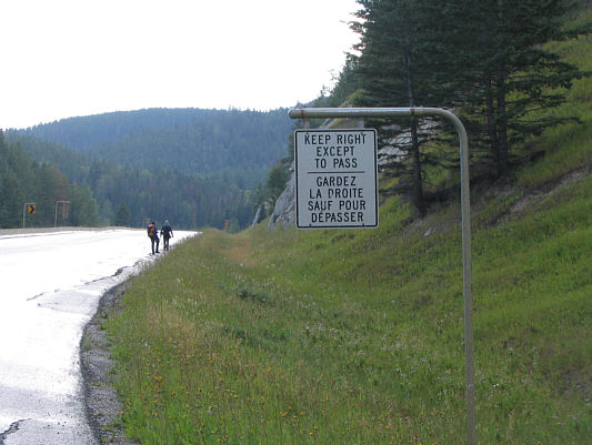
Dinah and Bob walk back to Sonny's car along the highway. |
|
|
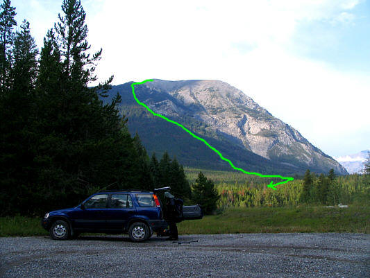
Bob unloads his gear into Sonny's car. The approximate descent route is shown. |