

Photo courtesy of Paul Russell
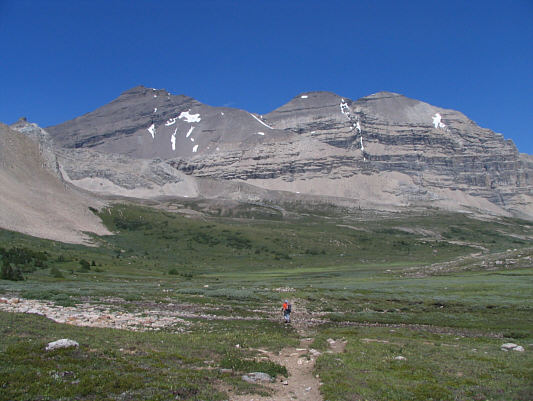
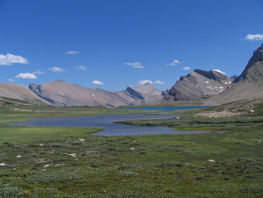
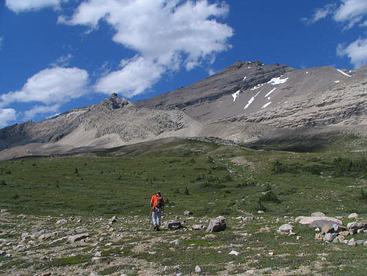

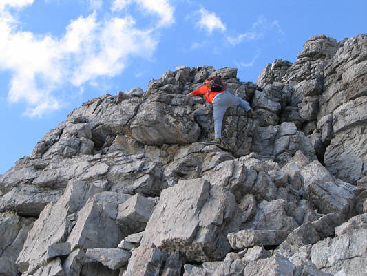
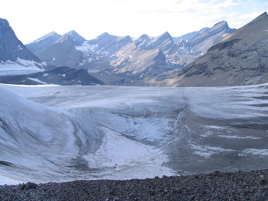

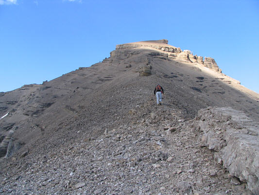
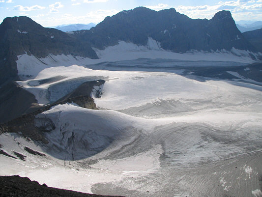
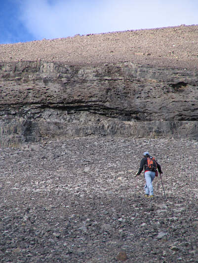
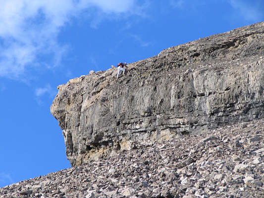
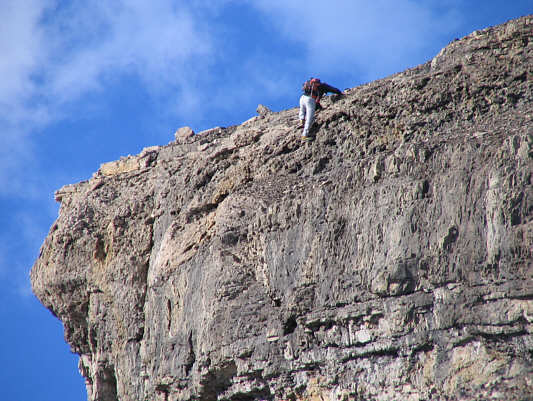
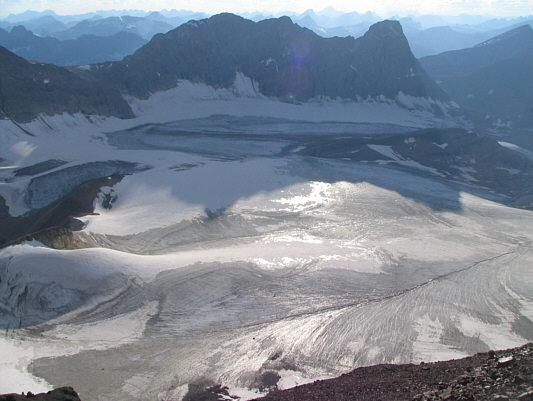


Photo courtesy of Paul Russell


After a short break, we glissaded and plunge-stepped down a steep snow slope before descending loose rubble to reach the sub-alpine meadows of the Siffleur River headwaters. While crossing these meadows would normally be easy (though still annoying because of all the ups and downs), my heavy pack, my lack of sleep the night before, and my upset stomach all took their toll on my body, and I had to constantly fight the urge to sit down and fall asleep. Paul thought I was joking when I suggested that we stop and pitch our camp beside a small tarn not even halfway across the meadows. Thankfully, Paul was always in good spirits, and I drew enough strength from his encouragements to continue on. We eventually climbed over Clearwater Pass and reached the largest of the Devon Lakes where we found an excellent camping spot. It had taken us roughly 9.5 hours to get here from the trail headmuch longer than I was anticipating. The question now was whether or not I had any gas left in the tank to ascend Mount Willingdon.
After setting up camp and sorting out our gear, I took a ten-minute nap to try and re-energize myself a little. Paul and I left camp at 4:30 PM and started up the ridge. The entire route was bone-dry on this day, and despite an abundance of treadmill scree, we encountered few difficulties on our way to the summit. I topped out at 8:22 PM, about twenty minutes after Paul.
Paul and I began our descent at 8:38 PM and took an alternate route down the southeast side of the summit block. We were hoping to reach some giant scree slopes on that side of the mountain, but as it turned out, we were foiled by large cliff bands and had to traverse across some unpleasant terrain to get back on the normal route. We descended the rest of the route in growing darkness, and Paul probably saved us a lot of time by using his GPS to relocate our camp. We rolled into camp at 11:30 PM and had a quick dinner (very salty chili) before enjoying a well-deserved sleep.|
|
Paul enjoys a danish before heading for Mount Willingdon. |
|
|
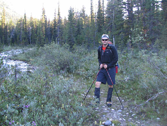
Paul leaves the trail to bushwhack along the north fork of Mosquito Creek. |
|
|
After bushwhacking for about four kilometres up the north fork of Mosquito Creek, Paul finally breaks out of the trees. |
|
|
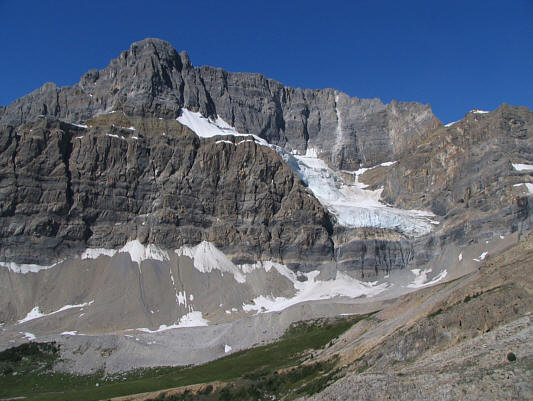
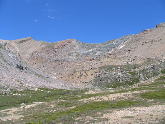
There is some impressive scenery at the head of the valley. |
|
|
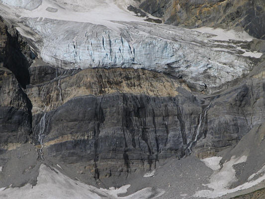
Here is a closer look at the hanging glacier from the previous photograph. |
|
|
Paul works his way through the tumbled mess of an ancient rock slide. |
|
|
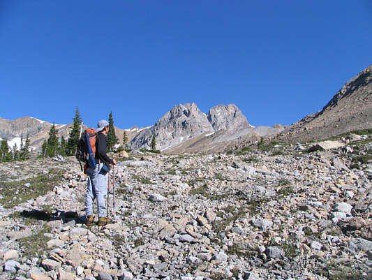
Paul hikes up a loose scree slope near the head of the valley. |
|
|
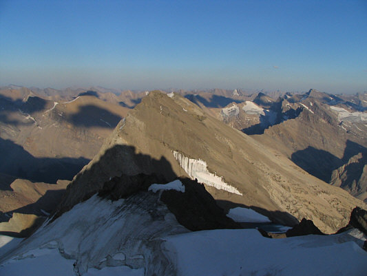
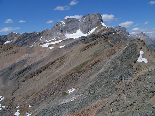
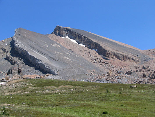
This is the view of Mount Willingdon from the ridge crest northwest of Quartzite Col. |
|
|
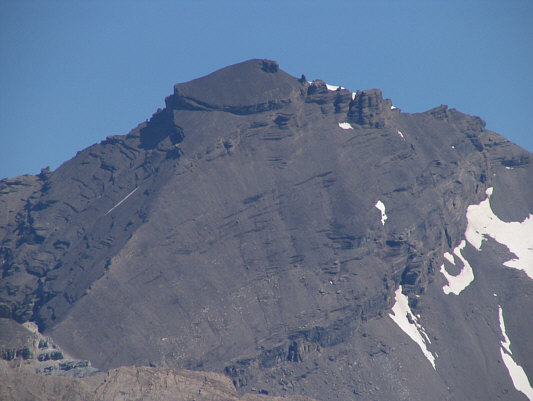
Here is a close-up of Mount Willingdon's main summit. |
|
|
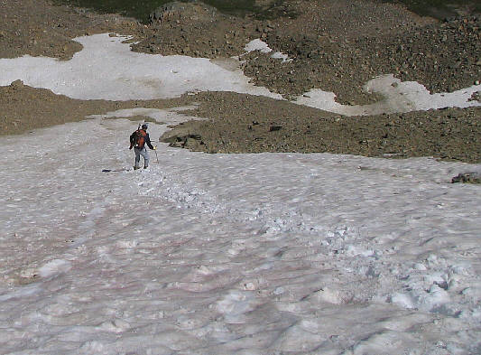
Paul plunge-steps down a steep snow patch. |
|
|
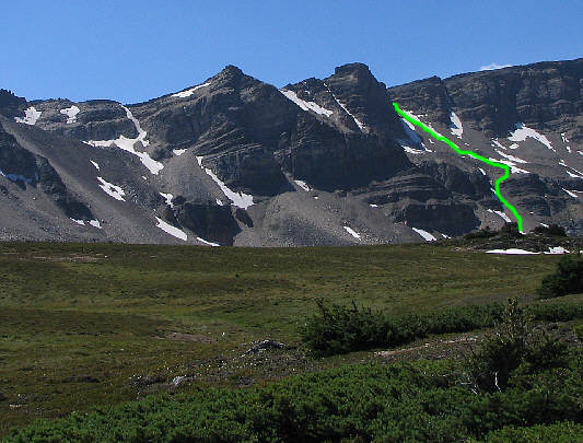
This is looking back at Quartzite Col (far left) from the meadows near the headwaters of the Siffleur River. Paul's and Sonny's descent route is shown. |
|
|
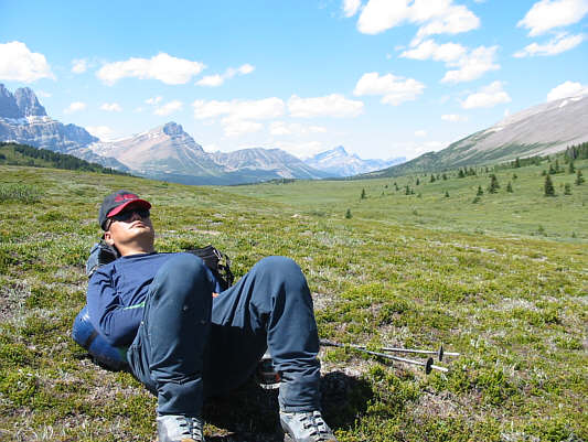
Sonny sleeps. Photo courtesy of Paul Russell |
|
|
Paul hikes across Clearwater Pass. |
|
|
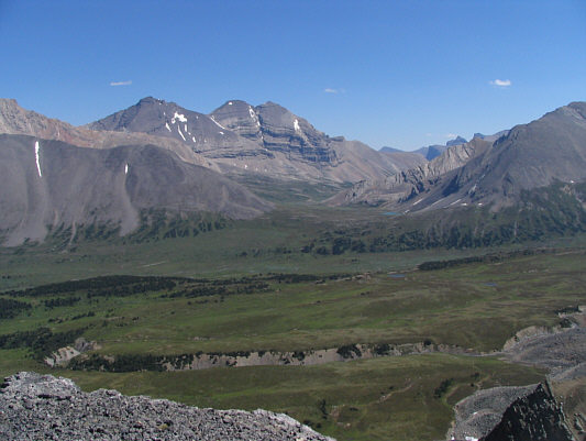
The largest of the Devon Lakes finally comes into view. At center on the horizon is Dip Slope Mountain (3125 metres). |
|
|
After setting up camp, Paul starts climbing up Mount Willingdon. |
|
|
The route follows the ridge and traverses just below the blocky knob in the distance at right. |
|
|
Paul scrambles up some big blocks along the ridge. |
|
|
On the north side of the connecting ridge between Clearwater Mountain and Mount Willingdon is this unexpectedly large icefield. |
|
|
Devon Lakes and Devon Mountain dominate the view south from the connecting ridge. |
|
|
Paul continues grinding up the connecting ridge to the summit block. |
|
|
Here is another perspective of the large icefield northwest of Mount Willingdon. At far left is Clearwater Mountain. |
|
|
Paul approaches the cliff band guarding the summit block. |
|
|
Paul scrambles up the crux. |
|
|
Here is a close-up of Paul surmounting the final obstacle before the summit. |
|
|
This is a final look at the icefield from near the crux. |
|
|
There is a cord dangling over the crux. |
|
|
Sonny staggers up the last few metres
to the summit. Photo courtesy of Paul Russell |
|
|
Paul waits patiently for Sonny at the summit. |
|
|
Paul and Sonny stand on the 3373-metre summit of Mount Willingdon. |
|
|
This is looking southeast to the lower summits of Mount Willingdon. |
|
|
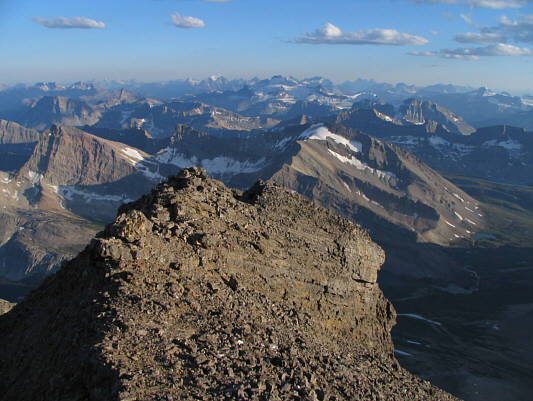
A sea of peaks stretch off to the south. |
|
|
Paul heads down the southeast side of the summit block. |
|
|
Paul down-climbs an awkward cliff band not far below the summit. |
|
|
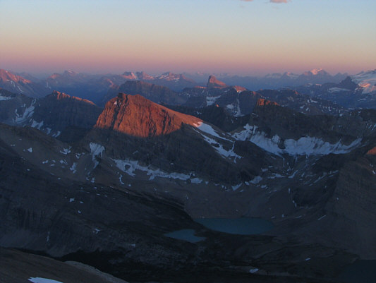
The last rays of sunshine disappear over the Canadian Rockies. |
|
|
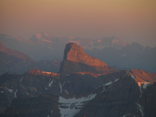
Molar Mountain presents a striking profile. |
|
|
A nearly full moon rises up behind a distant peak. |
 |
The morning sun warms up the camp near the largest of the Devon Lakes. |
 |
Paul prepares to leave his and Sonny's camping spot below Mount Willingdon. |
 |
Paul hikes toward Quartzite Col. |
 |
This is one of the headwaters of the Siffleur River. |
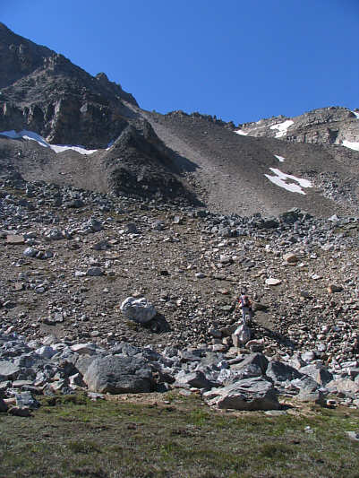 |
Paul climbs up the rubble slope below Quartzite Col. |
 |
Here is a view of the upper Siffleur River valley from partway up the rubble slope. |
 |
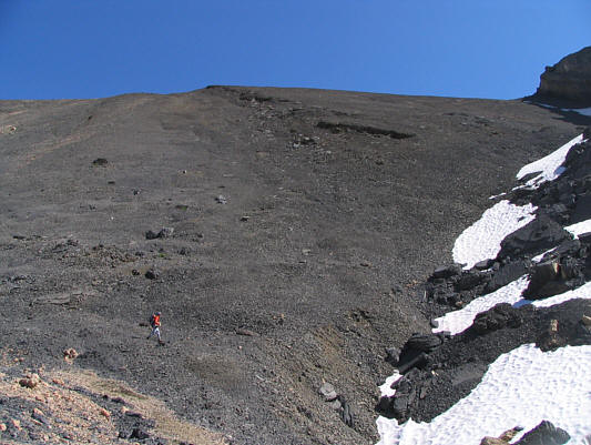
Sonny struggles up loose scree near
the top. Photo courtesy of Paul Russell |
 |
This is looking north along the crest of Quartzite Col. |
 |
This is Quartzite Col as seen from the southwest. There are different opinions about the best routes for ascent and descent. |
 |
South of Quartzite Col are some impressive rock slides. |
 |
Noseeum Mountain (3002 metres) dominates the view to the south as Paul heads back to Mosquito Creek. |