
|
|
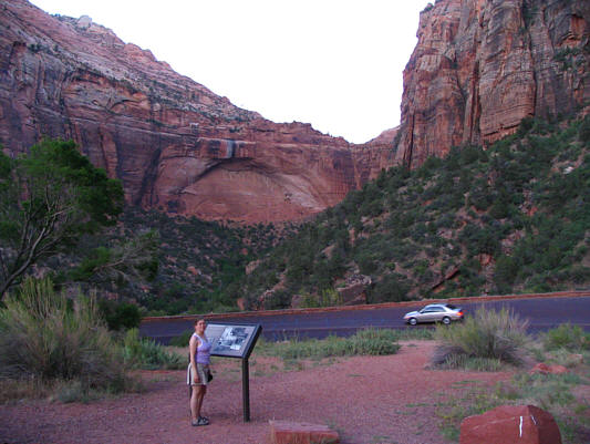
Kelly stands at a pullout near the west entrance of the Zion-Mt. Carmel Tunnel which is 1.77 kilometres long. The hole in the wall above Kelly is one of five gallery windows blasted out of the sandstone cliffs to facilitate the construction of the tunnel. A fascinating account of this engineering marvel can be found here. |
|
|
Visible from the same pullout is The Great Arch. The east entrance of the Zion-Mt. Carmel Tunnel is on the other side of the cliffs at right. |
From spring to fall, Zion National Park prohibits public motorized traffic into Zion Canyon but offers visitors a free shuttle bus system which ferries people into and out of the canyon as well as connecting with the town of Springdale. After leaving our car at the visitor centre, we hopped on a bus headed into Zion Canyon and disembarked at the trail head known as "The Grotto". From here, we hiked up the popular trail to Scout Lookout, and while Kelly waited for me there, I continued up to the spectacular perch known as Angels Landing. Because of the serious exposure between Scout Lookout and Angels Landing, the park service has installed chains on the route and has also cut steps in the sandstone at key locations. I found the chains to be largely superfluous and thoroughly enjoyed the easy scramble up to the top.
After rejoining Kelly at Scout Landing, we returned to the trail head (about 4 hours round-trip) and caught a bus back to the visitor centre. We then drove into Springdale to do some shopping and have dinner before taking another bus into Zion Canyon in the evening. This time, we got off at the last trail head known as "Temple of Sinawava" and hiked the very easy Riverside Walk which ends at a narrowing of the canyon known appropriately as "The Narrows". The paved trail ends here, but many people continue further upstream by walking in the river. Kelly and I were content to turn around here and return to the trail head and ultimately the campground.
When we drove back to our campsite, we were a little shocked to see
another car with a tent pitched right beside it in our parking spot.
As we had feared, someone had mistakenly thought that the parking spot
was a separate campsite from where we had pitched our tent. Of
course, they also conveniently ignored our "occupied" stub.
Luckily, the parking spot was big enough to accommodate both our cars and
their tent, and I simply asked our "squatters" to move their car over a
bit so that I could park there too. After spending a very warm
night in our tent, Kelly and I got up early the next morning, packed up,
and left Zion National Park.
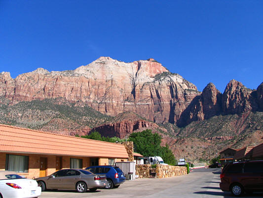 |
There is a nice view of The West Temple (2380 metres) from the parking lot of Zion Park Motel. |
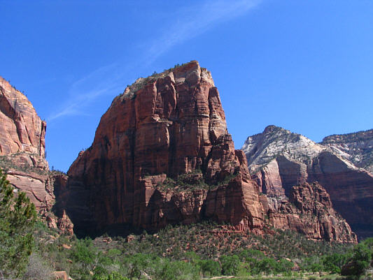 |
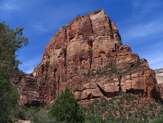
This is Angels Landing as seen from below. |
 |
The paved trail winds its way up the headwall on the right. |
 |
Kelly hikes up the paved trail. |
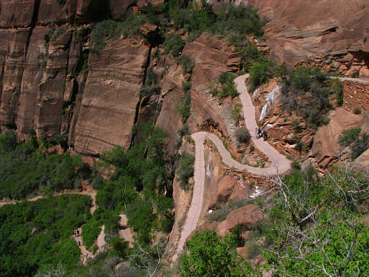 |
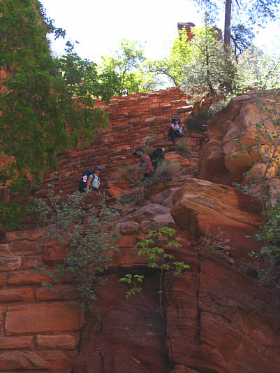
This view gives a good perspective of the winding trail. |
 |
Kelly continues up the headwall. |
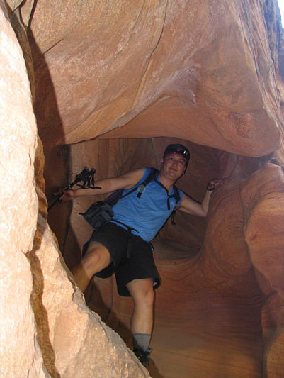 |
Sonny finds a little nook to crawl into. |
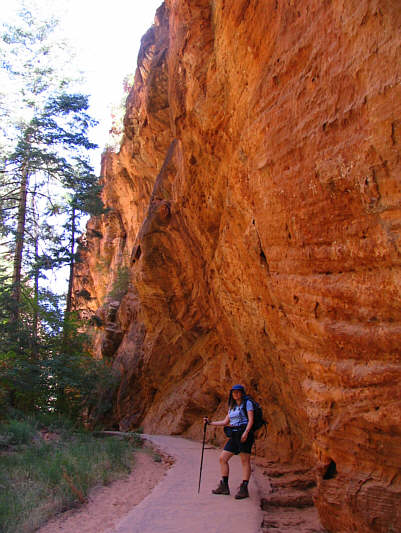 |
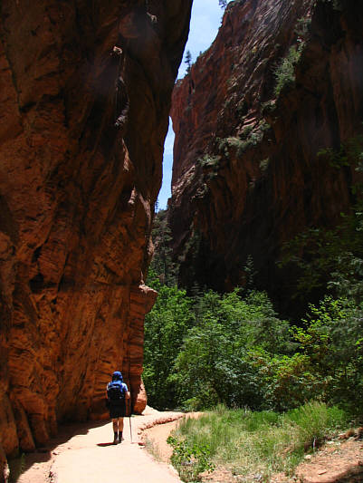
Kelly hikes through Refrigerator Canyon, so named because it offers some shade from the sun. |
 |
These immaculately built switchbacks (there are 21 in total) are known as "Walter's Wiggles" and connect Refrigerator Canyon with Scout Landing. |
 |
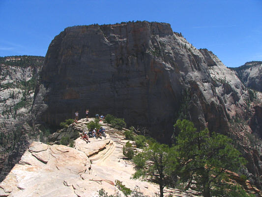
This is the view from Scout Landing of Angels Landing. To the left in the distance is The Great White Throne (2056 metres). |
 |
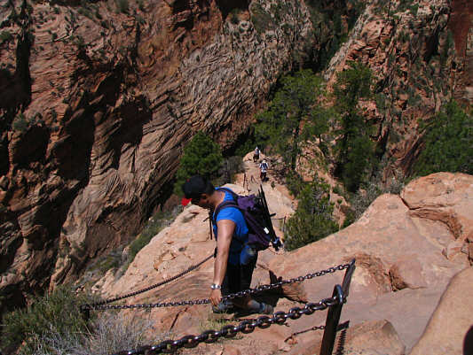
Kelly starts up the chains. She would turn around soon after this. |
 |
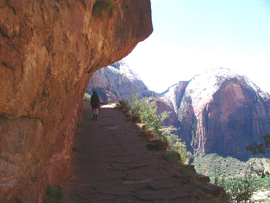
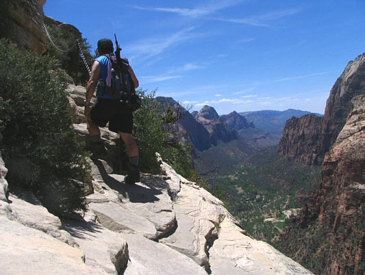
Here is a more dramatic view of the connecting ridge between Scout Landing and Angels Landing. |
 |
This is looking back along the connecting ridge to Scout Landing. |
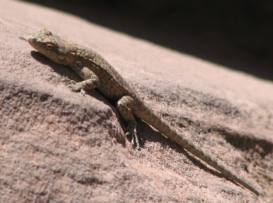 |
Zion Canyon is full of little lizards like this one. |
 |
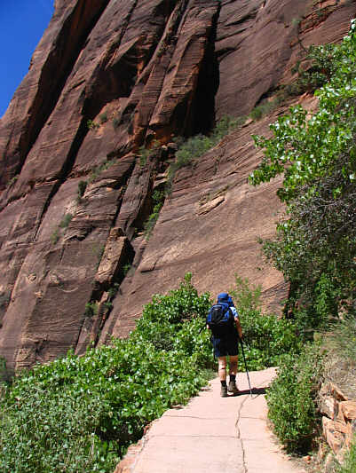
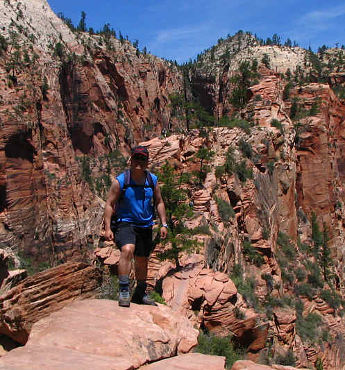
The route starts to get steep near the top. |
 |
Sonny hikes up some slabs near a considerable drop off. |
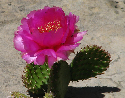 |
A pink cactus flower is in full bloom near the top of Angels Landing. |
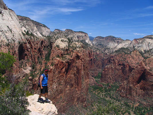 |
This is the view to the north of the upper canyon from near the top of Angels Landing. |
 |
The Great White Throne dominates the view to the southeast. |
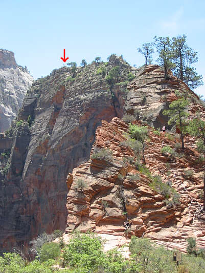 |
This is the view from Scout Landing of Sonny
(indicated) standing on the high point of Angels Landing (1763 metres). Photo courtesy of Kelly Wood |
 |
This is the view of the lower canyon to the south (toward the park entrance). Red Arch Mountain (1806 metres) looks indistinct (left of center in shadow) from here. |
 |
Sonny heads back down the connecting ridge to Scout Landing. |
 |
Kelly hikes back through Refrigerator Canyon. |
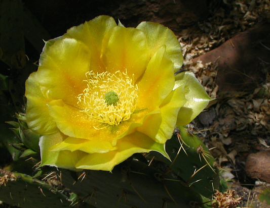 |
Here is a yellow cactus flower. |
 |
Angels Landing gets baked in the afternoon sun. Click here to read an interesting article about Angels Landing. |
 |
Kelly rides the shuttle bus back to the visitor centre. |
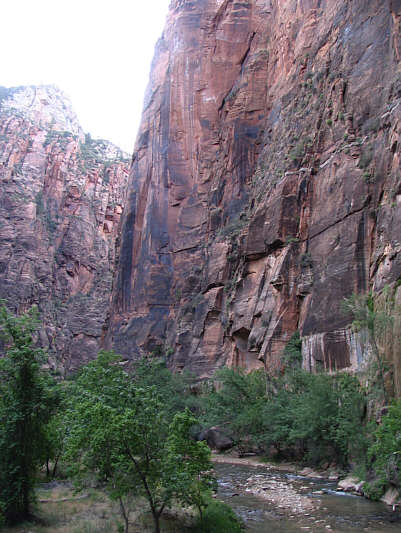 |
Here are some of the cliffs along the Riverside Walk. At the bottom is the North Fork of the Virgin River. |
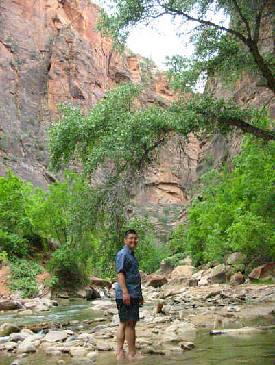 |
Sonny cannot resist dipping his feet in the Virgin River. Photo courtesy of Kelly Wood |
 |
Kelly reaches "The Narrows" at the end of the Riverside Walk. |