BOU AVENUE
Old Goat Mountain
Lying 16 kilometres south of Canmore, Alberta on the boundary between Banff National Park and Kananaskis Country, unofficially-named Old Goat Mountain is the highest peak in the Goat Range.  I hooked up with Rafal (Raff) Kazmierczak on 5 September 2009 to scramble up the east ridge of Old Goat Mountain as per Andrew Nugara's description in his guidebook, More Scrambles in the Canadian Rockies.  Not taking any chances, Raff brought along a rope and also lent me a climbing harness in case we had to rappel off any sections that were too difficult to down-climb.  Much of the ascent unfolded exactly as described by Nugara.  Raff and I biked the West Side Trail briefly and chose the alternate ascent route--a rocky drainage--to access the water-worn gully leading to the high col.  Though dry, the gully was challenging enough to give me pause about returning the same way.  At the col, we took a break and tried to enjoy views of Old Goat Glacier while being buzzed by a couple of low-flying helicopters likely carrying sightseeing tourists.  We soon turned our attention to the east ridge, and the ascent was every bit as difficult as advertised and then some.  We scrambled up a seemingly endless series of obstacles, some more difficult than others but all of them requiring some degree of concentration and perhaps some courage as well.  Severe exposure to climber's right was our constant companion except when we took the two described detours off the ridge.  Even the summit ridge required some care to traverse, but Raff and I eventually reached the summit cairn none the worse for wear.  Despite a chilly breeze, we spent over 50 minutes at the summit before retracing our steps back down the east ridge.  The descent really put our down-climbing skills to the test.  Even when we bypassed the more difficult sections of the ridge by dropping down to skier's right, we still encountered lots of exposed, loose and down-sloping terrain that was very tricky to descend or traverse.  Below the col, we down-climbed slabs and rubble to skier's left of the gully and breathed a huge sigh of relief when we finally cleared this section.  The remainder of our trip, though technically easy, was not without its share of misery in the form of some bushwhacking and side-hill bashing.  The hike out the drainage was unbearably long, but the bike ride back to my car was short and sweet (round-trip time of less than 12.5 hours).  Afterward, Raff and I agreed that Old Goat Mountain is probably more than just a scramble given the sustained difficulty of the east ridge, but we were nevertheless pleased to have completed the trip without using his rope.

Be sure to check out Raff's photos of this trip as well as some of Marko Stavric's photos from nearby Mount Nestor on the same day.
Sigh.  I remember when you could actually drive up this road. 
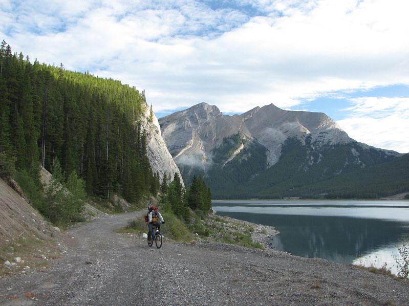
Raff cycles along West Side Trail.  Across Spray Lakes Reservoir is Rimwall Summit.
No Dinah, I didn't bag this rock! 
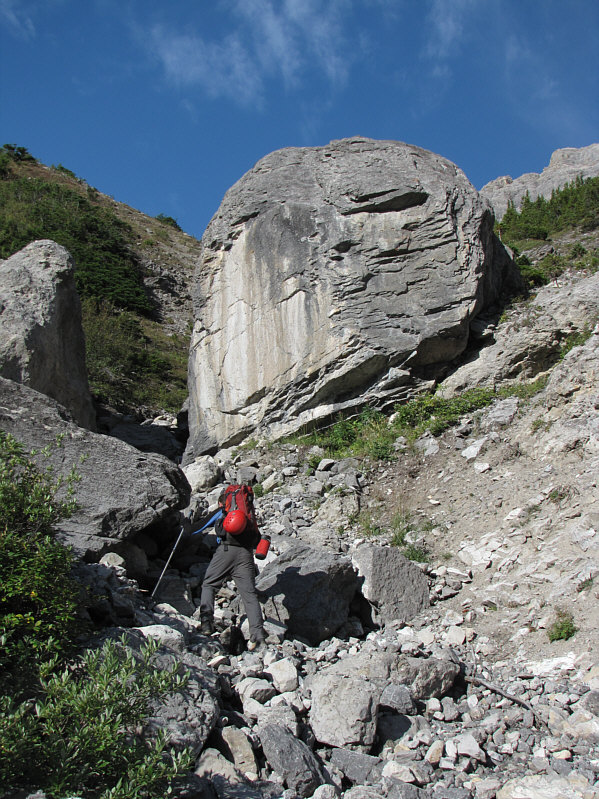
Raff approaches a huge boulder on his way up the drainage.
The Windtower is one of the few scrambles I have actually repeated. 
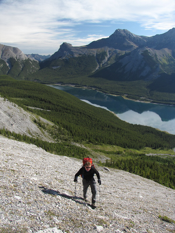
Raff climbs out of the drainage.  Spray Lakes Reservoir, the Windtower (left) and the first peak of Mount Lougheed are visible in the distance.
This is a beautiful mountain from any angle. 
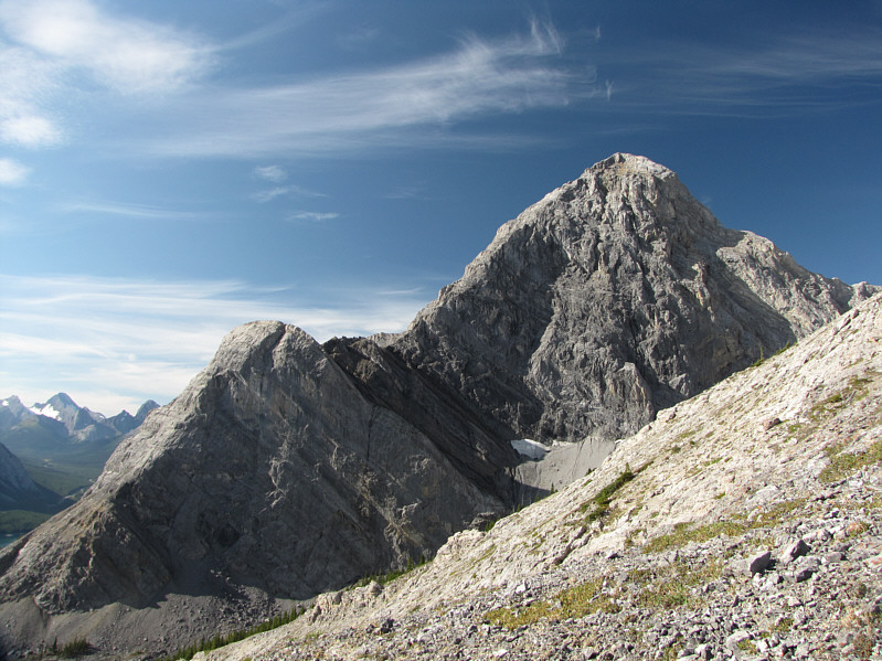
The north face of Mount Nestor already dominates the view to the south.
I wouldn't want to ascend this gully if it's wet. Raff scrambles up beside the water-worn gully.
We left our hiking poles here, but I wish I had brought them along for the rest of the ascent. Raff reaches the high col.  Above him is the east ridge of Old Goat Mountain.
A large bergshrund prevents easy access to the col from the glacier. This is Old Goat Glacier as seen from the col.
Only seconds earlier, another helicopter flew by barely skimming above the crest of the col. A helicopter flies over the col.
It only gets worse... 
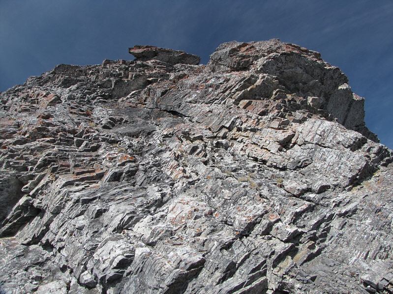
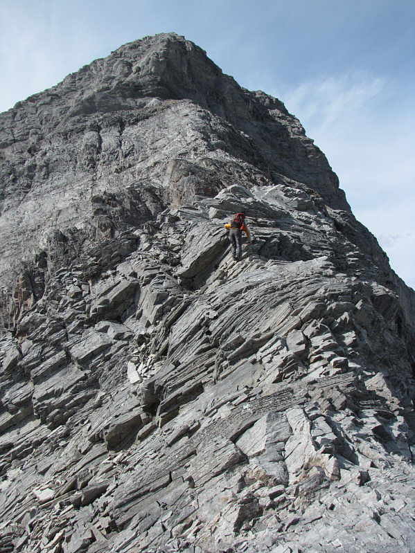
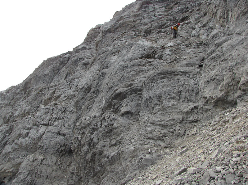
This is looking up one of the first challenging obstacles along the east ridge.
Anyone wanna traverse Peaks 1-3 with me? 
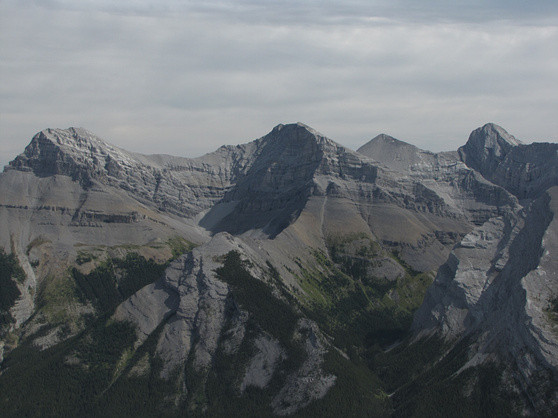
This is looking east at the four peaks of Mount Lougheed.
The exposure to the left in the photo is severe! 
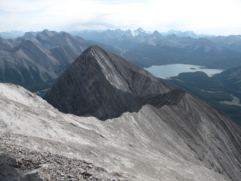
Raff descends a minor high point along the east ridge.  On the horizon at far left is Mount Sparrowhawk.
After descending to the first obvious weakness, you should climb all the way back up to regain the ridge. Raff drops down a rubble-filled gully on the first detour off the ridge.
Believe it or not, some of the scrambling was actually fun! 
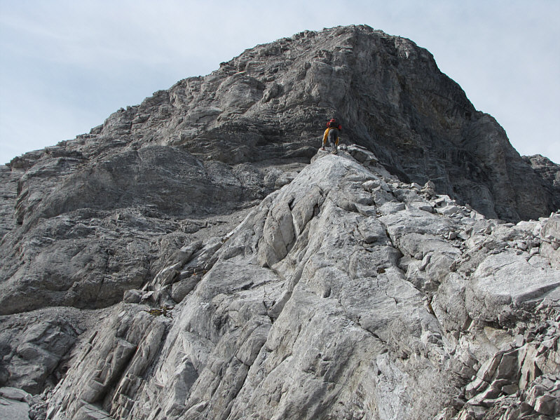
This is one of the easier sections along the ridge.
Lots of loose rock here.  It's best to wear a helmet and go up one at a time. 
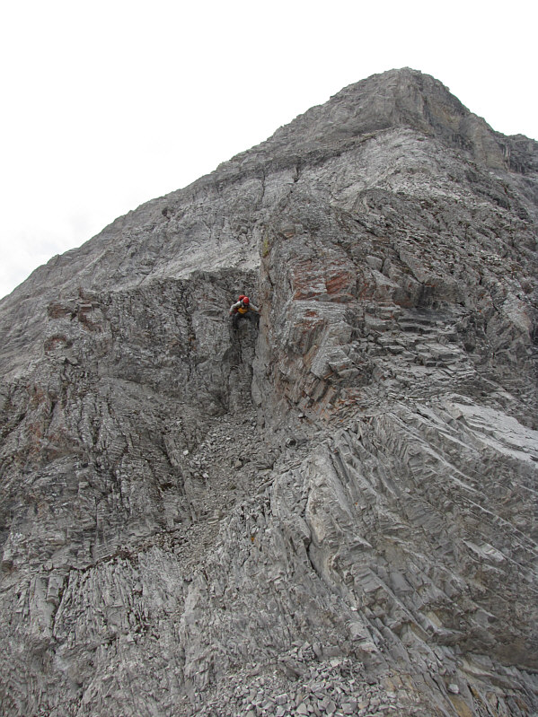
Raff climbs up a chimney.
Getting tired yet? Raff continues up more loose rubble and slabs.
The second detour off the ridge is just below the next cliff band. Raff approaches the summit block.
We're making the second detour off the ridge here. 
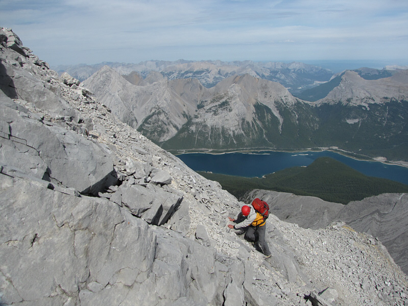
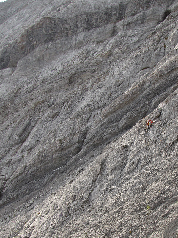
This photo gives a good indication of the steepness of the terrain.
Unbeknownst to us, Marko & Co. were climbing up Mount Nestor at roughly about the same time. Raff works his way back to the ridge after the second detour.  Mount Nestor dominates the view behind him.
I've already lost count of how many fruit bars Raff has eaten! Raff grovels up the last few metres before the summit ridge.
It will take us another 10 minutes to get there. 
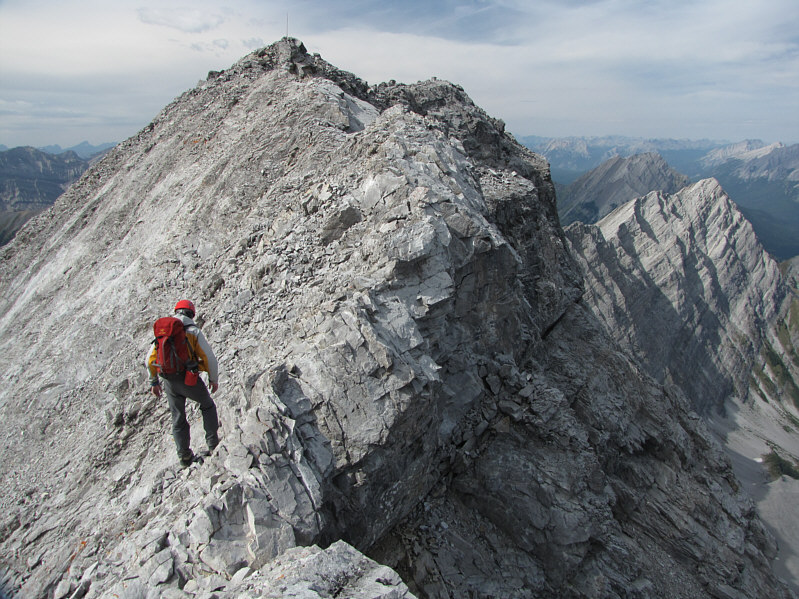
The summit cairn is the last bump on the left.
You probably don't want to slip here... 
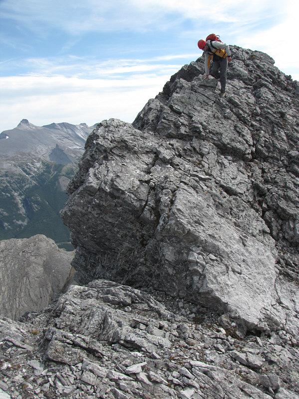
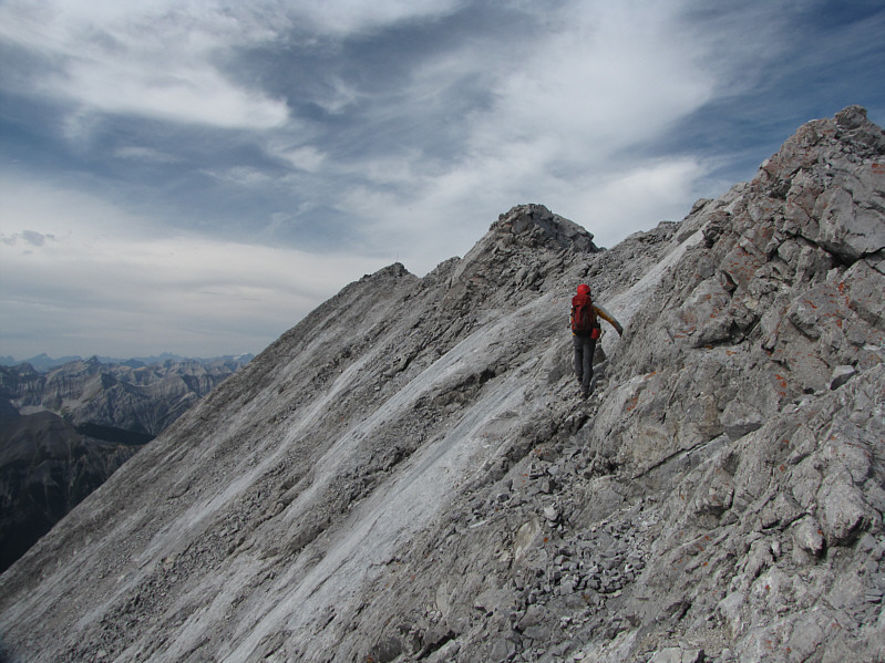
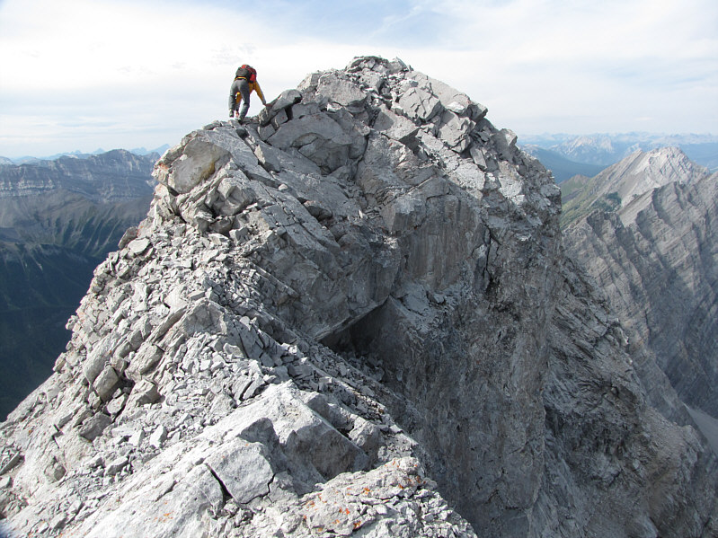
Raff carefully traverses the exposed summit ridge.
This is one summit you will definitely feel you have earned. Raff takes the last few steps to the summit.
6.5 hours from the car! 
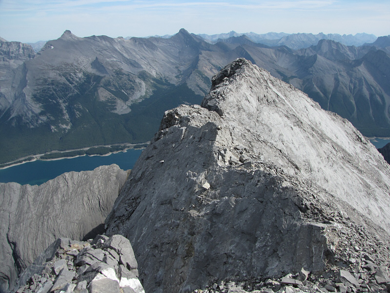
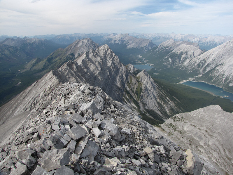
This is looking back along the summit ridge from the summit cairn.
Raff is a great partner to have on a serious trip like this. 
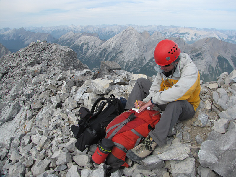
Raff and Sonny stand on the 3123-metre summit of Old Goat Mountain.
If you have a sharp eye, you should be able to spot Mount Aylmer on the horizon. 
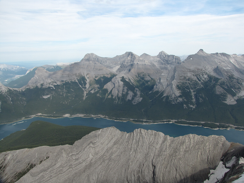
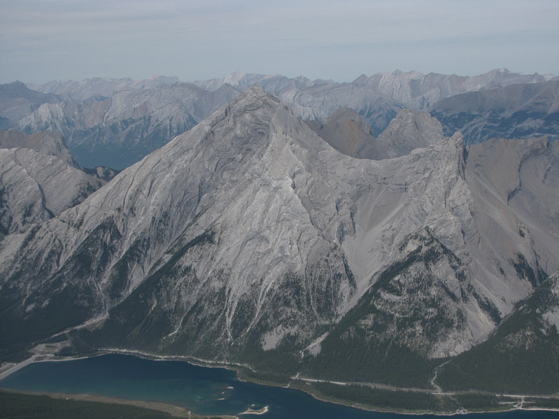
This is looking north at the rest of the Goat Range.  Goat Pond and the north end of Spray Lakes Reservoir are visible.
In terms of elevation, Old Goat Mountain actually surpasses all those peaks! To the east are (L to R) the Windtower, the four peaks of Mount Lougheed, and Mount Sparrowhawk.
Anyone wanna scramble up Wind Mountain with me? 
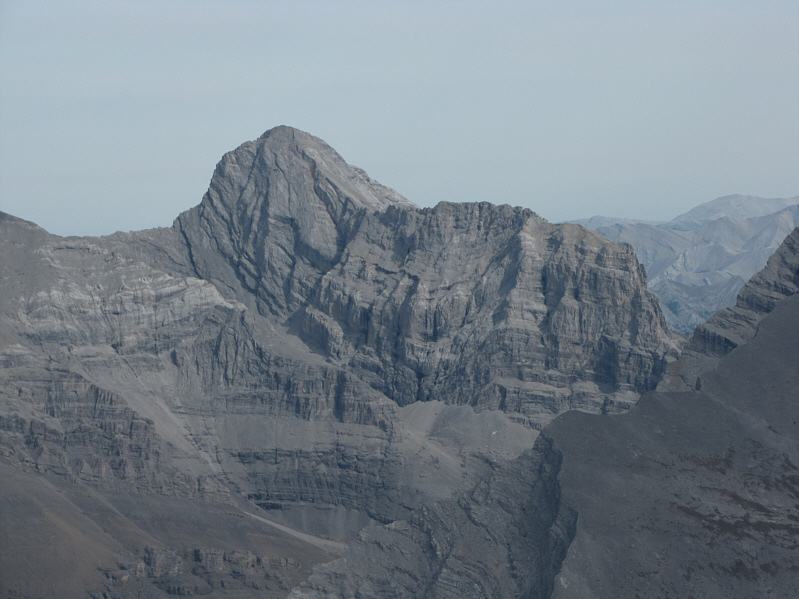
Here is a close-up of the fourth peak of Mount Lougheed which is also known as Wind Mountain.
Marko & Co. were on the summit of Mount Nestor roughly at about this time. This is looking south along the connecting ridge to Mount Nestor.  The most obvious peak on the horizon is Mount Sir Douglas.
Also barely visible in the gap between Eon Mountain and Aye Mountain are Mount Farnham and Farnham Tower. 
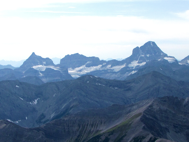
To the west are (L to R), Eon Mountain, Aye Mountain, Lunette Peak and Mount Assiniboine.
The snow-capped peak on the horizon is Mount Ball. 
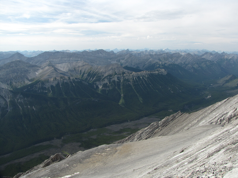
This is the view to the northwest across the Spray River valley.
Not to be confused with Three Sisters near Fernie, BC! To the north are The Three Sisters.
Maybe one party a year ascends this peak. Raff signs the summit register.
Now the real fun begins! Raff carefully descends the summit ridge.
Also known as "crab-walking", I used this technique a lot on the descent. Raff demonstrates how to butt-slide down a rock slab.
It's not as bad as it looks.  Okay, maybe a little... Raff looks for an easy way down these cliff bands.
I bet Santa never had to down-climb a chimney like this! Raff down-climbs the previously shown chimney.
Check your hand and foot holds! Cracks such as this one are useful for getting through tough cliff bands.
And this is only marginally easier than what he avoided! 
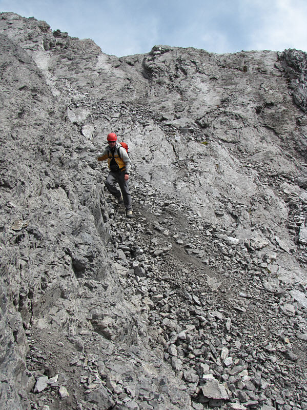
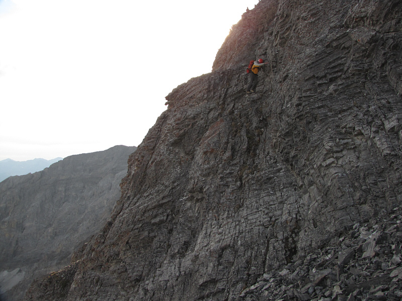
Raff descends some tricky terrain in order to bypass the most difficult sections of the east ridge.
What were we thinking?  Better yet, what was Andrew thinking?? This is the last cliff band Raff has to down-climb before reaching the col.