


Round-Trip Time: 10 hours 49 minutes
Total Elevation Gain: 1575 metres
The trip to Caldron Lake was uneventful, but as we hiked over the undulating terrain toward Caldron Peak, a heavy rain began falling. After all the effort of hiking across the gravel flats, over a low ridge, along Peyto Creek, up the moraine, under the east face of Peyto Peak, and down to the lake, I was anguished by the thought of having to turn back, but the miserable weather was even harder to bear. After a short debate, we decided to turn around, but as we headed back toward Caldron Lake, we hunkered down beside a giant wall of snow that was reminiscent of a glacier. Though it did little to keep us from getting soaked, the wall at least sheltered us from the bitter wind. The rain turned out to be short-lived, and we were once again teased by sunny breaks to resume our ascent. When we crested the ridge coming off of Caldron Peak's false summit, it was disheartening to see that we still had some elevation to lose before commencing an ungodly long scree slog of over 400 vertical metres. Without further ado, we dropped partway down into the bowl west of Caldron Peak and began churning our way up the treadmill scree. Rain began falling again when we were partway up the final slope, but by this point, there was really no turning back, at least not in my mind. Six hours after leaving the parking lot, we stood beside the summit cairn of Caldron Peak. Although the rain had tapered off again, Dinah and Bob began descending after spending less than 15 minutes on the summit while I stayed for another 15 minutes to sign the register and take photographs.
Wet and shivering from the chilly wind, I eventually followed Dinah and Bob down the mountain. We made the mistake of trying to contour around the edge of the bowl to avoid having to re-climb the aforementioned ridge, but stumbling across ankle-breaking rubble and the occasional steep snow patch was both time-consuming and downright aggravating. After regrouping just beyond the ridge, we enjoyed a pleasant hike back to Caldron Lake and took a short break there before rain prompted us to get moving again. The rain made our footing slick, and we had to be especially careful while descending the moraine and scrambling over the smooth rocks alongside Peyto Creek. Otherwise, our hike back to the parking lot was uneventful though Dinah and I both felt like throwing up after climbing nearly 300 vertical metres to Peyto Lake lookout at the end of the day.
Be sure to check out Bob's movie and trip report here.
|
|
Dinah and Bob mingle with the tourists at Peyto Lake lookout. Caldron Peak dominates the backdrop. |
|
|
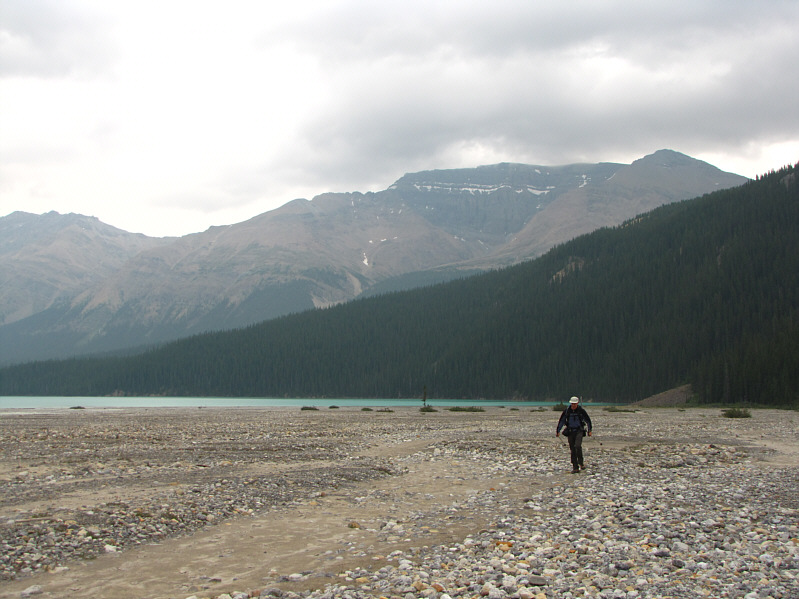
Bob hikes across the gravel flats west of Peyto Lake. Behind him on the right skyline is Observation Peak. |
|
|
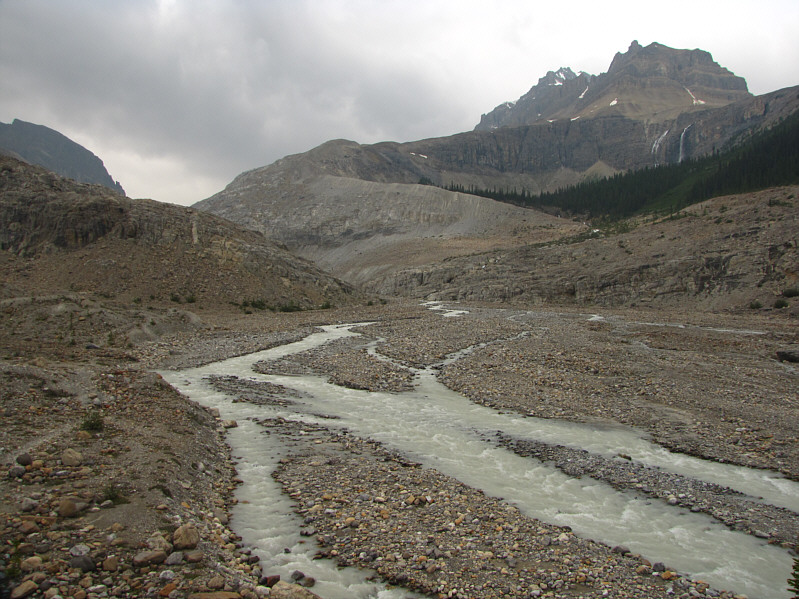
Much of the route to Caldron Lake--alongside Peyto Creek on the left, up the moraine at centre and under the east face of Peyto Peak at right--can be seen here. |
|
|
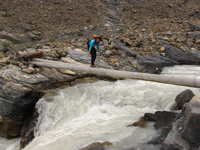
Dinah carefully crosses the bridge over Peyto Creek. |
|
|
Bob gets a carabiner caught on a wire supporting the bridge. |
|
|
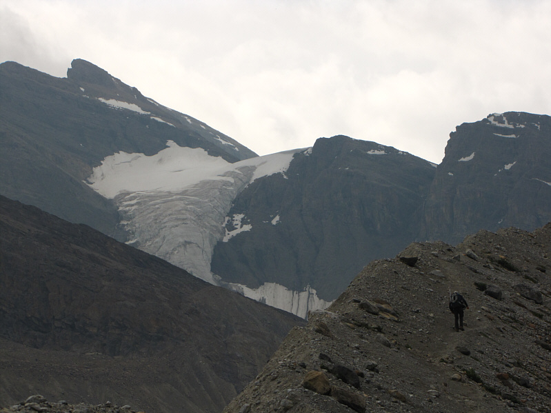
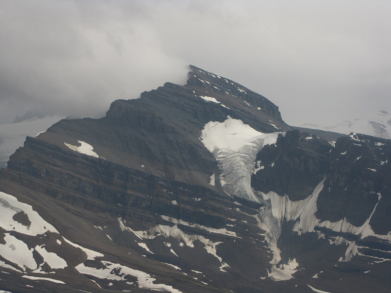
Mount Thompson and its namesake glacier provide a dramatic background as Bob climbs up the moraine. |
|
|
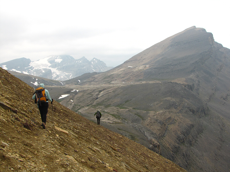
Bob and Dinah work their way toward the traverse (far right) below the east face of Peyto Peak. |
|
|
This is Peyto Glacier as seen from the moraine. A weather station is visible at bottom left. |
|
|
Dinah and Bob traverse below the east face of Peyto Peak. Caldron Peak is at right while Mount Patterson is partly visible at distant left. |
|
|
Dinah admires Caldron Lake near its outlet. Mistaya Mountain is directly ahead. |
|
|
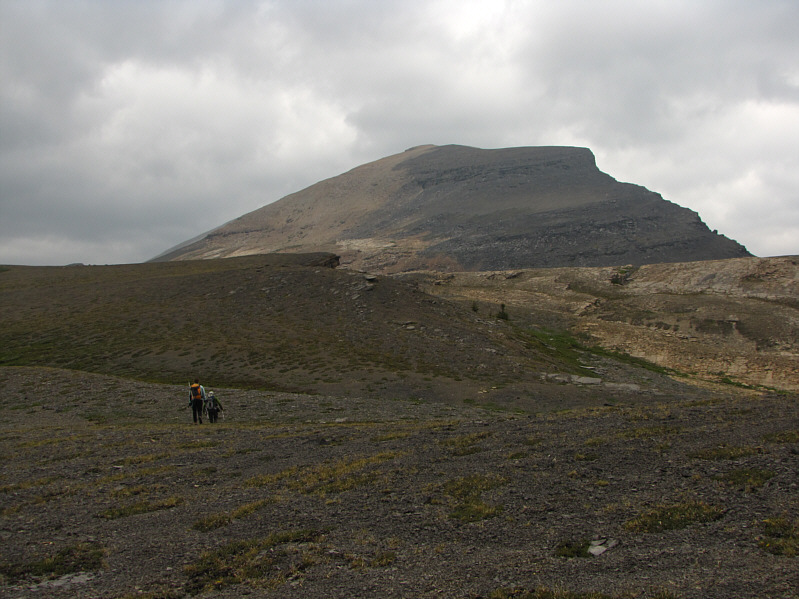
Dinah and Bob continue hiking toward Caldron Peak. |
|
|
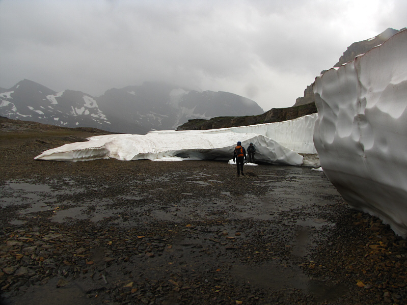
Dinah and Bob try to take shelter from the wind and rain beside the snow wall. |
|
|
This cleft in the snow wall is remarkably similar to a glacial crevasse. |
|
|
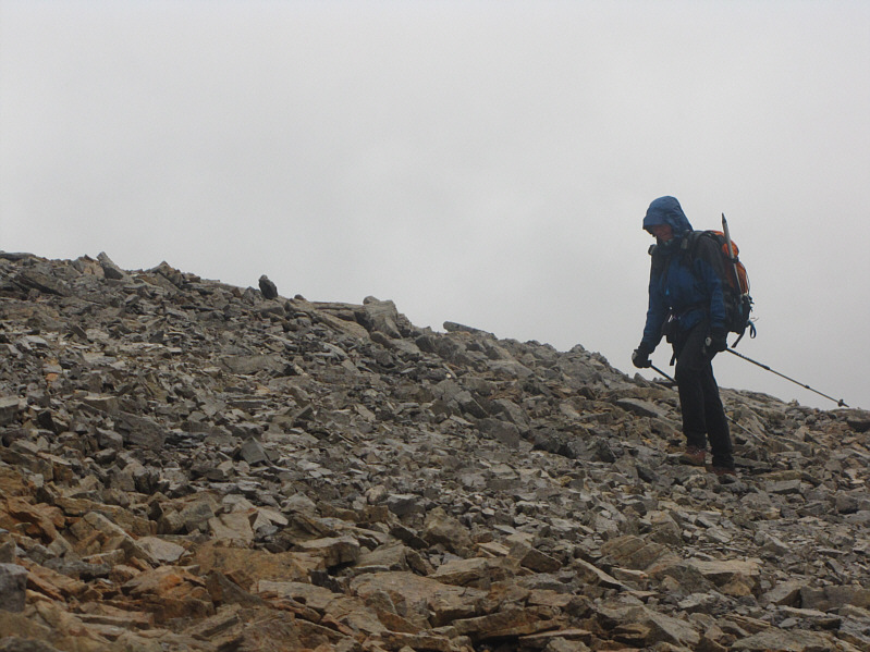
Dinah trudges up scree in the rain. |
|
|
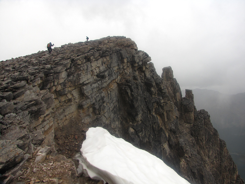
Dinah and Bob ascend the summit ridge. |
|
|
Bob, Dinah and Sonny stand on the 2910-metre summit of Caldron Peak. |
|
|
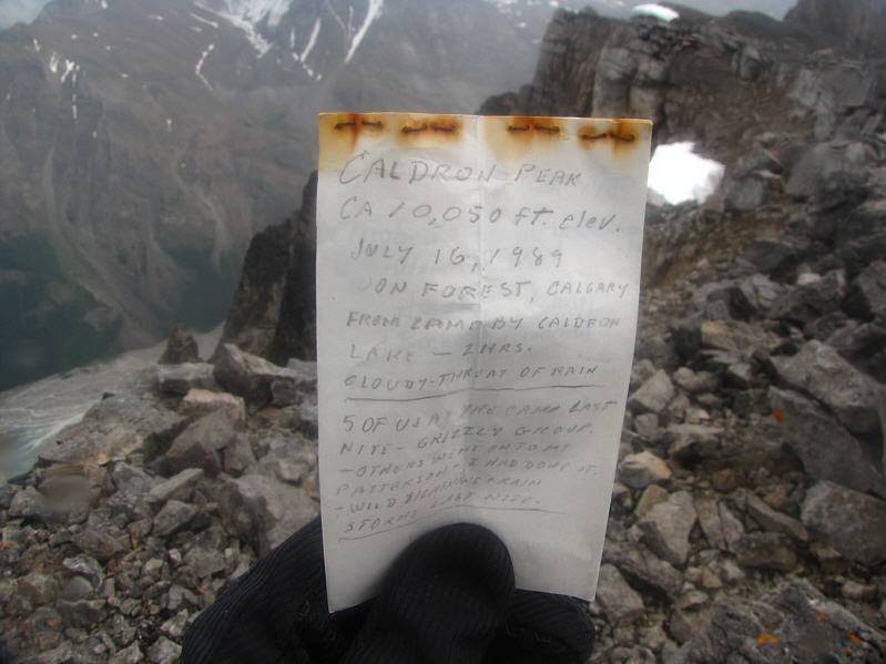
This is the original register left by the legendary Don Forest. |
|
|
The top of Mount Patterson is shrouded in cloud to the northwest. |
|
|
The view to the west is dominated by Mistaya Mountain (left), Barbette Mountain (right of centre), and the Delta Glacier. |
|
|
Mount Weed is visible to the north. |
|
|
To the south is Mount Thompson. |
|
|
Southeast of Caldron Peak is Mount Jimmy Simpson. |
|
|
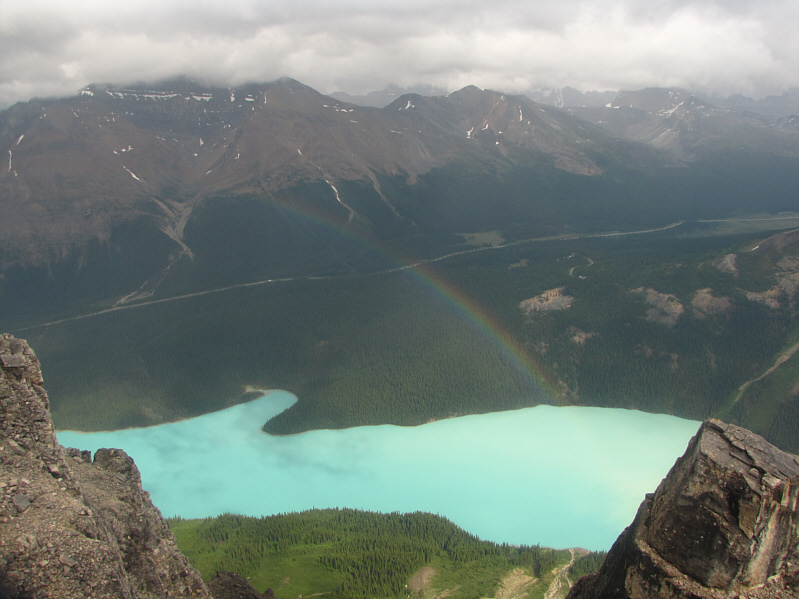
A rainbow appears over Peyto Lake to the east. Observation Peak is at left. |
|
|
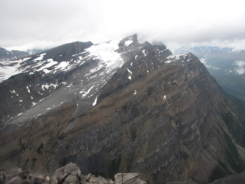
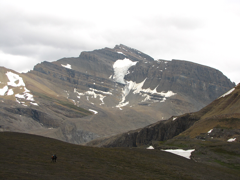
Here is a more comprehensive view to the south. Landmarks include Mount Thompson (left), Peyto Glacier (centre), Peyto Peak (right of centre), and Caldron Lake. |
|
|
Here is a closer look at Caldron Lake. |
|
|
Mount Thompson provides a beautiful backdrop as Dinah and Bob descend to Caldron Lake (not visible here). |
|
|
This is the route as viewed in Google Earth. |
|
|
Total Distance: 21.9 kilometres Round-Trip Time: 10 hours 49 minutes Total Elevation Gain: 1575 metres |