


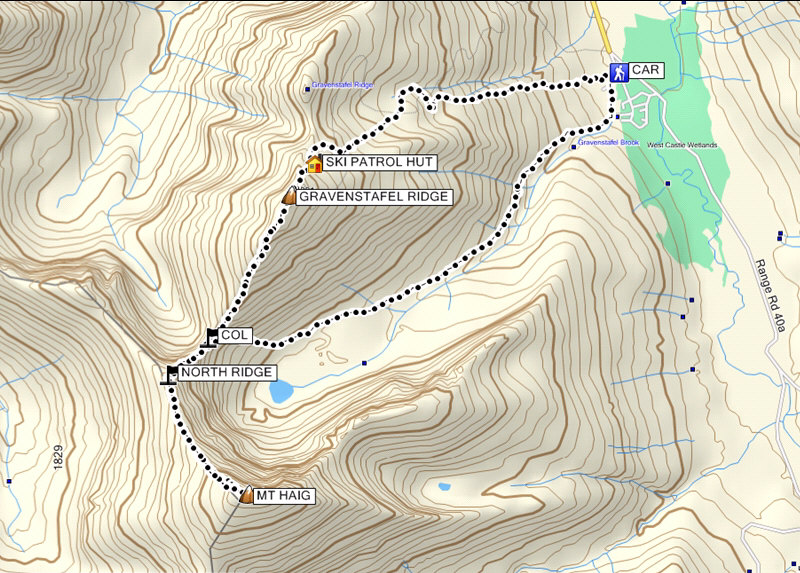
Total Distance: 12.8 kilometres
Round-Trip Time: 9 hours 4 minutes
Total Elevation Gain: 1497 metres
As I pulled into Castle Mountain ski resort's parking lot, I was surprised to find the day lodge open with quite a few people coming and going (there was some sort of mountain biking competition that weekend). I geared up and began hiking up the ski run under the Sundance Triple Chair. About two-thirds of the way up Gravenstafel Ridge, I noticed not far behind me a woman in shorts and T-shirt walking briskly up one of the many maintenance roads crisscrossing the ski resort. She was carrying only a water bottle and obviously just out for an afternoon walk. As she climbed effortlessly up more switchbacks, I laboured up a direct line underneath the Tamarack Chair and wondered why I bothered hauling a large pack full of extra clothes and food, crampons and an ice axe. I was half expecting the woman to greet me at the top of the Tamarack Chair, but before I even got there, I noticed that she was already walking back down (she had presumably turned around somewhere just below the outlier to the north). More worrisome was the fact that the wind had picked up and thunderstorms were brewing in the area. There is a Ski Patrol hut near the top of the Tamarack Chair, and I took an extended break here to let the foul weather pass (it turned out to be only a short-lived light drizzle). As predicted, the sky began to clear, and though it was tempting to stay put in the warm and cozy hut, I eventually departed and climbed the remaining 140 metres to the top. While the threat of thunderstorms was gone, the miserable wind remained and would be my constant companion for much of the rest of the day. I spent only 10 minutes at the summit of Gravenstafel Ridge before descending to the col leading to Mount Haig. The col was somewhat sheltered from the wind, and I enjoyed the best scrambling of the day between the col and Mount Haig's north ridge. All too soon, I was on the ridge crest and exposed again to the dreadful wind which was strong enough at times to knock me off my feet. The remaining 340 metres of elevation gain to the summit was a pure slog that could not end soon enough for me.
After a half-hour stay on top of Mount Haig, I quickly retraced
my steps back to the col and dropped down the east side which is the
alternate descent as described in Andrew Nugara's More Scrambles In
The Canadian Rockies. The sun soon disappeared as I stumbled
down some ankle-breaking rubble to the valley bottom. I eventually
picked up a flagged trail which essentially follows the ski-out known as
"Cinch Traverse" all the way back to the day lodge. When I arrived
at my car, the parking lot was full, and people were camped out
everywhere including inside their cars and even on the concrete floor
beside the door to the day lodge (it was kept open to allow people to use
the washrooms or to use their laptops presumably with free Wi-Fi). Since nobody was partying, I
bought a soda from a vending machine and quietly drove off into the
night.
|
|
This is looking up the Sundance Triple Chair. |
|
|
A couple of mule deer are startled to find an intruder on their ski hill. |
|
|
At centre behind the sign is the northern outlier of Gravenstafel Ridge, also known as "North Peak". Note the shack at far right. |
|
|
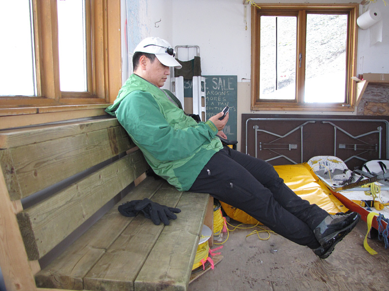
Sonny checks his GPS inside the Ski Patrol hut. |
|
|
Sonny ascends a snow patch just above the Ski Patrol hut. Syncline Mountain is visible in the background. |
|
|
Sonny scrambles up a large block just below the top. |
|
|
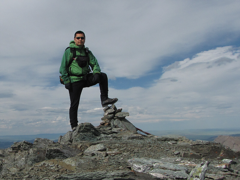
Sonny stands on the 2390-metre summit of Gravenstafel Ridge. |
|
|
The striking peak on the northern horizon is Mount Darrah. |
|
|
To the west is St. Eloi Mountain (right). |
|
|
Syncline Mountain sits to the north. |
|
|
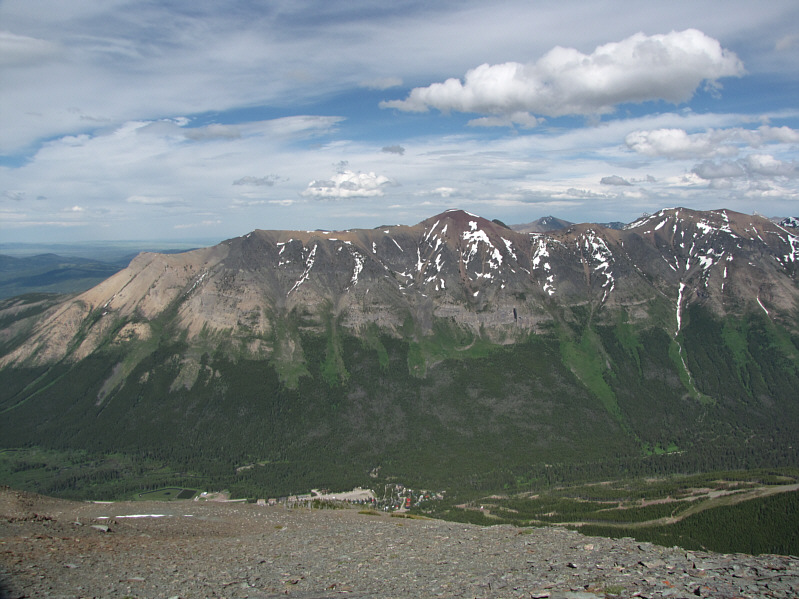
Southfork Mountain (second bump from the left) and Barnaby Ridge dominate the view to the east. |
|
|
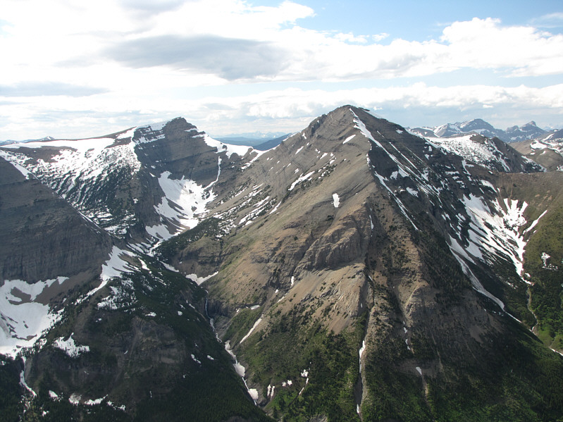
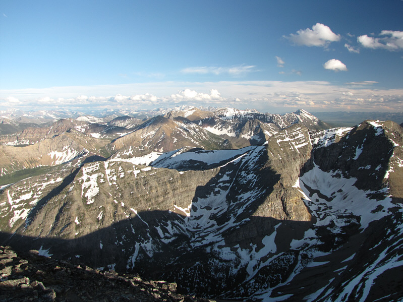
Mount Haig and the rest of the Clark Range stretch away to the south. |
|
|
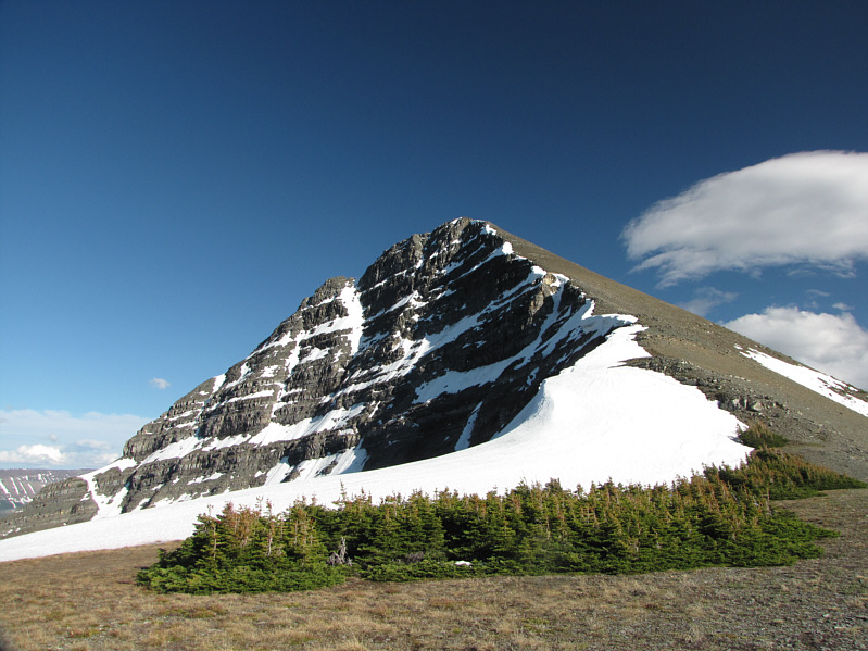
A tarn is nestled below the north face of Mount Haig. |
|
|
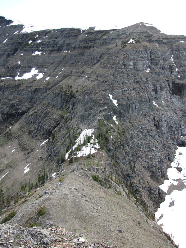
Here is a closer look at the section between the col and the north ridge of Mount Haig. |
|
|
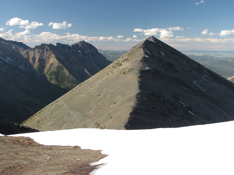
Here is a look back at Gravenstafel Ridge from partway up the other side of the col. |
|
|
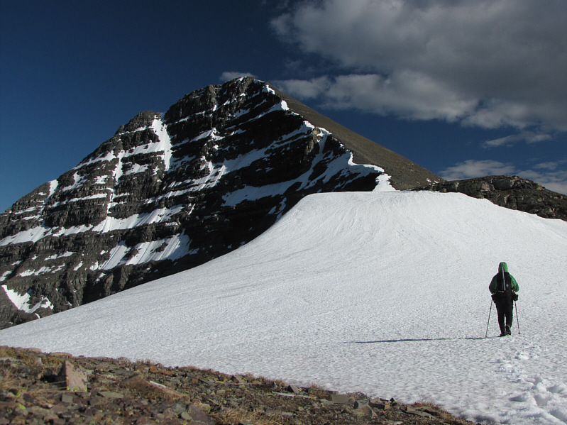
Sonny begins the long slog up the north ridge. |
|
|
This is the last of the Krummholz on the windswept ridge. |
|
|
Here is another look back toward Gravenstafel Ridge (right) and Syncline Mountain (distant left). |
|
|
Sonny reaches the 2610-metre summit of Mount Haig. |
|
|
Tombstone Mountain (right of centre) is barely visible above the intervening unnamed ridge to the southwest. |
|
|
Here is another look at the tarn below Mount Haig's north face. Gravenstafel Ridge and Syncline Mountain provide a dramatic backdrop. |
|
|
To the south, the Clark Range invites further exploration. |
|
|
The last rays of sunshine disappear over the ridges to the west in this view from the col. |
|
|
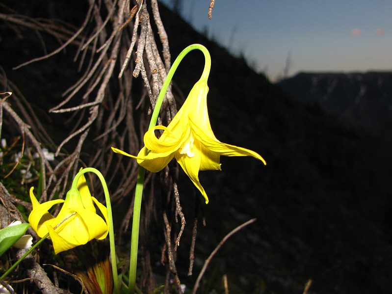
Glacier lilies bloom on the slopes east of the col. |
|
|
Total Distance: 12.8 kilometres |