

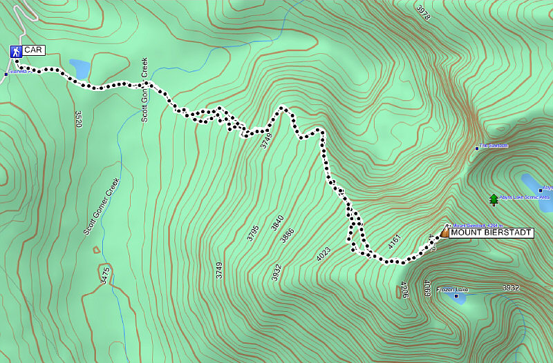
Round-Trip Time: 5 hours 21 minutes
Net Elevation Gain: 749 metres
Unlike my trip up Mount Elbert two days before, I had a much easier time with the rarefied air on Mount Bierstadt. Of course, Mount Bierstadt is a much shorter trip, and perhaps the previous day's rest in Denver helped me acclimatize better to the high altitude. In any case, I seemed to get into a much better hiking rhythm on this day and easily reached the summit without much trouble. I spent about 50 minutes there chatting with a local who had already climbed all the '14ers' in Colorado but was just out that day to walk his dog. I considered traversing the connecting ridge known as the Sawtooth to nearby Mount Evans, but with snow on the route and having left my crampons in the car, I decided that it was not worth the added risk on this day. Instead, I more or less retraced my steps back to the trailhead though I had a much tougher time with the softening snow in Guanella Pass on my return trip. A lengthy construction delay on my drive back down the access road allowed me to relax in my car and eat my lunch while dreaming about my next vacation.
|
|
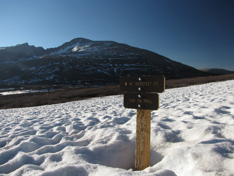
There is still a lot of snow on the trail to Mount Bierstadt. |
|
|
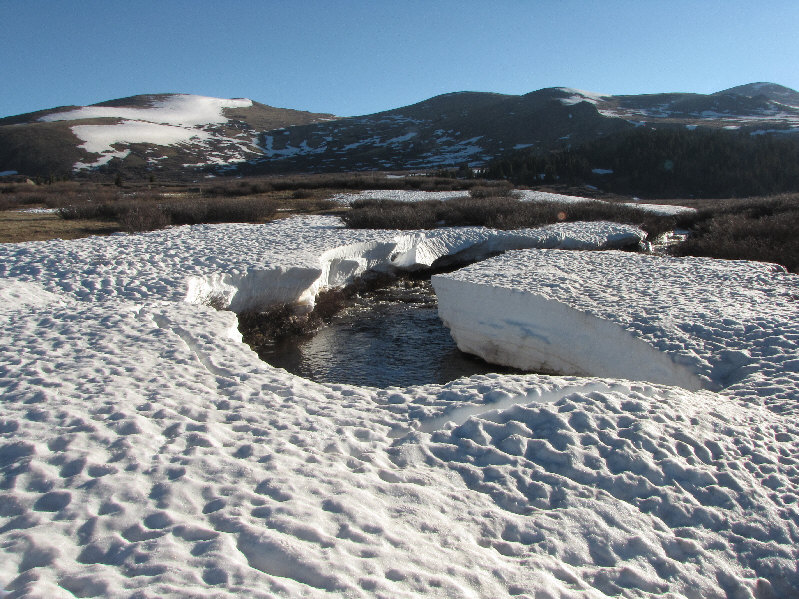
A snow bridge spans Scott Gomer Creek. |
|
|
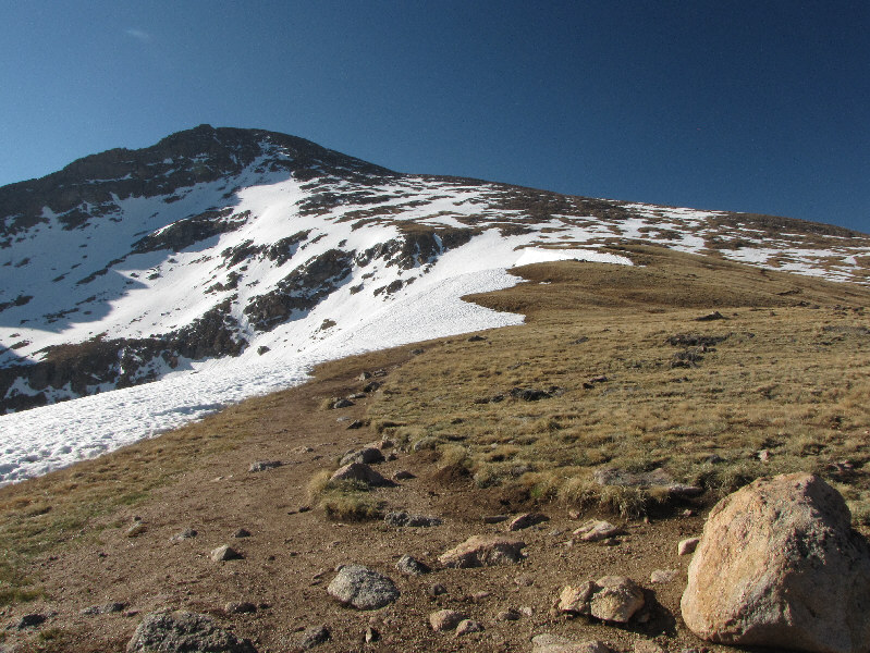
This is the broad northwest ridge of Mount Bierstadt. |
|
|
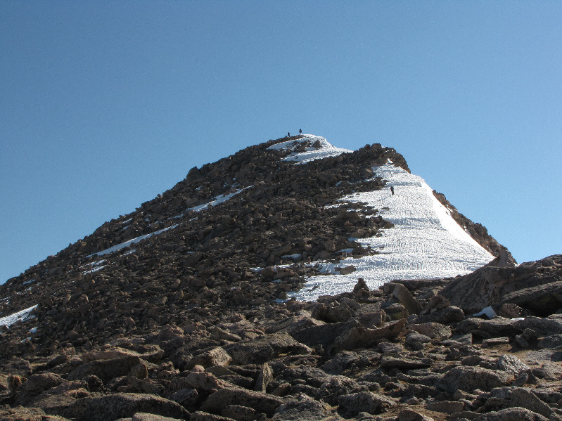
Some hikers ascend the summit ridge. |
|
|
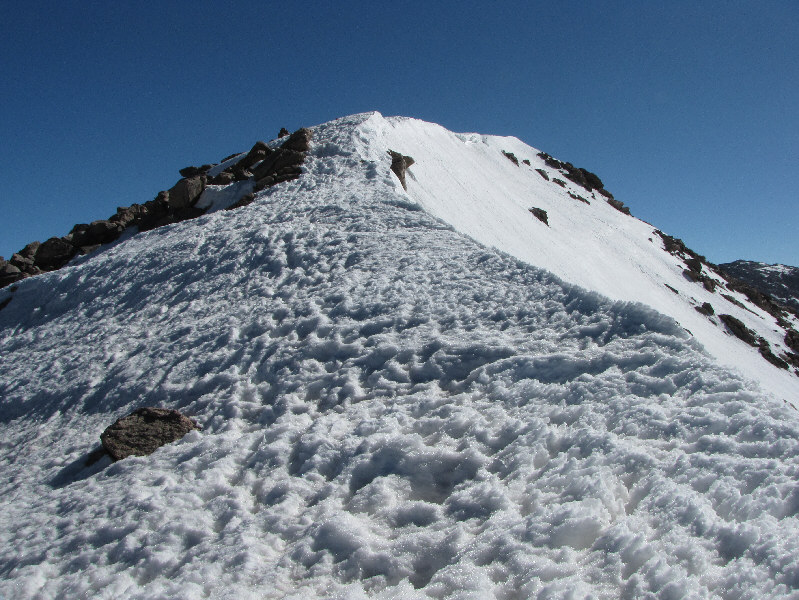
Here is a close-up of the summit ridge. |
|
|
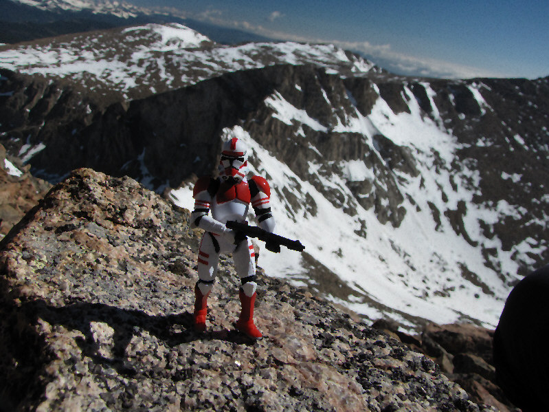
Sonny stands at the 4287-metre summit of Mount Bierstadt. |
|
|
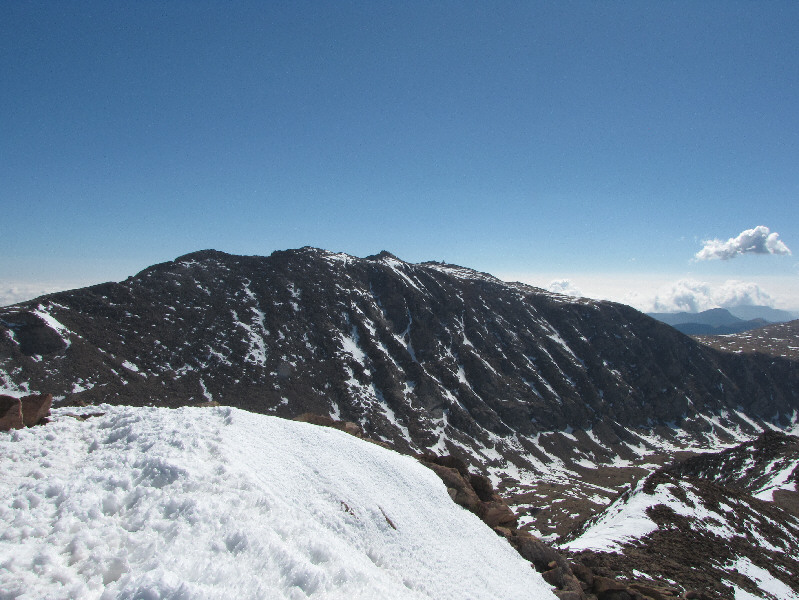
Mount Evans dominates the view to the east. |
|
|
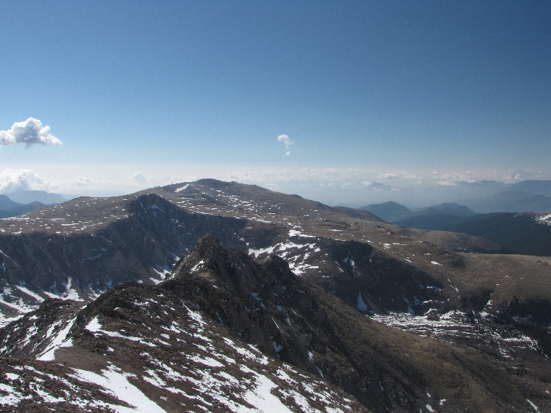
To the southeast are Epaulet Mountain (shadowed ridge at left) and Rosalie Peak. |
|
|
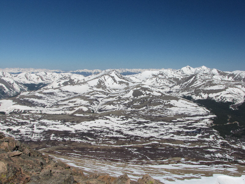
The summit of Mount Bierstadt provides an expansive view of Guanella Pass. Grays Peak and Torreys Peak are visible on the horizon at far right. |
|
|
This is the Sawtooth as seen from the top of Mount Bierstadt. |
|
|
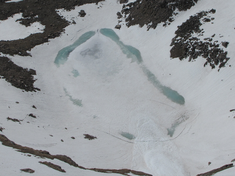
South of Mount Bierstadt, Frozen Lake live up to its name. |
|
|
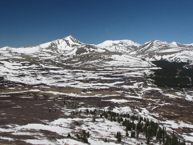
Here is another look at Guanella Pass from lower down Mount Bierstadt's northwest ridge. From left to right are Square Top Mountain, Argentine Peak, Mount Wilcox, and Mount Edwards (peeking over shoulder of Mount Wilcox). |
|
|
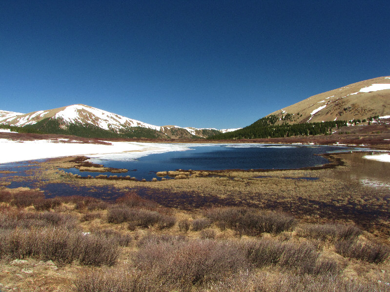
This is an unnamed lake in Guanella Pass. At left is Otter Mountain. |
|
|
Here is a final look at the Sawtooth (left) and Mount Bierstadt from the parking lot. |
|
|
Total Distance: 12.1 kilometres Round-Trip Time: 5 hours 21 minutes Net Elevation Gain: 749 metres |