BOU AVENUE
Elliott Peak
Sparked by Rafal (Raff) Kazmierczak's and Andrew Nugara's recent ascent, I hooked up with Eric Coulthard on 8 October 2011 to climb Elliott Peak in Alberta's David Thompson Country.  Our trip got off to an inauspicious start when we hiked up the wrong trail on the north side of the Cline River.  There was some confusion regarding the access description that Eric had read on Bivouac.com, and neither Eric nor I were aware that there is another trail on the south side of the river (this trail is unmarked on most topographical maps).  After rebooting and finding the correct trailhead, we hiked westward and turned south up the first drainage that we came across.  We briefly ascended this dry creek bed until Eric astutely noticed that we were still a bit too far to the east.  Traversing westward across an intervening ridge, we found the correct drainage, but a flowing creek and thick vegetation forced us to climb the ridge instead.  When we started to encounter slabs on the ridge, we dropped awkwardly down into the drainage, but fortunately, the creek bed at that point is dry and easy to ascend.  We eventually entered the large cirque below the complex northwest face of Elliott Peak.  From Raff's trip report, we knew about a tedious but easy scree ramp at the back of the cirque, but the access point is not readily obvious from below.  After hiking to the back of the cirque, Eric led the way up through the initial cliff bands, and although a light dusting of snow and some verglas made for slippery conditions on this day, we were able to gain the scree ramp without too much trouble.  As we ascended the ramp, we encountered more and more snow patches, but these turned out to be easier to hike up than the rubble they covered.  Eric did an admirable job of breaking trail through the snow patches, and despite the increasing angle of the slope, neither of us felt the need to don our crampons.  We eventually reached a vast scree slope on the west face of Elliott Peak and settled into an easy plod up to the summit.  After spending about half an hour at the top, we quickly descended to the top of the scree ramp where we elected to don our crampons to give ourselves better traction.  This turned out to be a good call, and we had a trouble-free descent down the ramp and into the cirque.  Retracing our steps down the drainage, we left it at the spot where the flowing creek emanates from the creek bed.  A stretch of light bushwhacking had us back on the main trail without too much fuss, and the remaining hike to the trailhead in the dark was uneventful.

Be sure to check out Eric's trip report here.
We squandered almost an hour and a half on our false start. 
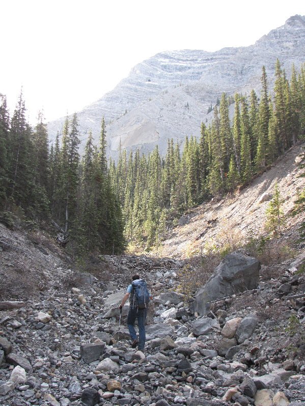
Eric hikes up the access drainage.
At this point, there are still about 900 vertical metres of elevation gain left! 
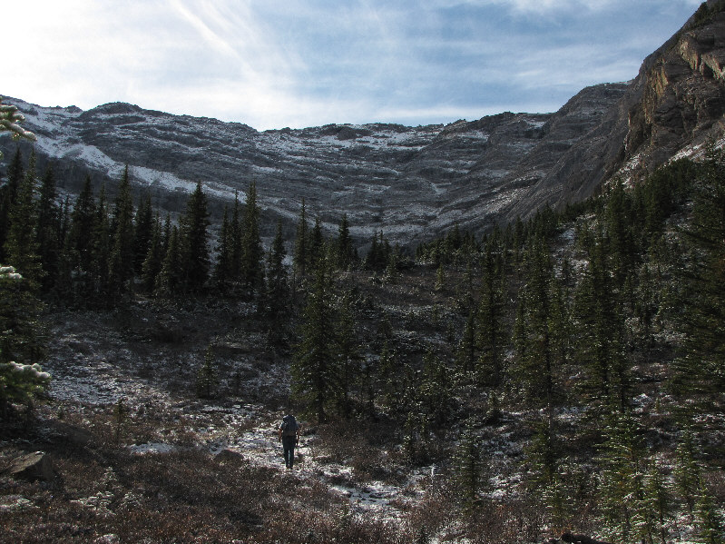
Eric approaches the last trees before the cirque.
Although we didn't see much of the sun in this cirque, at least it was sheltered from the wind. 
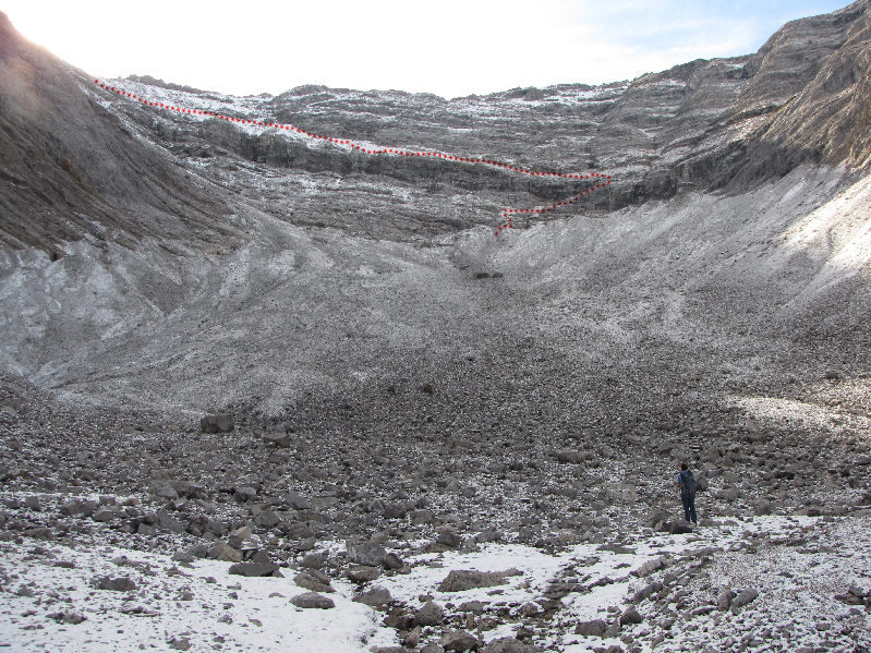
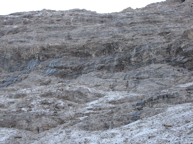
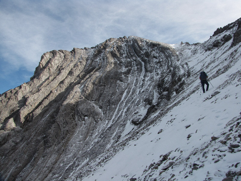
The approximate route through the cliff bands at the back of the cirque is shown.
The summit is not visible here. 
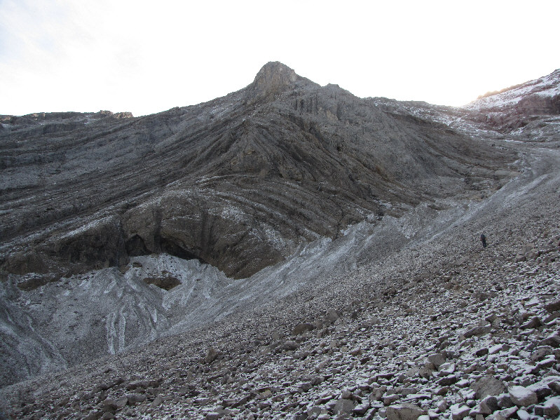
Eric climbs up the scree slope in the cirque below the northwest face of Elliott Peak.
Looks worse than it really is... 
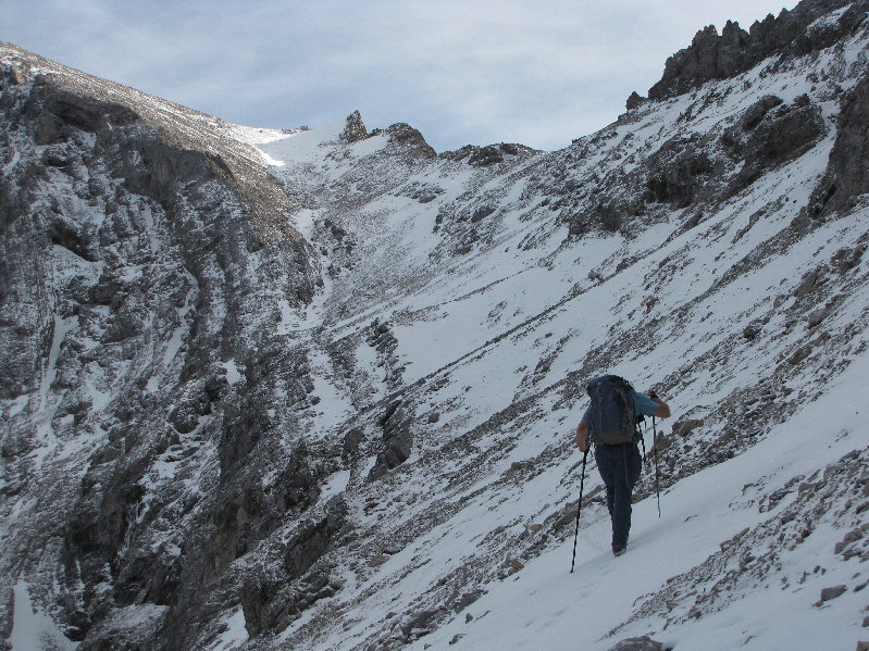
Eric reaches the bottom of the cliffs.
I took a shortcut to get ahead of Eric here. Eric gains the scree ramp below the southeast face of Sentinel Mountain.
Made in 1972. 
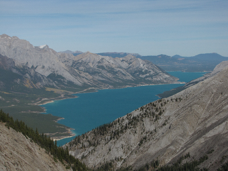
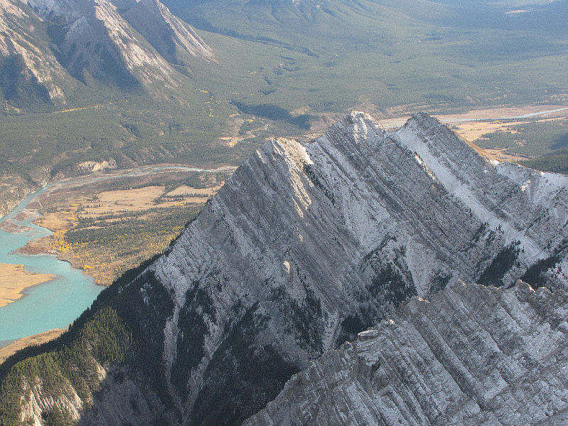
Abraham Lake is visible in this view from the scree ramp.
I can't believe Eric is still climbing in a T-shirt! Brrrrr!!! 
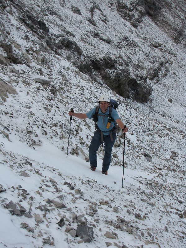
Eric takes advantage of some early-season snow patches to ascend the scree ramp.
Not a good place to drop your Powerade bottle...oops! 
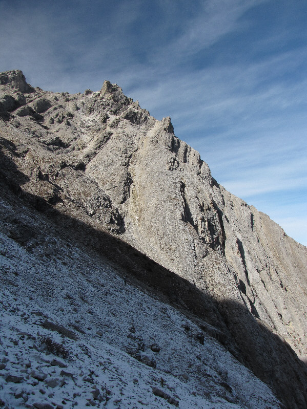
The scree ramp is deceptively steep.
The end of the ramp is farther away than it looks. Eric leads the way up the remainder of the scree ramp.
Nice to be in the sun again! 
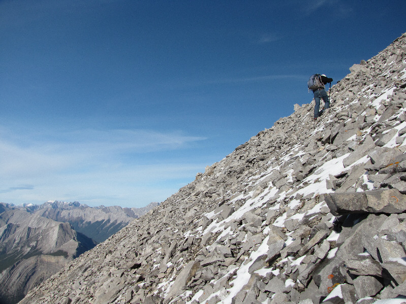
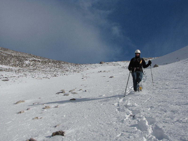
The scree ramp leads to a vast scree slope below the summit ridge.
Almost there. 
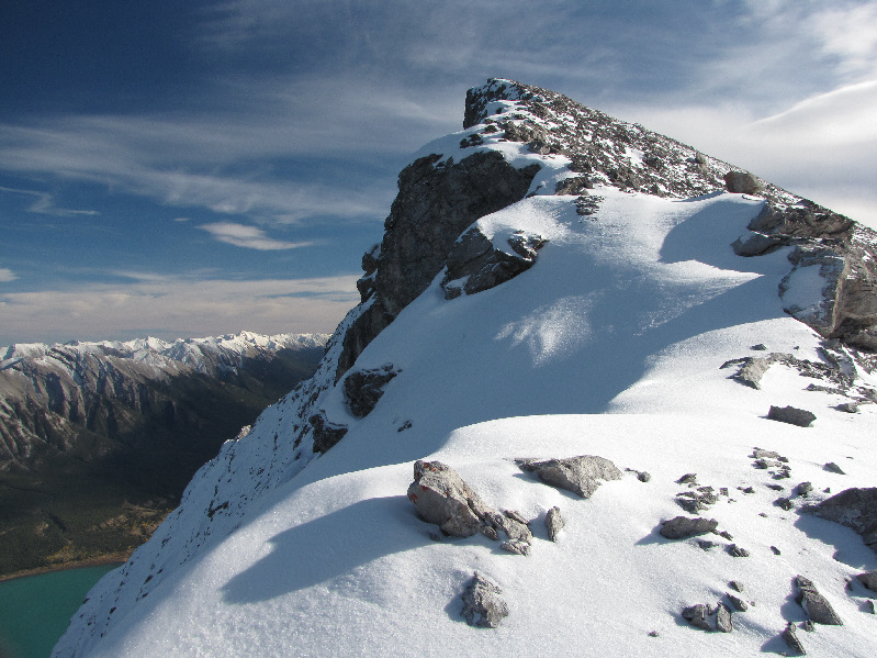
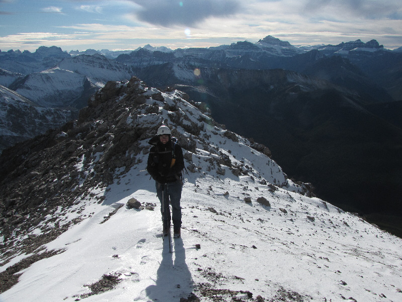
This is the summit ridge of Elliott Peak.
Yes, Eric is wearing blue jeans (he forgot to bring hiking pants)! Eric and Sonny stand atop Elliott Peak (2888 metres).
Mount Murchison and Mount Forbes are the most easily recognizable peaks on the horizon. 
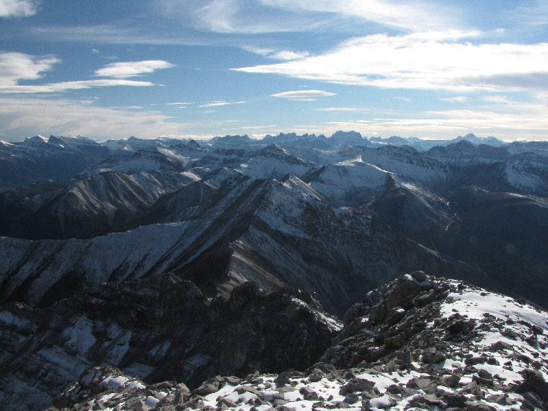
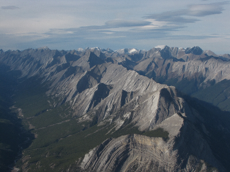
A sea of peaks stretch out to the southwest.
Lotsa places worth exploring up this valley. 
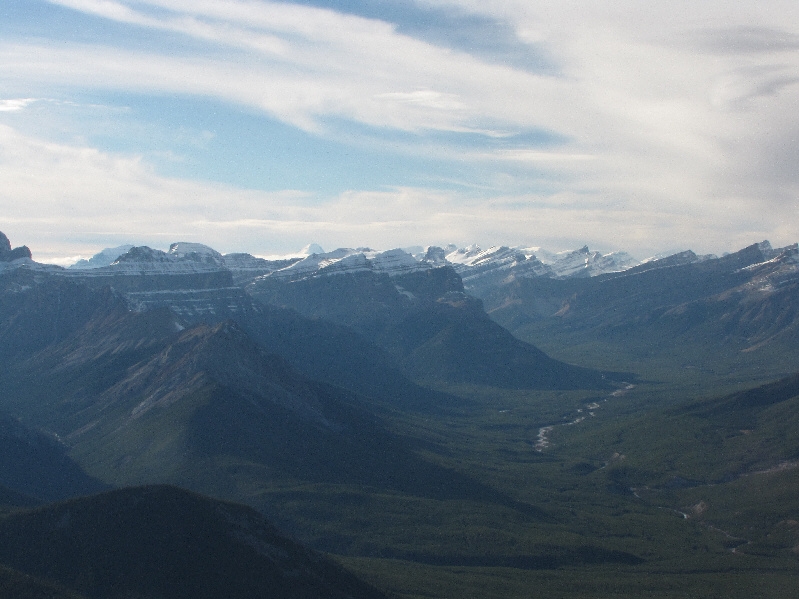
This is looking west up the Cline River valley into Banff National Park.  The snowy mountain on the horizon left of centre is Mount Columbia.
Mount Columbia is over 66 kilometres away. 
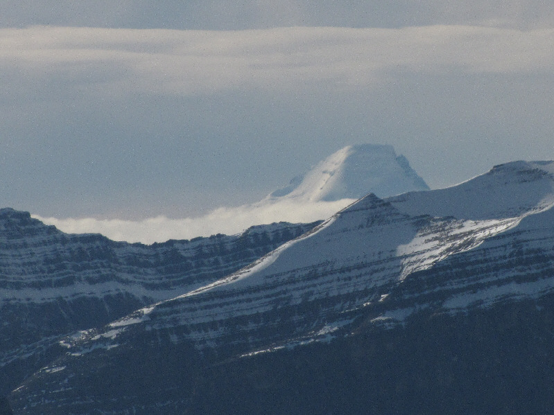
Here is a closer look at Mount Columbia.
Eric noticed how odd it was that many of these peaks and ridges were snow-free. 
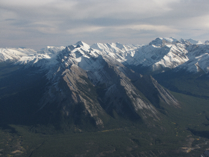
Mount Stelfox (centre) and a plethora of unnamed peaks dominate the view to the northwest.
Despite being an officially named peak, Mount Michener isn't even labeled on some topo maps! 
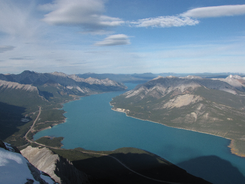
Abraham Lake steals the spotlight to the north.  At right is Mount Michener.
Definitely more snow on the front ranges to the south! 
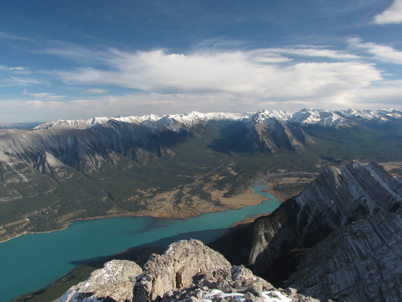
Whiterabbit Creek valley (centre) to the southeast is flanked by Mount William Booth (left) and Ex Coelis Mountain (right).  Also visible is the mouth of the North Saskatchewan River at the south end of Abraham Lake.
Ex Coelis is latin for "out of the clouds". Ex Coelis Mountain is comprised of five peaks named Normandy, Ardennes, Rhine, Elbe, and Stan Waters.
I was up there on 17 June 2006. Closer at hand to the southeast is Mount Ernest Ross.
Eric looks a bit chilled here. Eric prepares to descend the scree ramp from a high shoulder just west of Elliott Peak's summit.  At right on the horizon is Mount Cline.
Sure glad I brought my crampons today! After donning his crampons, Eric marches down the steep snow slope with confidence.
Maybe I'll come back some day to climb Sentinel Mountain... 
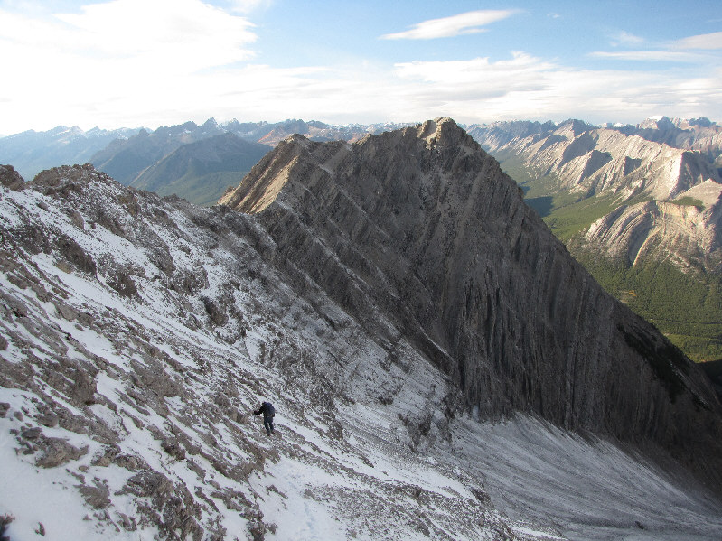
Eric works his way down the ramp with Sentinel Mountain in the background.
The foot of God?? 
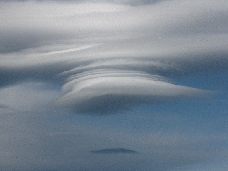
Some odd cloud formations appear late in the day.
Eric refers to the scramble route on Abraham Mountain as the "Endless Scree Gully of Pain"! 
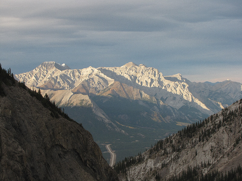
The late day sun lights up Allstones Peak and Abraham Mountain to the north.
Easy but mind-numbingly long. 
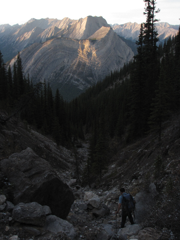
Eric descends the access drainage in fading light.  Mount Stelfox is visible in the distance.
Trickiest part is getting into the 2nd drainage above the flowing creek. 
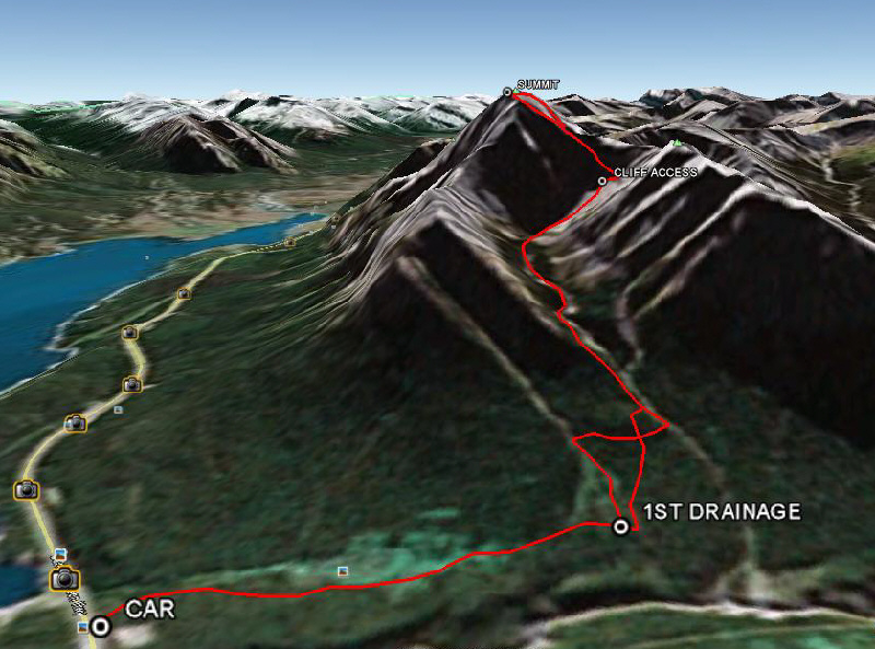
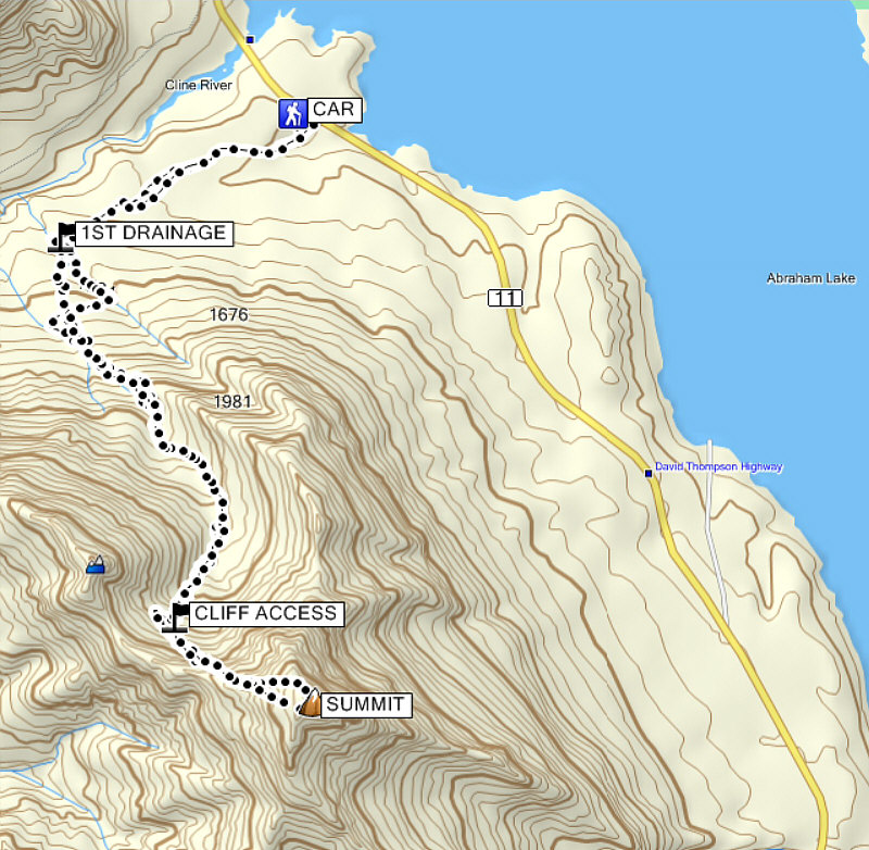
This is the route as viewed in Google Earth.
Actually, the trickiest part is finding the right trailhead--south, not north, of the Cline River!!

Total Distance:  12.9 kilometres
Round-Trip Time:  9 hours 30 minutes
Net Elevation Gain:  1522 metres

GPX Data