BOU AVENUE
Guadalupe Peak
After spending the night in a comfortably air-conditioned motel in Carlsbad, New Mexico, Kelly Bou and I got up early on the morning of 31 May 2011 and drove to Guadalupe Mountains National Park on the Texas side of the state border.  We then hiked the lengthy but well-graded trail to the top of Guadalupe Peak, the highest point in Texas.  We met a few people on the trail throughout the day, but otherwise, the hike was straightforward and uneventful.  Kelly and I spent nearly an hour at the summit before returning the same way.
It's already warm in the morning. The trail switchbacks to the far left before climbing over the right shoulder of the ridge ahead.
Horse riders are advised to dismount at this point. Kelly hikes across an airy traverse.
There is a good trail that goes up there too. Hunter Peak makes a nice backdrop on the way up.
The trail takes a rather roundabout approach to the summit from here, possibly to accomodate those riding horses. The summit of Guadalupe Peak finally appears.
Very convenient! This bridge facilitates travel across an eroding ledge.
The bridge from the previous photo is somewhere at the left end of the cliff bands. This is looking back at some cliff bands guarding the eastern outlier of Guadalupe Peak.
There's a place to tie up horses not far from here. Kelly hikes the last few metres before the summit.
Remember what happened to those apes that touched the obelisk in 2001: A Space Odyssey? Kelly and Sonny stand on the 2652-metre summit of Guadalupe Peak.
That register book is brand new and was left here the day before. This is an excerpt from Wikipedia regarding the pyramid: 

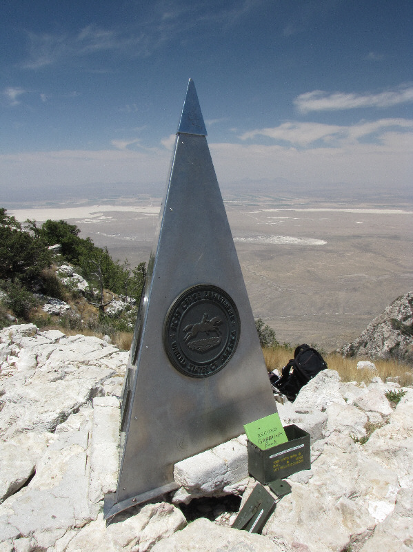
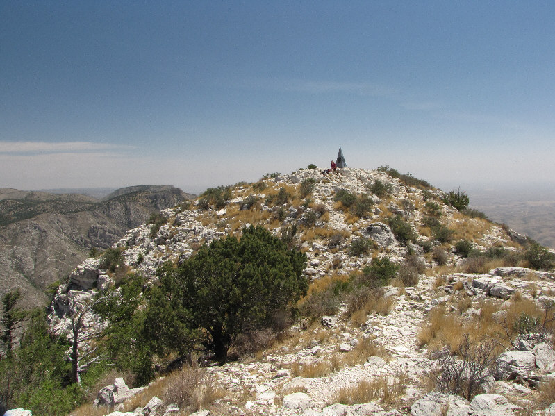
"A stainless steel pyramid marks the summit. It was erected by American Airlines in 1958 to commemorate the 100th anniversary of the Butterfield Overland Mail, a stagecoach route that passed south of the mountain. One side of the pyramid has the American Airlines logo. The second side displays a U.S. Postal Service tribute to the Pony Express Riders of the Butterfield Stage. The third side displays a compass with the logo of the Boy Scouts of America."

Both are probably easy scrambles that no one ever bothers to do. To the northwest are Shumard Peak and Bartlett Peak (right of centre in the distance).
This is the less dramatic side of the peak. El Capitan stands guard to the south.
That pyramid looks sharp enough to poke out someone's eye! Here is a view of Guadalupe Peak's summit from a slightly lower bump to the west.
So I wonder where those green farm circles get their water from... To the west are the salt flats of Linda Lake.
Very interesting peaks that may warrant a return trip... The remote Cornudas Mountains are barely visible through the haze to the west.
It was starting to get bloody hot at this point. Kelly descends the trail back to the parking lot.  Note all the switchbacks.
Too bad there wasn't any water in Linda Lake 'cause it would have felt really nice to jump in! Here is a parting view of Guadalupe Peak and El Capitan from the salt flats.
My 3rd US state high point!

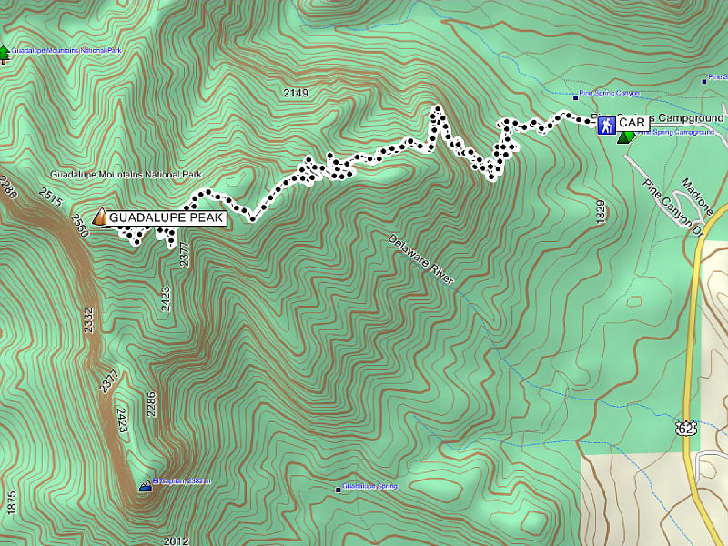
Total Distance:  14.1 kilometres
Round-Trip Time:  6 hours 51 minutes
Net Elevation Gain:  870 metres

GPX Data