


Sure enough, when we arrived at the
Logan Pass parking lot, it was full. Rather than play the silly
game of driving around in circles until a spot opened up, we backtracked
a bit to Oberlin Bend where we were fortunate enough to find parking.
As we geared up for the hike, my gaze was drawn to the spectacular
feature known as the Garden Wall under which the Highline Trail runs.
One of the peaks along the Garden Wall, Mount Gould, had been on my radar
ever since I saw its striking east face from the summit of Mount Siyeh.
With the perfect weather, I simply could not resist an attempt on the
west face scramble route as described in A Climber's Guide to Glacier
National Park by J. Gordon Edwards.
From Oberlin Bend, we hiked back along the side of the road to reach the
start of the Highline Trail. While Kelly was content to enjoy a
leisurely hike and to take photographs along the very scenic trail, I
parted company with her and marched ahead more purposefully. At the
broad saddle between Mount Gould and Haystack Butte, I left the trail and
scrambled up the obvious drainage coming down diagonally from the upper
reaches of Mount Gould. I followed Edwards' described route for
much of the ascent except that I stayed near the drainage all the way to
a distinctive notch in the summit ridge. Peering over the other
side of the notch was rather unnerving as the east face drops away
precipitously for nearly 1200 metres to the valley below. From the
notch, I worked my way back onto the west face to circumvent some
pinnacles, and I eventually regained the ridge not far from the summit.
Though I had been buffeted by a strong breeze for much of my ascent on
the upper mountain, conditions were surprisingly calm at the summit.
I took my requisite photographs before retracing my steps back to the
drainage. Just as Edwards mentions, the plethora of cairns strewn
about the upper mountain made route-finding on the descent a bit tricky,
but I managed to get back down to the Highline Trail without any mishaps.
Kelly had been waiting patiently for me at the saddle for several hours,
and after rejoining her, we hiked uneventfully back to the trailhead
together.
|
|
Kelly hikes beside the Going-to-the-Sun road to get to the start of the Highline Trail. It is forbidden to take a short cut through the "rehabilitated" area on Kelly's left. |
|
|
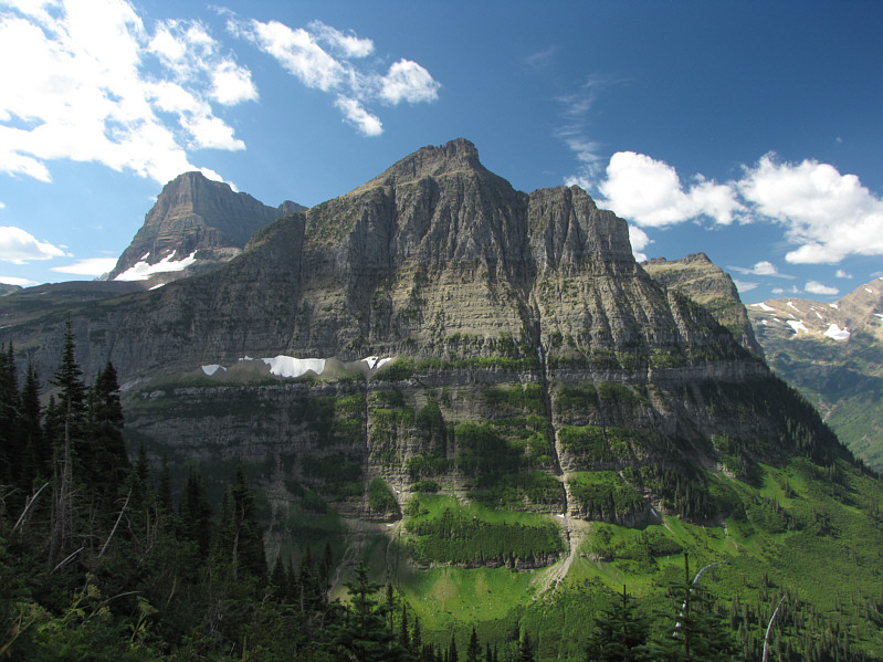
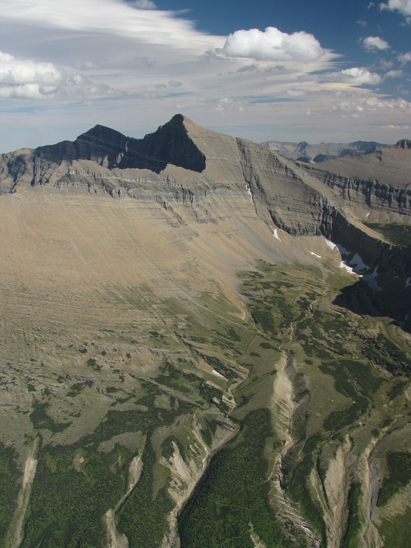
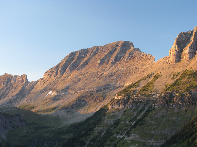
The west face of Mount Gould looks formidable enough from near the start of the Highline Trail. Click here to see what the east side of Mount Gould looks like. |
|
|
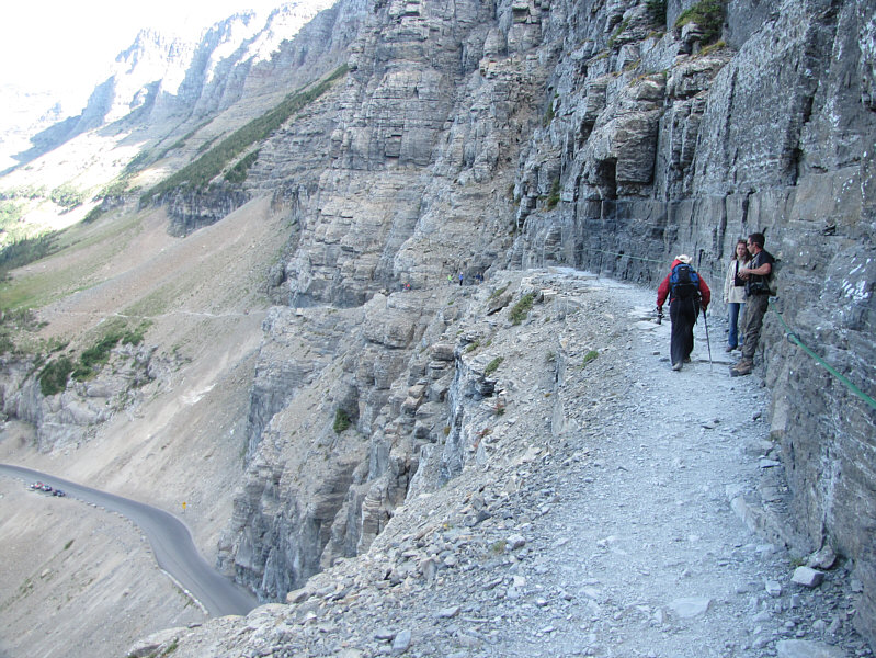
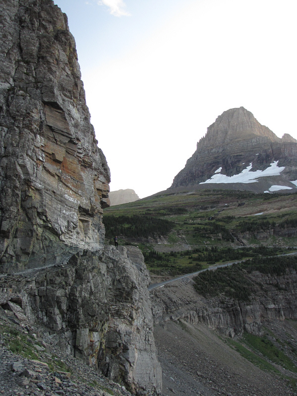
Kelly walks past a couple of hikers on the exciting first section of the Highline Trail. Going-to-the-Sun road runs parallel to the trail further down the cliffs. |
|
|
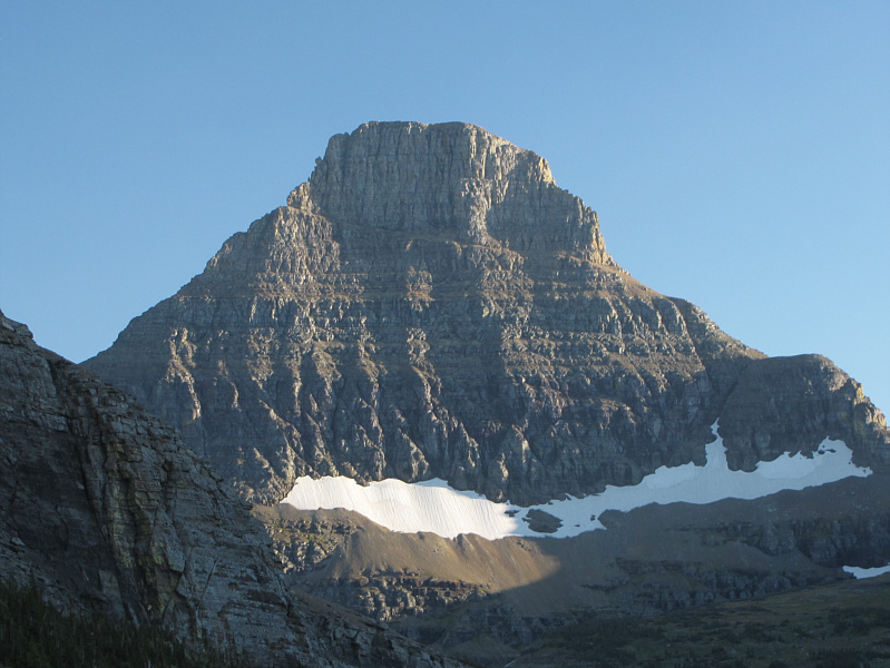
The east face of Mount Oberlin gives no indication that the peak is one of the easiest to climb in Glacier National Park. Peeking over its shoulder on the left is Clements Mountain. |
|
|
Heavens Peak garners some attention further to the west. |
|
|
Were it not surrounded by more impressive peaks, Haystack Butte would be a much more attractive climbing objective. |
|
|
Here is the west face of Mount Gould as viewed from the Highline Trail just before the broad saddle between the peak and Haystack Butte. The scramble route that Sonny would follow is roughly indicated. |
|
|
A herd of bighorn sheep graze on the lower slopes of Mount Gould. |
|
|
Here is a breach in the first significant rock band encountered. |
|
|
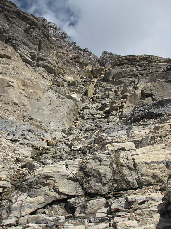
This drainage runs all the way up to a notch in the summit ridge. |
|
|
Sonny climbs up increasingly loose and steep terrain. |
|
|
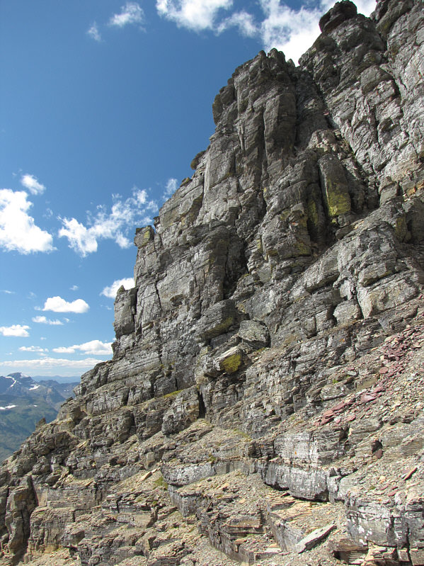
The terrain on the upper mountain is fairly complex and requires good route-finding skills to negotiate. |
|
|
From the notch in the summit ridge, the east face of Mount Gould is an intimidating sight. |
|
|
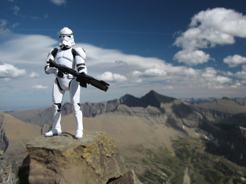
Sonny stands on the 2917-metre summit of Mount Gould. |
|
|
There appears to be a fire somewhere behind Mount Cannon (right of centre) to the southwest. |
|
|
Mount Cleveland (left) and Mount Merritt (right) are visible to the north. The shadowy sharp peak in the foreground is Iceberg Peak. |
|
|
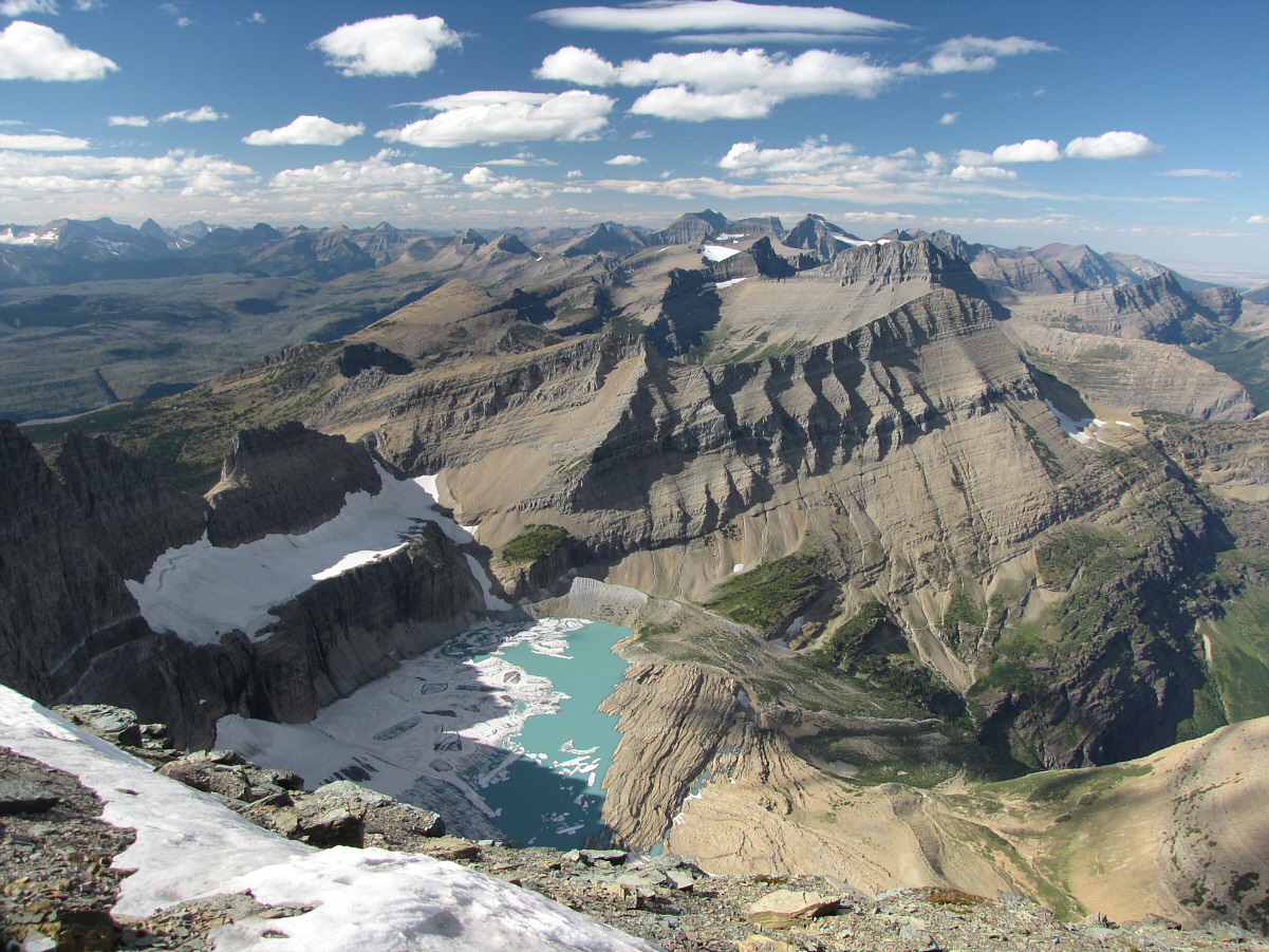
Upper Grinnell Lake is full of icebergs from the Grinnell Glacier. |
|
|
Here is a closer look at the northern end of Upper Grinnell Lake. |
|
|
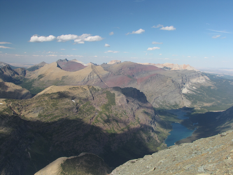
Lake Josephine and Swiftcurrent Lake draw the most interest to the northeast. Chief Mountain is just visible on the horizon at centre. |
|
|
Allen Mountain is the pointy peak to the east. |
|
|
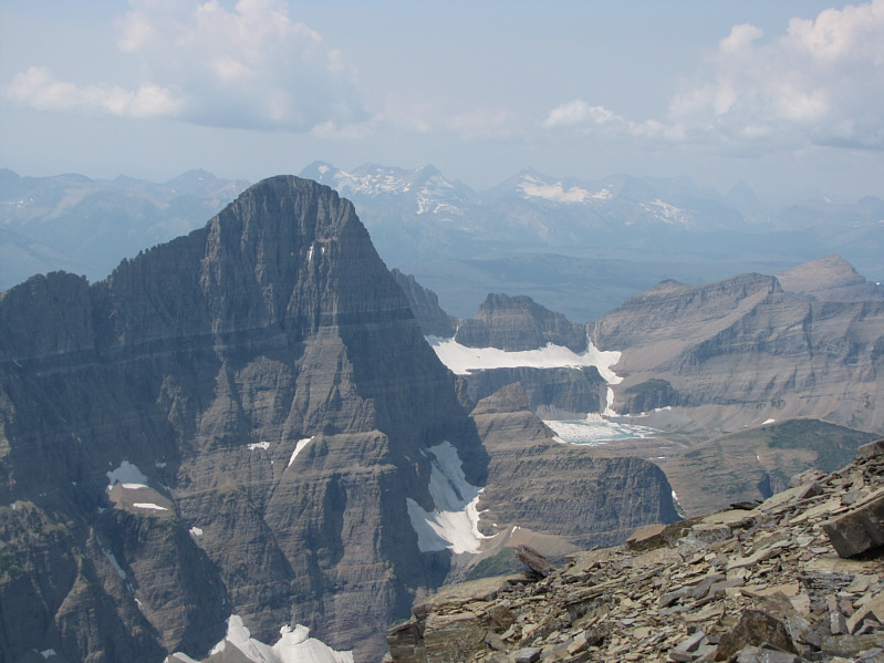
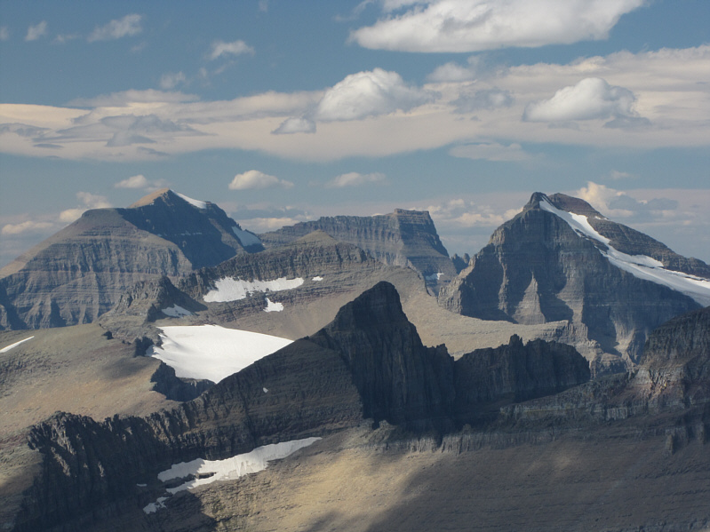
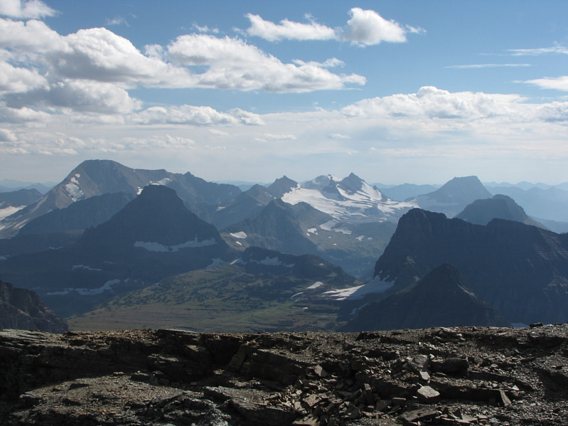
Mount Siyeh looks massive to the southeast. |
|
|
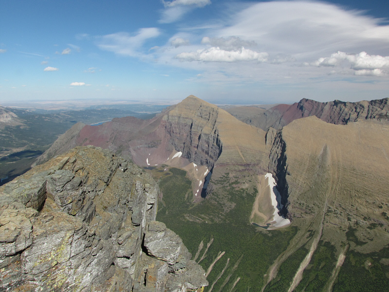
This wider view to the southeast includes Mount Siyeh (far left), Matahpi Peak (left of centre), Going-to-the-Sun Mountain (right of centre), Cataract Mountain (diminutive peak in centre foreground), and Piegan Mountain (far right). |
|
|
Here is a closer look at Going-to-the-Sun Mountain. The dark peak at far right is Little Chief Mountain. |
|
|
Mount Jackson (far left) and Sperry Glacier are the most prominent features to the south. |
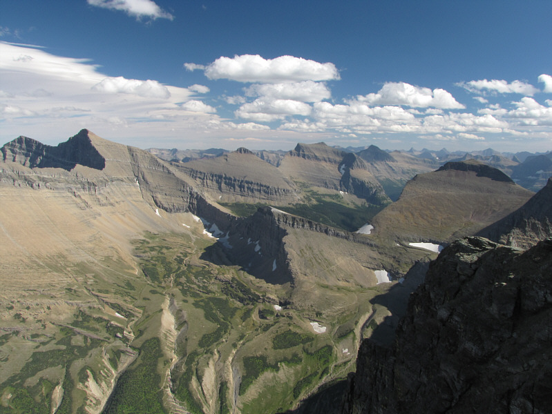
This is a more comprehensive view to the north.
 |
This is looking down the east face from a different angle near the notch in the summit ridge. |
 |
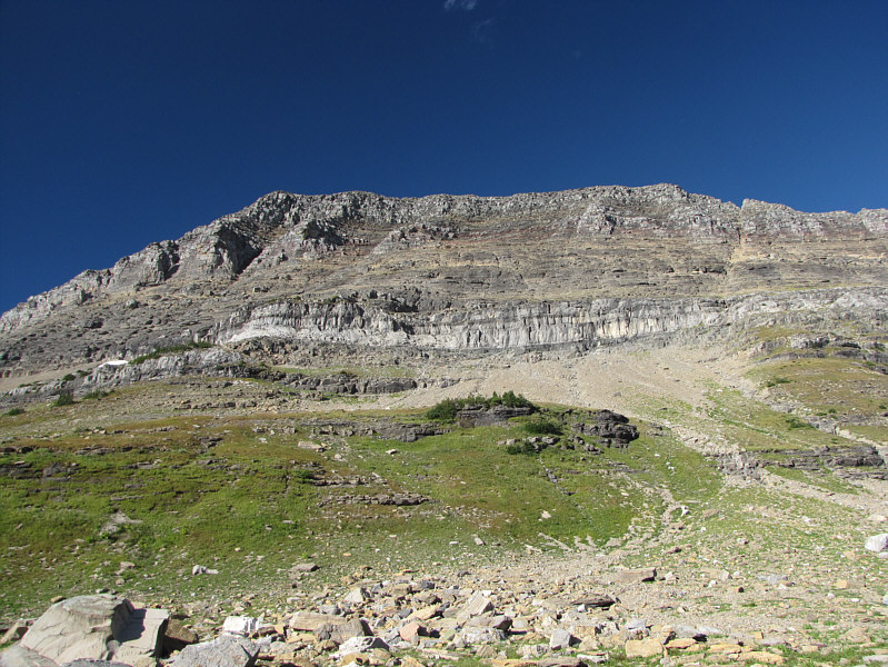
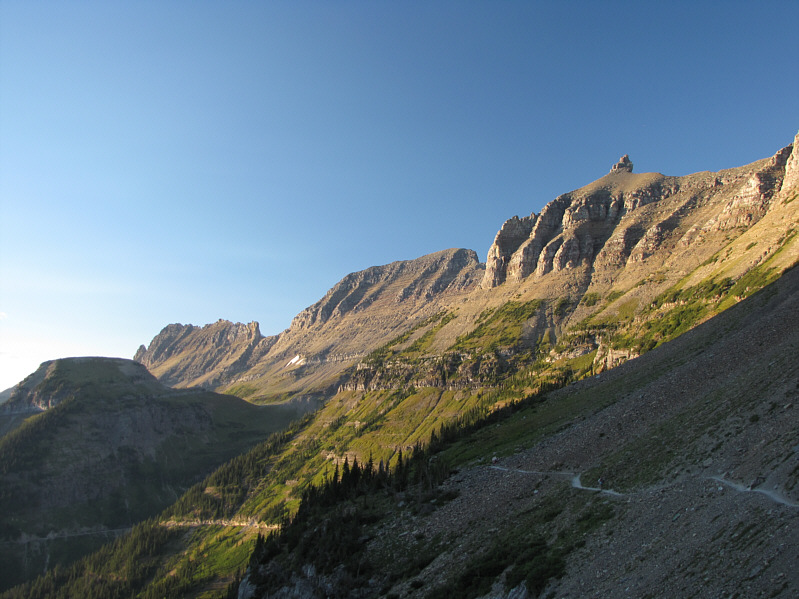
The north side of Bishops Cap comprises one of the more spectacular sections of the Garden Wall. |
 |
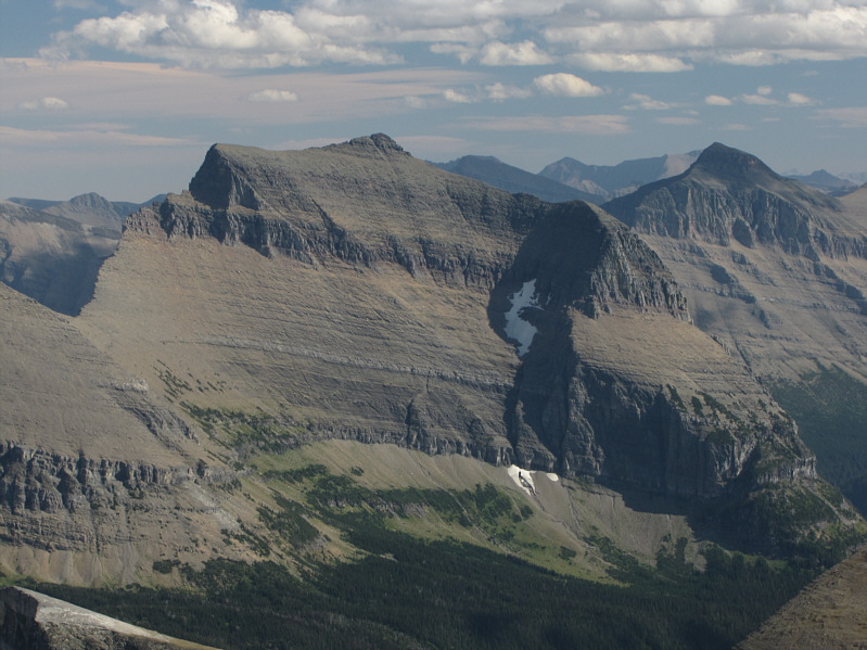
Here is another look at Mount Gould's west face from the broad saddle. |
 |
Kelly hikes back along the Highline Trail. Mount Cannon is visible at right. |
 |
Reynolds Mountain is illuminated by the late day sun. |
 |
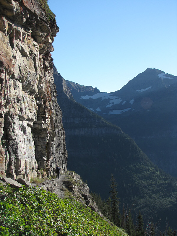
Kelly retraces her steps along the precipitous first section of the Highline Trail. At right is Clements Mountain. |
 |
The Garden Wall includes Mount Gould (centre) and Bishops Cap (right). Haystack Butte is in shadows at far left. |
 |
Going-to-the-Sun Mountain rises above the trees in this view from near the trailhead. |
 |
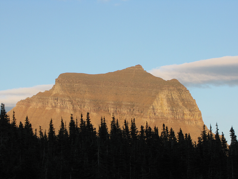
Dusk falls on Mount Gould. |
 |
Oberlin Falls are right beside the road near the Oberlin Bend parking area. |
 |
Total
Distance: 14.4 kilometres (approximate) Round-Trip Time: 8 hours 47 minutes Net Elevation Gain: 915 metres |