


Leaving Calgary somewhat late on 28 July 2013, I ended up driving all the way to Cooke City, MT via Yellowstone National Park. Because it was dark by the time I arrived at the park, I did not get checked for having a park pass although I am not sure if the authorities would normally allow vehicles to drive through to Cooke City without one. There is a campground just on the outskirts of town, but feeling too cheap to pay the camping fee, I opted to drive partway up Lulu Pass Road and found a nice pullout where I slept in my car for the night.
The next morning, 29 July 2013, I got up and drove the remaining short stretch to the trailhead at an old mill site. Rather than hauling a full backpack, I decided to travel with just my regular daypack and forego taking cookware. I managed to stuff my sleeping bag in the bottom of my pack while securing my one-man bivy tent and Thermarest with my pack's compression straps. After stopping briefly to check out a dilapidated cabin at the mill site, I awkwardly hopped over a creek behind the cabin and was on my way up the wide trail to Lady of the Lake. The trail contours around the west side of Lady of the Lake before heading north past a large fen and crossing an unnamed creek. Just before reaching Broadwater River which is the confluence of Star Creek and Zimmer Creek, I reached a fork in the trail with some deadfall laid across the right-hand branch. Although I did not know it at the time, this right-hand branch is actually the start of an alternate approach up Sky Top Creek. I stuck to the left-hand branch (cairn), and after crossing Star Creek, I was soon hiking up the west side of Zimmer Creek. A trio of fishermen and their dog passed me here, but I would later pass them as they were taking a break at the bottom of "Heartbreak Hill" where the trail leaves Zimmer Creek and climbs steeply up to Lower Aero Lake.
As beautiful as Lower Aero Lake is, it is a real pain in the butt to get around. With no trail to follow, I was boulder-hopping for much of the way around the southern and eastern shores. Steep embankments forced me to climb over several low ridges which was both wearisome and time-consuming. On a couple of occasions, I thought I had reached Upper Aero Lake only to learn that the body of water in front of me was yet another arm of Lower Aero Lake! After several hours of difficult hiking, I finally came upon the shores of Upper Aero Lake. There are lots of great bivy sites here, and I quickly found a nice spot to set up my tent. As I sat down to eat a cold McDonald's double cheeseburger for dinner, a thunderstorm began to develop over the area. I hastily gobbled my burger and dove into my tent just as rain began to fall. After the long hike in, I was feeling exhausted, and it felt great to doze off inside my tent while lightning flashed and thunder roared outside. When the thunderstorm passed about an hour later, I woke up feeling quite refreshed and ventured out of my tent to stretch out a bit.
My original plan was to climb Granite Peak from my bivy site at Upper
Aero Lake and return the same way, but the thought of having to
boulder-hop around Lower Aero Lake again prompted me to consider exiting
via the adjacent Sky Top Creek basin instead. With a couple of
hours of daylight left, I decided to pack up everything and move my bivy
site closer to Granite Peak. A couple of goats escorted me off the
premises as I left Upper Aero Lake and hiked over a col into Sky Top
Creek basin. I found another nice bivy site near one of the Sky Top
Lakes and set up my new camp just as darkness fell. It began
raining again during the night, and I wondered if I would even get a
chance to climb Granite Peak in the morning.
|
|
The mill site at the trailhead is littered with a lot of junk. |
|
|
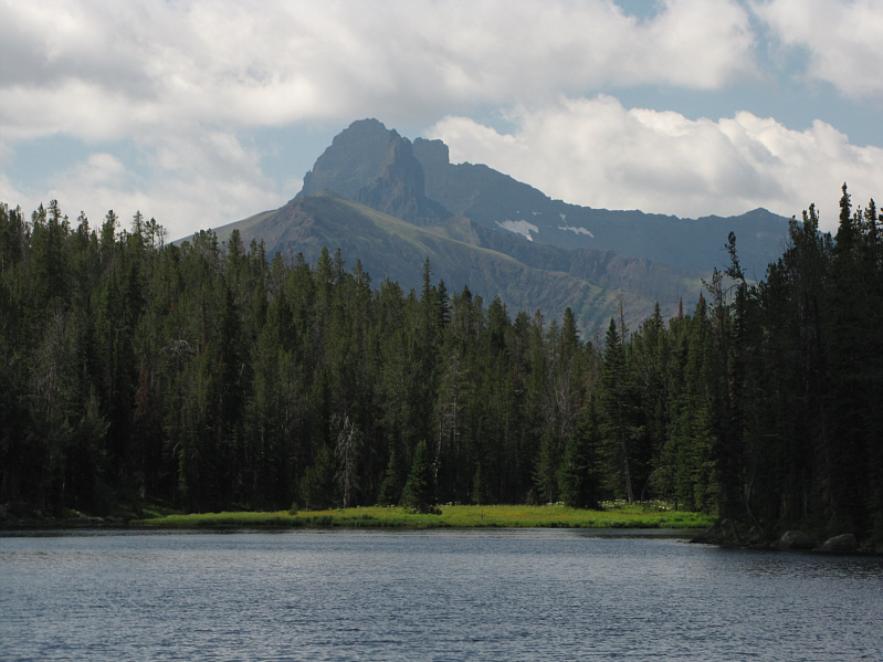
Index Peak is superimposed in front of Pilot Peak in this view south from Lady of the Lake. Both peaks are located in Wyoming. |
|
|
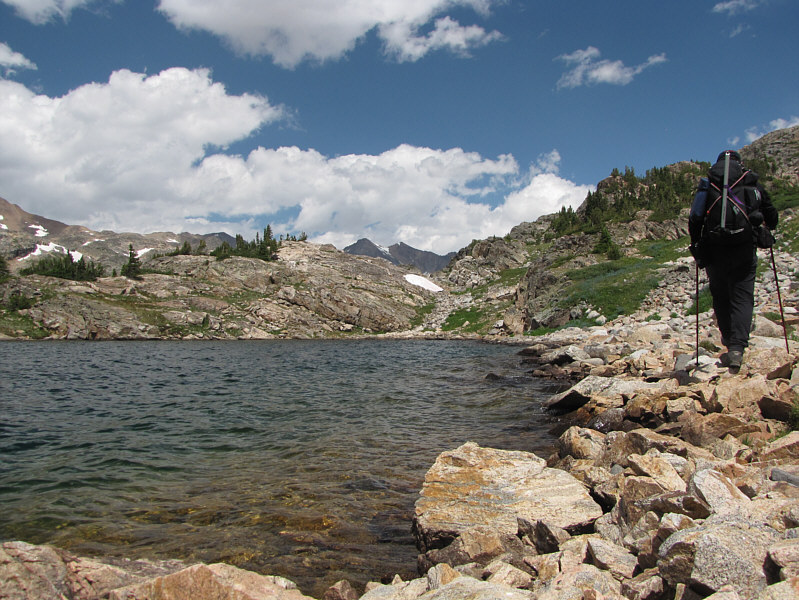
Sonny hikes past a large chunk of rock on the approach to Lower Aero Lake. |
|
|
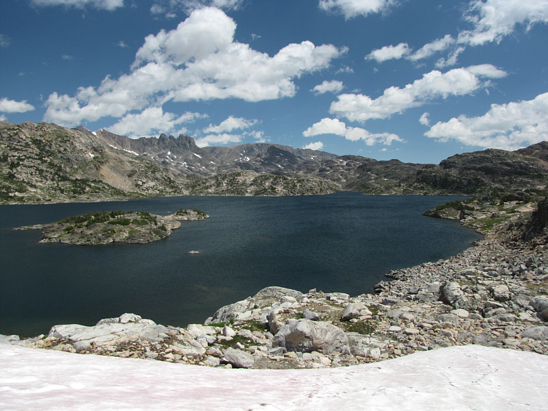
Lower Aero Lake sits at an elevation of about 3048 metres. |
|
|
Mount Zimmer is the prominent peak in this view from Lower Aero Lake's south shore. |
|
|
Sonny boulder-hops along the shore line of Lower Aero Lake. |
|
|
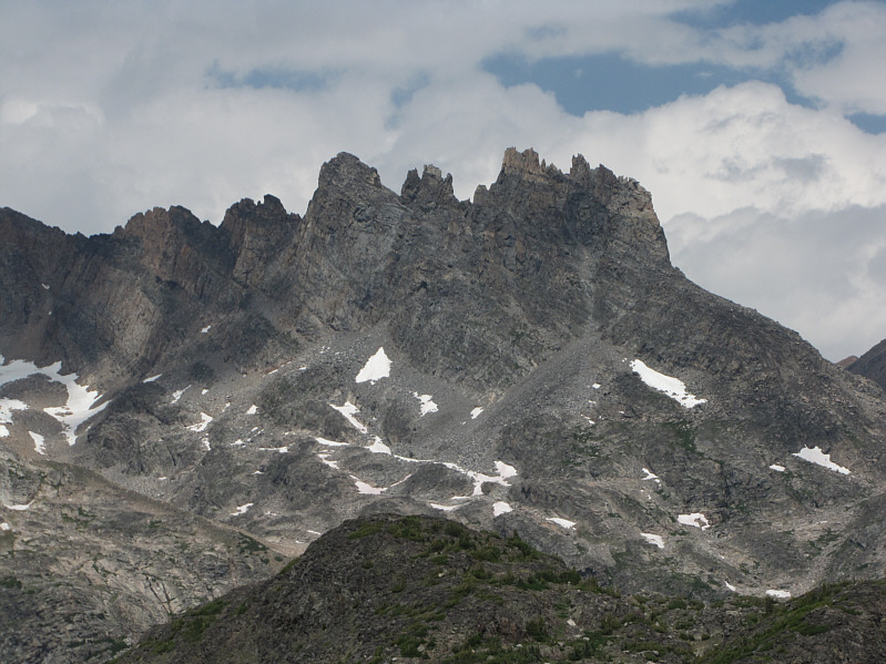
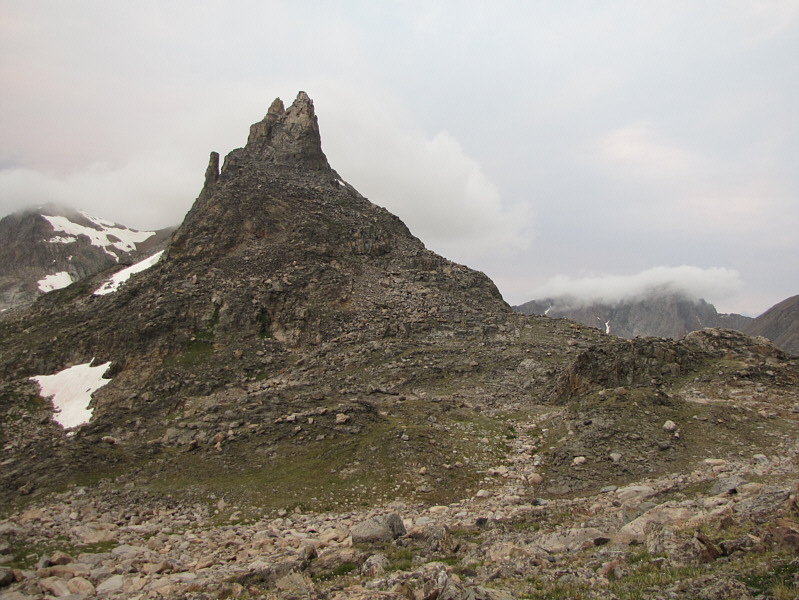
The south ridge of Mount Villard is comprised of these spectacular spires. |
|
|
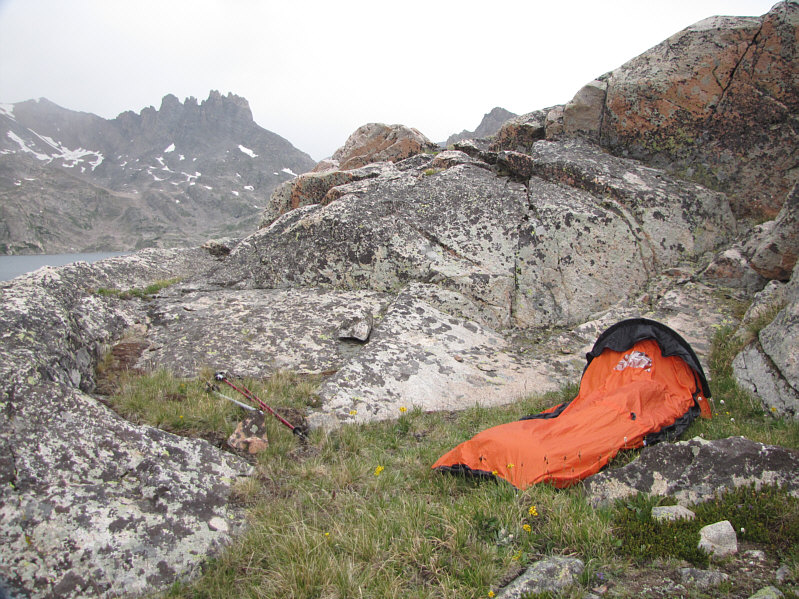
This is Sonny's temporary bivy site near Upper Aero Lake. |
|
|
One of the resident goats in the area stands on some rocks above Sonny's temporary bivy site. |
|
|
Another goat joins the first goat in following Sonny's tracks. |
|
|
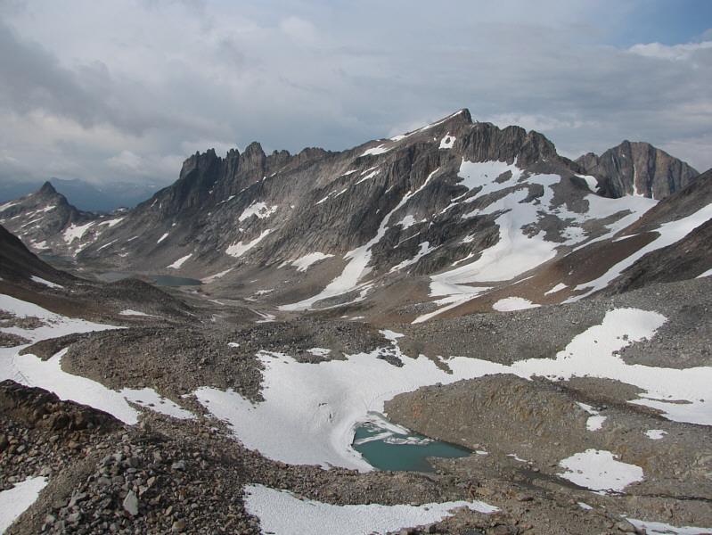
From Upper Aero Lake, the col to the right of the spires grants access to Sky Top Creek basin. Just to the left of the spires is Mount Villard. |
|
|
Shrouded in clouds beyond the col is Granite Peak. |
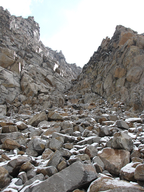
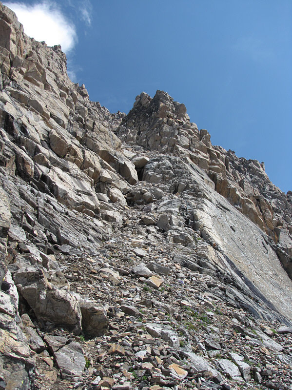
The couloir was much steeper than I was expecting, but that seemed to perk me up somewhat from my sluggish fog. There are two significant cruxes in the couloir. Early in the proceedings, I had to scramble over to climber's right of a large chock stone blocking the lower part of the couloir. There is some exposure here, but the rock was dry and reliable. Further up, there is a narrowing of the couloir with some overhanging rocks. On this day, water was flowing over the rocks, and fresh snow made for some slippery holds. Getting up this section (and staying dry while doing so) was definitely the most difficult scrambling of the day. At the top of the couloir, I stayed to climber's right for the easiest access (still Class 3) to the final ridge. This final ridge is by no means trivial (some route-finding and exposure), but the scrambling is generally straightforward and enjoyable.
From my camp, it took me five hours to step onto the summit of Granite Peak, and it was most gratifying to finally stand on the highest point of MT. Peering over the eastern side of the summit, I was a bit surprised that there were no other parties coming up the standard east ridge route. I was also thankful that I did not have to down climb that route as it did not look very inviting from my perspective. The weather at the summit was also better than I could have hoped for, but given the pattern of developing thunderstorms in the afternoons, I limited my stay to less than 40 minutes before starting my descent. Other than a couple of awkward moves to get down the crux with the flowing water, I had few problems retracing my steps down the mountain.
At the bottom of the steep snow ramp, I met a man and two boys who were apparently not that far behind me during my ascent but had turned around at the first crux. These were the first people I had seen since I left the fishermen behind at Lower Aero Lake the day before (I would encounter more people on my hike out). The man had apparently climbed Granite Peak years ago and was a bit shocked that the route appeared to be more difficult than he remembered. After a lengthy chat, I left them behind and stumbled down a series of snow patches to the uppermost Sky Top Lakes where I rock-hopped the rest of the way back to camp. As I had expected, thunderstorms began to develop in the afternoon, and just as I reached my tent, it began to rain...hard. I quickly squeezed my pack under a large rock and dove into my tent where I spent the next two hours waiting out a particularly nasty thunderstorm.
When the storm finally passed, I packed up my soggy tent and began hiking
out along the Sky Top Creek basin. I knew I would not make it back to the
trailhead that evening, but I figured that I would at least shave off
some distance before nightfall. Hiking out Sky Top Creek was just as
tedious as getting around the Aero Lakes, and I also had some uncertainty
as to where I was supposed to be headed (the terrain looks the same in
every direction). A
good map used in conjunction with a GPS or compass is essential for navigating this
wild landscape. I made it as far as Shelter Lake before darkness
forced me to set up camp for the night. At least there was no more
rain, and I even had the tent open for most of the night so that I could
stare at the brilliant stars in the sky.
 |
Granite Peak (right of centre) finally reveals itself in this view from Sonny's first camp near one the Sky Top Lakes. |
 |
This natural causeway allows easy hiking across Sky Top Creek. |
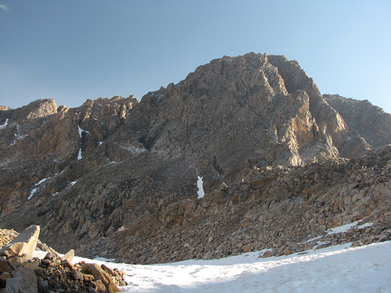 |
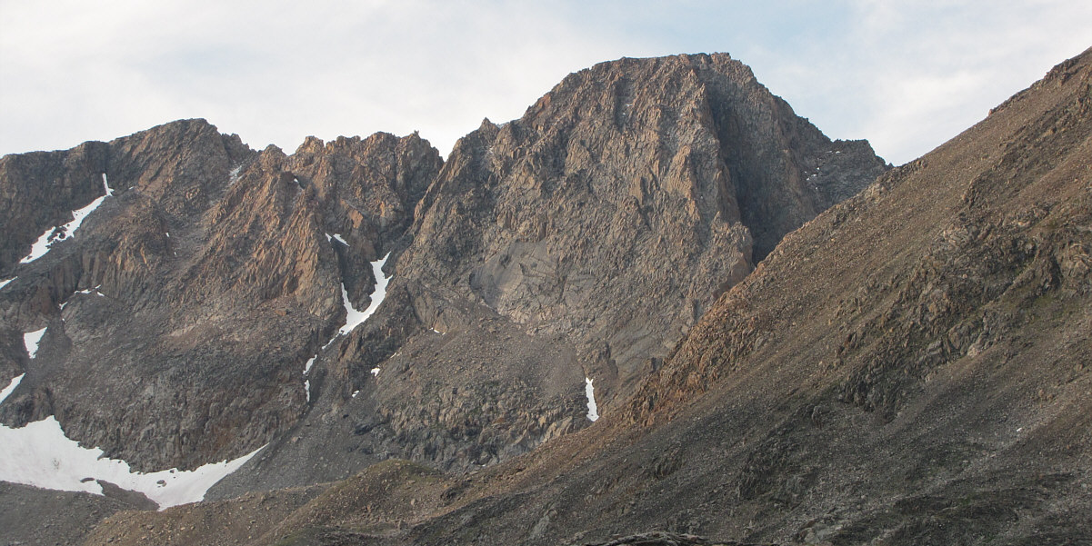
The south face of Granite Peak looks impregnable. |
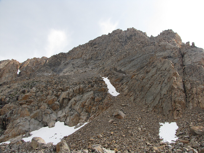 |
The route follows the left edge of the steep snow ramp at centre. The start of the couloir is on the left side of the big slabs above and to the left of the snow ramp. |
 |
Upper Sky Top Creek basin is a beautiful but desolate place. At right is Mount Villard and Glacier Peak. |
 |
Sonny encounters fresh snow near the start of the couloir. |
 |
This is looking up the couloir above the first crux. |
 |
Sonny triumphantly raises his arms on the 3900-metre summit of Granite Peak. |
 |
This is the USGS bench mark found near the summit. |
 |
Immediately south is Cairn Mountain. |
 |
Here is a view of several of the Sky Top Lakes plus Mount Villard and Glacier Peak to the southwest. |
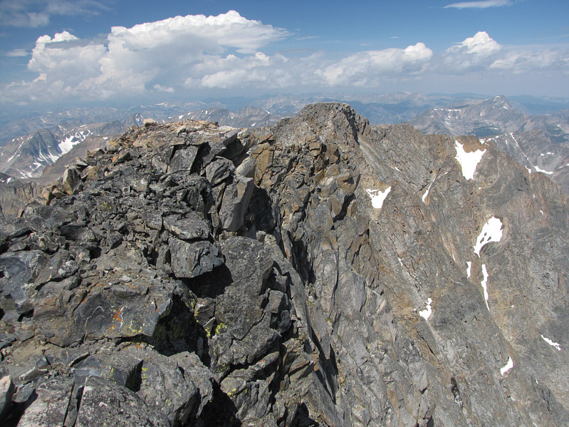 |
This is looking along the summit ridge toward the northwest outlier of Granite Peak. The traverse to the outlier is a technical climb although the outlier itself can be scrambled via a different route from Sky Top Creek basin. |
 |
Avalanche Lake sits to the north. On the horizon at left are Mount Hague and Mount Wood. At centre on the horizon is Pyramid Mountain. |
 |
To the east are Tempest Mountain (far left) and Mount Peal (right of centre). Also visible at lower right are Granite Lake and Lowary Lake. |
 |
Here is a closer look at the final ridge below the summit. |
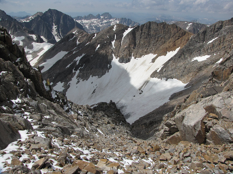 |
From near the top, the couloir seemingly plunges into the abyss. Beyond the abyss is Sky Top Glacier. |
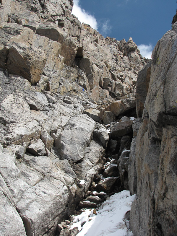 |
This is the second crux in the couloir. Note the blue sling among the rocks a little higher up and slightly to the left. |
 |
Here is the view of the couloir from near the bottom. The first crux and chock stone are visible at centre. |
This is the parting view of Granite Peak just after the thunderstorm.
 |
Rough Lake is a complex body of water to get around. |
It took me a little over four hours
to return to the trailhead from Shelter Lake. After changing
clothes and enjoying a refreshing soda pop, I drove back out to the
highway and headed southeast into Wyoming (WY). Later in the day, I
saw some spectacular vistas which are beyond the scope of this trip
report, but I am now motivated to return to WY in the future to do some
more exploring and perhaps to climb Gannett Peak (highpoint of WY)!
I eventually checked into a comfortable motel in Lander, WY and enjoyed
one of the best meals I have had in awhile at a local restaurant called
Thai Chef. Overall, this was a great way to kick off my 3-week road
trip.
 |
The morning sun shines on Shelter Lake. |
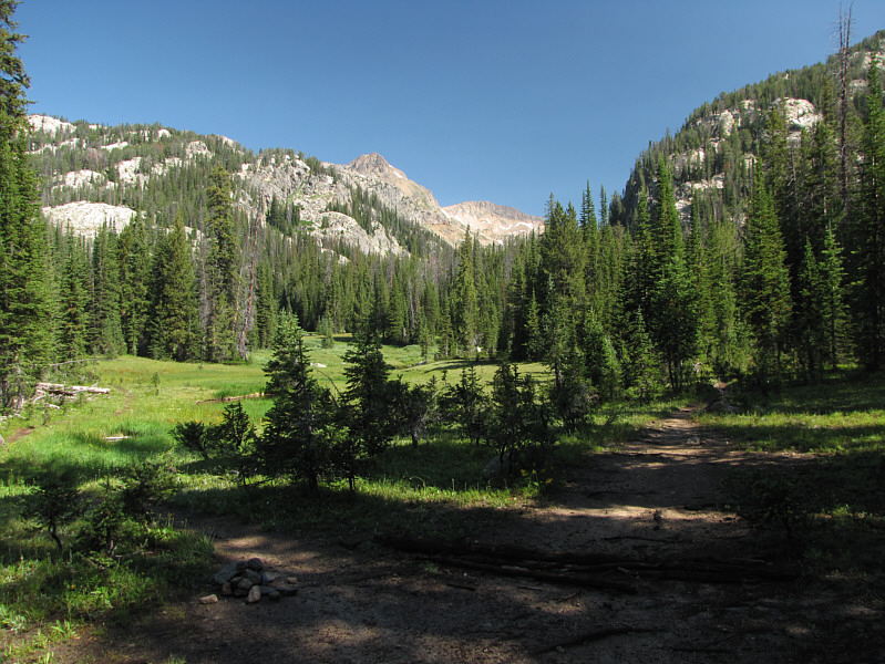 |
This is the fork in the trail near Broadwater River. The left branch (cairn) heads up Zimmer Creek toward the Aero Lakes while the right branch (deadfall) leads to Sky Top Creek basin. |
 |
Total
Distance: ~36.2 kilometres Round-Trip Time: 51 hours 17 minutes Net Elevation Gain: 1287 metres |