Crossing back into Utah from Nevada, I passed the community of Gold Hill
and did not see a single soul out and about. Gold
Hill looked like a ghost town, and if any place deserved
the title of "Armpit of Utah", this was it. I next drove through an
interesting canyon that was part of the historic and ultimately doomed
Pony Express route, and beyond the canyon was an interpretive display
beside the stony remains of a Pony Express outpost. After driving
past the community of Callao and a
CCC
campground (picnic tables and fire rings but no other amenities), I
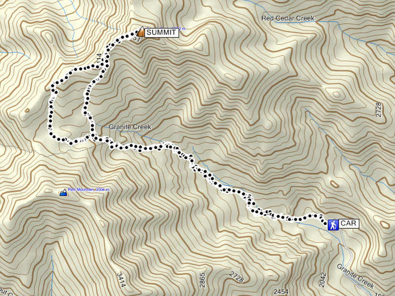
turned west onto the rough Granite Creek road which goes past a ranch and
eventually ends at the trailhead. Not taking any chances, I stopped
several times and got out to walk up the road a bit and check conditions.
The second of two creek crossings gave me some pause not because the
creek is deep, but because there is an awkward turn down a steep
embankment just before it. I was worried about getting back up this
embankment on the drive out, but after taking a closer look on foot, I
felt confident that it would not pose any problems for my car.
Perhaps not surprisingly, the trailhead was deserted when I arrived, and
I found a nice spot to park and set up camp. Being all alone out
here felt a little spooky, but the beautiful surroundings helped to
alleviate some of my apprehension. After eating dinner, I scrambled
up some interesting rock formations near camp before retiring for the
night.
|
|
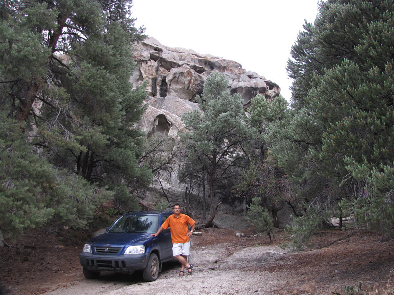
Sonny stands beside his trusty '98 Honda CR-V at a makeshift campsite near the trailhead. |
|
|
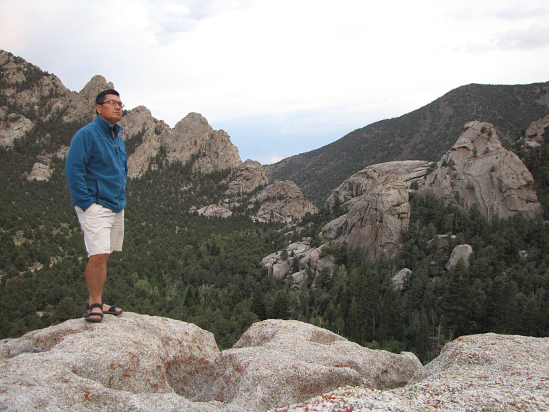
Near the campsite, Sonny wanders on top of some rocks overlooking Granite Creek Canyon. |
After spending about 50 minutes at the top, I began my descent by retracing my steps along the summit trail. The summit trail eventually disappears below the minor bump, but instead of heading back to the broad pass, I simply made a beeline due south in hopes of intercepting the main trail. Other than a little bit of unpleasant bushwhacking near the main trail, this worked out pretty well for me and helped to shave a bit of distance off the return trip. The rest of my descent went without a hitch.
Back at the trailhead, I changed into some fresh clothes before
driving back out the valley. As I had expected, the embankment near
the second creek crossing was not a problem for my car, and beyond that,
it was pretty much smooth sailing back to the main dirt road.
Instead of returning to Wendover though, I turned south toward US
Highway 6 and passed a few more remote communities along the way.
Near Trout Creek, I drove by a well-kept Mormon church, and oddly enough,
the road is paved for the short section in front of the church. On
the outskirts of Trout Creek, I nearly hit a deer when it darted out from
behind some bushes. I had forgotten that it was getting late in the
day, and I endeavoured to be more vigilant for the rest of the drive.
At Partoun, there is a modern-looking high school but not much else which
prompted me to wonder about the staff and students here (be sure to read
this interesting news
article plus accompanying
comments regarding this school). There are apparently some warm
springs near Gandy, but given the lateness of the day, I did not have the
time to check it out. After what seemed like an eternity, I finally
reached US Highway 6, and it felt great to pull onto hard pavement again.
About a kilometre to the west was the Utah/Nevada border, and there is a
motel/gas station/restaurant/casino/RV park situated here known as the
Border Inn. On the strength of another Ibapah Peak trip report I
found on the Internet, I decided to check-in here for the night and was
not disappointed. A hot shower, a delicious meal, and a comfortable
bed were a fine reward for a long day and a half spent in some very
remote wilderness.
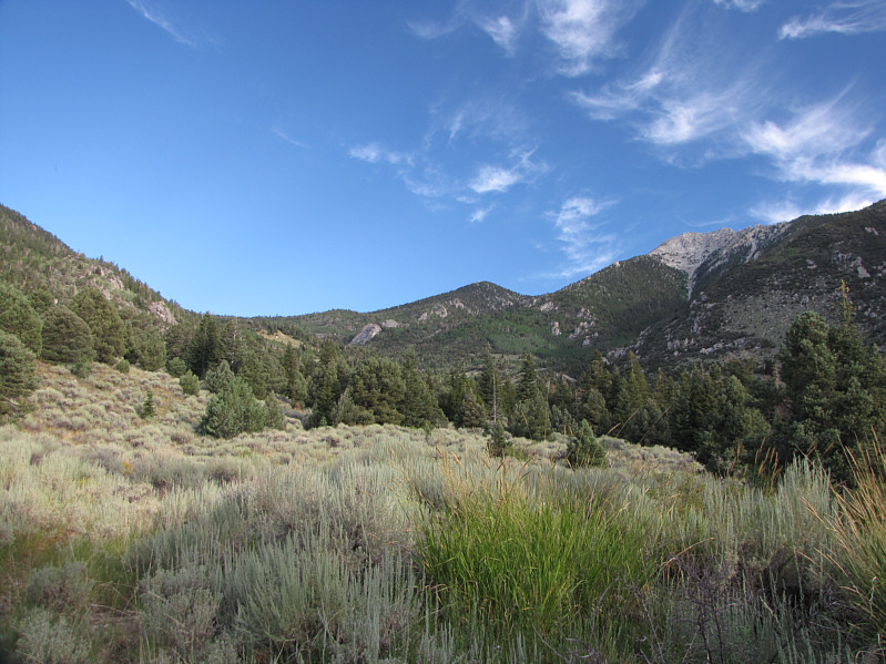 |
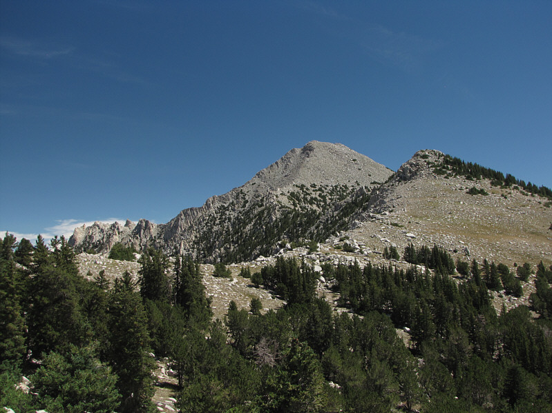
The trail leads to the pass at left. On the right is Ibapah Peak. |
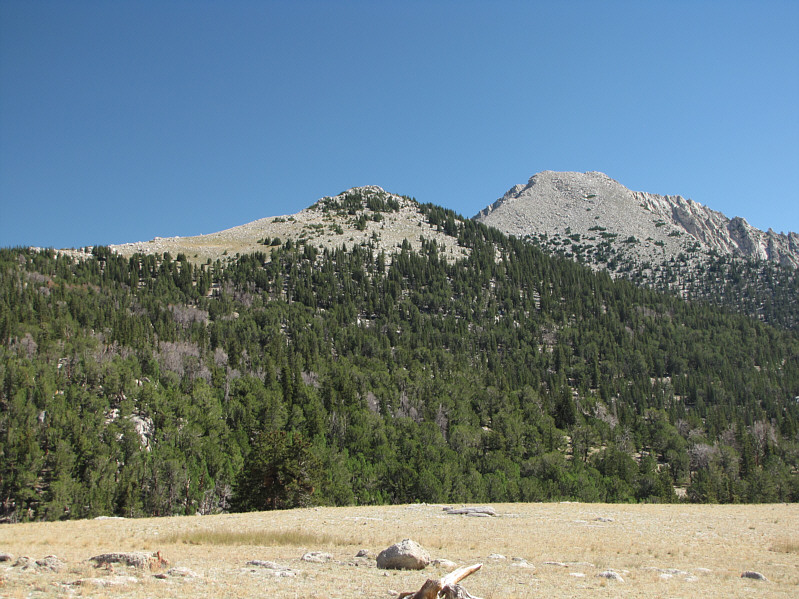 |
From the pass, Ibapah Peak (right) is about 3 kilometres away to the northeast. |
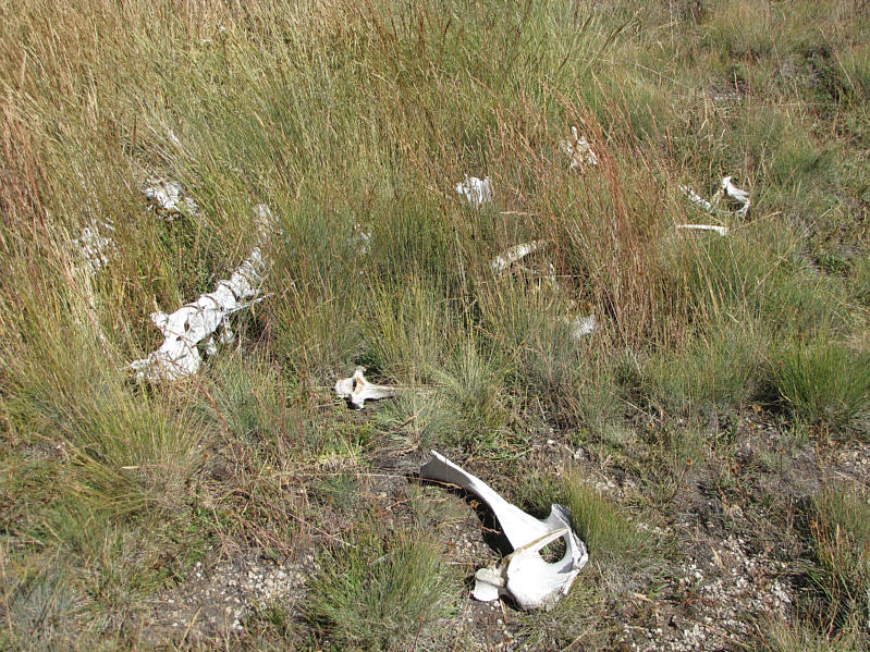 |
Something big died here at the pass. |
 |
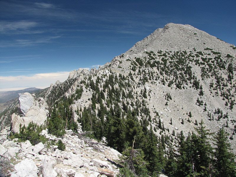
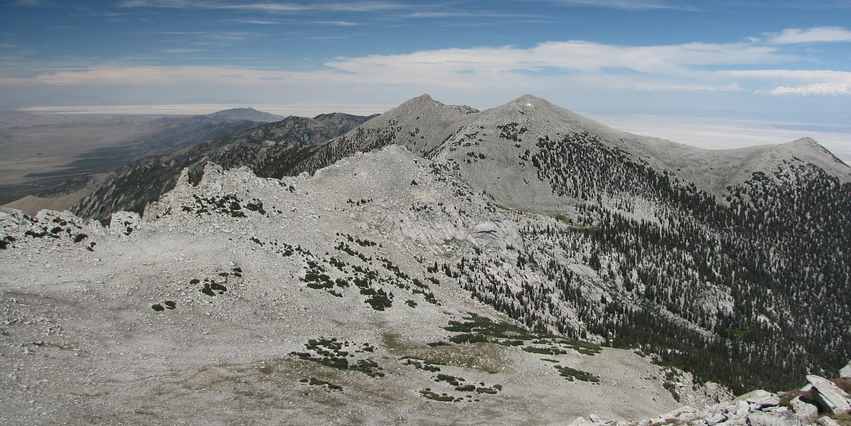
This is looking along the crest of the southwest ridge of Ibapah Peak. A good trail can be picked up on the east side of the minor bump at right. |
 |
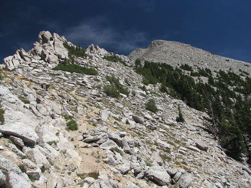
Here is a closer look at the upper mountain from the minor bump along the southwest ridge. |
 |
The trail switchbacks up the last 200 metres or so to the summit. |
 |
Here is the summit benchmark. |
 |
Sonny sits on the remains of a heliograph station on the 3685-metre summit of Ibapah Peak. Visible in the distance is the Great Salt Lake Desert. |
 |
A wildfire erupts in the distance beyond the slightly lower west summit (3678 metres). |
Haystack Peak dominates the view to the north.
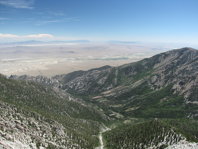 |
Granite Creek basin is to the southeast. |
 |
Red Mountain to the southwest is aptly named. |
 |
Here is another look at the wildfire burning on the western horizon. |
 |
Total
Distance: 22.3 kilometres Round-Trip Time: 11 hours 30 minutes Net Elevation Gain: 1623 metres |