BOU AVENUE
Moapa Peak
Several years ago on my very first visit to
Las Vegas, Nevada, I was struck by the sight of a prominent mountain on
the north side
of the I-15 after driving across the state line from Arizona. I
would later learn that this was Moapa Peak, and though it is not the
highest mountain in the region, it is immensely popular with local
peak-baggers. Besides its visibility from the highway, Moapa Peak
garners much attention because of its infamous summit ridge which is
narrow and exposed in places. Admittedly, this was part of the
appeal for me when I set out to climb the mountain on 18 October 2013.
Armed with an excellent route description
from Summitpost.org,
I left my hotel in Las Vegas before dawn and drove east along the I-15.
I left the I-15 at exit 100, and after driving through a narrow tunnel
under the highway, I turned onto a dirt road heading north toward Moapa
Peak. Although the road was fairly
easy to follow, one particular fork a couple of kilometres before the
trailhead caused some confusion (stay right). The road became
significantly rougher the closer I approached the trailhead, and even
though I tried to drive more carefully, I still scraped the bottom of my
rented Chevy Equinox a couple of times.
Starting from a large sign
at the trailhead, I hiked up the continuation of the road through a low
pass to Jacks Pockets, an unexpectedly green oasis of desert vegetation.
A couple of large washes emanate from the south slopes of Moapa Peak and
converge at Jacks Pockets.
I was initially unsure about which wash to hike up, but a quick
consultation of the route description pointed me in the right direction
(take the wash to climber's left).
The wash eventually turns westward and narrows to a short canyon which
dead-ends at a pour-over. Fortunately, I found a cairn marking a
by-pass route on climber's left which allowed me to circumvent the
pour-over. Easy terrain beyond allowed me to grind my way up to
a low saddle. From this saddle, I worked my way northward up to
some Class 3
ledges which are what I would consider the crux of the trip. The route up these
ledges is not entirely obvious, and after a bit of searching about, I eventually ascended a rather
sketchy gully on climber's right. A wide ramp above the ledges ultimately
led me to another saddle on the west ridge of the mountain.
From this second saddle, I headed up the ridge to a large wall stretching
across the south face of the upper mountain. A long traverse
eastward across the base of this wall was followed by another steep grind before I finally gained the crest of the east
ridge. The final scramble along the exposed summit ridge was
exhilarating but not overly difficult.
After spending about 45 minutes at the
summit, I retraced my steps back down the mountain. At the Class 3
ledges, I followed cairns down a slightly different route that was further
west of where I originally ascended. There is one slightly tricky
step here, but overall, this is probably the correct route and is easier
than my route of ascent. The rest of my descent went without a
hitch except when I snapped one of my hiking poles that I bought earlier
in the week from a Wal-Mart in Las Vegas. The pole lasted all of four
trips!
Overall, Moapa Peak lived up to its hype as
a classic scramble. While the knife-edge of the summit ridge was a
highlight of the trip, the real appeal for me was the overall elegance of
the route--easy approach, moderately steep hiking, and enough
route-finding and Class 3 scrambling to keep things interesting.
Climbing Moapa Peak was a great way to cap off a fantastic week for me in
Las Vegas, and I am already looking forward to my next trip to Sin City.
 |
This interpretive sign seems a little out of place at this remote
trailhead. Moapa Peak is directly ahead. |
 |
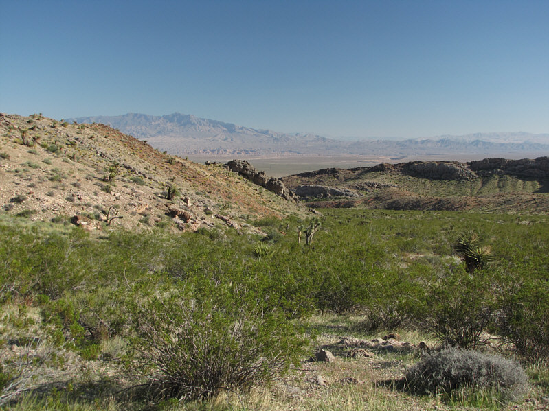
Jacks Pockets is an unexpectedly green oasis below the south face of
Moapa Peak. The
route follows the wash to the left. |
 |
The wash narrows to a short canyon.
The cairn marks the spot to by-pass the canyon on climber's left. |
 |
This is looking back down the access
gully from the first saddle. |
 |
The route continues up more Class 2 terrain above the first saddle. |
 |
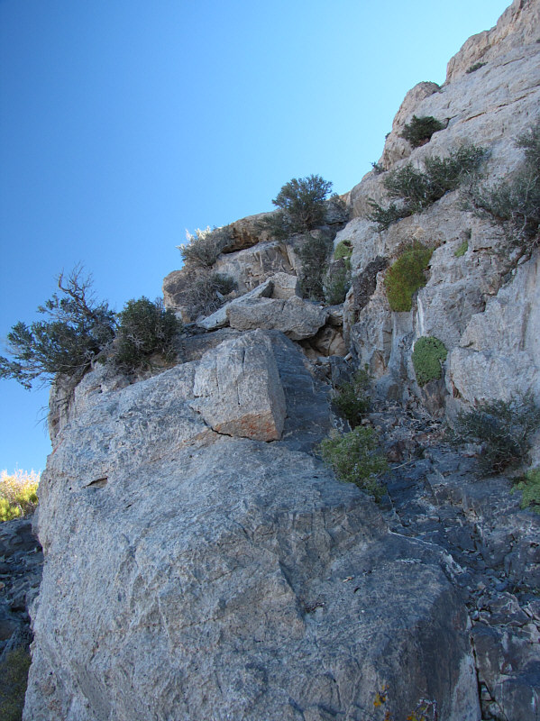
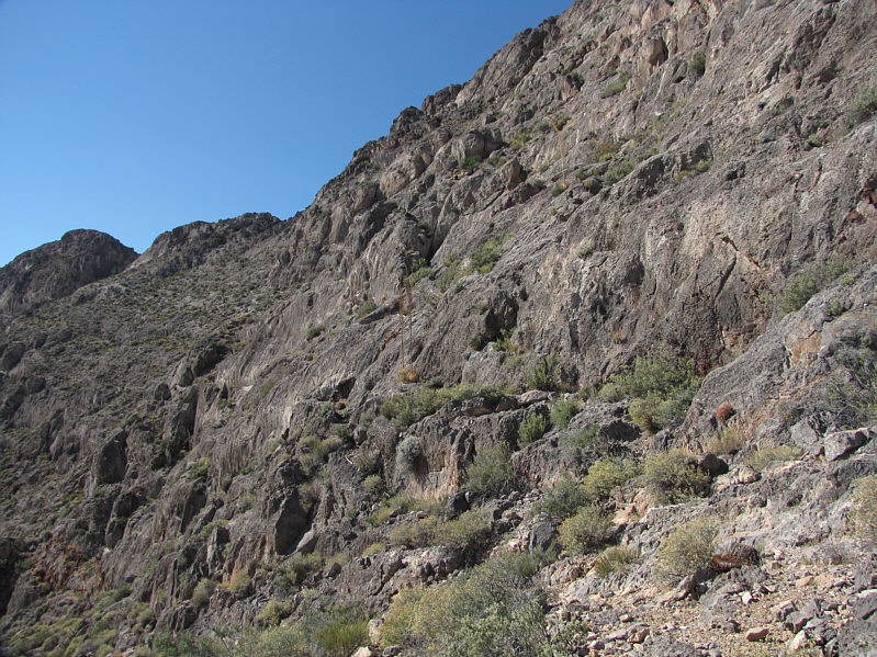
This is the right side of the crux. A little route-finding and
Class 3 scrambling is required to ascend here. |
 |
This is looking back at the crux (bottom centre) from the top of the
ramp. |
 |
Above the second saddle is more easy Class 2 terrain. |
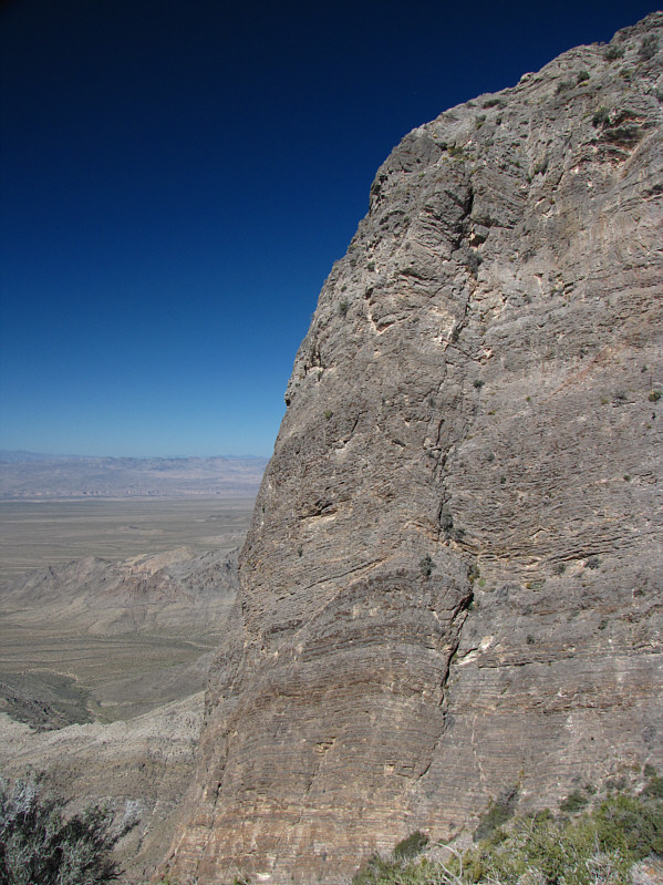 |
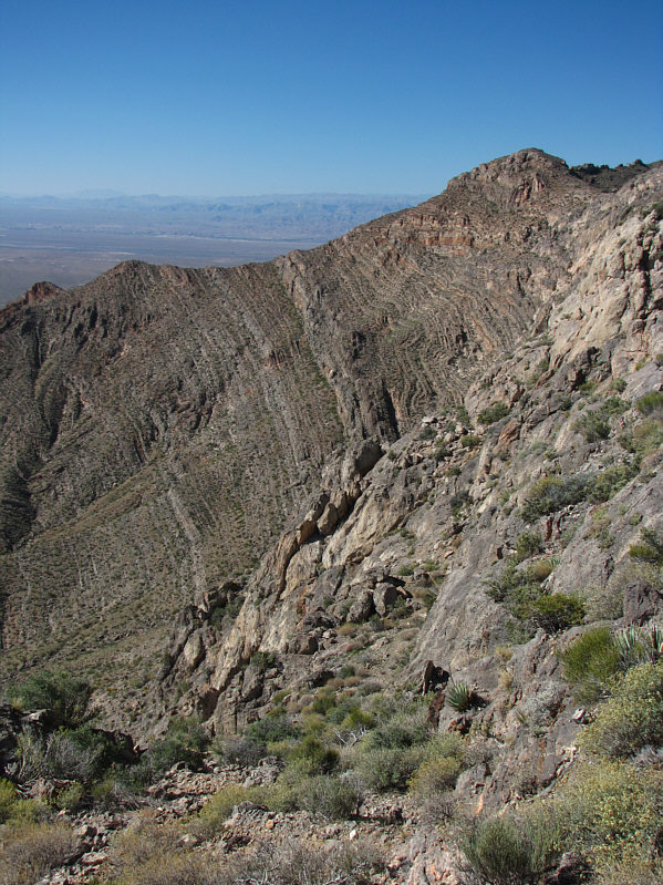
A surprising cliff face presents
itself further up. |
 |
The route continues eastward along the base of this wall. |
 |
It is easiest to gain the summit ridge by dropping down slightly to the
north (shadowy area to the right) and climbing up a Class 3 crack (not
visible here) in behind. |
 |
This is looking up the Class 3 crack on the north side of the summit
ridge. |
 |
The exposure on the north side of the summit ridge is unforgiving. |
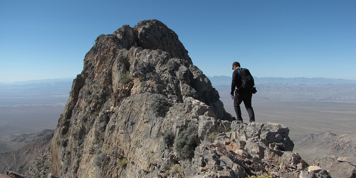
Sonny walks carefully along the summit ridge.
 |
There are some overhanging sections of
rock just before the summit. |
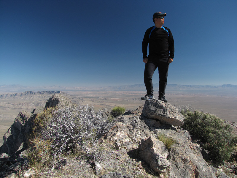 |
Sonny stands on the summit of Moapa Peak (1966 metres). |
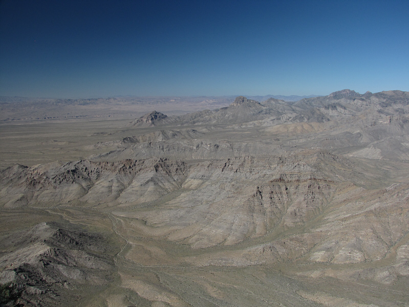 |
Mormon Peak (far right on horizon) is visible to the north. |

To the east, Davidson Peak is barely visible behind the
eastern outlier of Moapa Peak.
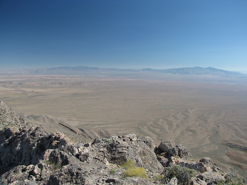 |
Mount Bangs (left) and Virgin Peak
(far right) are visible on the southeast horizon. |
 |
Sonny's rental car is visible at the
trailhead loop. The bright patch of green marks the entrance to
Jacks Pockets. |
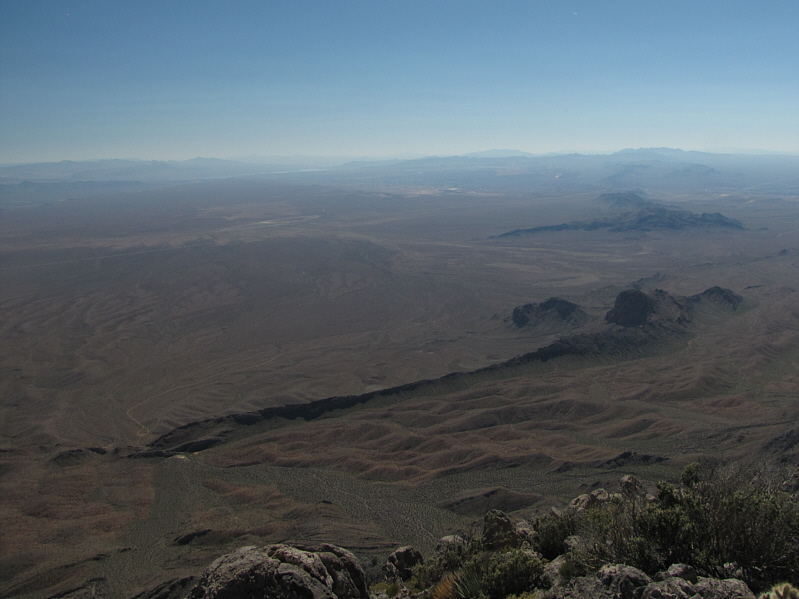 |
Here is a more comprehensive view of
the trailhead and Jacks Pockets at bottom left. Lake Mead is
barely visible in the distance at left. |
 |
This is the narrowest part of the
summit ridge. |
 |
This barrel cactus is looking rather
erect. |
 |
This is the left side of the crux.
The trickiest spot is behind the two agave plants at centre, but the
ledges above are pretty straightforward (there are cairns). |
 |
The open wash of Jacks Pockets is a
welcome sight at the end of the day. At left in the distance is
Virgin Peak. |
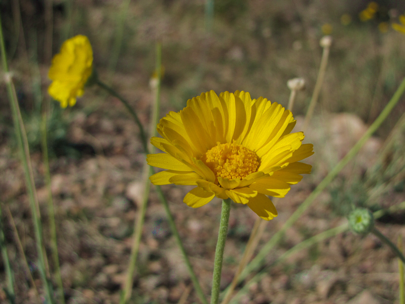 |
Desert marigolds are in full bloom. |
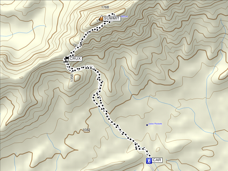 |
Total
Distance: ~8.8 kilometres
Round-Trip Time: 7 hours 38 minutes
Net Elevation Gain: 1009 metres |
