BOU AVENUE
Mount Girouard
Marko Stavric, an outstanding local
photographer and outdoor enthusiast, had posted a message on Facebook
looking for partners for a weekday trip to the mountains. Since I was
still on holidays, I promptly replied and suggested that we attempt Mount Girouard in Alberta's Banff National Park. This was an ideal
opportunity to finally do my first scramble with Marko as well as knock
off a peak that I had been eyeing for quite some time. Despite
being the highest peak of the Fairholme Range, Mount Girouard seems to
have been largely neglected by peak-baggers if a search on the Internet
is any indication. In his last edition of Scrambles in the Canadian
Rockies, Alan Kane erroneously mentions in the route description for
nearby Mount Inglismaldie that Mount Girouard "is not a scramble". This
may have dissuaded many scramblers from attempting Mount Girouard, myself
included! The Rocky Mountain Ramblers Association (RMRA) had posted a trip
report
of a non-technical ascent in 2011, but their route photos are sorely
lacking. Unaware of the RMRA report at the time, I was actually inspired by Rafal
(Raff) Kazmierczak's
photos of his ascent in 2013. Although I was still
uncertain about the exact route on the upper mountain, I somewhat
inferred from my previous conversations with Raff that there was probably
no serious difficulties. Unfortunately, I was unable to contact Raff for
more information prior to picking up Marko from downtown Calgary on the
morning of 27 August 2014.
A light drizzle greeted us as we drove out to
the trailhead at Johnson Lake, and the weather did not look promising in
the morning. After hiking around Johnson Lake, we continued eastward
through some light bush to reach the major drainage emanating from the
south side of Mount Girouard. Travel up this drainage was initially very
easy, but as we progressed further upstream, we had to negotiate through
increasing amounts of deadfall likely deposited as a result of the
biblical floods of 2013. The tedium of boulder-hopping was somewhat
alleviated by an abundance of ripe raspberries everywhere. Both Marko and
I could not resist stopping constantly to stuff our greedy mouths, but
this also slowed our pace considerably.
Just before a major fork in the drainage,
we took to the steep embankment on climber's left and headed up through
light forest before emerging from the last trees onto a vast field of
rubble. We continued up this field of rubble into a large
amphitheatre
bounded on one side by Mount Girouard and on the other by Mount Peechee.
By now, the weather had improved significantly, and so had our outlook on
this ascent. Still a little unsure of the exact route, we made an educated guess and
headed straight up toward some impressive pinnacles on the north side of
the amphitheatre. The route actually unfolded itself for us as we worked
our way up the path of least resistance to climber's right of the
pinnacles. We eventually crested the southwest ridge, and from
there, it is a short but miserable grovel up horribly loose rubble to
reach the summit ridge and cairn. Views from the top were
breathtaking, but the enormity of the long approach made us limit our
summit stay to less than half an hour.
Monotonous and tedious would aptly
describe our return trip. Though uneventful, the hike out was both
physically and mentally taxing as evidenced by my sore feet and abundant
whining. Eating more raspberries on the way out only prolonged the
agony. Darkness fell upon us while we were still in the bushes
short of Johnson Lake, and while I had foolishly neglected to bring a
headlamp, I was able to follow Marko who had the foresight to bring his.
Although we ended the trip in the dark, this allowed us an opportunity to
witness some spectacular Northern lights on the drive home.
Overall, the route up Mount Girouard is
nothing more than a lengthy off-trail hike with very minimal scrambling, and though the approach is
grueling, the summit views are well-worth the suffering to get there.
A little over a month after our ascent,
Vern Dewit
and
Steven Song paid a visit to Mount Girouard and have since posted trip
reports. With the "explosion" of route information now available on
the Internet, it is likely that Mount Girouard will see more visits in
the future.
Be sure to check out Marko's fabulous
photos of this trip.
 |
Cascade Mountain is reflected in
Johnson Lake. |
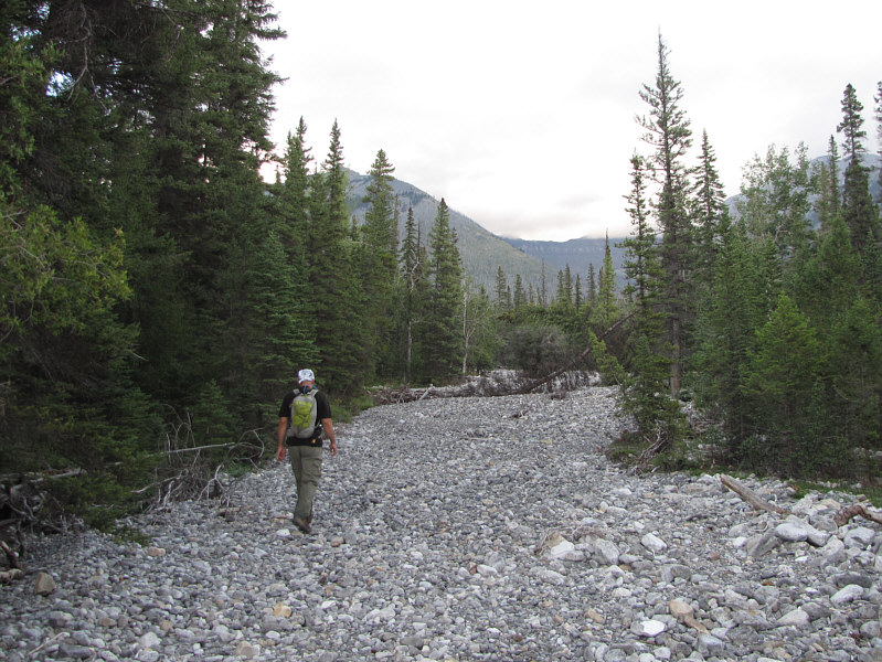 |
Marko hikes up the broad drainage. |
 |
At least one anticline is visible in
the exposed rock on the edge of the creek bed. |
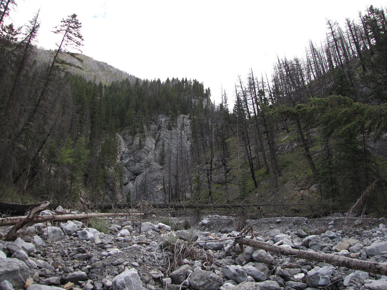 |
An abundance of deadfall in the creek
bed makes for tedious travel. |
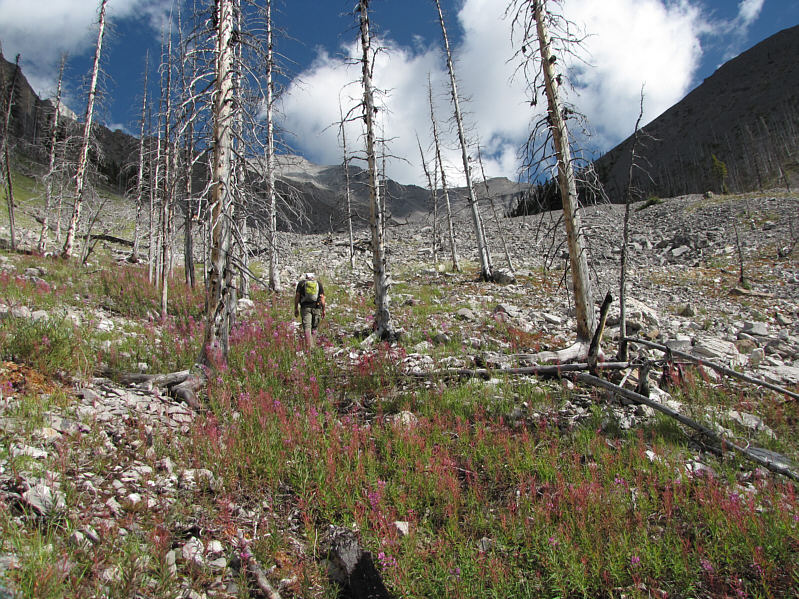 |
Marko progresses beyond the last
trees. |
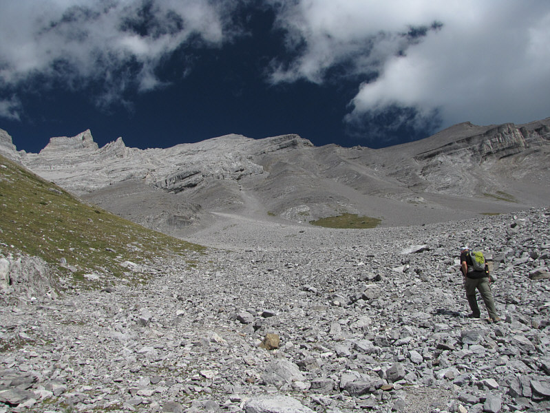 |
Marko slogs up more rubble. |
 |
The ascent route goes up this drainage
before veering to the right below the pinnacles. |
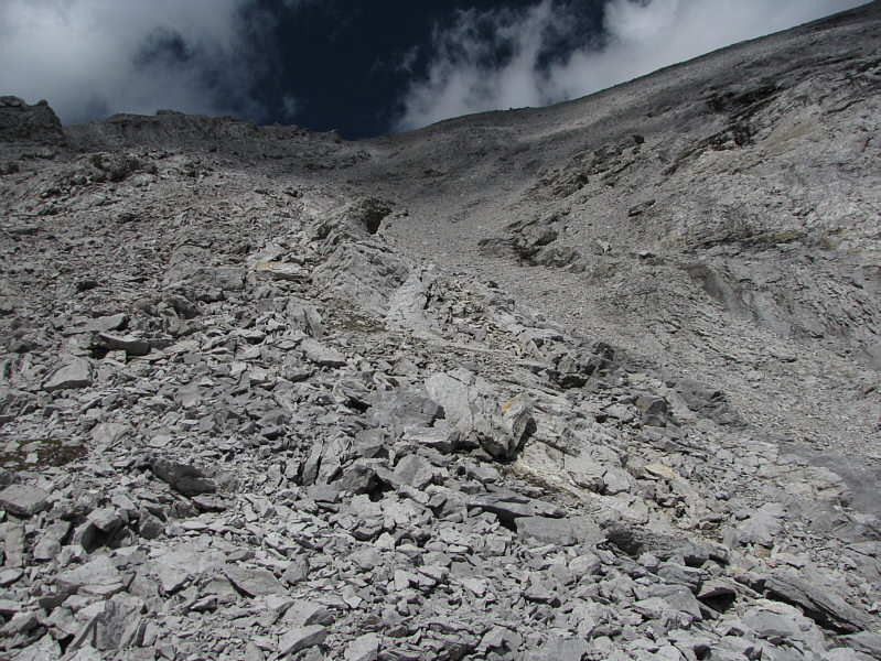 |
The route becomes steeper here and
eventually follows the right-hand skyline. |
 |
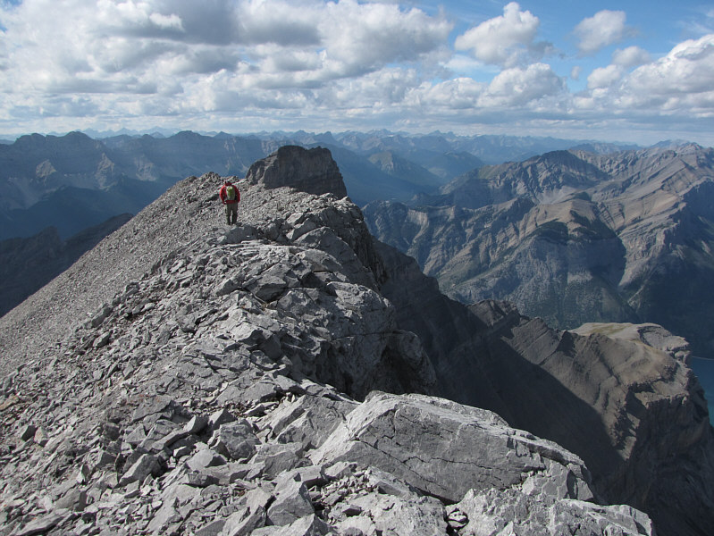
Marko is barely visible on the summit
ridge. |
 |
Marko casually strolls along the ridge
toward the summit. |
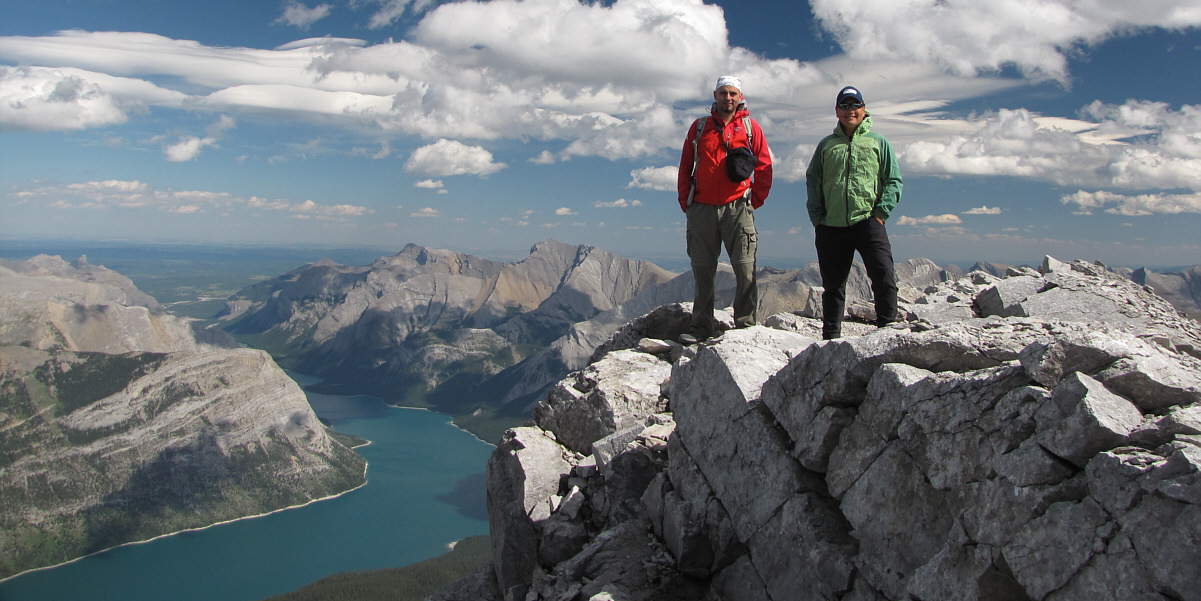
Marko and Sonny stand on the 3020-metre* summit of
Mount Girouard.
* Taken from my own GPS reading.
Most publications and topographic maps give Mount Girouard an elevation
of 2995 metres.
 |
Mount Assiniboine stands out to the
southwest. |
 |
To the north across Lake Minnewanka is
Mount Aylmer. |
 |
The unmistakable form of Devils Head
pokes up to the northeast. |
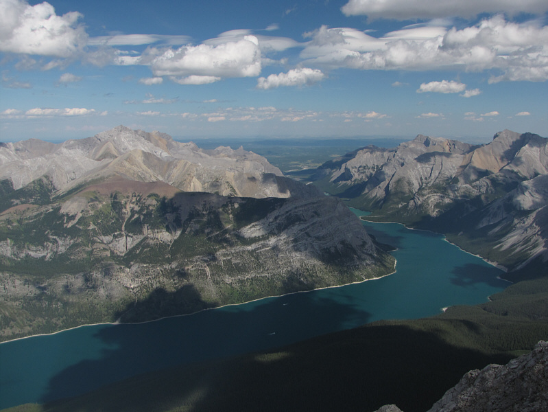 |
The view to the east includes Mount
Costigan (left) and the eastern half of Lake Minnewanka. |

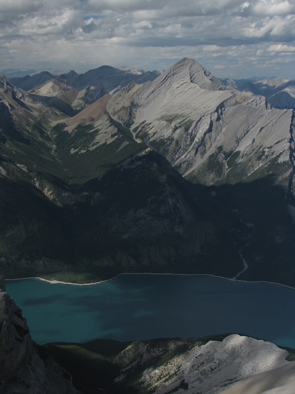
Mount Peechee is the next mountain to the southeast.
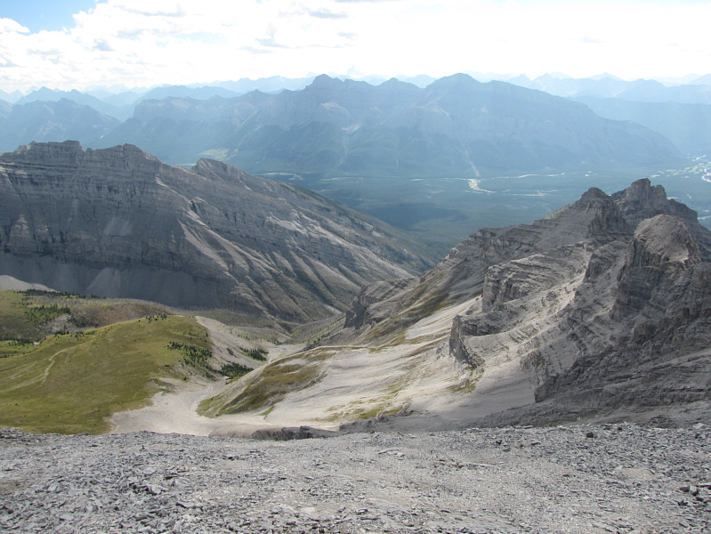 |
This is looking back down at the
access drainage from the summit. Mount Rundle is visible in the
distance. |
 |
Marko begins the long descent. |
 |
Mount Girouard's companion peak to the
west is Mount Inglismaldie. |
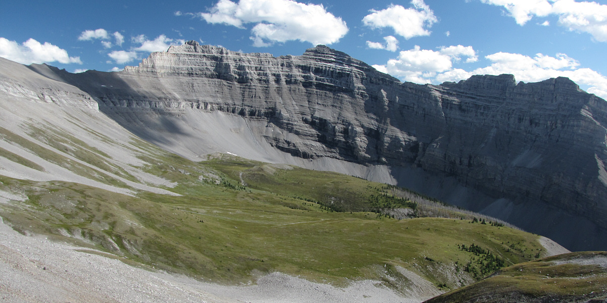
Here is a more comprehensive look at Mount Peechee
and the amphitheatre below its west face.
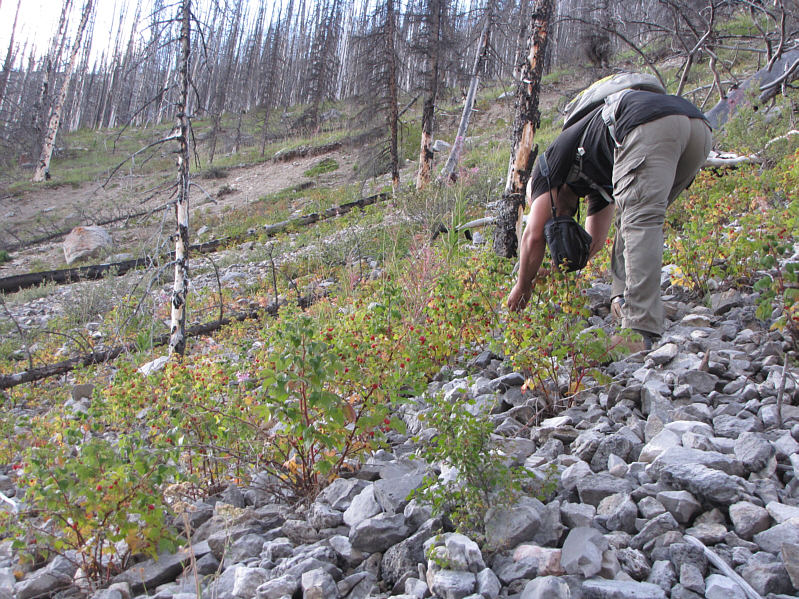 |
Marko stops on the way out to gorge on
ripe raspberries. |
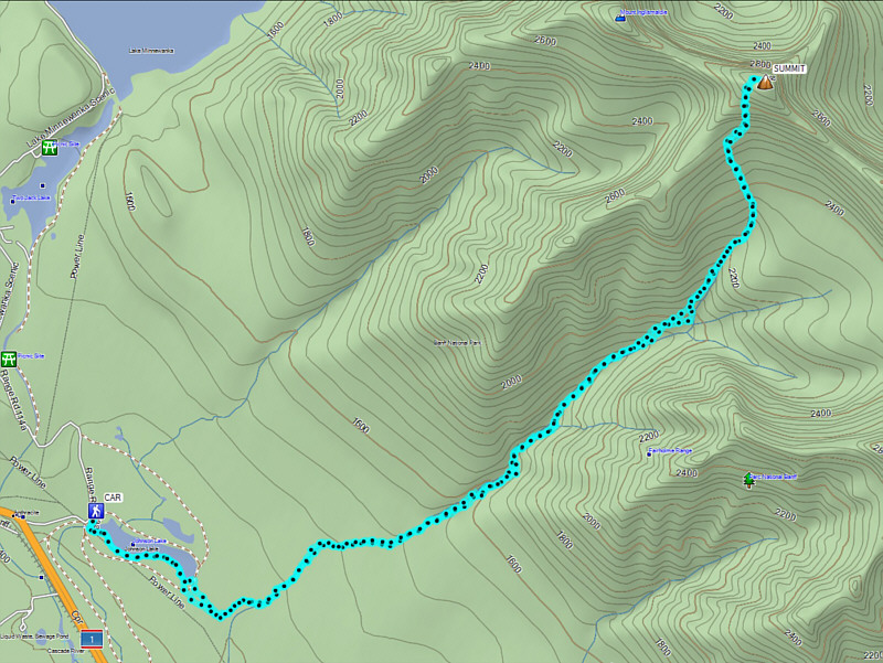 |
Total
Distance: 23.4 kilometres
Round-Trip Time: 14 hours 41 minutes
Net Elevation Gain: 1589 metres
GPX Data |