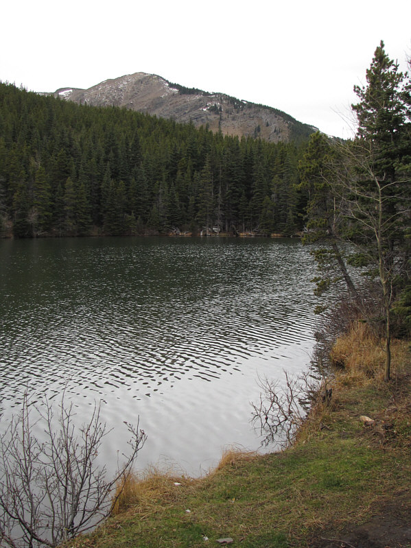
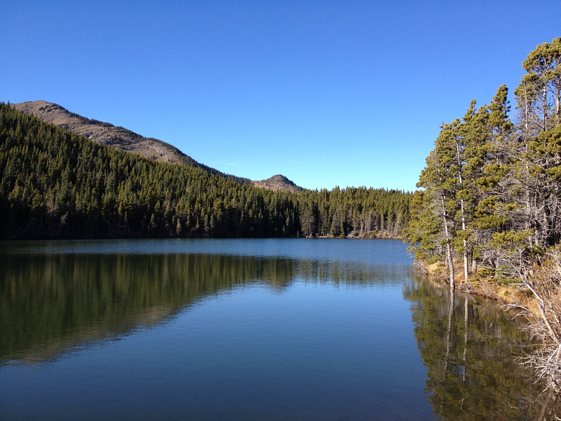
BOU AVENUE
Iron Lakes Ridge

Bob Spirko invited me to join him and Dinah Kruze for a hike on 25 October 2014 at the south end of Alberta's Kananaskis Country.  Our modest objective was an unnamed ridge about two kilometres northeast of Hailstone Butte.  Bob would later dub this as "Iron Lakes Ridge" given its close proximity to the so-called Iron Lakes described in Gillean Daffern's Kananaskis Country Trail Guide.  Starting from the trailhead for Bear Pond, we quickly hiked past the popular fishing hole and descended about 100 metres to the idyllic meadows of the North Fork of Johnson Creek.  Heading westward, we crossed the creek and gained a semi-open ridge which allowed us to climb up to a wind-swept high point.  Bob had plotted a loop route for our return, but we had some trouble finding a way down the northeastern side of Iron Lakes Ridge due to the steepness of the terrain.  Undeterred, we continued northward along the open ridge and eventually found a reasonable game trail which led us down the northeastern slope.  After stopping for lunch on a rocky knoll overlooking Iron Lakes, we followed a well-worn path before leaving it to descend open forest.  Intersecting the trail to Iron Lakes, we turned south to regain the meadows where we initially started the loop.  There was a fair bit of grumbling and whining--mostly from Dinah and myself--as we re-climbed the 100 metres we initially lost at the beginning of the trip, but much of the misery was soon forgotten once we hiked past Bear Pond and back to the trailhead.  Although Iron Lakes Ridge is not likely to become a classic, the trip is interesting enough to merit some attention especially as a shoulder-season hike.

Be sure to check out Bob's trip report here.
I've never seen a bear here. Iron Creek Ridge is visible in the distance beyond Bear Pond.
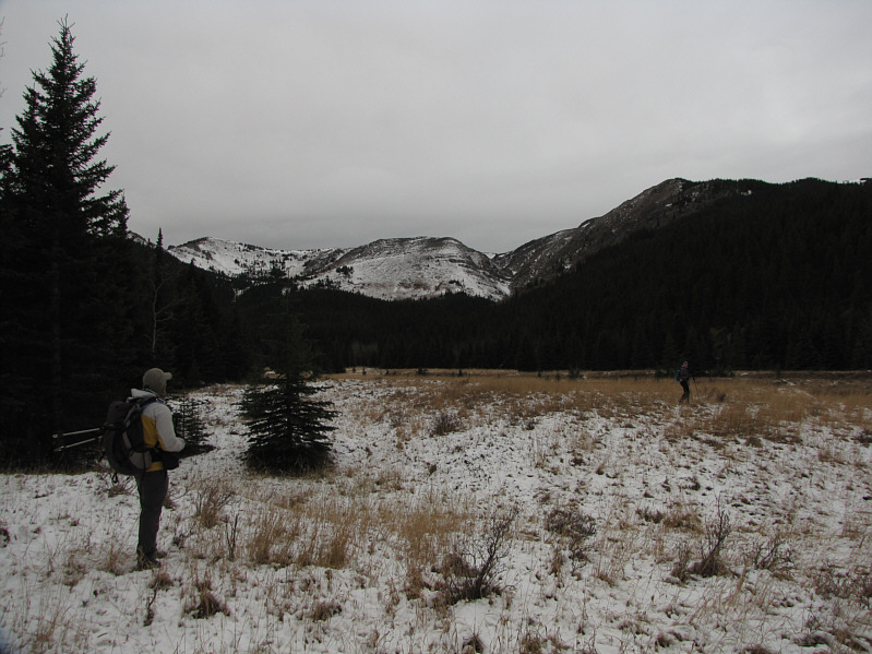
You should take a GPS waypoint here; the cairn marking the trail is easy to miss on the return trip! Iron Creek Ridge is on the right as Bob and Dinah arrive at the meadows of the North Fork of Johnson Creek.
Moderately strenuous hiking here. 
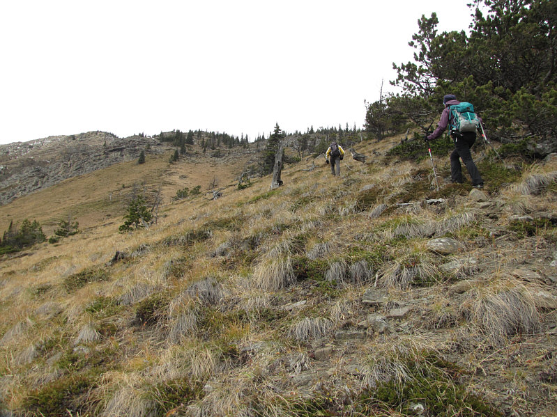
Bob and Dinah ascend grassy slopes.
There is a little hands-on scrambling ahead. 
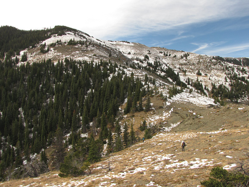
Bob and Dinah follow the crest of the ridge as best as they can.
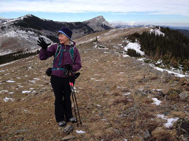
Happy belated birthday, Dinah! On the 2159-metre high point of Iron Creek Ridge, Dinah counts how many times she had to remind Bob that it was her birthday two days ago.
Took us a little over 2 hours to get here. 
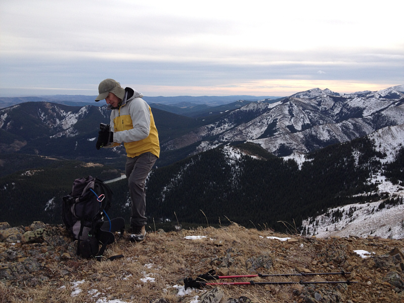
Bob fiddles with his camera on the high point.  Saddle Mountain is visible on the right horizon.
That's a great smile, Dinah! 
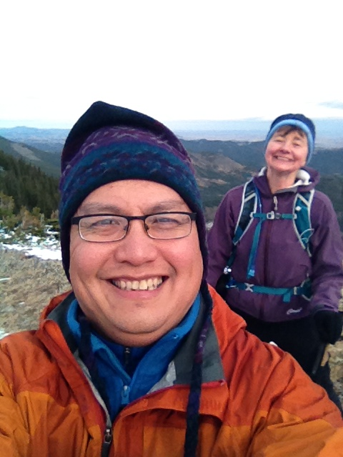
Dinah photo-bombs Sonny's selfie on the high point.
Can you spot the access road? 
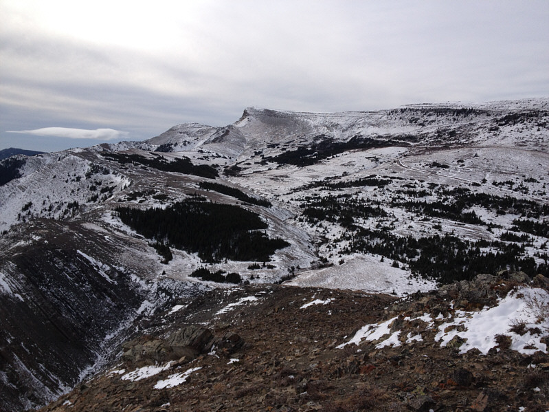
Hailstone Butte dominates the view to the southwest.
Not looking forward to that climb back up to Bear Pond... The meadows of the North Fork of Johnson Creek and Bear Pond are both evident to the southeast.
How do we get down from here?? 
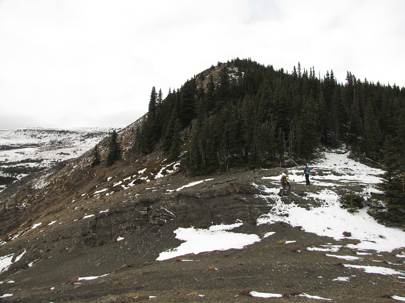
Bob and Dinah hike along the top of the ridge.

Great colour coordination!

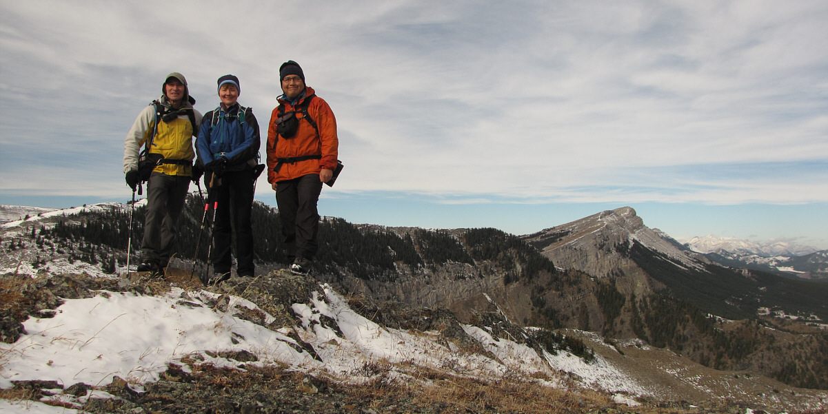
Bob, Dinah and Sonny pose for a group photo on the ridge with Sentinel Peak visible at distant right.

Okay, this hike is fun again! Dinah and Bob are all smiles after discovering a good game trail descending from the top of the ridge.
You know that it is NOT tick season when Dinah is sitting down on the rocks! 
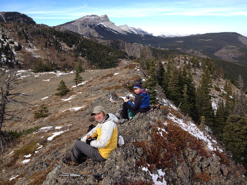
Bob and Dinah enjoy a well-deserved lunch on a rocky knoll.
Bob and Dinah don't think much of these lakes... 
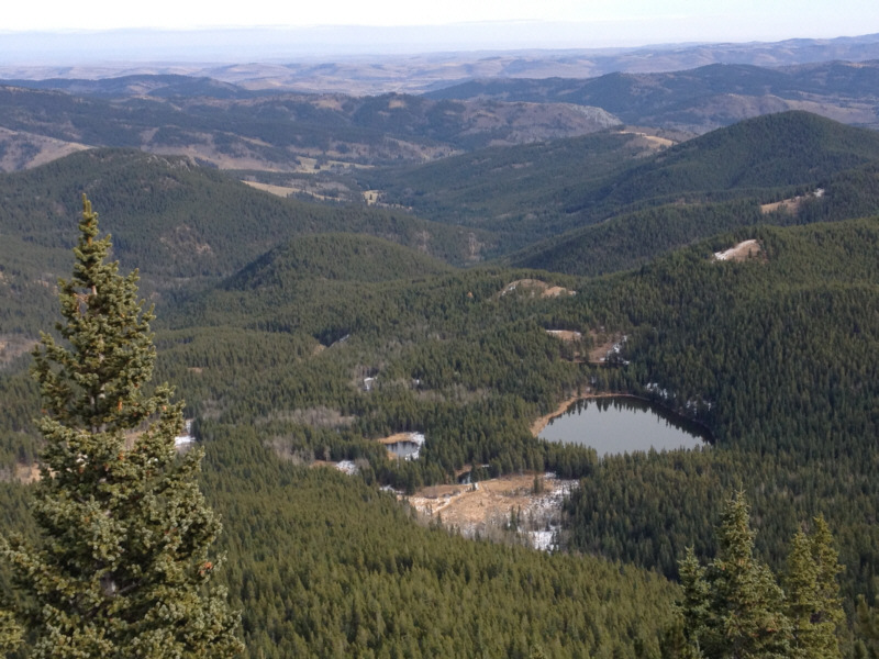
A number of the Iron Lakes are visible from the rocky knoll.
We may have started this trip too early; the weather is starting to improve! Continuing their descent, Dinah and Bob head for the draw to the left to pick up a well-worn path.
I nearly crushed my hand trying to help Bob move the boulders! 
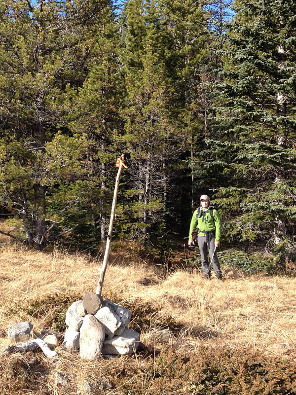
Bob built this cairn with flagging to mark the trail that leads to the Iron Lakes.
Now off to Black Diamond for some bakery goodies! Here is a last look at Iron Creek Ridge (left) and the rocky knoll (centre) from Bear Pond.
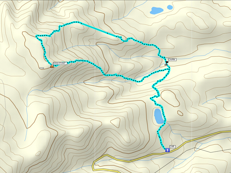
Not sure what happened with my GPS on the northern part of the loop; it looks like I took two giant steps to get down half the ridge! Total Distance:  8.5 kilometres
Round-Trip Time:  5 hours 35 minutes
Net Elevation Gain:  416 metres

GPX Data