Above the headwall, we crossed a small plateau before scrambling up through a short cliff band to reach Noseeum Lake. As Stavric had mentioned in his report, the lake and its surroundings are a worthy destination in their own right, and it was awfully tempting to just sit down and lounge about for the rest of the day. Instead, we worked our way northward aiming for an obvious scree gully which grants access to the ridge crest leading to Noseeum Mountain's summit. This gully is both steep and loose, and with such a large group, we had to be extra cautious to avoid knocking rocks down on each other. Bob was the only one among us who had the forethought to bring a helmet, but ironically, he ended up climbing the gully without donning it! From the col at the top of the gully, we enjoyed an easy hike all the way to the spacious summit of Noseeum Mountain. For such an unassuming peak, the views from its summit on this day were extraordinary.
After an extended break, we more or less retraced our steps back to the col. The gully again proved to be challenging due to the size of our group and the looseness of the rock. Thankfully, we all made it down safely without a scrape, and after another short break, we continued our descent. At the bottom of the headwall, we again encountered some route-finding difficulties, but after backtracking a bit, we finally found the correct access route--a shallow, eroded gully just to climber's left of the steep gully that Bob and I had climbed earlier in the day. The rest of our hike out Noseeum Creek was trouble-free.
Overall, this was a really fantastic trip with outstanding scenery and just the right dose of quality suffering. Sharing the experience with Bob and his acquaintances made the trip even better. The other hikers turned out to be excellent company, and I look forward to running into them again on some other mountain in the future.
Be
sure to check out Bob's trip report
here.
|
|
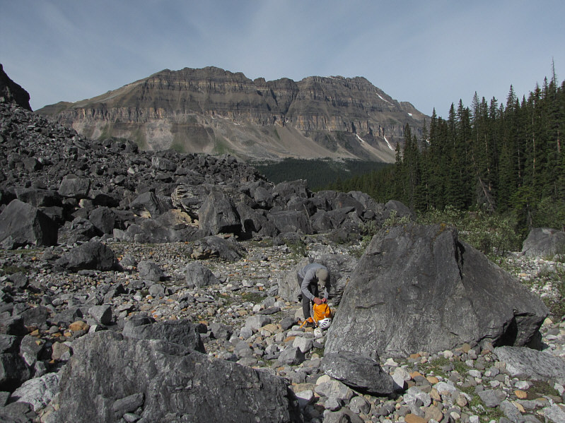
Bob stops to fiddle with his pack near a boulder field. Bow Peak is visible in the background. |
|
|
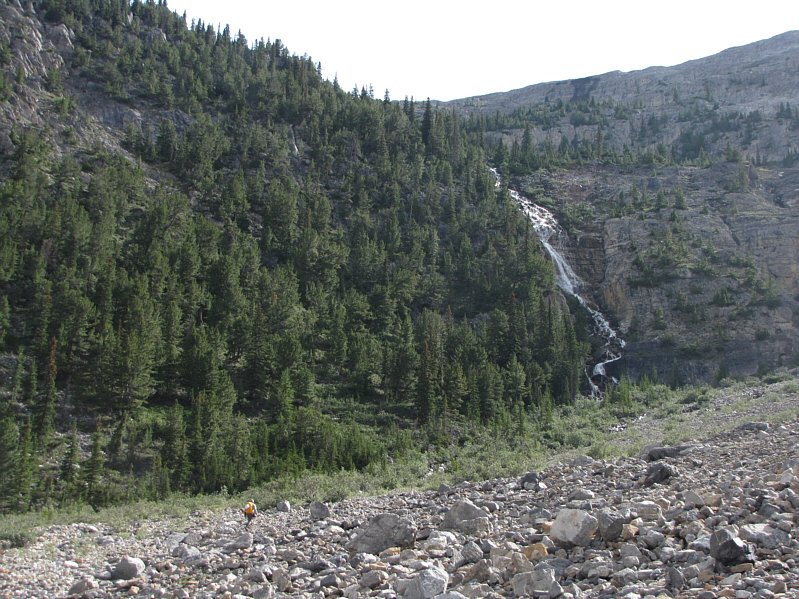
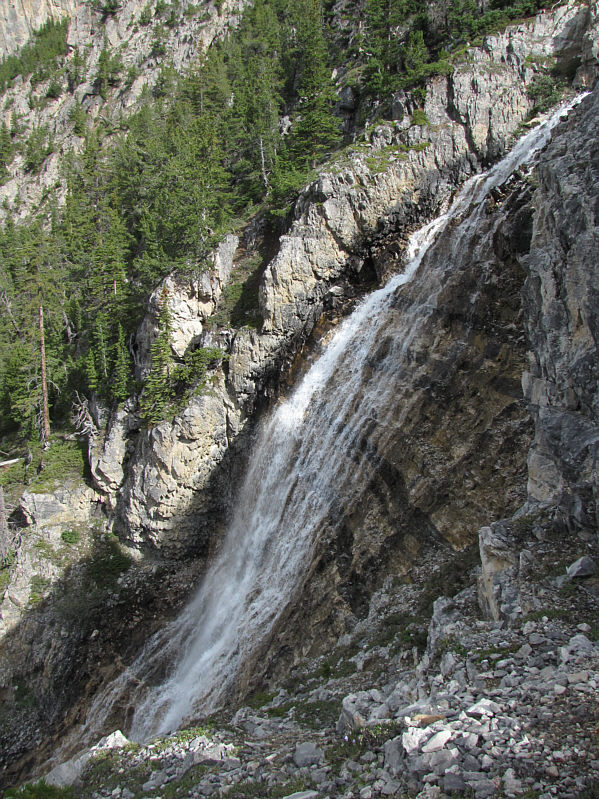
The most popular route to surmount the headwall follows a steep trail to the right of the cascades. |
|
|
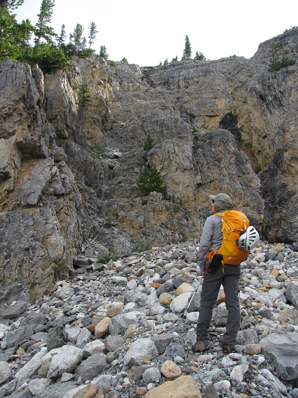
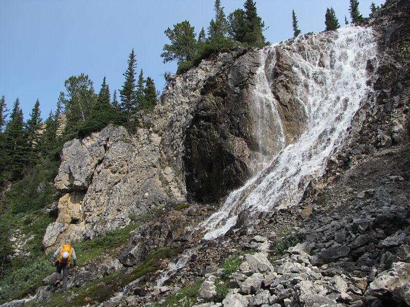
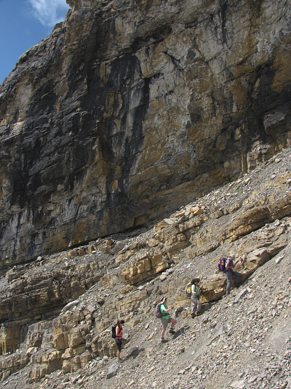
Bob searches for a route up the cliffs. He would eventually follow Sonny and climb up the steep gully ahead. An easier route is just out of sight to the left. |
|
|
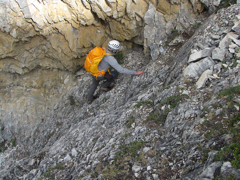
Bob scrambles up the steep gully. |
|
|
Here is a closer look at the cascades from partway up the headwall. |
|
|
Bob traverses below these cascades near the top of the headwall. |
|
|
Bob leads the multitude to the promised land! |
|
|
The route continues up these easy ledges. |
|
|
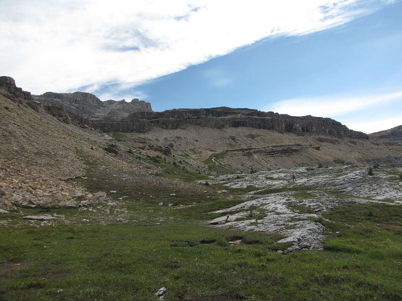
Bob crosses a small plateau above the headwall. |
|
|
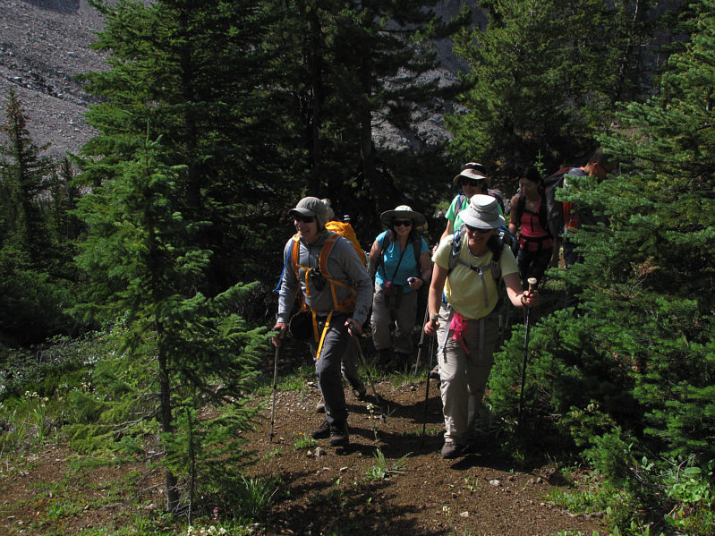
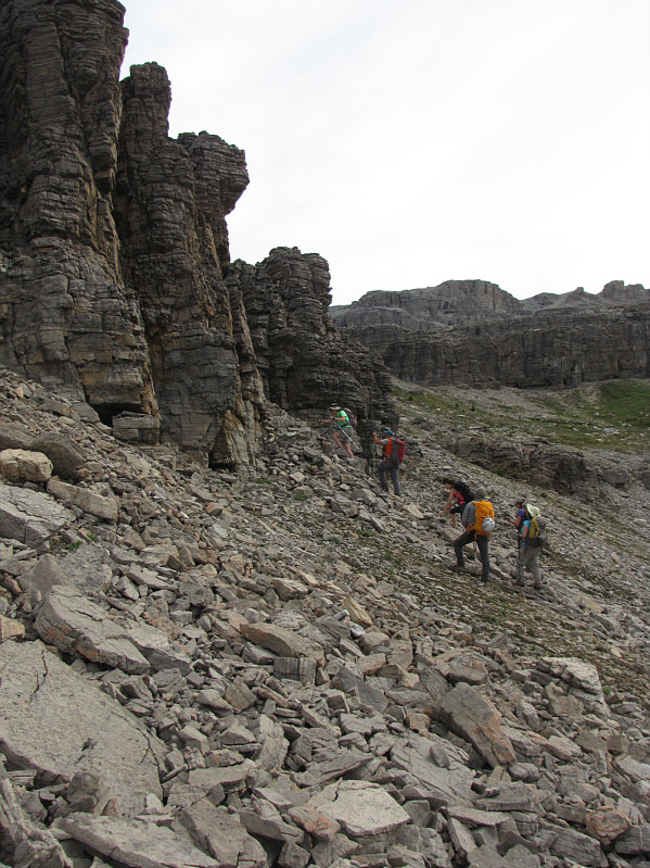
The group scrambles up a break in the cliffs. |
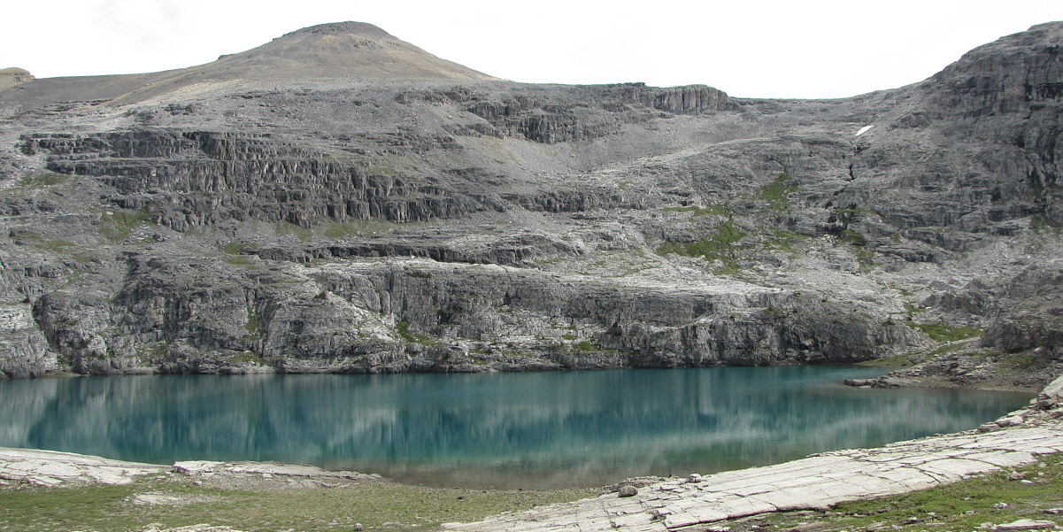
"Noseeum Lake" is truly a hidden gem.
 |
Noseeum Mountain is reflected in Noseeum Lake. The summit is the bump on the right. |
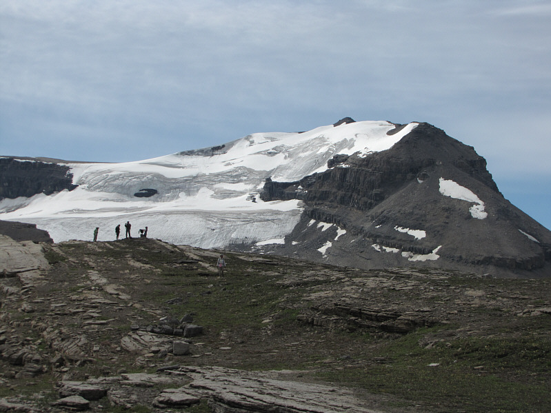 |
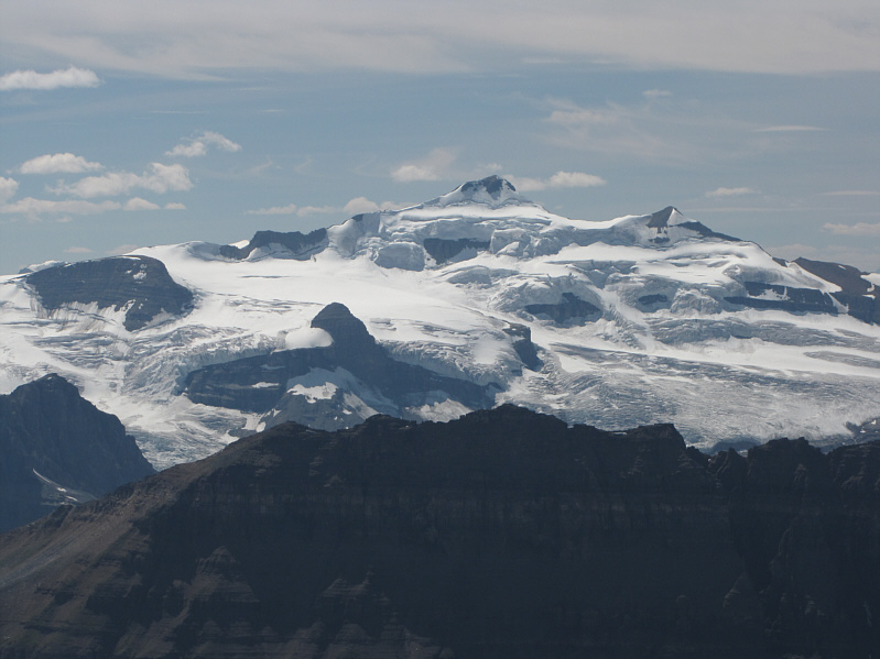
Some of the other hikers are silhouetted against the Molar Glacier which covers much of Mount Andromache. |
 |
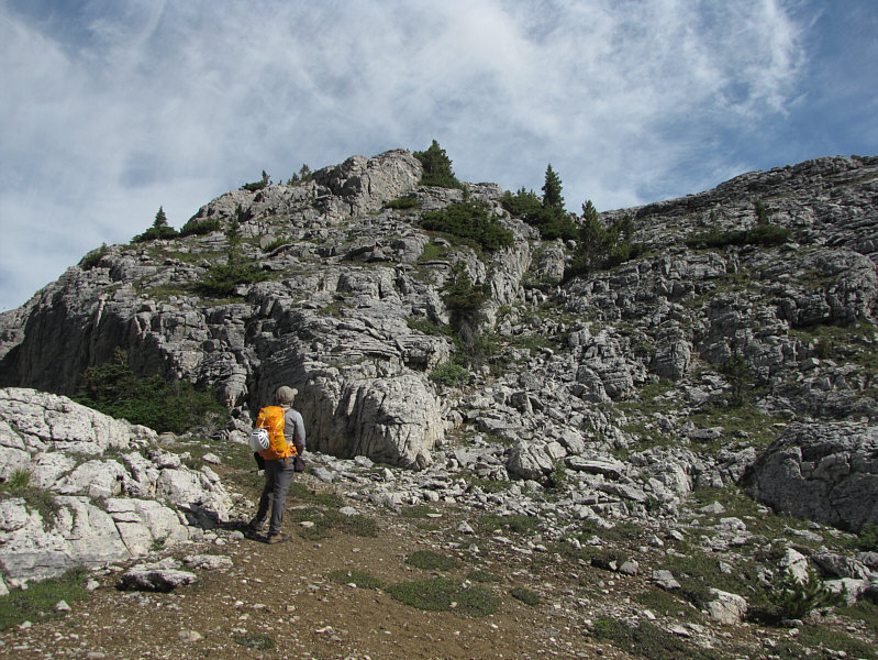
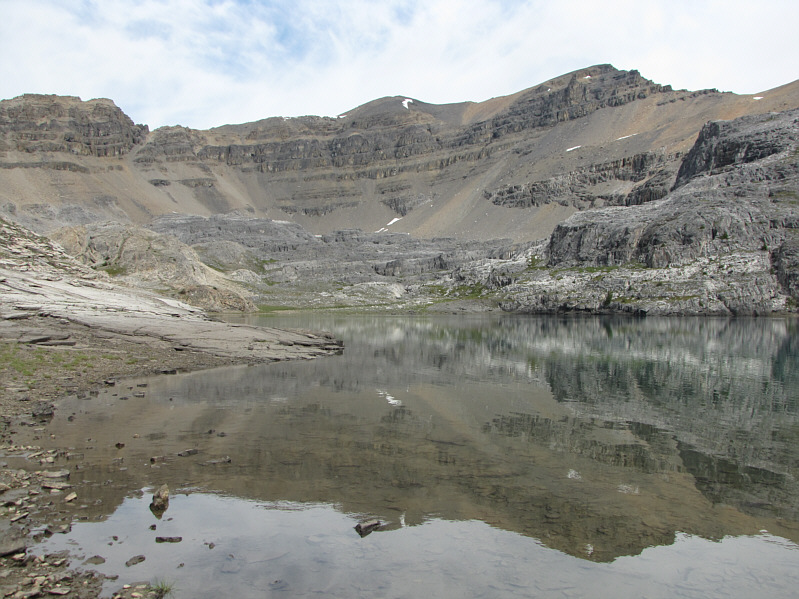
The easiest access to the summit of Noseeum Mountain is via the scree gully to the right of centre. |
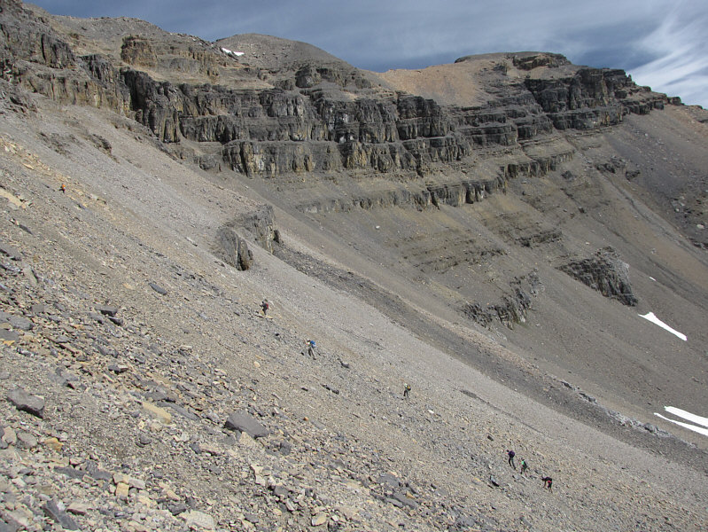 |
Bob leads a ragtag group of hikers up the scree slope. The summit of Noseeum Mountain is at upper right. |
 |
The scree gully is steep and very loose. |
 |
Progress is painfully slow going up the scree gully. |
 |
The scree gully leads to a high col. |
 |
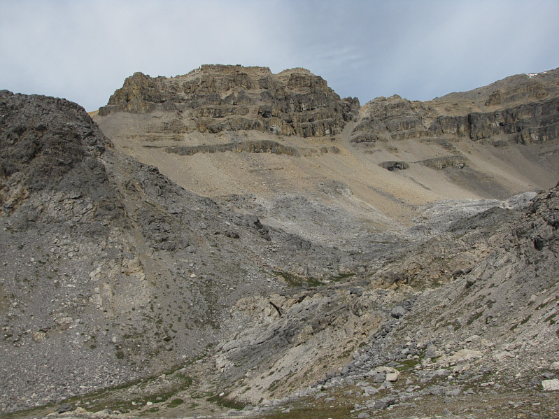
This outlier of Noseeum Mountain towers above the col. |
 |
Bob continues hiking along the ridge. At distant centre is Mount Balfour. |
 |
Bob and the others head for the summit. |
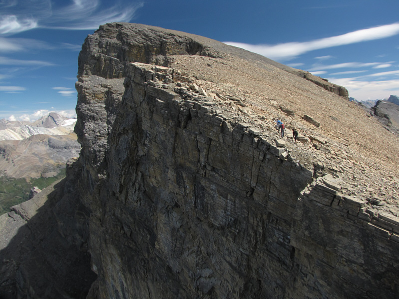 |
The north side of Noseeum Mountain is quite precipitous. |

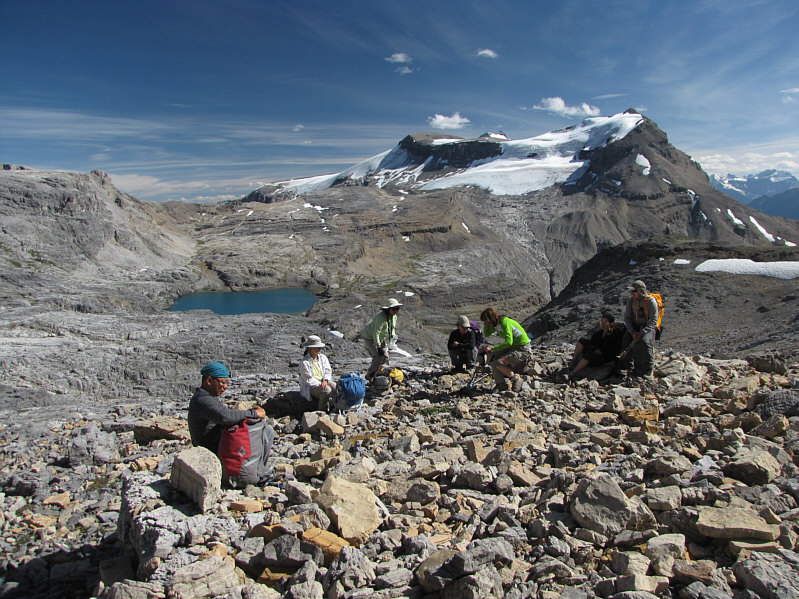
Gathered on the 3001-metre summit of Noseeum Mountain are (L to R) Bob, Sonny, Becky, Hanna, Zora, Wendy, Bernadette, and Jonathan.
 |
Here is a closer look at Mount Balfour to the southwest. |
 |
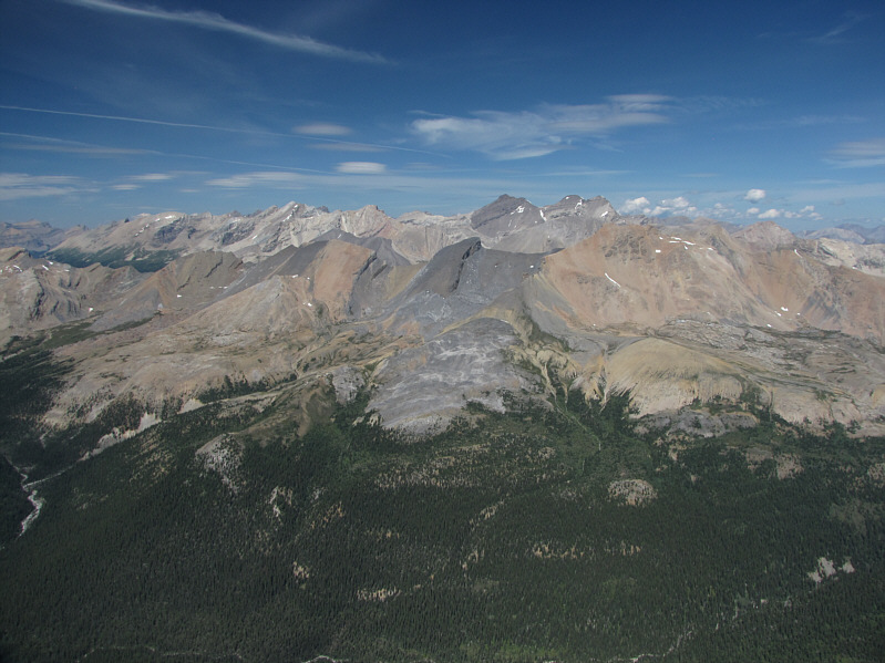
To the west, Bow Lake and Mount Thompson (centre) are the most obvious features. At distant far right are some of the peaks of the Freshfield Icefield, and the snow-clad peak on the horizon just left of centre is Mount Mummery. |
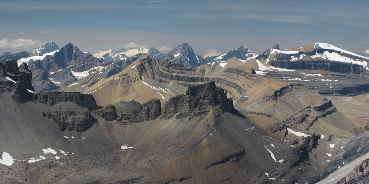
Stretching across the horizon behind Cirque Peak are (L to R) Mount Forbes, Mount Patterson, the Lyells, Howse Peak (centre), Mount Columbia (partially obscured by a small cloud), White Pyramid, Mount Chephren and Observation Peak.
 |
To the north are the three peaks of Mount Willingdon (right of centre). |
 |
An unexpected glacier lies below the southeast ridge of Noseeum Mountain. |
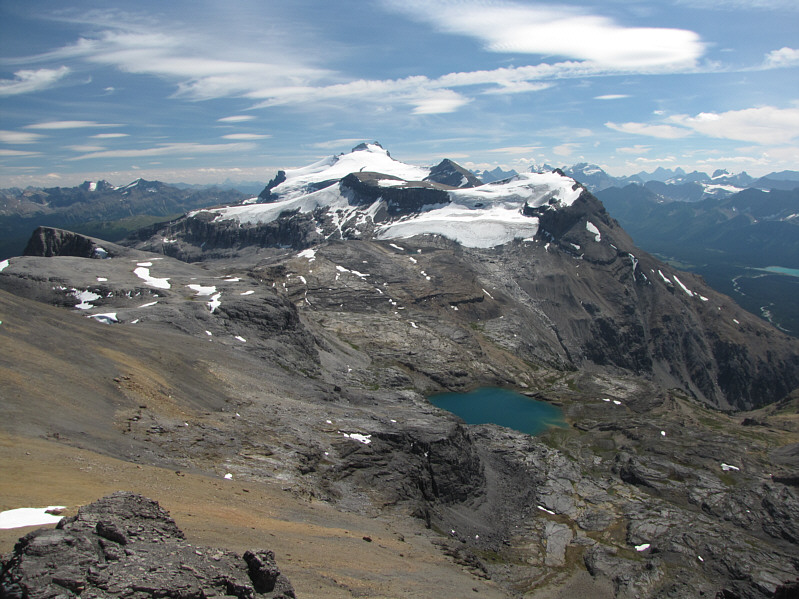 |
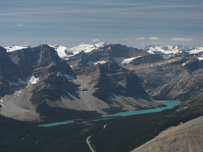
Mount Hector and Noseeum Lake garner the most attention to the south. Also visible to the right of Mount Hector are Little Hector and Mount Andromache. |
 |
Hector Lake is visible to the southwest. The peaks on the horizon include (L to R) the Goodsirs, Cathedral Mountain, Mount Stephen (centre), Mount Vaux, and Mount Daly. |
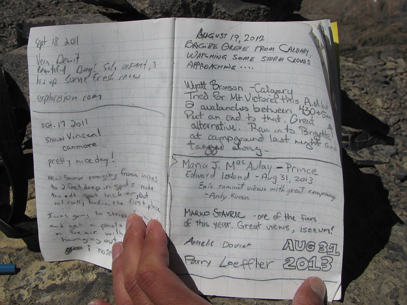 |
There are a few familiar names in the summit register. |
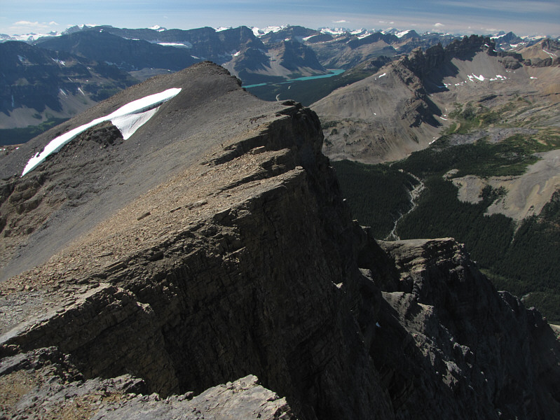 |
The group (barely visible on the ridge) heads back toward a false summit. |
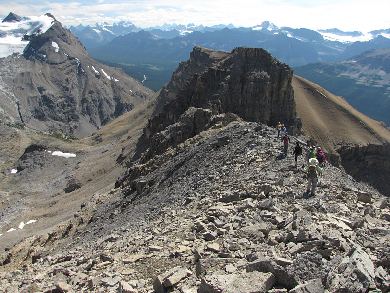 |
The group continues down the ridge to the crux gully. |
 |
The shadows begin to lengthen on the northeast face of Dolomite Peak. |
 |
Descending the gully seems to be
harder than climbing up! Click here to see a video of this descent. |
 |
The gully affords a fine perspective of Noseeum Lake and its environs. |
 |
The group takes a break before the long trudge back to the trailhead. |
 |
Little Hector looks striking from the Noseeum Creek trailhead. |
 |
Total
Distance: 13.7 kilometres Round-Trip Time: 9 hours 25 minutes Net Elevation Gain: 1149 metres |