BOU AVENUE
Mount Racehorse
A poor weather forecast for 28 June 2014
prompted Dinah Kruze, Bob Spirko and me to head to the Crowsnest Pass
region of southern Alberta in hopes of avoiding rainy weather.
Inspired by a trip
report from Trevor Helwig, Bob suggested that we try to ascend
Racehorse Peak, an unofficially named summit to the north of Racehorse
Pass near the south end of the High Rock Range. From the Crowsnest
Highway (Highway 3), we drove about 18 kilometres north on Allison Creek
Road to an obvious turnoff. Although in retrospect I probably could
have driven all the way to Racehorse Pass, we opted to leave my car on
Allison Creek Road and hike the long but easy 4.5-kilometre approach.
When we reached Racehorse Pass, the weather
did not look promising. The top of Racehorse Peak was shrouded in
clouds, and I was not in the mood for expending a lot of energy climbing
to a viewless summit. Furthermore, the prospect of route-finding in
limited visibility was also unappealing. After some discussion, we
opted to try ascending another unnamed peak to the south of the pass.
This unnamed peak is actually mentioned briefly in Alan Kane's
Scrambles in the Canadian Rockies, and from our perspective, it
looked like a relatively straightforward climb without route-finding
worries.
After a short bushwhack through trees, we
emerged onto the open slopes of the unnamed peak. The ascent was
relatively easy and trouble-free, and the few rock bands that we
encountered were easily surmounted or circumvented. The only
negative aspect was arriving at the summit and finding it shrouded in
clouds just like the top of Racehorse Peak. With little to see, we
simply snapped some photographs of ourselves beside the summit cairn
before descending back to the pass. We stopped briefly for a quick
lunch before continuing the lengthy but uneventful hike back to my car.
Despite the lack of summit views and
getting rained on several times, I still enjoyed the good exercise and
the pleasant company. It is likely that we will return in the
future to ascend Racehorse Peak, but the unnamed peak that we climbed has
much to recommend it. As such, Bob and I agreed to give it an
unofficial name of its own--Mount Racehorse. Get it?
Be sure to
check out Bob's trip report
here.
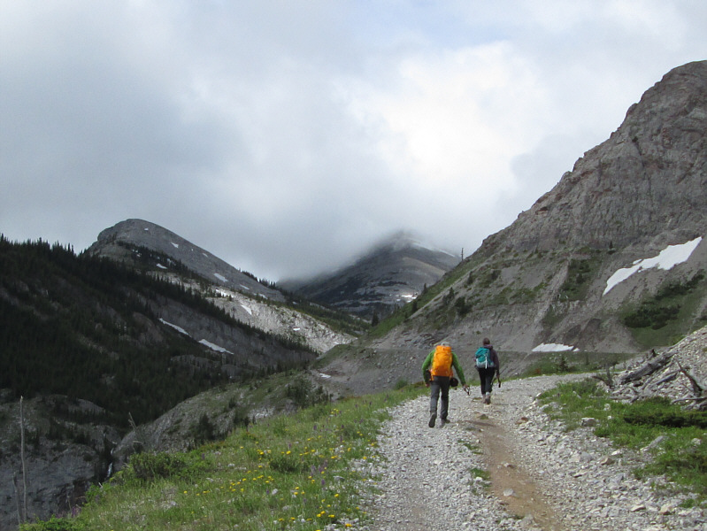 |
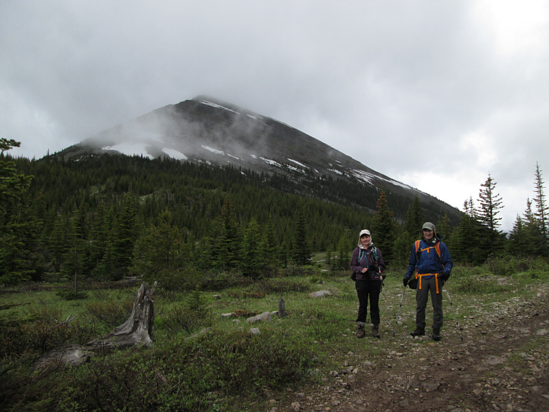
Bob and Dinah walk along the road that leads to Racehorse Pass.
Mount Racehorse is partially shrouded in clouds at centre. |
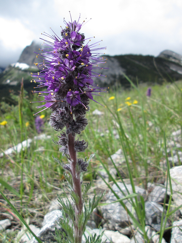 |
Silky scorpionweed is abundant alongside the road. |
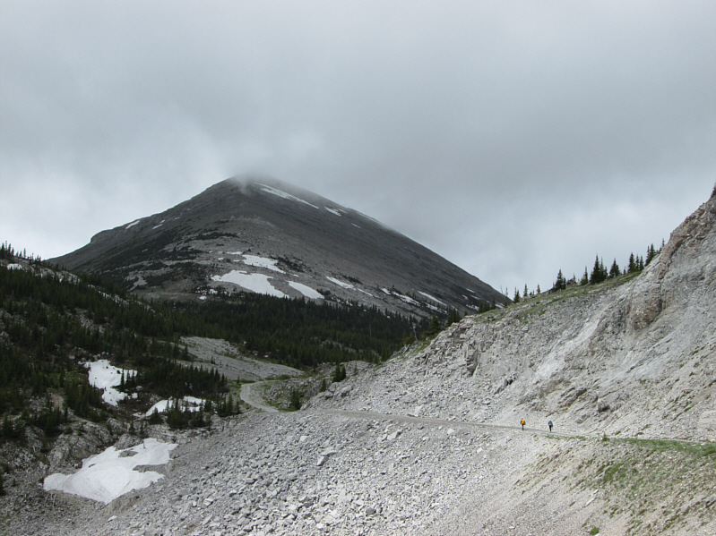 |
The clouds lift somewhat to reveal
more of Mount Racehorse. |
 |
As Bob looks into British Columbia at
Racehorse Pass, Dinah looks discouraged by the prospect of climbing
into clouds on Racehorse Peak. |
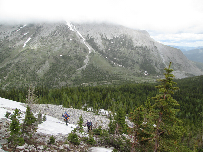 |
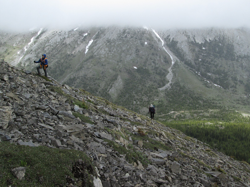
Bob and Dinah emerge from the trees
onto the lower slopes of Mount Racehorse. Across Racehorse Pass
(centre), the top of Racehorse Peak is still shrouded in clouds. |
 |
Dinah makes her way up some rubble. |
 |
Bob and Dinah climb higher up the
slope. |
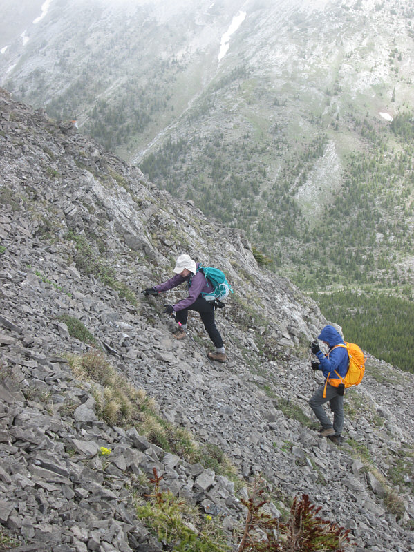 |
There is a little bit of hands-on
scrambling on this slope. |
 |
There are a few false summits along the way. |
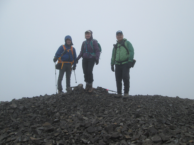 |
Bob, Dinah and Sonny stand beside a small cairn on the
2530-metre summit of Mount Racehorse. |
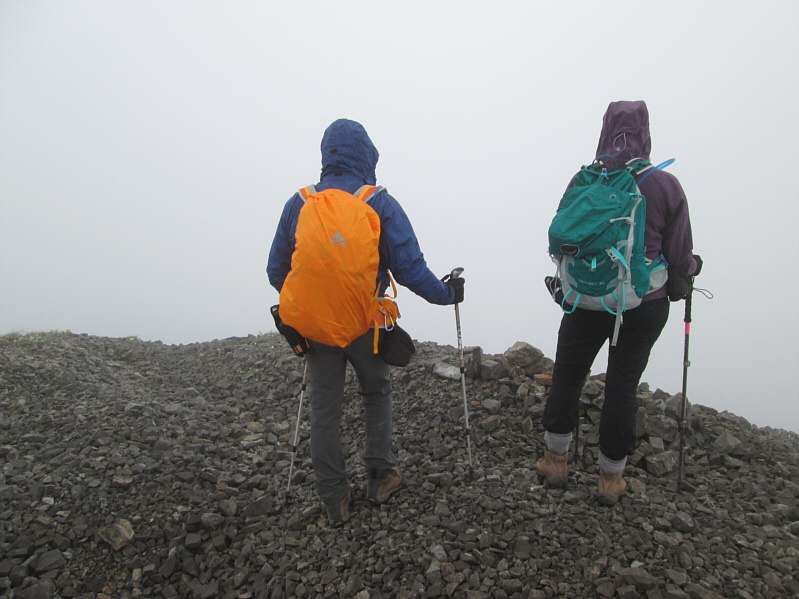 |
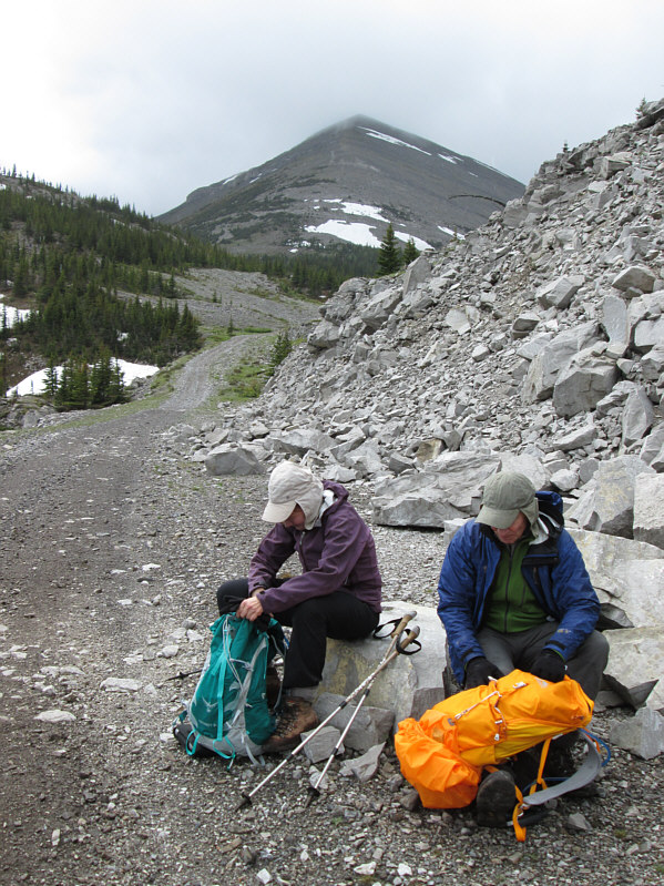
The best views from the summit on this
day are of Bob's and Dinah's new packs. |
 |
Dinah and Bob regain the road near
Racehorse Pass. |
 |
Dinah and Bob stop to have a bite.
Mount Racehorse is still visible in the distance. |
 |
Dinah and Bob hike out below some of the spectacular cliffs of Racehorse
Peak. |
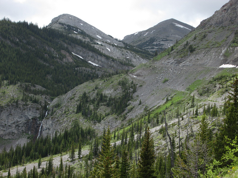 |
Here is one last look at Mount
Racehorse (right). Note the waterfall at left. |
 |
A couple of ATVs pass by along the
road. |
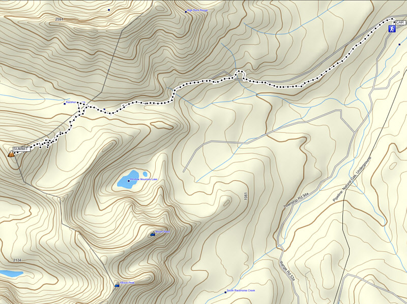 |
Total
Distance: ~11.5 kilometres
Round-Trip Time: 5 hours 7 minutes
Net Elevation Gain: ~820 metres |