BOU AVENUE
Swiftcurrent Mountain

When I visited the Many Glacier area of Montana's Glacier National Park on 6 July 2014, I had plans to scramble up Crowfeet Mountain and Mount Henkel via the trail to Ptarmigan Lake.  Unfortunately, the maze of trails near the start at Swiftcurrent Motor Inn were rather confusing for me to follow, and I inadvertently ended up on the trail to Swiftcurrent Pass instead.  By the time I realized my mistake, I had already reached the shores of Redrock Lake which is about 2.3 kilometres from the trailhead.  Rather than backtracking, I decided to go with Plan B and ascend Swiftcurrent Mountain which is just to the north of its namesake pass.

As previously documented by Andrew Nugara, the ascent of Swiftcurrent Mountain is not technically difficult given that an official hiking trail runs all the way to the summit.  That suited me just fine as I settled into an enjoyable walk up the very scenic Swiftcurrent Creek valley.  With an abundance of lakes, waterfalls and open meadows, this valley is deservedly popular especially with casual hikers.  Not surprisingly, most of them do not proceed beyond the last of the lakes to the headwall where the trail begins to climb in earnest.  I am always amazed when a well-constructed trail rises through seemingly impassable terrain as is the case here.  For me, ascending the headwall was a delight.  The grade never felt too strenuous, and the airiness of the trail afforded some amazing vistas which had me reaching for my camera often.

Higher up, I began to encounter more and more snow patches, and the trail disappeared in a few places as a result.  Fortunately, the snow was well-consolidated and easy to walk upon, and there were also plenty of footprints to follow and stay on track.  From the signed junction at Swiftcurrent Pass, I turned onto a spur trail and climbed about another 400 metres to the summit which is occupied by a fire lookout.  The lookout is actually visible from the pass as well as most of the way up this last stretch which makes the summit look a lot closer than it really is.  Consequently, the climb up to the summit from the pass seemingly felt much longer than it should have been.

I initially had the summit all to myself but was soon joined by several other groups of hikers, most of them coming up from the shorter western approach via Granite Park.  After taking a half-hour break on the summit, I began retracing my steps back down the mountain.  My return trip was largely uneventful although my feet were definitely in distress for the last few kilometres.  It had also been a warm day, and I felt a bit grungy compared to the multitude of fresh-looking casual hikers out for an evening stroll.  What a relief it was to change into some clean clothes back at my car!  As a bonus, it was nice to be able to pick up some refreshments immediately from the convenience store at Swiftcurrent Motor Inn before making the long drive home.
If you know where to look, you might even be able to spot the trail that climbs the headwall. Swiftcurrent Mountain looks striking from the east.  On the left is Swiftcurrent Pass.
Bear grass on the right! Here is a more comprehensive view of Swiftcurrent Mountain from the approach trail.
It's very tempting to lounge around here on a warm, sunny day! 
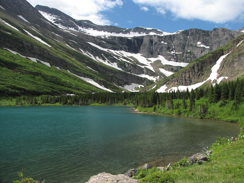
Bullhead Lake is a popular place to stop for many hikers.
Can you spot the trail? 
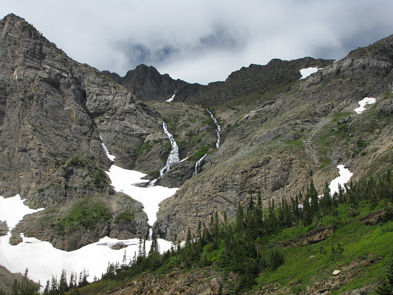
Swiftcurrent Pass is guarded on the east by this spectacular headwall.
Well, I was supposed to be climbing Henkel today... Mount Henkel (left) and Altyn Peak (right) make a colourful backdrop to Bullhead Lake.
And also another very popular place to stop along the trail. 
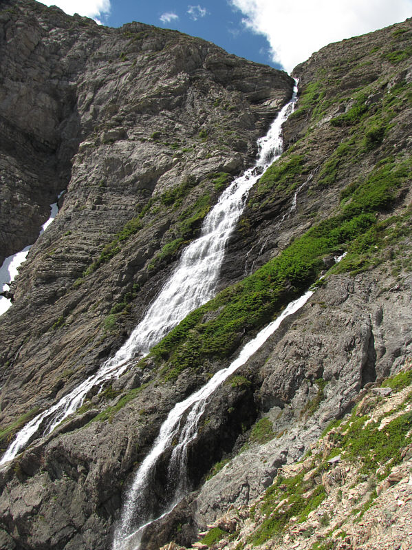
This is one of the more impressive waterfalls cascading down the headwall.
What a view! And we're only halfway up! The views of Swiftcurrent Creek valley improve with each step up the headwall.
Anybody wanna climb Wilbur with me? Windmaker Lake sits at the foot of the south face of Mount Wilbur.
Given the name, there must be some good trout fishing there. Here is a close-up aerial view of Bullhead Lake.
Still some good skiing to be had? 
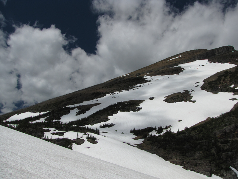
The southern slopes of Swiftcurrent Mountain are still mostly covered with snow.
Took me about 3.5 hours to hike to the pass. Heavens Peak is a real eye-catcher to the southwest from Swiftcurrent Pass.

If you wanna get to Heaven...you gotta raise a little Hell!

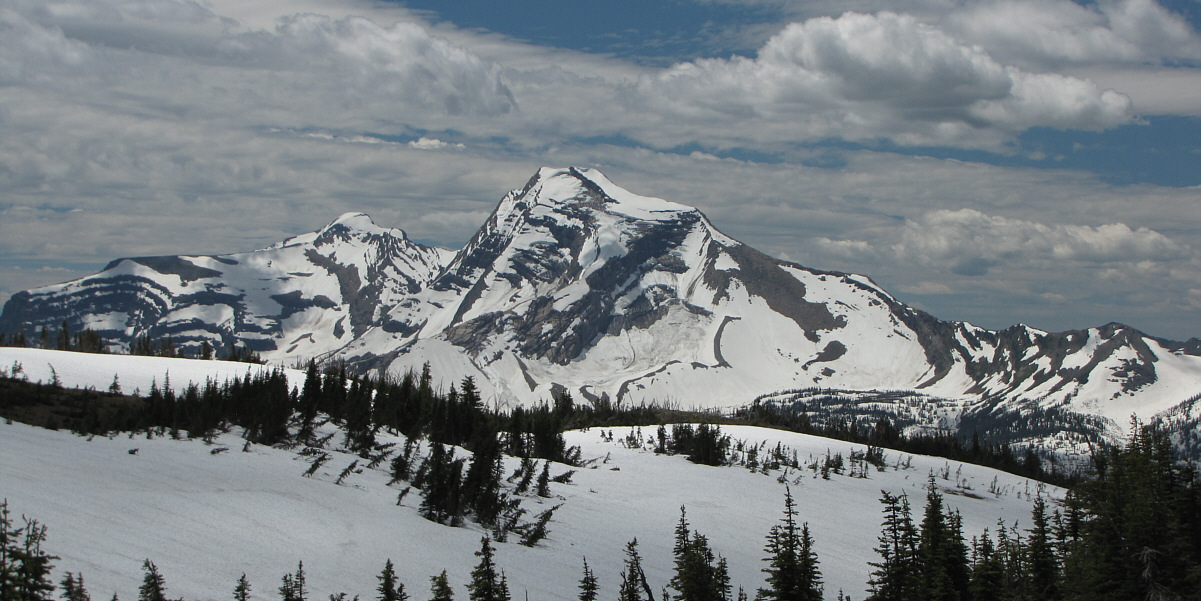
Here is a closer look at Heavens Peak.  To the left is Mount Vaught.

The summit is farther away than it looks... The lookout building on top of Swiftcurrent Mountain is visible from the trail junction at Swiftcurrent Pass.
Sigh...that lookout almost looks farther away now! 
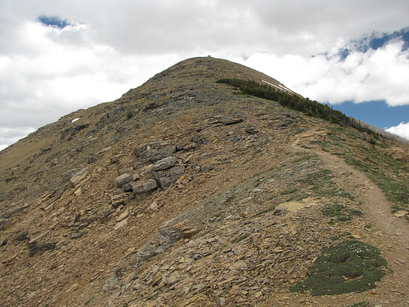
A good trail runs all the way to the top.
No need for reading material when you're doing your business up here! Even the biffy near the top has great views!
It figures; the darn clouds are rolling in just as I reach the summit! The lookout building is closed and unmanned on this day.

Took me ~4.75 hours to hike up here.

Sonny stands near the 2564-metre summit of Swiftcurrent Mountain.

I've only climbed Cleveland, but there are a few others here that I want to climb...soon. 
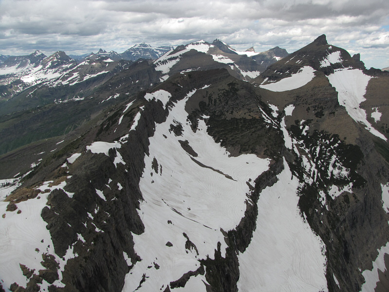
The plethora of named peaks visible on the horizon to the north include (L to R) Cathedral Peak, Mount Kipp, Stony Indian Peaks (multiple pointy peaks), Mount Cleveland, Ipasha Peak (big snow patch), Mount Merritt, Cosley Ridge (triangle on top of glacier), Natoas Peak, and Iceberg Peak.
There are some pretty long approaches for all three of these mountains... 
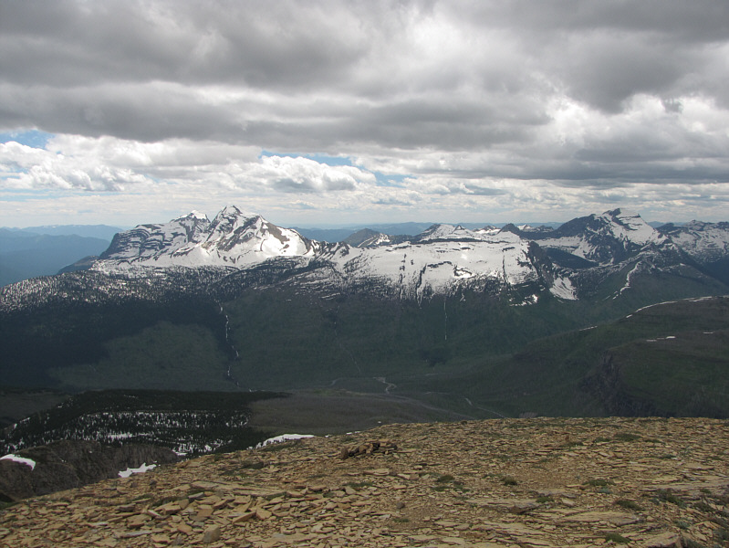
In this view to the southwest, Mount Vaught and Heavens Peak are at left while Longfellow Peak is at far right.
Lotsa peaks I want to climb in this photo! The Logan Pass area is at far left in this view to the south.
Mount Gould is a fantastic scramble. The view to the southeast is dominated by Mount Gould's impressive north face.  Also visible in the distance at left is Going-to-the-Sun Mountain.
This one has gone up on my to-do list! 
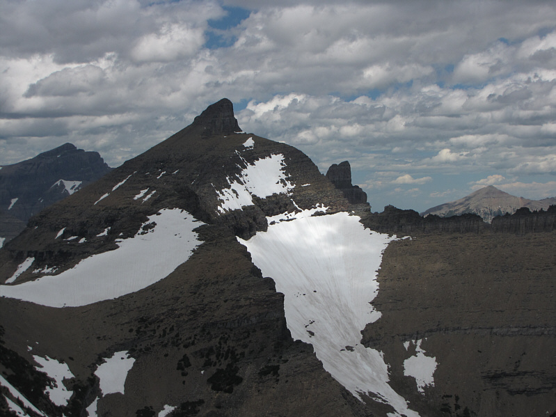
Iceberg Peak's striking form deserves a second look.
Looks like a pretty serious climb...pushing it downward on my to-do list... 
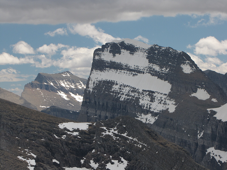
Also worth another look is Mount Wilbur's south face.
Man, I'm a long way from my car!! Lakes abound in this view to the east.
What a cutie! 
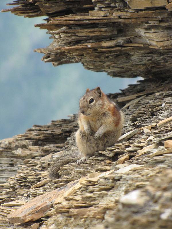
A golden-mantled ground squirrel pauses to scrutinize yet another hiker disturbing its peace.
Not much privacy if you need to pee! There are quite a few dead trees on the slopes of Swiftcurrent Mountain.
Looks like they still need to shovel their front walk. Barely visible through the dead forest are the Granite Park Chalets.
Kinda funny how the marmot's back is seemingly parallel to the rock in front. A hoary marmot peers over the edge of a drop-off beside the trail.
My feet are starting to hurt... 
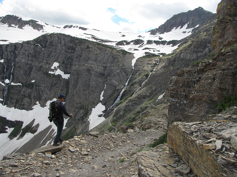
Sonny continues hiking down the headwall.
I almost wanna pet them... Here is one last look at some bear grass.
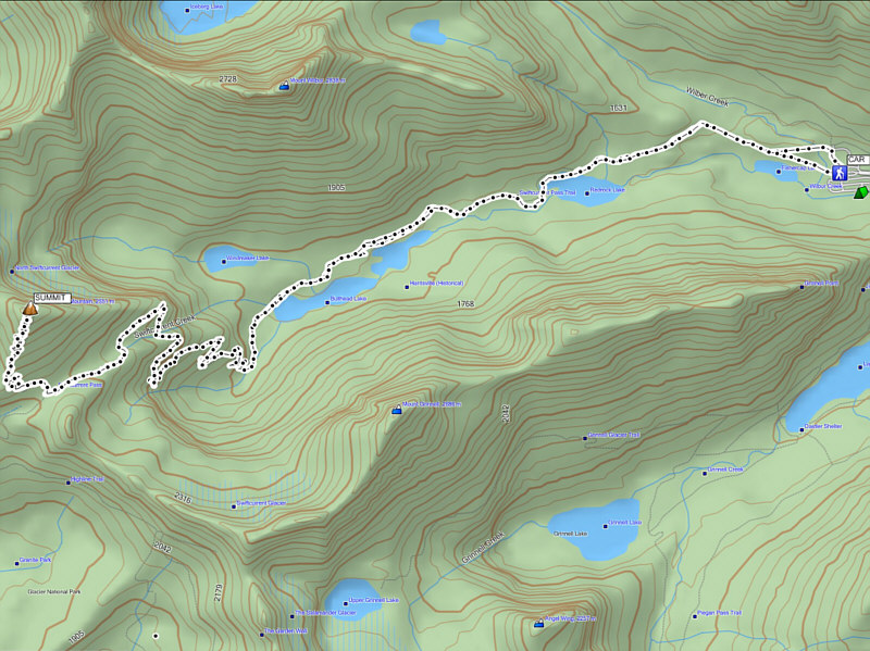
Maybe one of the best hikes in the park! Total Distance:  ~22.5 kilometres
Round-Trip Time:  8 hours 51 minutes
Net Elevation Gain:  1118 metres