BOU AVENUE
West Lion
Anyone who looks northward from Vancouver,
British Columbia on a clear day will likely notice the striking twin
towers of the Lions in the North Shore Mountains. I had been
wanting to climb both towers for quite a few years, but it was not until
recently that I decided to finally visit the area and make a serious
attempt. Descriptions of scramble routes for both West Lion and
East Lion can be found at
summitpost.org, and
the route for the higher West Lion is also described in Matt Gunn's Scrambles in
Southwest British Columbia. There are two different approaches
to the base of the Lions. The longer approach starts from Cypress
Mountain Ski Area and utilizes the Howe Sound Crest Trail (HSCT) while
the shorter approach starts from the village of Lions Bay and utilizes
the Paul Binkert Trail (PBT). Both trails are described in Jack
Bryceland's excellent hiking guidebook, 103 Hikes in Southwestern
British Columbia. The HSCT approach has less elevation gain but
is lengthier in terms of distance while the PBT approach is shorter but
has significantly more elevation gain. A very long day can be
expected either way, but I ultimately settled for the PBT approach
because I felt that the constant elevation gains and losses along the
HSCT would perhaps negate the advantage of starting at a higher
elevation.
After spending the previous night in the
town of Squamish, I drove to the Lions Bay trailhead on the morning of 19 August
2014. Parking at this trailhead is ridiculously minimal.
There is space for about five vehicles in the designated visitor parking
while nearly double the space is inexplicably reserved for residential
parking. Because all the visitor spots were full, I had to park
about 400 metres back on the shoulder of Mountain Drive. Even here,
legal parking spots (ie. no signs) are limited, and I shudder to think
what the scramble for parking is like on weekends.
Returning to the trailhead on foot, I
settled into a long uphill hike through mostly viewless forest albeit on
a well-maintained trail. En route, I passed the access trails for
Brunswick Mountain and Mount Harvey, and after crossing Harvey Creek on a
sturdy bridge, I grinded my way up to a promontory which granted my first view of
West Lion. Feeling a bit exhausted, I stopped for a break here and
feasted on an abundance of ripe huckleberries. It had taken me
nearly 3.5 hours to get to this point, and I was disheartened by the fact
that I still had about 400 metres of elevation gain ahead of me to reach
the summit of West Lion. From the promontory, I followed the
flagged trail up an open
slope before reaching the junction with the HSCT. Some more hiking
and a little bit of scrambling brought me to the top of a rocky knoll
where I finally got my first look at East Lion.
East Lion is technically off-limits to
hikers since it lies within the Capilano Watershed which supplies
Vancouver's drinking water. Whether this is actually enforced is
questionable given the remoteness of the area. Besides, how
could hikers possibly contaminate the watershed any more than the
countless wild animals that must roam the area? Of greater concern
to me was the growing lateness of the day. I was confident that I
could ascend West Lion fairly quickly from the rocky knoll, but tagging
East Lion looked like it would consume at least a couple more hours.
Momentarily ignoring West Lion, I continued along the HSCT which actually
deteriorates at this point to a sketchy scrambler's route.
Following painted markers, I dropped down from the rocky knoll for about
50 metres before making a mildly exposed traverse below the southeast
face of West Lion. The HSCT strengthens into a trail once more
beyond this traverse, and I climbed over the bump, "Middle Lion", which
separates the twin towers. I descended for a short distance after
cresting "Middle Lion" before realizing that I still had to drop a
considerable amount of elevation just to get around the north side of
East Lion and reach the base of the scramble route. Short on time
and energy, my will to continue evaporated, and I quickly turned my
attention to West Lion.
An exposed notch separates the
aforementioned rocky knoll from West Lion, but rather than climbing back
up to the knoll along the HSCT, I scrambled directly up to the notch via
a steep Class 4 gully. A few awkward moves made me question my
route choice, but I eventually climbed out of the gully and gained the
ramp which is the start of the normal route up West Lion. The ramp
itself is down-sloping and exposed, and I took extra care to traverse
this section since Gunn mentions that there had been a fatality here. Beyond the ramp, the route steepens considerably,
and at one point, I actually had to climb through the exposed roots and
branches of a tree to continue upward. Another exposed traverse
higher up also requires some caution, and there was even a fixed rope
here for added security (of course, it is always prudent to test a rope
that has been left exposed to the elements before trusting one's life to
it). Past this second traverse, the remainder of the route to the
summit is an easy and enjoyable scramble.
The disappointment of forgoing East Lion
was tempered by the thrill of standing atop West Lion. Views were
somewhat limited by rolling mists, but the occasional breaks were
marvelously tantalizing. Knowing that I had a long descent ahead of
me, I was on my way down after spending only 15 minutes at the summit.
I had no significant problems retracing my steps back to the notch, but
climbing back up to the rocky knoll was a tricky affair. This
section is perhaps low 5th Class, and there was a rope that had been left
dangling here probably to facilitate the descent from the rocky knoll.
Admittedly, I used the rope while awkwardly climbing a flimsy tree to get
myself up this difficult section. After stopping on the rocky knoll for
a quick snack, I commenced a largely unremarkable but lengthy hike back
down the PBT. The last few metres before my car was highlighted by
a brief dash through a residential sprinkler that spilled partly onto the
road. After changing into some fresh clothes, I drove into
Vancouver to meet a friend for dinner before continuing on to Chilliwack
to check into a motel for the night.
Reflecting on this trip, I thoroughly
enjoyed the difficult scrambling on West Lion, but it hardly makes up for
the long and uninspiring slog up the PBT. If I ever go back to tag
East Lion, I may have to consider trying the HSCT approach instead.
 |
Sonny hikes along the Paul Binkert
Trail (PBT). |
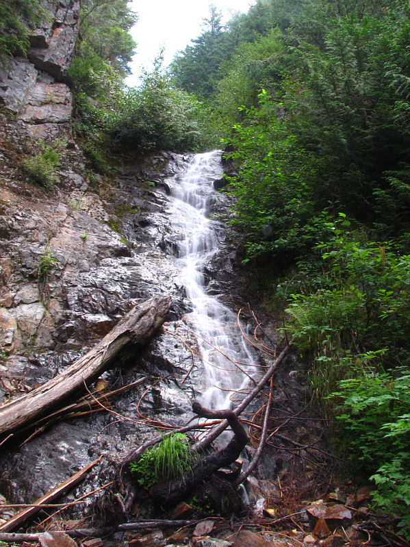 |
Alberta Creek cascades down some rocks
near the trail. |
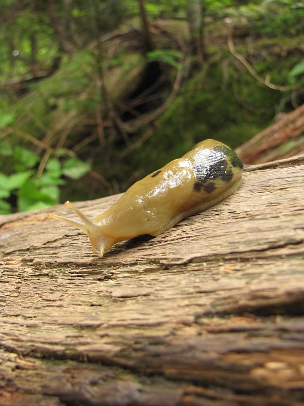 |
A banana slug crawls on top of a log. |
 |
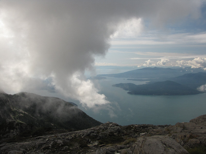
A break in the trees and mist reveals
some scenery in the distance. Hutt Island and Keats Island are
most readily visible at left. |
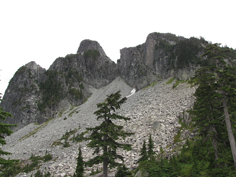 |
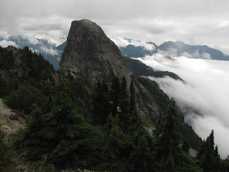
Here is a first look at West Lion
(left of notch at centre) from the promontory. |
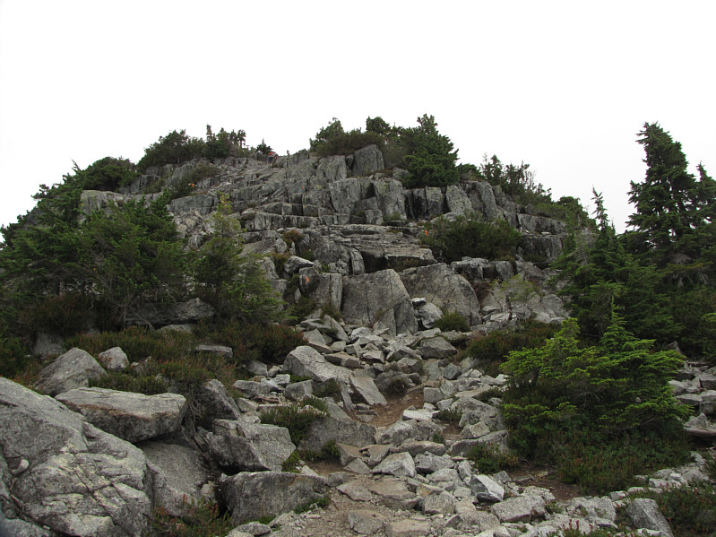 |
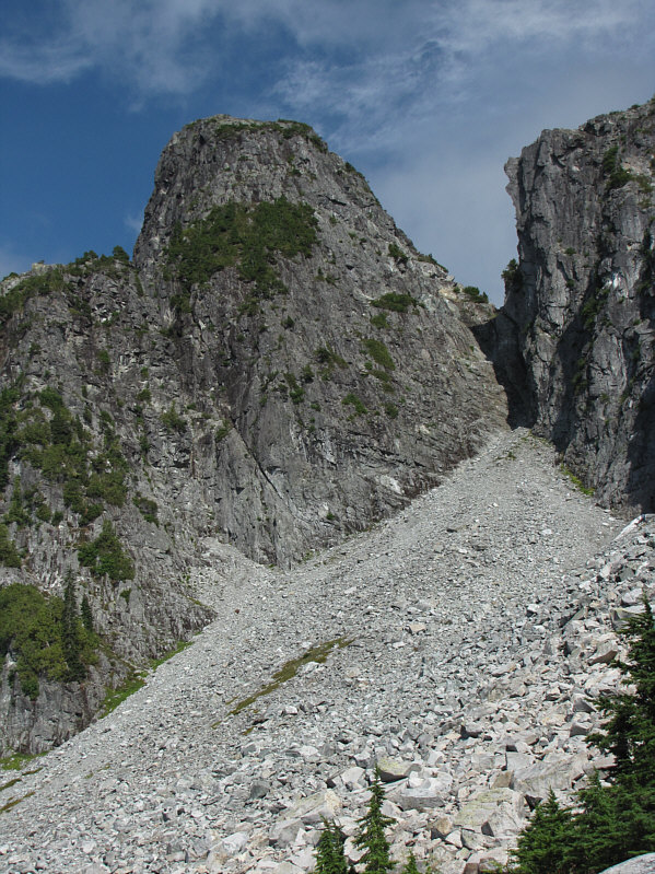
This is the final rise along the Howe Sound Crest Trail
to the top of the rocky knoll. |
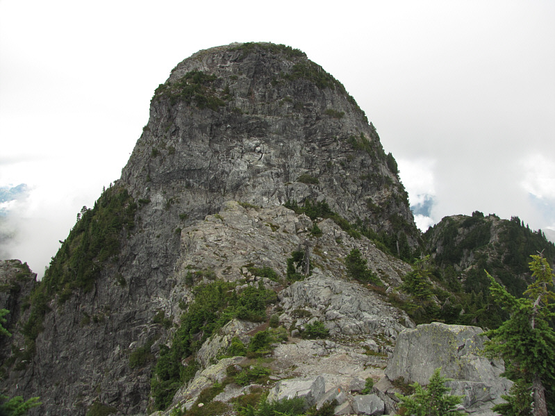 |
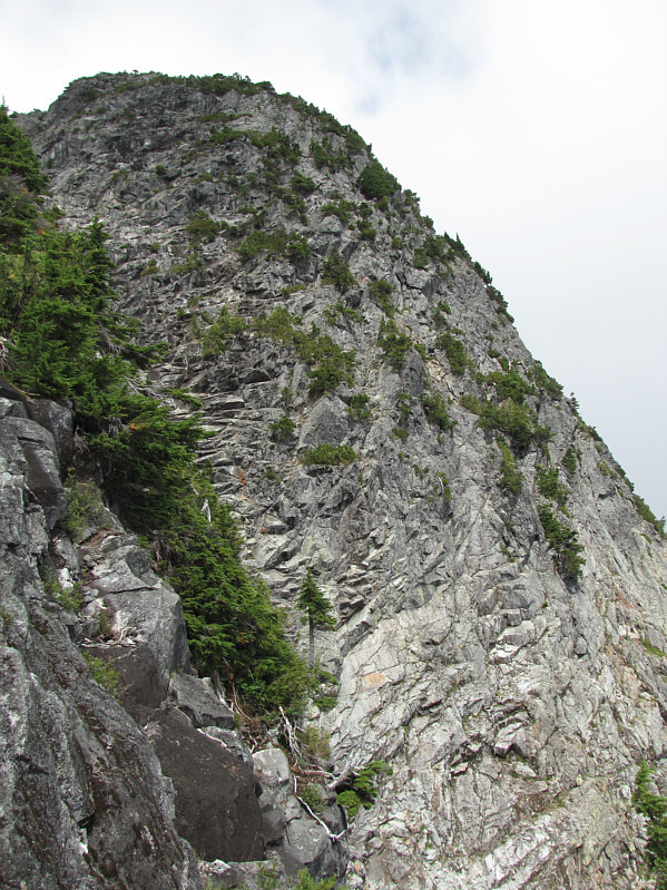
Here is West Lion as seen from the
Howe Sound Crest Trail. The standard route to the top follows
an exposed ledge on the right and goes up the right skyline. |
 |
East Lion emerges from the mist. |
 |
This is the southeast face of West
Lion as viewed from the Howe Sound Crest Trail near "Middle Lion".
The normal route goes up the upper portion of this face. |
 |
The west face of East Lion looks
formidable. Note the significant loss of elevation necessary at
bottom left to traverse safely around the north (left) side to the
base of the scramble route (not visible here). |
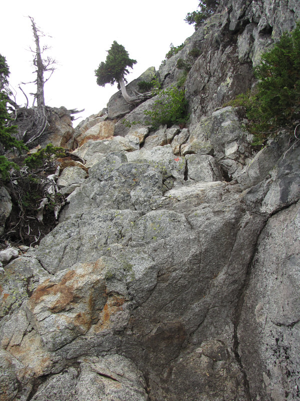 |
The normal route up West Lion is steep
and exposed in places. |
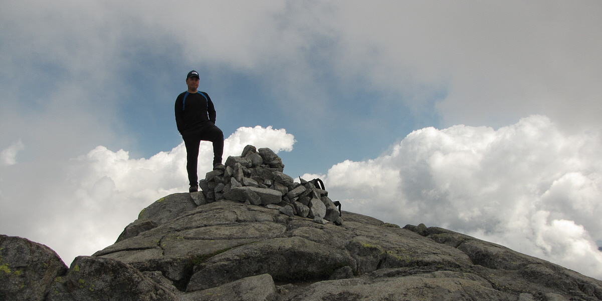
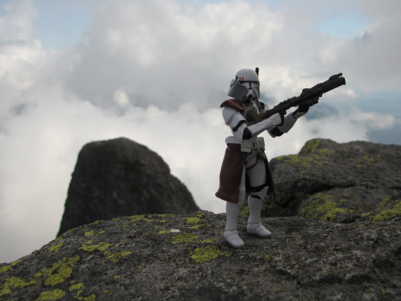
Sonny stands on the summit of West Lion (1641 metres).