BOU AVENUE
Mount Aberdeen And Haddo Peak
Inspired by Matthew Hobb’s recent trip report, Josée Ménard and Fabrice Carrara (goldenscrambles.ca) invited me to join them for a scramble ascent of Mount Aberdeen and Haddo Peak in the Lake Louise area of Alberta’s Banff National Park on 19 July 2015.  Also joining us were Charles Fortin, Jay Lund, and Derek Rowney.  Starting from the trailhead at 5:22 AM, we hiked into Paradise Valley along the official trail until the signed turn-off to Lake Annette.  Here, we continued west along a decommissioned trail which was still generally easy to follow despite some deadfall and overgrown sections.  As per Hobb’s trip report, we stayed north of Paradise Creek and bushwhacked for about 15 minutes before reaching the bottom of a large avalanche gully coming down the south side of Mount Aberdeen.

After taking a short break, we thrashed through some very thick undergrowth before breaking out below the mouth of a short canyon near the bottom of the gully.  Unfortunately, I lost my GPS unit somewhere in the undergrowth, and I backtracked briefly in a vain attempt to locate it.  When I re-emerged empty-handed from the bushes, some of the group who were further up yelled out that there was a bear coming down the gully.  They retreated to a bench to climber’s right of the canyon to allow the bear a chance to pass.  Fabrice had hung back to wait for me, and together, we both also veered to climber’s right to avoid the bear which we could now identify as a grizzly.  Fortunately, the bear paid little attention to us and nonchalantly disappeared into the thick undergrowth from which we had just emerged.  All things considered, we were very fortunate to encounter the bear before entering the short canyon where there would have been no room to maneuver.  Perhaps we were also very fortunate not to run into the bear in the thick undergrowth as well.

Entering the short canyon, we hiked up the same beaten path the bear had come down and even spotted some fresh scat.  Unfortunately, there would be little further excitement for the next three hours as we slogged up hundreds of metres of tedious treadmill scree.  A large snow patch about three-quarters of the way up helped alleviate some of the drudgery, and we took frequent breaks to re-fuel and re-hydrate.  We eventually reached the shoulder at the top of the gully where we were afforded some eye-popping views of Mounts Lefroy and Victoria.  Another short but steep plod brought us to the summit of Mount Aberdeen.

None of us were on top of Mount Aberdeen for long before we started descending the summit ridge toward Haddo Peak.  After a short traverse along the exposed ridge, we easily descended a break in the cliffs which allowed us access to the glacier on Mount Aberdeen's east face.  A rocky bench just below the break in the cliffs allowed us a comfortable spot to don our crampons and break out our ice axes.  While some of the snow on the glacier was not as supportive as we would have liked, we generally had no issues getting down to the dry col between Mount Aberdeen and Haddo Peak.  We ditched our crampons there and enjoyed an easy walk to the summit of Haddo Peak.

Although there were discussions earlier in the day about descending into Paradise Valley directly from Haddo Peak, the uncertainty of attempting such a tricky descent persuaded us to stick with the tedious but straightforward return over the summit of Mount Aberdeen.  The climb back up was actually quite enjoyable, and I began to understand why most mountaineers would probably still prefer to ascend Mount Aberdeen via the classic glacier route.  From the top of Mount Aberdeen, we basically retraced our steps down the large avalanche gully.  Some sections of scree were loose enough to afford some decent surfing, and the aforementioned snow patch provided a much-welcomed opportunity for glissading.  There was no sign of the bear when we reached the bottom of the avalanche gully, and I half-heartedly searched for my missing GPS unit but to no avail.  Hoping to minimize bushwhacking, we continued down to the north bank of Paradise Creek where we found bits of trail to follow downstream.  Unfortunately, we still had to contend with some heinous bushwhacking along the way, but we eventually regained the decommissioned trail much to our relief and none the worse for wear.  The rest of the hike out was easy but painfully long, and we did not arrive back at the trailhead until 7:33 PM (round-trip time of 14 hours 11 minutes).  Tired but happy, we all parted ways from the trailhead, and I had ample time on the drive home to reflect on the ups and downs, both literally and figuratively, of a most memorable trip.

Be sure to check out Josée's and Fabrice's trip report here.
Where's the dolphin?? 
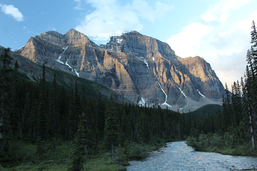
Paradise Creek flows below the great north face of Mount Temple.
Look! That's where we want to bushwhack! The group gets their first good look at Mount Aberdeen (left) from the decommissioned trail.
Was it really only 15 minutes to bushwhack through here? Seemed a lot longer! 
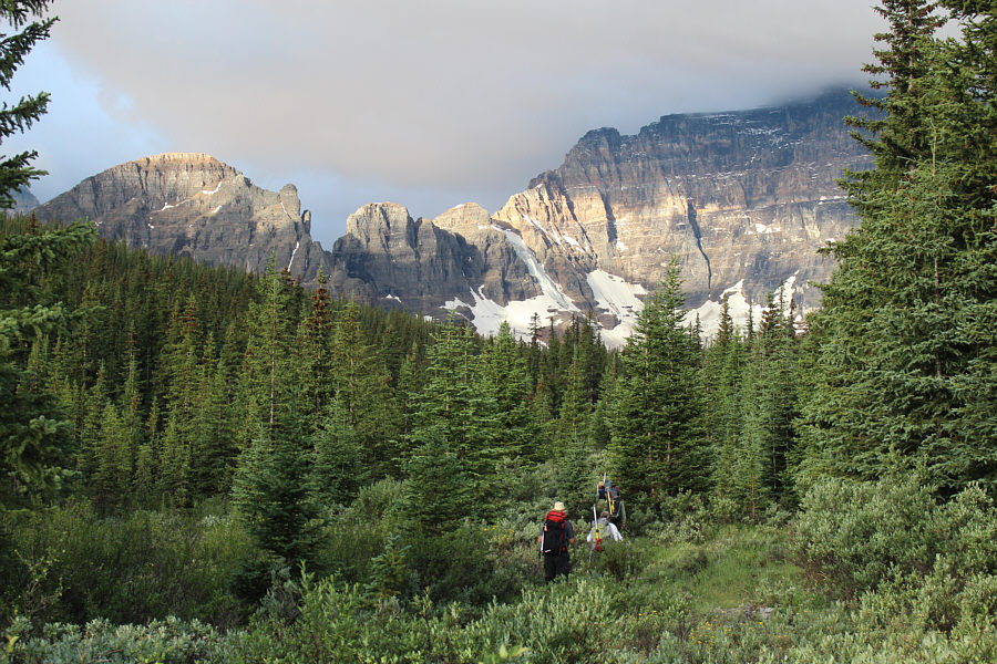
The group disappears into the bush after leaving the decommissioned trail.  At left is Wastach Mountain.
I lost my precious Garmin eTrex 20 somewhere here! :-( 
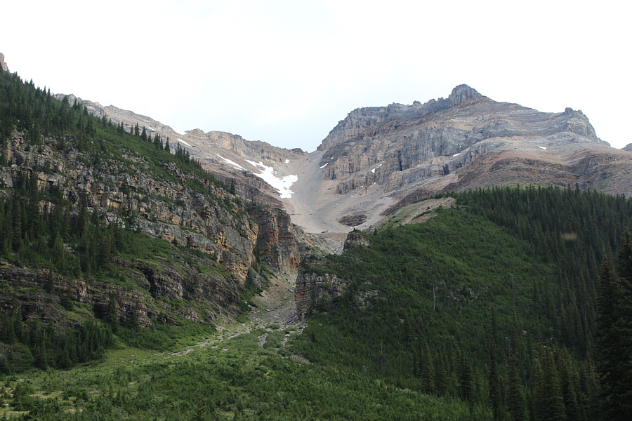
This large avalanche gully grants easy access to the top of Mount Aberdeen (right).
Last chance to fill up water bottles here! 
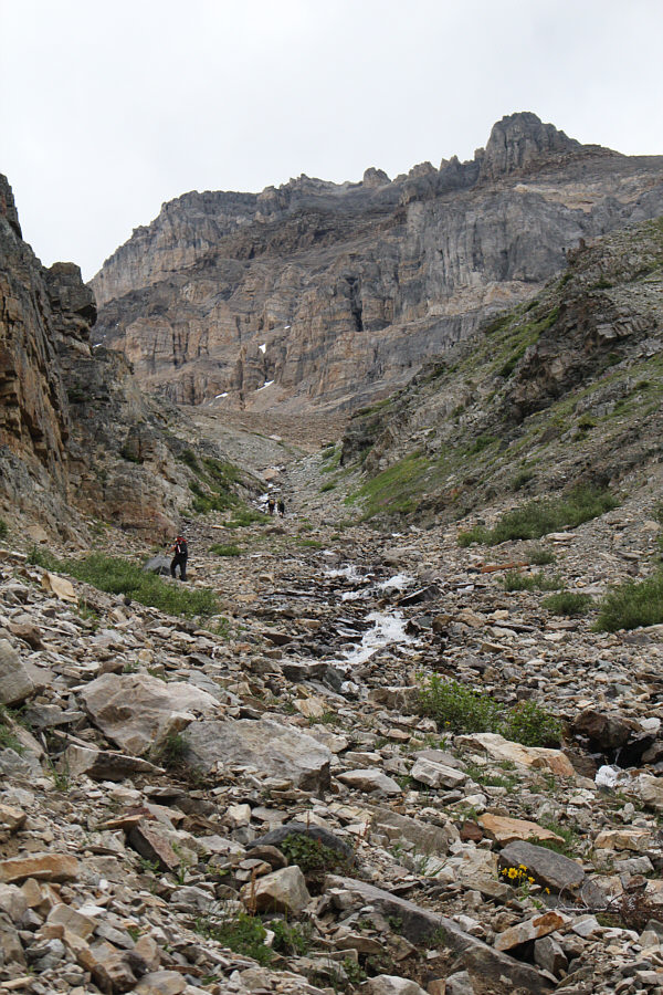
The group hikes just beyond the short canyon near the bottom of the gully.
Good place to sit and scratch your own back! 
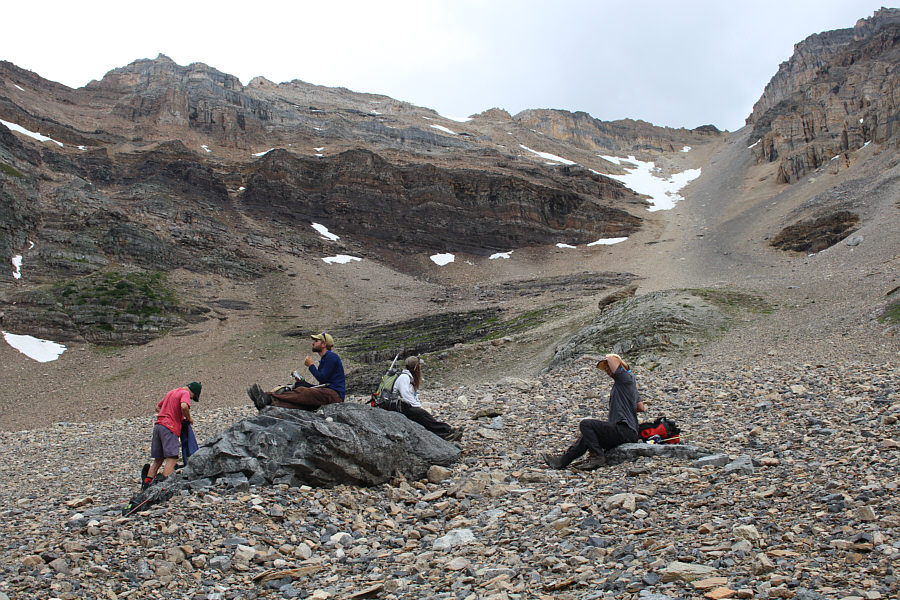
The group pauses for one of several breaks en route to the top.
Must we continue? 
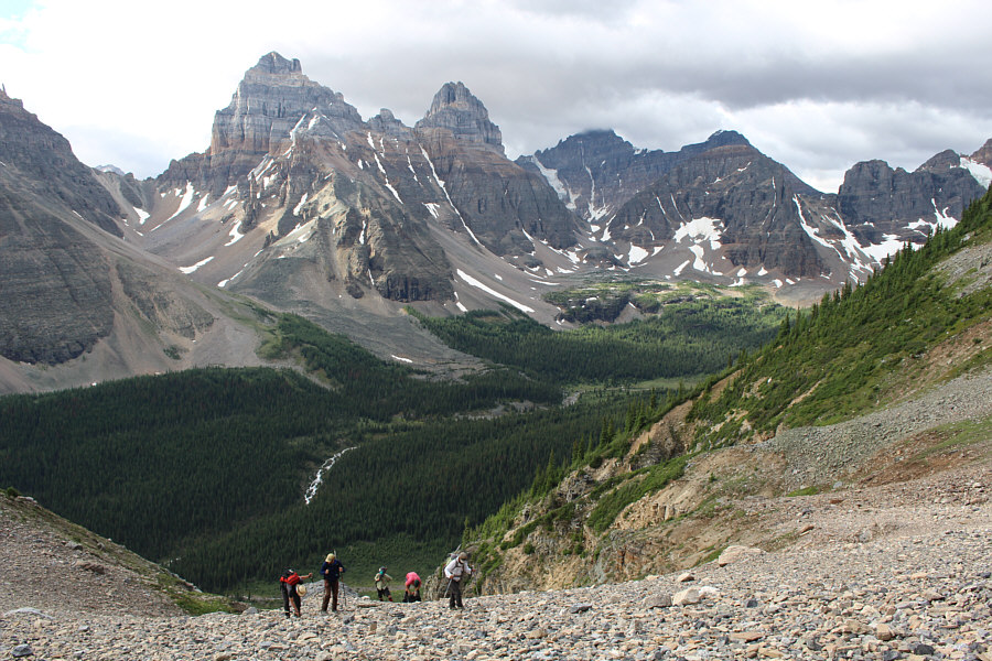
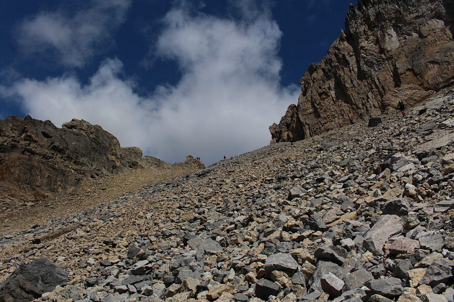
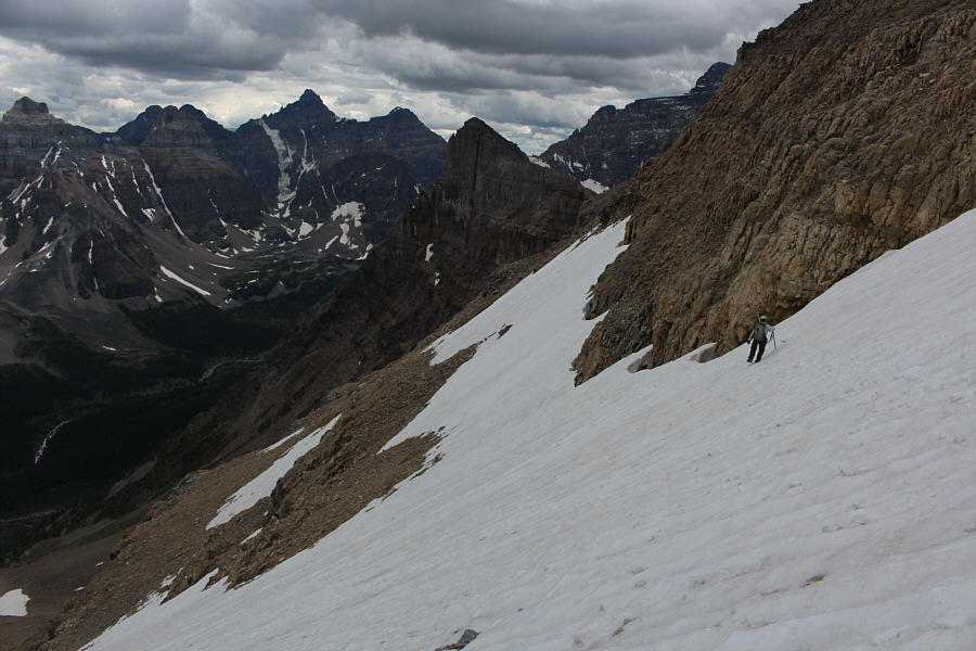
The slog continues up the scree slope.  On the far side of Paradise Valley are (L to R) Sentinel Pass, Pinnacle Mountain, Eiffel Peak, Deltaform Mountain (shrouded in clouds), and Neptuak Mountain which is nearly hidden behind Wastach Mountain.
I like these. Try not to step on them! 
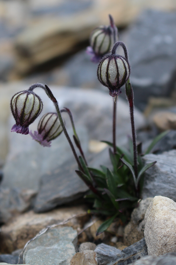
Lots of nodding cockles (Silene uralensis) grow in the avalanche gully.
Wish there was more snow in this gully! 
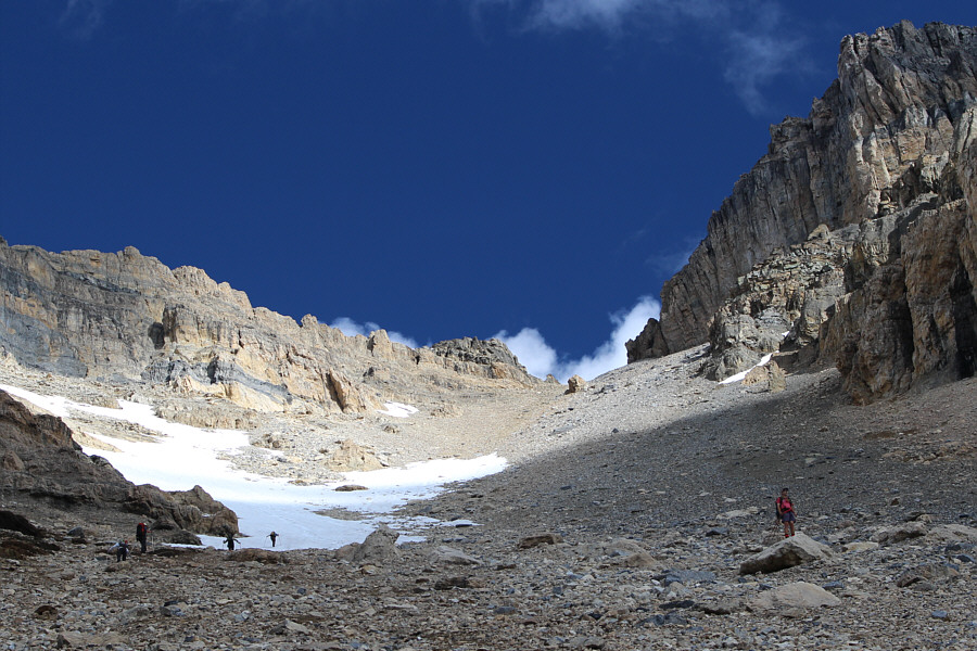
The group takes advantage of the lingering snow patch which is much easier to ascend than the rubble.
Maybe Matt Hobbs can find us a scramble route up that behemoth... The top of Hungabee Mountain is barely visible in the clouds.
The rubble here really, really sucks! Although it looks like a col from below, the gap is actually a shoulder below the summit block of Mount Aberdeen.
Charles looks so cool and relaxed! 
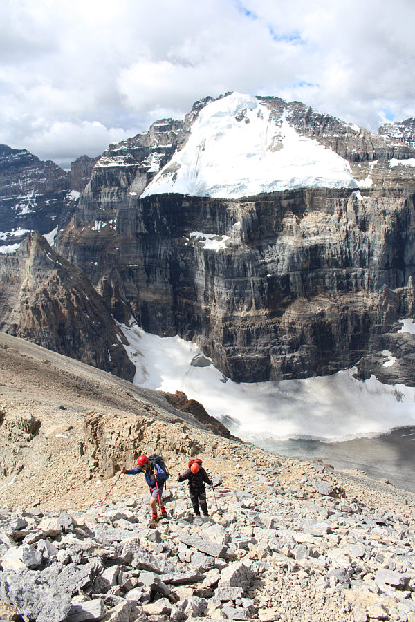
The group stops for a rest at the shoulder.  Mount Lefroy (far left) and Mount Victoria dominate the background.
Just in case you hadn't quite got your fill of rubble coming up the avalanche gully... The group pushes up the last stretch before the summit.
Motorcycle talk going on down there! Fabrice and Derek climb up from the shoulder.  Mount Lefroy gleams in the sunshine.
Everyone at the top is already eyeing Haddo Peak on the other side! Fabrice takes the last few steps before the summit.
Probably a ton of people on Fairview Mountain today. 
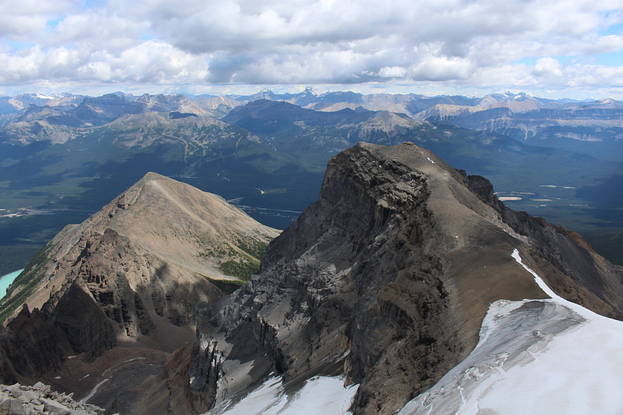
Fairview Mountain and Haddo Peak garner the most attention in this view looking east from the summit of Mount Aberdeen.

 Don't know if I'll ever climb any of these mountains...

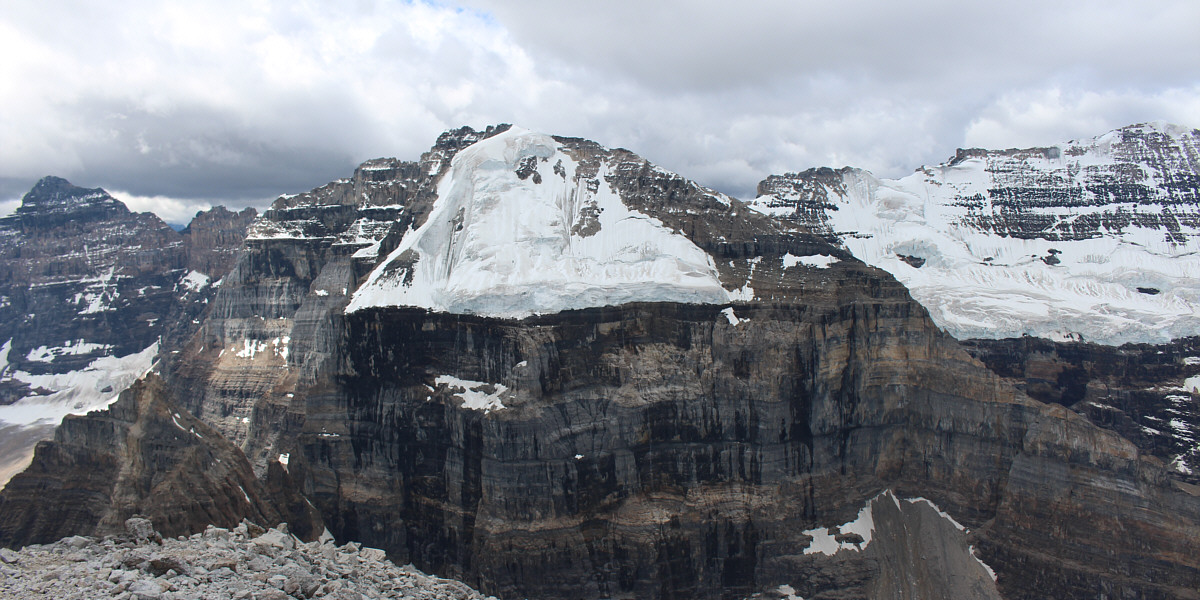
Mount Lefroy is the centrepiece in this view to the west and is flanked by Hungabee Mountain (left) and Mount Victoria (right).


I guess I could have walked out a bit further to get a better picture of Lake Louise! The view to the north includes Mount St. Piran and Lake Louise.  Also visible in the distance is Mount Hector (left of centre) and a bit of Hector Lake (far left).
Smell my finger! Sonny stands on the 3159-metre summit of Mount Aberdeen.  Behind him is Hungabee Mountain.
Not a good place to trip! 
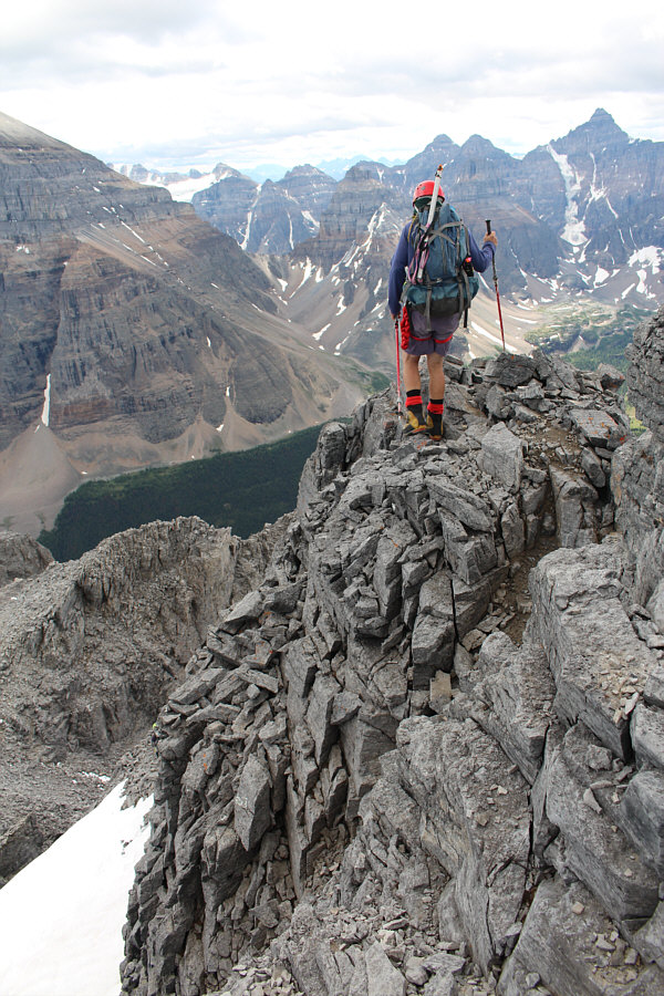
Fabrice traverses the exposed summit ridge.
Yep, we're all unroped.  Good thing someone else is in the lead! 
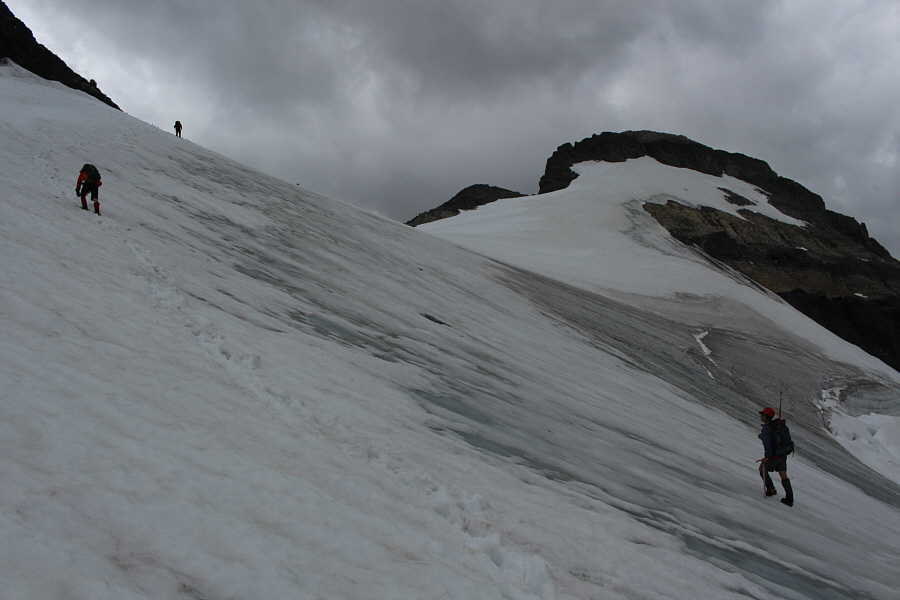
The group descends the glacier on the east side of Mount Aberdeen.
Get your free ice axes and crampons here! The group leaves the yard sale at the col and heads for the summit of Haddo Peak.

 Just another bunch of crazy peak-baggers!

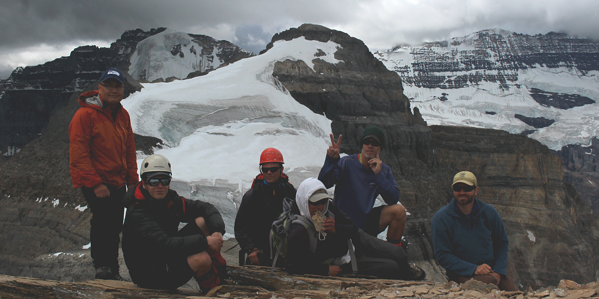
Sonny, Charles, Derek, Josée, Fabrice, and Jay gather on the summit of Haddo Peak with Mount Aberdeen behind them.


Is that a smile or a grimace? Sonny is all smiles while standing on the 3084-metre summit of Haddo Peak.
The glaciers almost look as wispy as the clouds. To the west are Mount Victoria (in clouds), Collier Peak (centre), and Popes Peak (right).
Not a great photo, but it shows how much higher Haddo Peak is compared to the other three mountains named. Fairview Mountain, Saddle Mountain, and Sheol Mountain occupy the foreground in this view to the east.  The Lake Louise ski area can be seen across the valley at left.

Mountain porn at its finest!

Southeast of Haddo Peak is Lake Annette and Mount Temple.

Can't believe we descended all that ice and snow...and now we gotta climb back up all of it! 
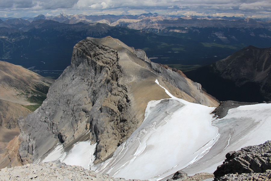
The best view from the summit of Haddo Peak is that of Mount Aberdeen and its splendid glacier.
Looks kinda like an artillery shell... 
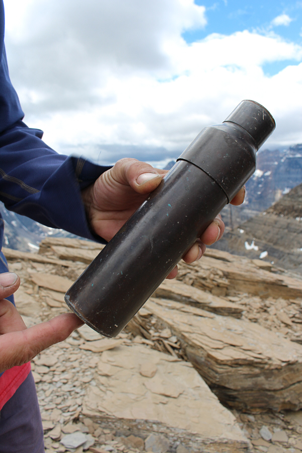
An old-school copper tube houses the summit register of Haddo Peak.
Anyone remember those cheap Alberta Centennial Mountain Expedition canisters?? 
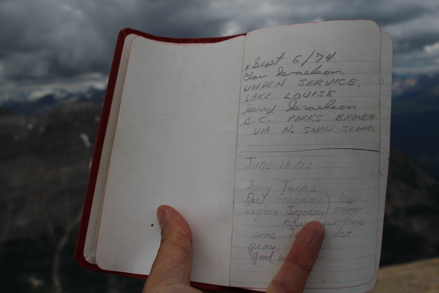
The register is in remarkably good shape after nearly 41 years.
Best climbing of the day! 
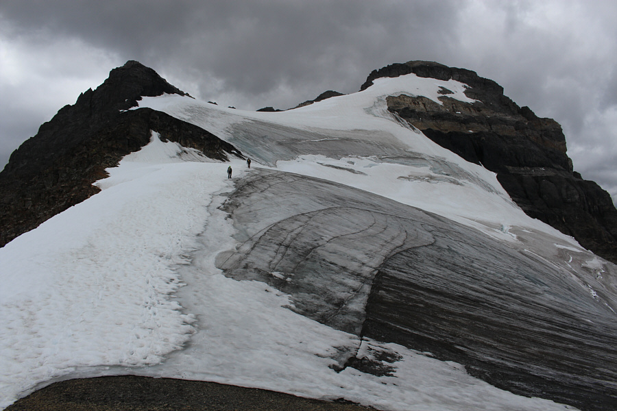
The group climbs back up the glacier toward Mount Aberdeen.
Either way, this is so much better than climbing rubble! Fabrice (lower right) elects to walk where the snow coverage is thinner to give his crampons better purchase on the ice.
Hmm...I don't remember those clouds looking so menacing! The group approaches the summit block of Mount Aberdeen.
Looks almost like an Escher drawing! 
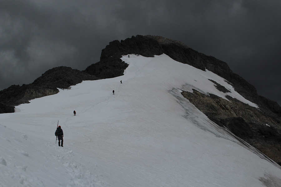
The group climbs back up the summit ridge.
See ya later, Haddo! Here is one last look at Haddo Peak from Mount Aberdeen.
The steepness was right on the edge of my comfort level! Josée traverses the large snow patch in preparation for a lengthy glissade.
We're not out of the woods yet! 
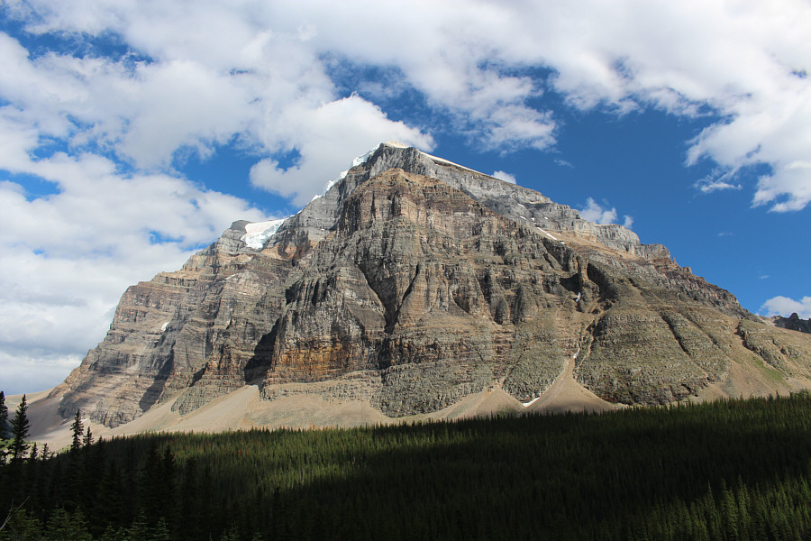
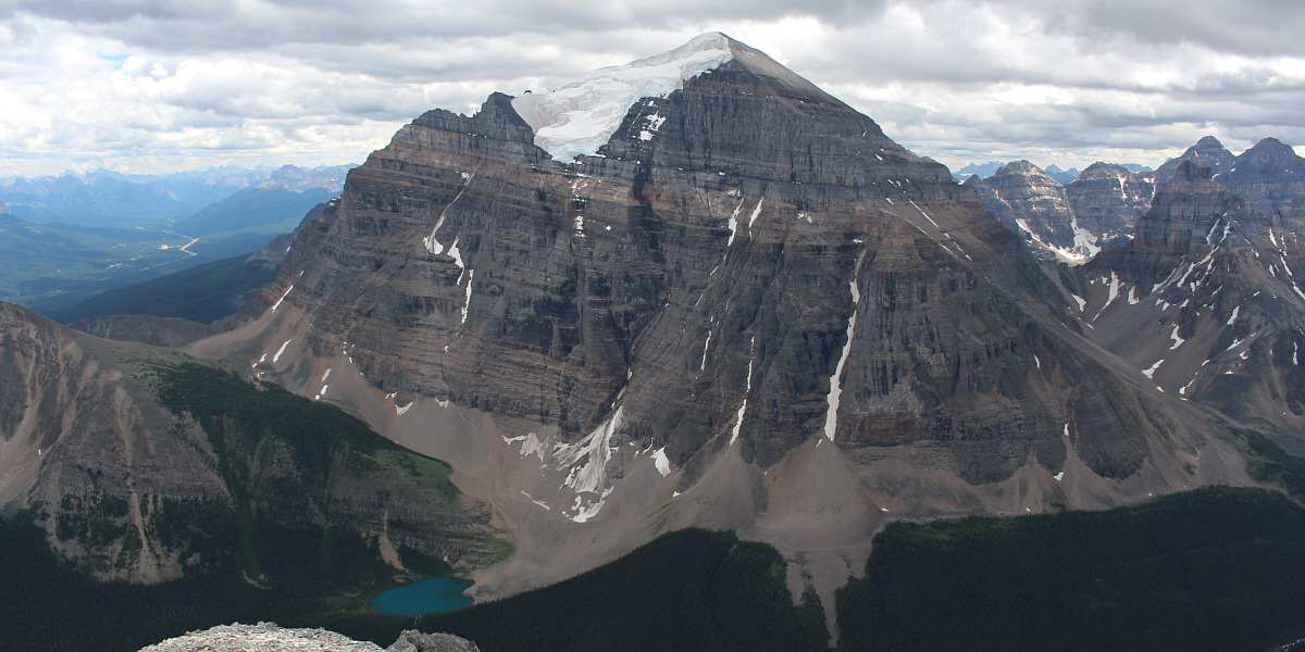
The last good view of the day is of Mount Temple.