BOU AVENUE
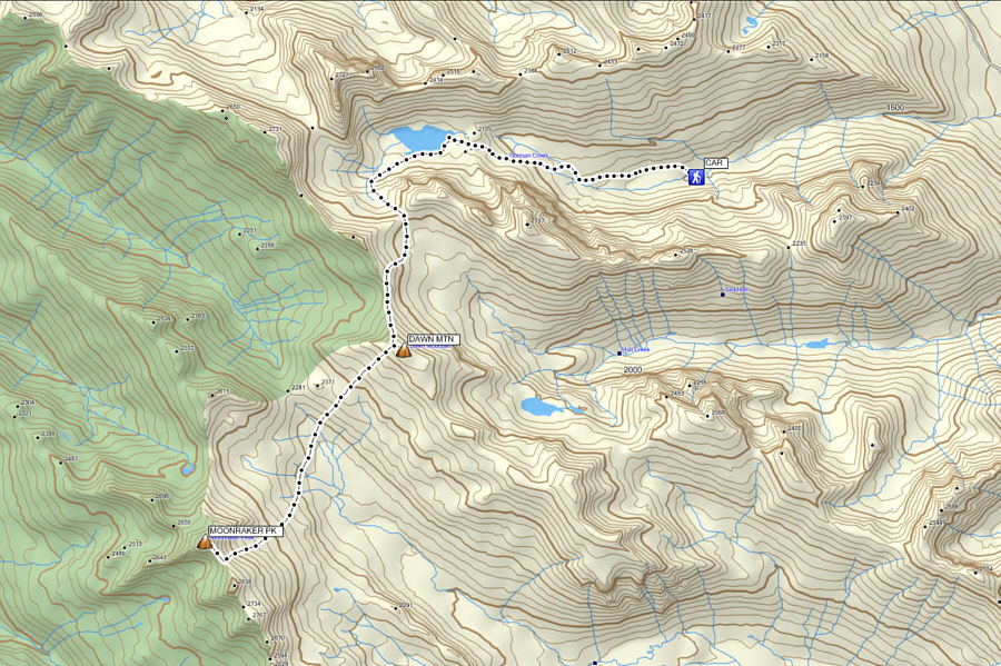
Dawn Mountain And Moonraker Peak
After spending three relaxing days at
Kicking Horse Mountain Resort near
Golden, British Columbia, I finally hooked up with Josée Ménard and
Fabrice Carrara (goldenscrambles.ca)
on 28 June 2015 for a strenuous hike in their backyard playground.
Having been thwarted on a previous attempt, they were keen on returning
to climb Moonraker Peak and Dogtooth Peak on the eastern
boundary of Glacier National Park. The trip would also entail
climbing over Dawn Mountain which Josée and Fabrice climbed in 1998. Access would be from
outside the park via Gorman Lake, an area that Josée and Fabrice are both
very familiar with since they have climbed most of the peaks surrounding
the lake. I knew very little about the area and its surrounding
peaks, but with the great weather forecast, I was game for just about
anything. This would turn out to be a good example of how ignorance
is bliss!I was a bit
sleep-deprived when I met Josée and Fabrice at 5:22 AM in the parking lot
at the junction of the road leading to Golden Golf Club which also
happens to be where Josée works during the summer. I threw my pack,
poles and ice axe into the back of Fabrice's truck but inadvertently
forgot my GPS unit in my car. By backcountry standards, the road to
the Gorman Lake trailhead is in pretty good shape although lots of side
roads may cause some confusion. Thankfully, Fabrice knew the road
well, and we arrived at the trailhead just as the sun was beginning to
creep above the eastern horizon. Mosquitoes were already in a
feeding frenzy, and we quickly geared up and started hiking up the trail.
It took us an hour to reach Gorman Lake, and we continued on a good trail
which runs briefly along the south shore before rising toward the basin
southwest of the lake. The trail eventually peters out, but we kept
climbing up loose rubble and then snow patches to reach the Gorman-Holt
col.
From the col, we dropped down briefly
into upper Holt Creek basin before climbing up to the north ridge of Dawn
Mountain. Much of this ridge was guarded by a large snow cornice,
but we were able to circumvent it albeit somewhat awkwardly. Once
on the crest of the ridge, we descended slightly before easily scrambling
up to the shoulder of Dawn Mountain. The broad summit is only a
short distance away from this shoulder, but having already climbed Dawn
Mountain, Josée opted to wait while Fabrice and I trudged the last few
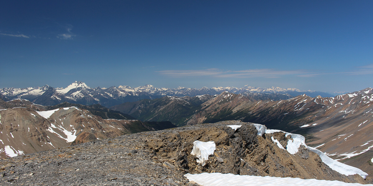
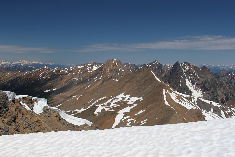
metres to the summit cairn. The panoramic view from the top of Dawn
Mountain was exceptional on this day, but it was a bit daunting to see
Dogtooth Peak and Moonraker Peak across the upper Canyon Creek basin.
In my tired state, it was hard enough to consider losing about 500 metres
of hard-won elevation only to have to gain it back and then some to reach
the tops of the two distant peaks. Worse was knowing that we would
have to do it a second time on the way back by dropping into the basin
and climbing nearly to the top of Dawn Mountain again. Admittedly,
I was tempted to just sit and relax on Dawn Mountain while Josée and
Fabrice continued on, but it would have felt rude doing so.
Instead, I followed Fabrice and Josée down into the basin, and we
methodically worked our way up into the snow-filled cirque separating
Dogtooth Peak from Moonraker Peak. We donned our crampons here and
began climbing straight up the increasingly steep snow slope.
Higher up, we opted to trudge up loose dirt and rocks while still wearing
our crampons since the snow quality was deteriorating. Josée led
all the way up, and both she and Fabrice appeared to be tireless.
I, on the other hand, struggled to keep pace and constantly fell behind
them. This would be a recurring theme for the rest of the trip.
When I finally joined Fabrice at the col
between the two peaks, Josée was already near the top of Dogtooth Peak.
Despite the easy walk-up from the col, Fabrice was quite content to
forego tagging the summit of Dogtooth Peak, and I felt the same. It
felt like heaven just to sit down and not move, and I was unsure if I
would even be able to get up again. When Josée rejoined us at the
col, we ditched our crampons and headed toward the summit block of
Moonraker Peak. Getting up the final 100 metres was a bit of a
challenge given the steep and very loose terrain, but Fabrice expertly
led us to the top without any mishaps. Our elation at reaching the
top of Moonraker Peak was tempered by the lateness of the day and the
reality of having to retrace our steps all the way back to the Gorman
Lake trailhead. We spent about half an hour on the summit before
starting our descent.
We donned our crampons again at the col
and descended awkwardly through the upper rocks and dirt. We made
better progress once we regained the snow and were off the steepest parts
of the cirque. Later, while taking an extended break beside a
melt-water stream, I noticed that I had lost my Black Diamond
Raven Pro ice axe. It had slipped off my pack somewhere in the
cirque on my descent, but I was much too exhausted to climb back up and
look for it. Ironically, I had not used my axe all day, so I chalked it
up as an offering to the mountain gods in exchange for getting me safely
back to Fabrice's truck! After re-hydrating and trying to choke
down some food (we all had lost our appetites), we crossed the basin and
started the tortuous climb back up Dawn Mountain. What a cruel
ascent this was! Never has the phrase, "uphill both ways", been
more aptly applied than to describe our journey. Physically, I was
running on fumes and even began to cramp up a few times.
Furthermore, foreshortening of the slope was mentally exasperating, and
an eternity seemingly passed before I finally staggered up to the
shoulder of Dawn Mountain again.
The sun had already dipped below the
western horizon by the time we reached the snow cornice by-pass.
This section proved to be trickier on our return trip due to the
looseness of the terrain, but we managed to get off the north ridge
safely and continue into the upper Holt Creek basin. The climb back
up to the Gorman-Holt col was relatively easy, but we were subsequently
forced to dig out our headlamps in order to make our way back down to
Gorman Lake in growing darkness. Partly because of Josée's and
Fabrice's familiarity with the area and partly through some trial and
error, we somehow managed to find the shoreline trail in the dark.
Of course, the GPS unit I left behind in my car would have greatly
simplified things! Nevertheless, we were quite ecstatic to be
finally walking on a trail again, and although the hike back to the
trailhead seemed longer on the way out, we could at least put our minds
on cruise-control and not have to worry about route-finding.
There was one more hitch when we arrived
back at Fabrice's truck. Fabrice caught what appeared to be a
marmot chewing on his truck's undercarriage. After chasing off the
marmot, he found a piece of mysterious tubing which had obviously been
chewed off from some part of the engine. Fabrice inspected his
truck as best as he could to make sure that nothing critical had been
compromised. On the drive back to my car, Fabrice's truck made an
odd noise whenever he stepped on his accelerator, but otherwise, he
managed to get us safely back to the main paved road. Given the
late hour, Josée and Fabrice suggested that I should return to their
place and stay the night before heading back to Calgary in the morning.
Unfortunately, I had to work the next day, but more importantly, I had an
early
dental appointment that I was loath to miss. I
declined their generous offer but reassured them that I would be okay to
drive home.
After we parted ways, I gassed up my car
in town and went to the 24-hour drive thru at McDonald's to pick up 3
double-cheeseburgers and 2 extra-large diet Cokes. I was all set!
The drive home was long but uneventful, and I eventually walked into my
apartment over 24 hours after I had awoken at the chalet at Kicking Horse
Mountain Resort. After feeding my cats and having a much needed
shower, I squeezed in about 1 hour of sleep before getting up again to go
to my dental appointment followed by work. This must be what it
means to live life to the fullest!
I want to thank Fabrice for driving and
hope that the repairs to his truck are minor. I also want to thank
both Josée and Fabrice for their outstanding companionship throughout
this long trip. I could not have made it up both peaks and back
without their expertise, their drive, and their understanding. Be
sure to check out their trip report
here.
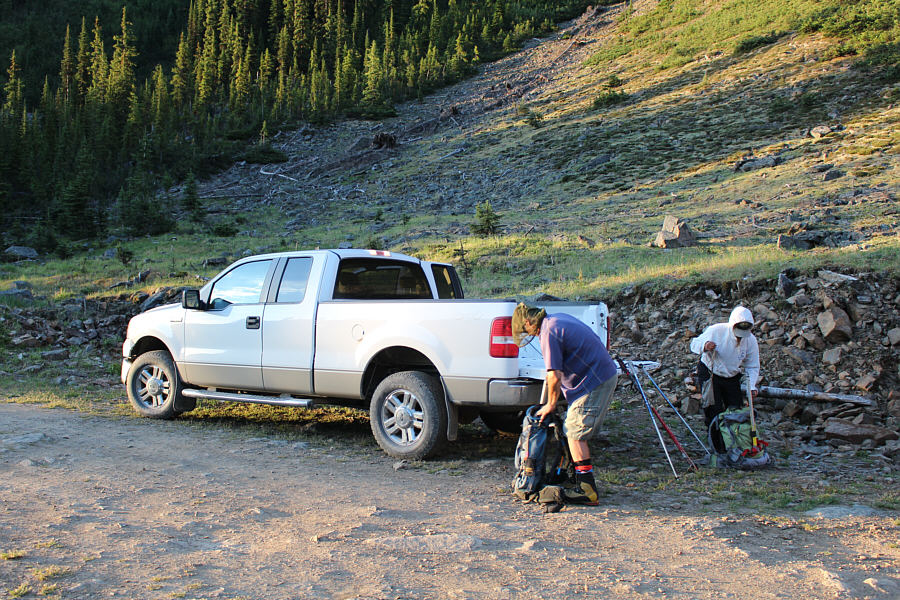 |
Fabrice and
Josée organize their gear at the
trailhead. |
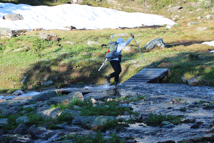 |
Josée
crosses a partially submerged footbridge just before Gorman Lake. |
 |
Gorman Lake is, in itself, a worthy
hiking destination. |
 |
Josée and
Fabrice hike along the south shore of Gorman Lake. At left is
Bokor Peak, and at right is Zombie Peak. |
 |
Here is a look back at Gorman Lake
from the rising trail. |
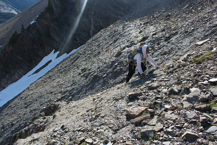 |
Josée
scrambles up the loose slope. |
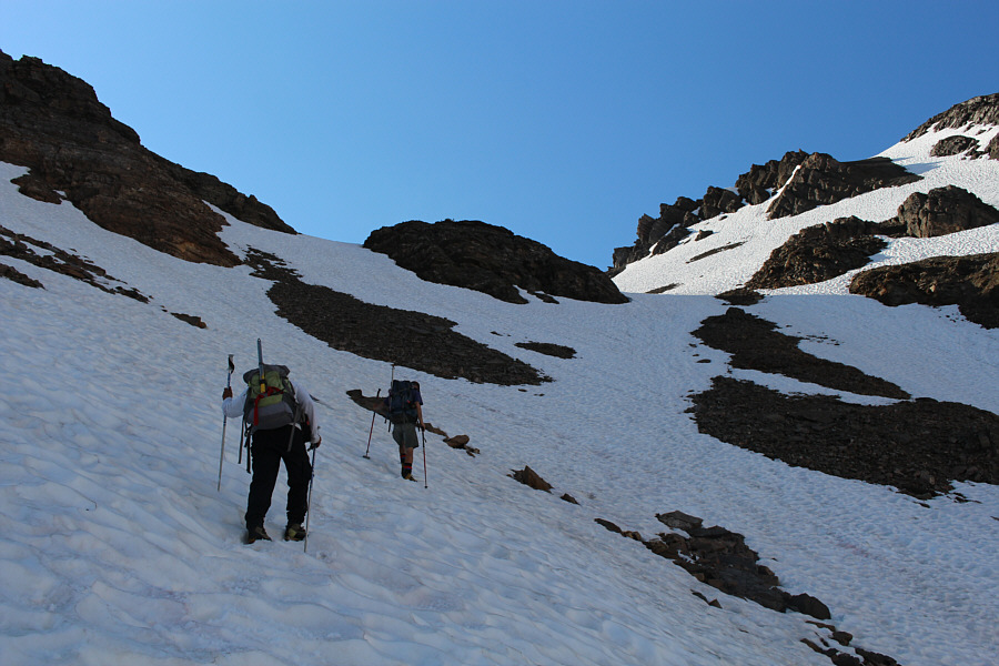 |
The firm snow allows easy climbing to
the Gorman-Holt col. |
 |
This is looking north toward the
Gorman-Lang col with Zombie Peak on the right. |
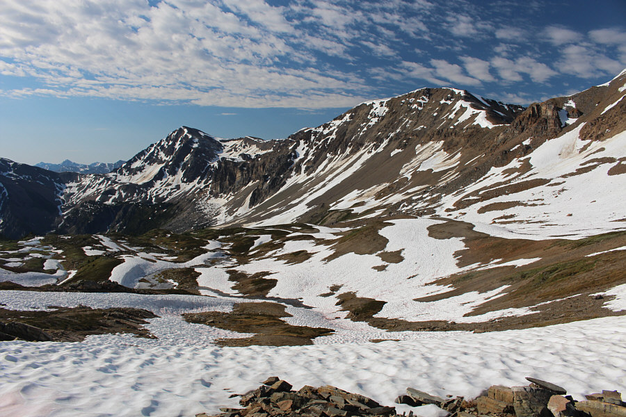 |
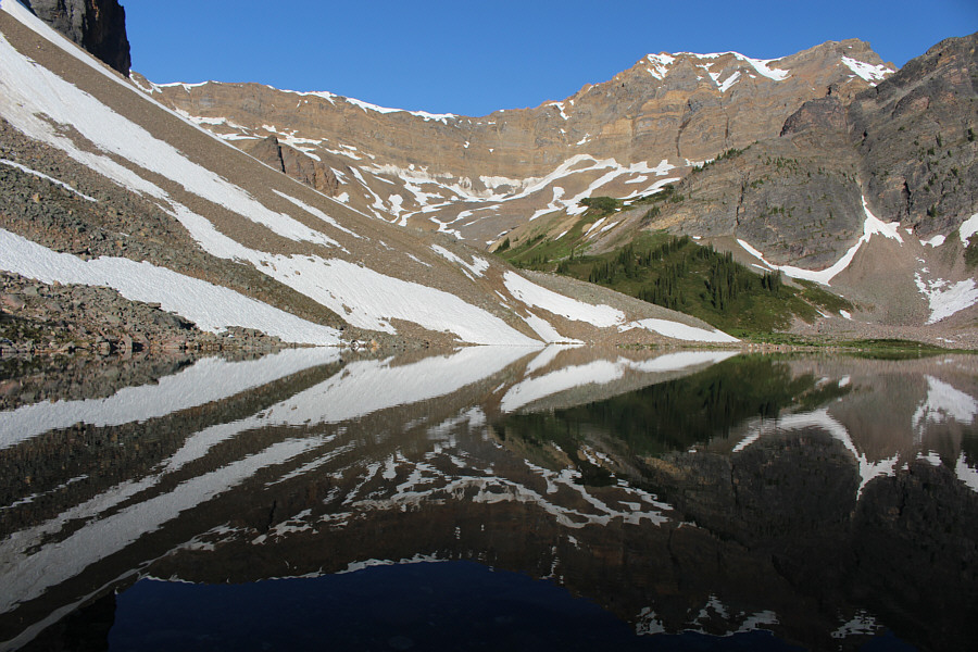
The Gorman-Holt col grants a sweeping
view of the upper Holt Creek basin. Holt Peak is at left while on the
right is Dawn Mountain. |
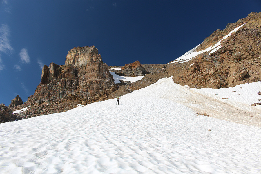 |
Josée
climbs up another snow slope. |
 |
Fabrice
and Josée hike under a snow cornice guarding the north
ridge of Dawn Mountain. |
 |
The rest of the ascent up Dawn
Mountain is easy from here. |
 |
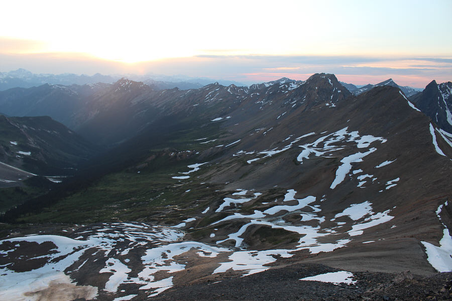
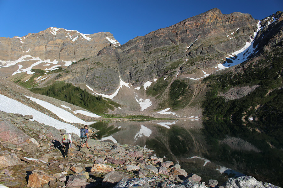
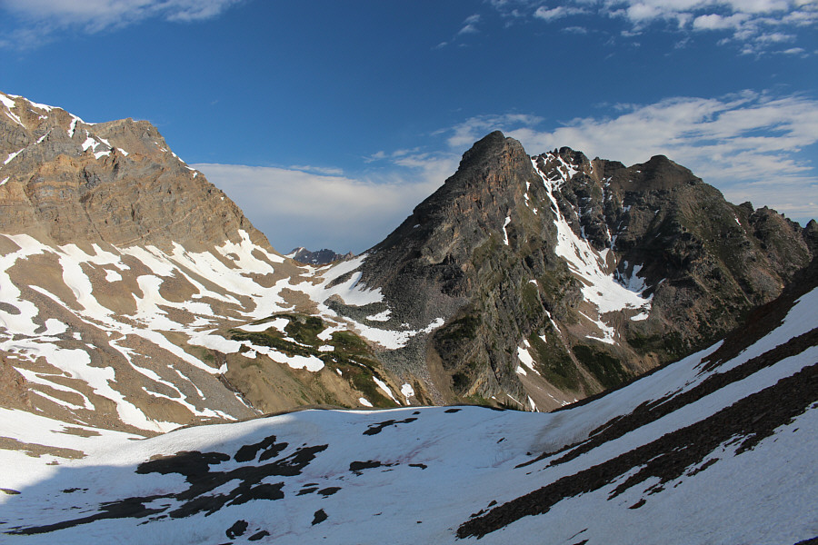
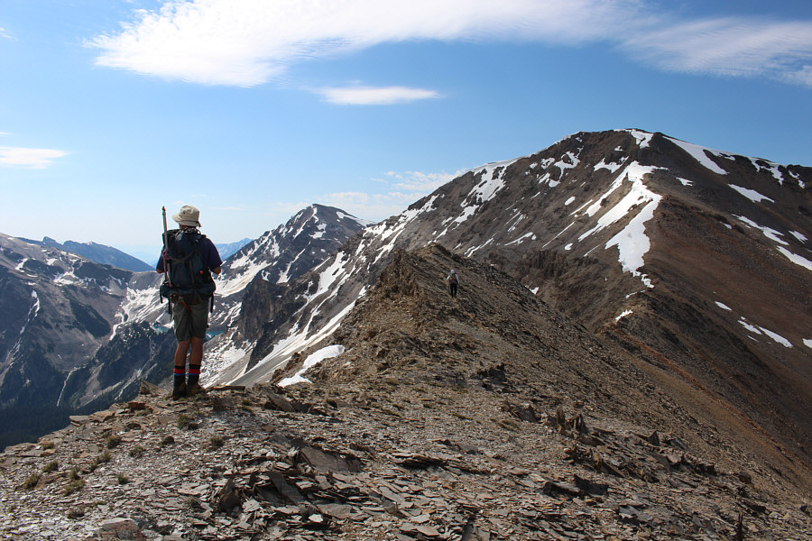
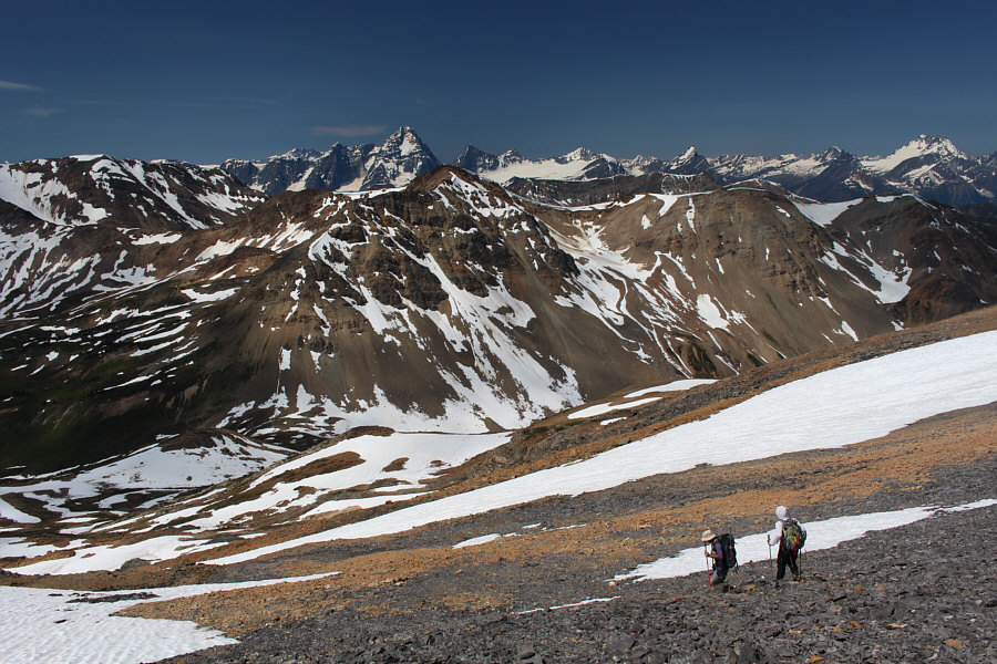
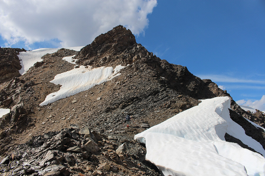
From just below the summit of Dawn
Mountain, Dogtooth Peak (left) and Moonraker Peak (right) finally
come into view. |
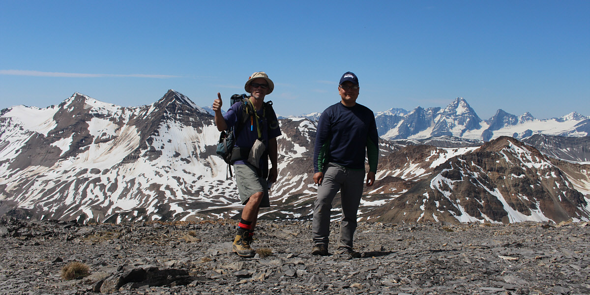
Fabrice and Sonny stand on the 2681-metre summit of
Dawn Mountain (elevation courtesy of
Peakbagger.com).
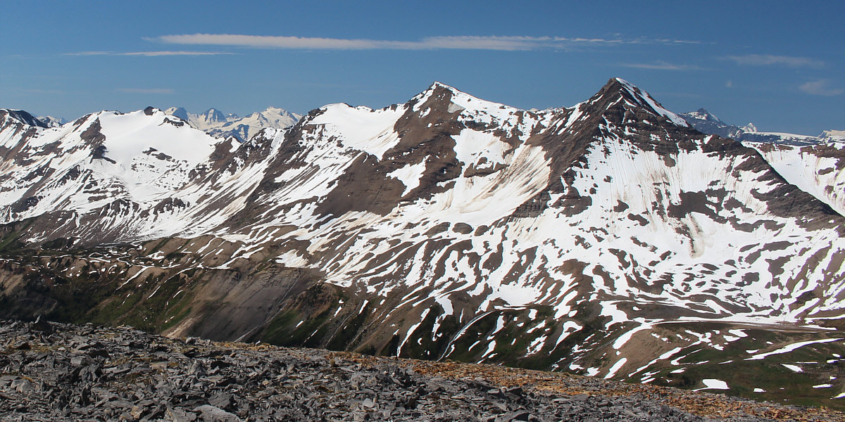
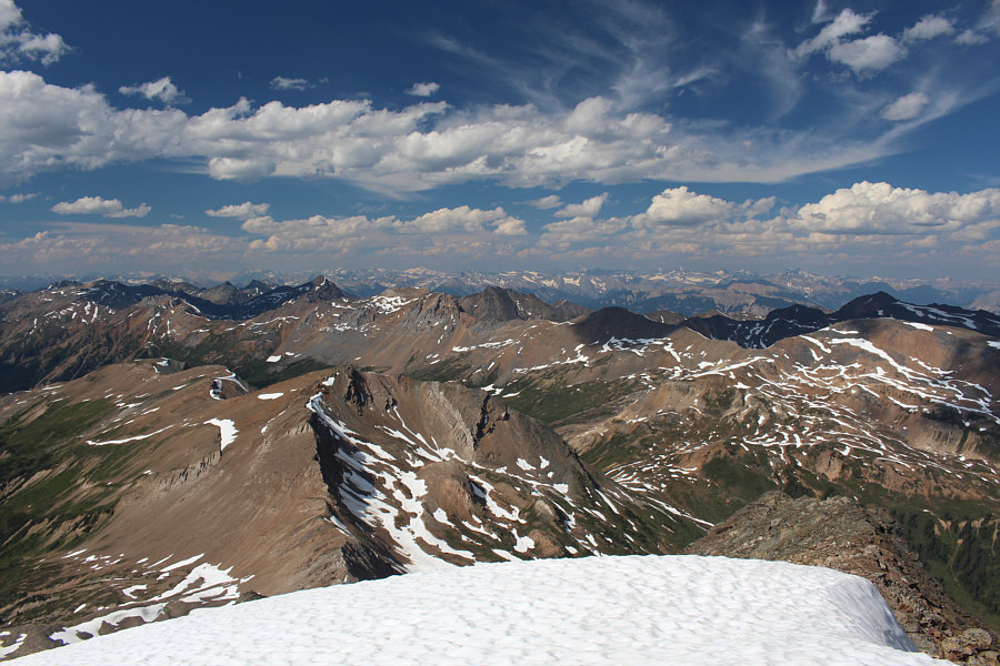
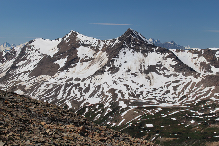
Dogtooth Peak and Moonraker Peak sit on the other
side of the valley to the southwest.
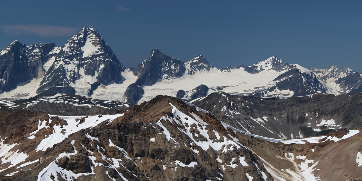
Visible to the west are (L to R) Mount Sir Donald,
Uto Peak, Eagle Peak, and Avalanche Mountain. The large swath of
ice is Avalanche Glacier.
To the northwest, Mount Rogers (left) and Mount Sir
Sanford (right) stand out from among the peaks on the horizon.
 |
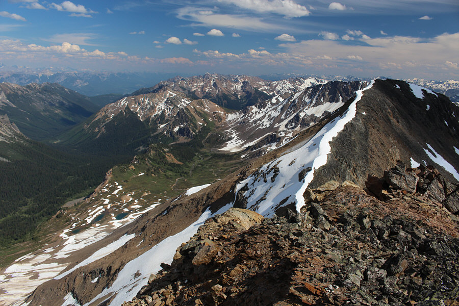
In this view to the north, Bokor Peak
is at centre while the black horn of Zombie Peak stands out at right.
In between the two and further away is Kingpin Peak. At lower
far-right is Gorman-Holt col. |
 |
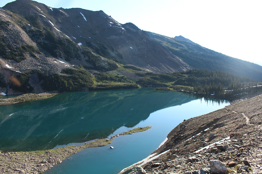
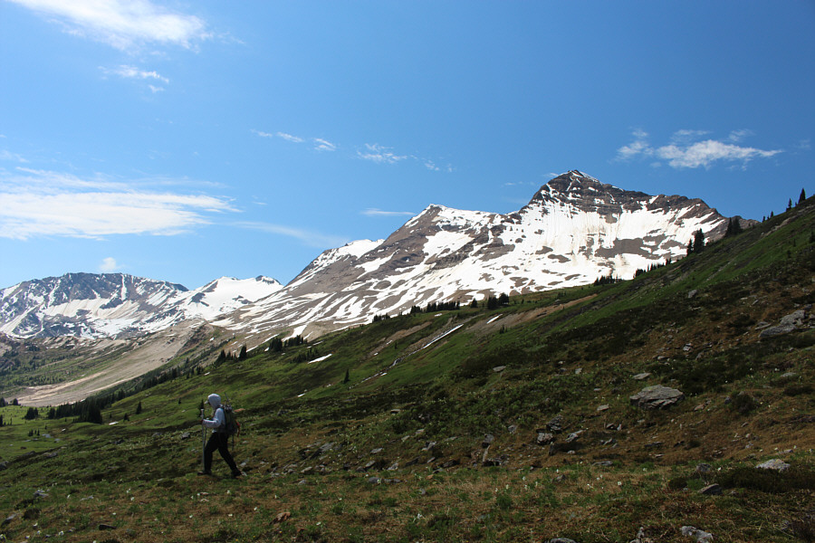
Fabrice
and Josée descend into the upper Canyon Creek basin. |
 |
Josée
keeps descending into the basin to avoid a lot of side-hill bashing. |
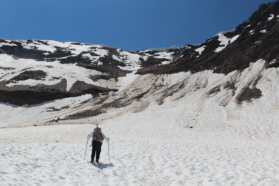 |
Josée
heads toward the Dogtooth-Moonraker col. |
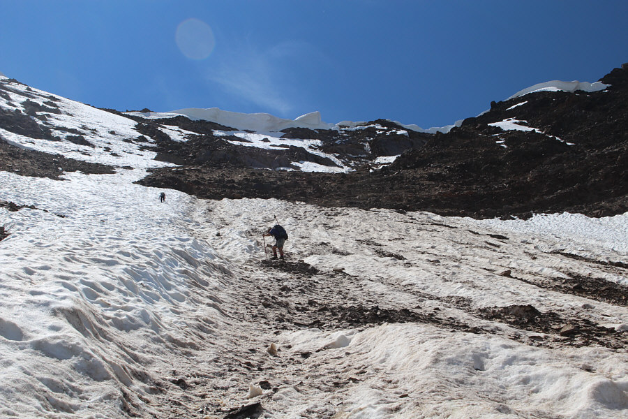 |
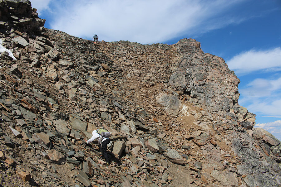
The terrain gets really steep higher
up. |
 |
Fabrice climbs up to the final summit
block of Moonraker Peak. |
 |
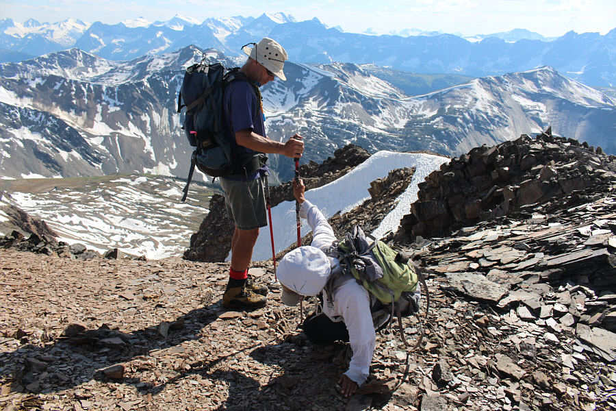
Fabrice
takes the last few steps to the top while Josée muddles her way up
the loose slope. |
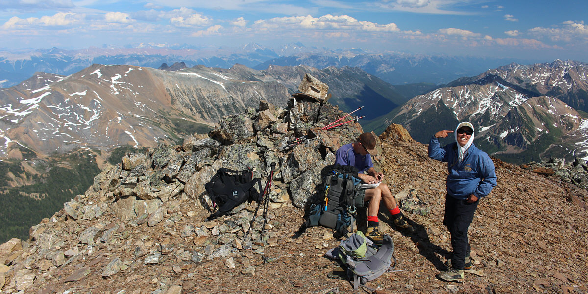
Fabrice and Josée reach the 2836-metre summit of
Moonraker Peak (elevation courtesy of
Peakbagger.com).