BOU AVENUE
Mackay Hills
Amelie Doucet, Bob Spirko, and Marko Stavric joined me for a hike up the Mackay Hills in Alberta's Kananaskis Country on 22 August 2015.  This trip largely came about as a result of discussions with Rafal (Raff) Kazmierczak regarding feasible climbing or hiking objectives in light of recent snowfall.  Ironically, Raff was absent when the rest of us set off along the Evan-Thomas Creek trail in hopes of hiking the loop as described in Gillean Daffern's Kananaskis Trail Guide.  The approach hike was not as straightforward as we would have liked.  The epic floods of 2013 ravaged much of the Evan-Thomas Creek trail, and although some sections near the trailhead have been repaired or re-routed, much of the trail in the backcountry remains washed out or completely obliterated.  To make things more complicated, the fresh snow caused many of the deciduous trees and bushes to bow over, effectively choking some sections of trail.  It took us a little over 3 hours to reach the Camp Creek junction, and I cannot recall the last time I did this much route-finding and bushwhacking on an established trail!  Fortunately, the trip would improve as we hiked another 20 minutes to reach Rocky Creek Pass.  From there, we picked up a game trail which heads north toward the southernmost of three distinct peaks which comprise the Mackay HIlls.  Just as Daffern describes, we left the trail above tree line to ascend grassy slopes to the top of the South Peak.  The soles of my light hiking shoes were somewhat worn, and consequently, I had some issues with traction on the snow-covered slopes.  I gradually fell behind the others, and by the time I reached the South Peak's summit, they were already well on their way to the Centre Peak.  I eventually caught up with everyone while they were taking a break at the top of the Centre Peak, the highest point in the Mackay Hills.  The ridge on the north side of the Centre Peak is guarded by a few minor cliff bands, but we easily down-climbed or circumvented these obstacles.  An otherwise unremarkable plod brought us to the top of the North Peak which is also known as Mackay's Mountain.

From the top of Mackay's Mountain, we opted to follow Daffern's recommended "East Slope" descent route, or at least we tried to.  After descending the north ridge to about tree line, we dropped down the east side of the ridge and picked up an old trail which probably has not seen human passage in quite a few years.  Still, having an overgrown trail was better than having no trail at all, and we followed it down alongside an obvious drainage leading back to Evan-Thomas Creek.  Unfortunately, the trail eventually peters out, and even though we were fairly close to Evan-Thomas Creek, steep cliffs prevented us from descending further.  Our only option at this point was to contour northward and make a beeline for the logging road promised by Daffern at the end of the descent.  This was, of course, easier said than done.  The next half kilometre or so ranks highly among the worst bushwhacking I have ever endured.  Crisscrossing logs and alder bushes created a formidable barrier which made travel slow and frustrating.  I lost all sense of time as my focus narrowed to just scrambling over the next log or squeezing through the next set of tangled branches.  After an exasperatingly long thrash, we finally hit upon a faint trail that led us to a series of marshy glades and ultimately to Daffern's logging road.  We subsequently turned right on the Wedge Connector trail which took us over a bridge back to the Evan-Thomas Creek trail to complete the loop.  An already long day was made even longer when we had to drive back to Calgary via Highway 1A because of a traffic jam on the Trans Canada Highway.  Unfortunately, we only traded one traffic jam for another as we ended up waiting possibly just as long to get through the busy intersection with Highway 22 at Cochrane.

The Mackay Hills loop turned out to be a much longer and more arduous hike than I had anticipated, and though I feel a bit guilty for subjecting Bob, Amelie and Marko to such an epic ordeal, I am nevertheless happy to have shared their excellent company.

Be sure to check out Bob's trip report and Marko's photos.
Kevin Barton supposedly skied up the facing slope/ridge! Snow must have covered the tops of all the trees! 
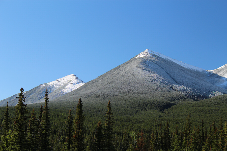
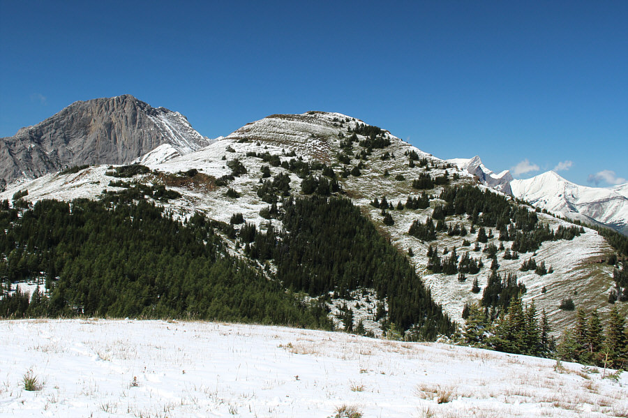
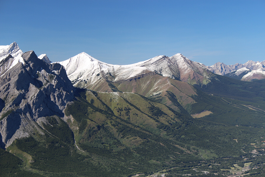
An opening along the Evan-Thomas Creek trail grants this view of the Centre Peak (left) and the North Peak (Mackay's Mountain).
Watch your step around here! 
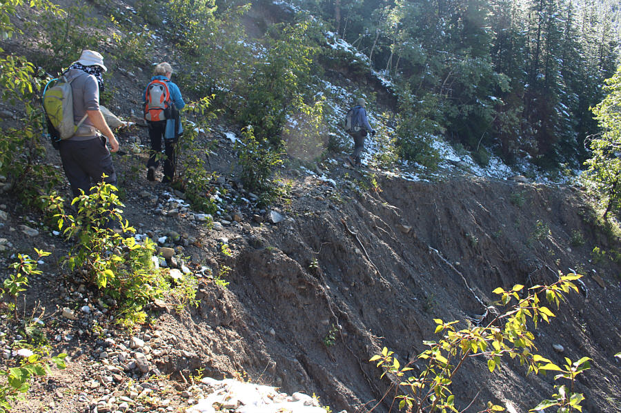
The group treads carefully around a washed out section of trail.
So much for trying to keep my hiking shoes dry! 
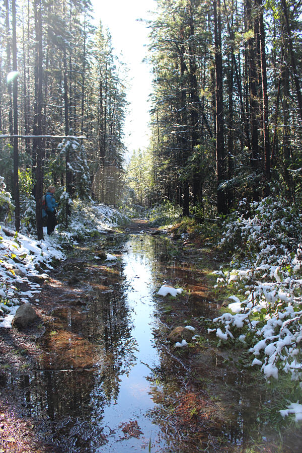
This section of trail is a bit wet.
Going through this was actually a breeze compared to what was to follow later in the day... Fresh snow has caused trees and bushes to bow over onto the trail.
Maybe the creek is where the trail used to be! 
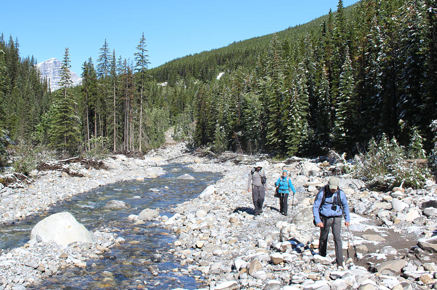
Where the trail has disappeared completely, the group hikes along the creek bed.
Look for cairns a little upstream to find the trail again. 
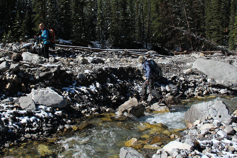
Amelie and Bob boulder-hop across a side creek.
Wow, a trail that is actually still in good shape! 
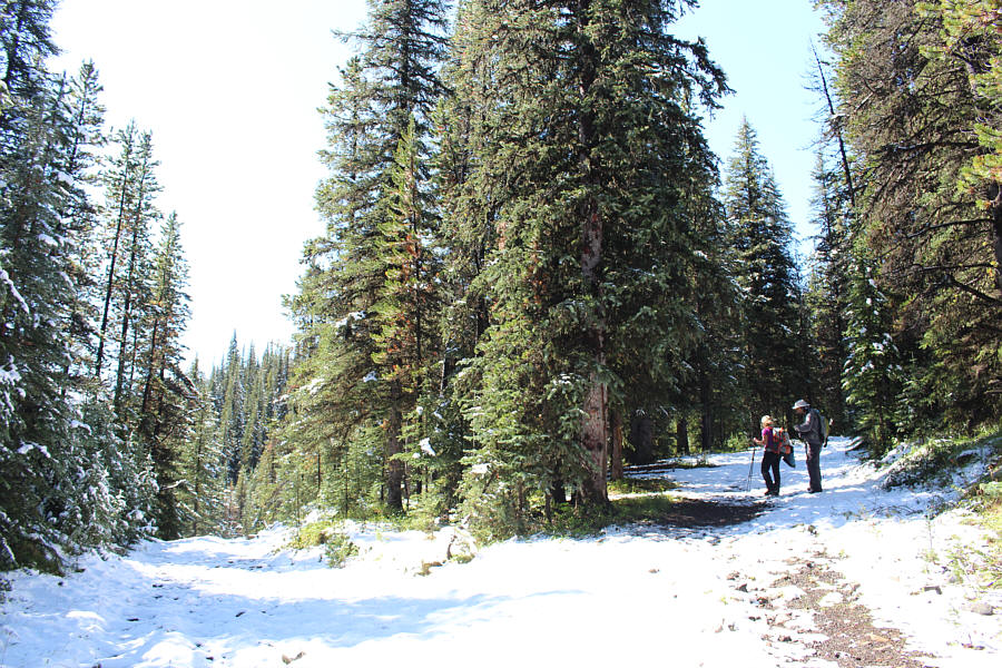
Amelie and Marko reach the junction with Camp Creek trail which heads off to the right.
Is it ski season yet? 
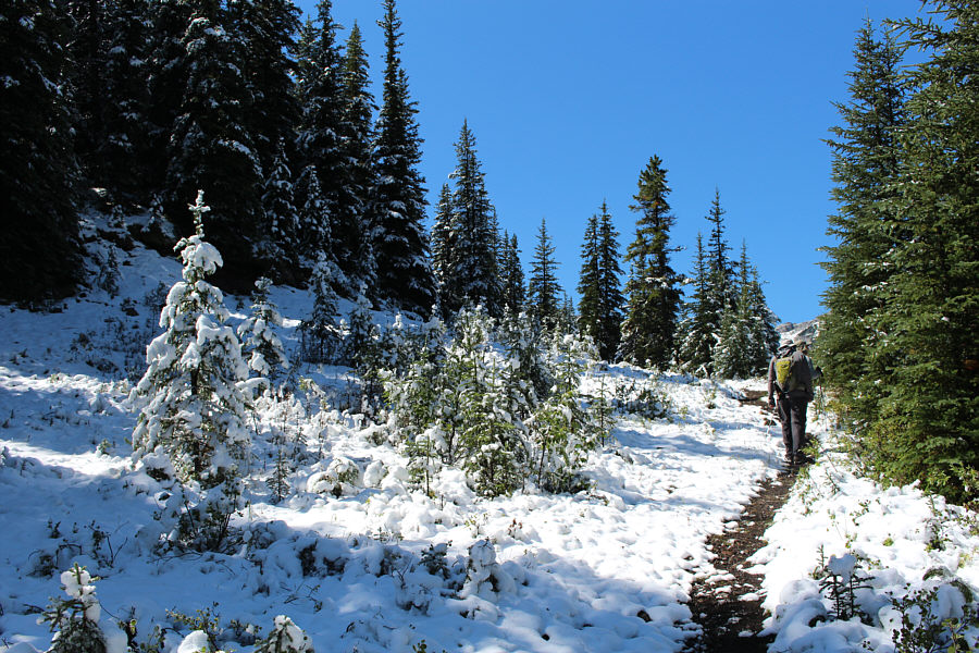
Parts of the Camp Creek trail appear to be in mid-winter conditions.
The top of the peak is further away than it looks here. 
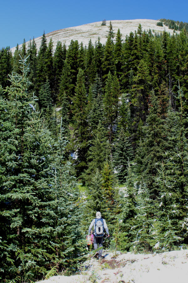
From Rocky Creek Pass, Bob takes the game trail which leads to the South Peak directly ahead.
Where is everyone?? 
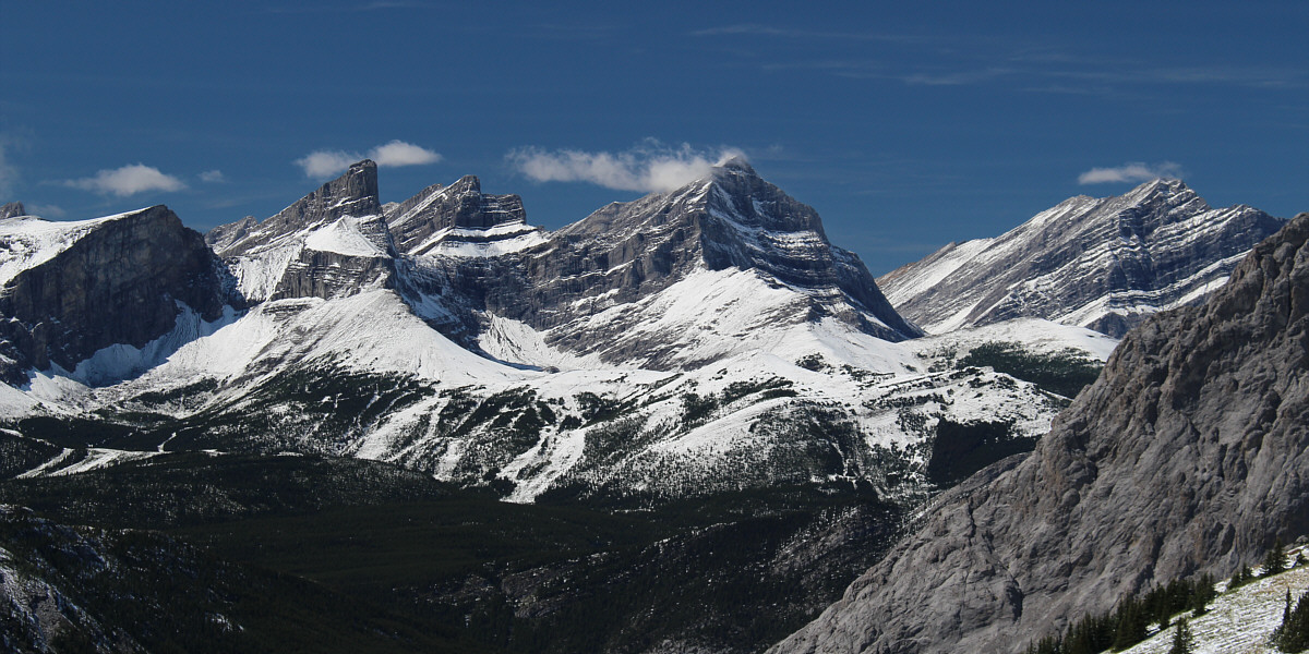
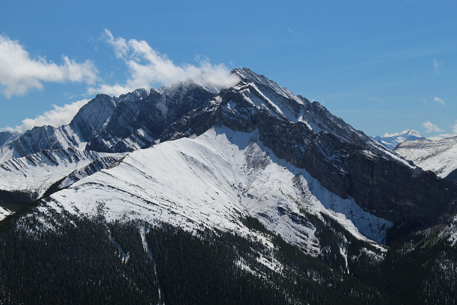
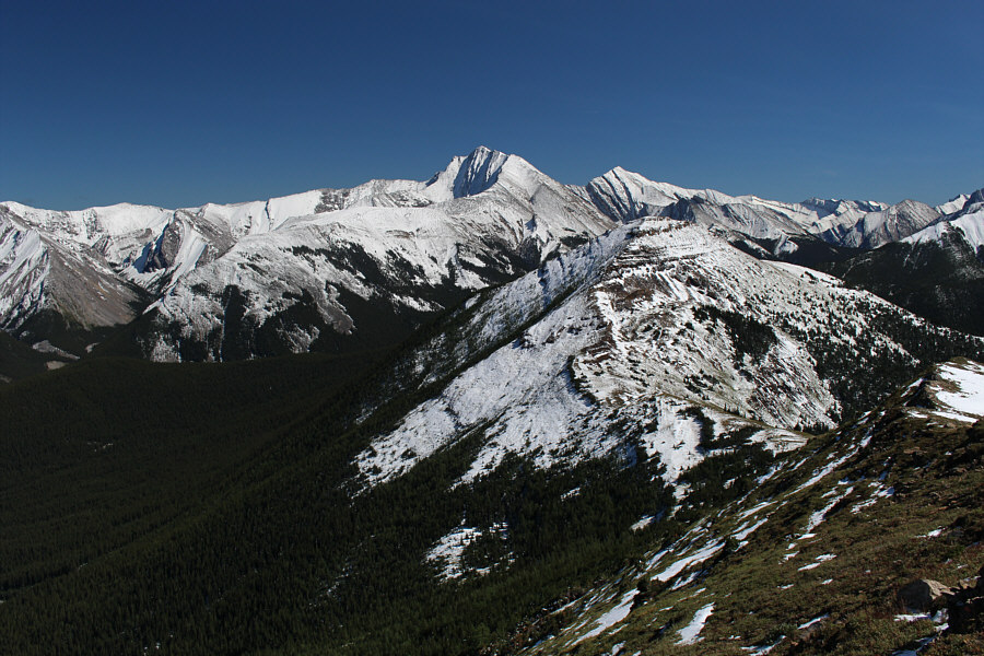
This is the Centre Peak as seen from the 2351-metre summit of the South Peak.  To the left is the Wedge.
Will be a much longer trip up Fisher Peak now that the Evan-Thomas trail is no longer bicycle-friendly... 
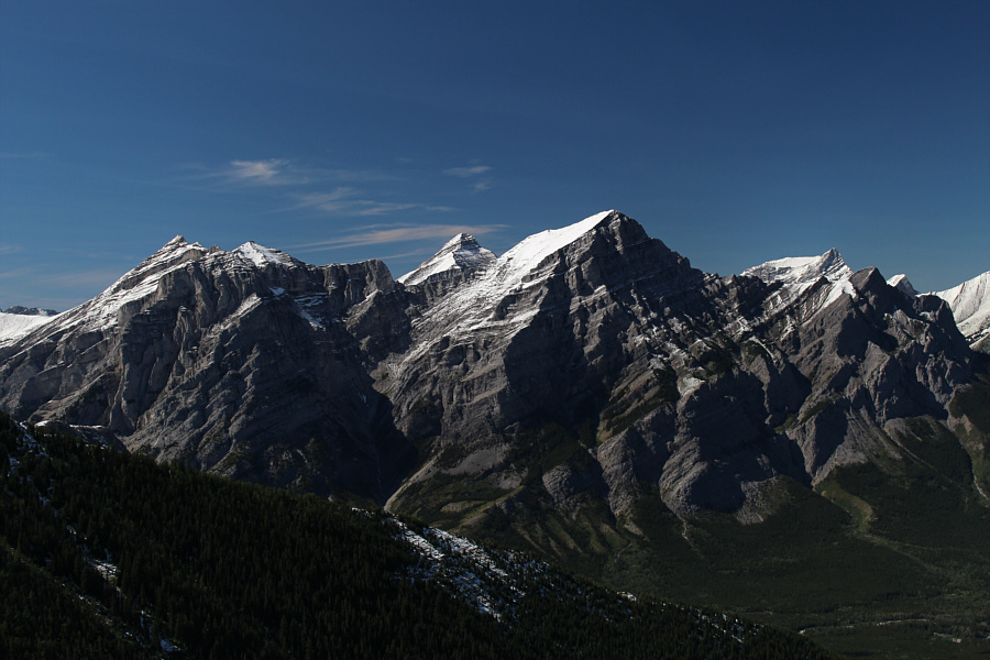
Fisher Peak draws the most attention to the east.

 I wonder if they're still filming "Hell On Wheels" at the old Fortress Ski Resort...

The view to the west includes (L to R) the Fortress, Gusty Peak, Mount Galatea, and the Tower.


I need to catch up to the rest; they're almost at the top! 
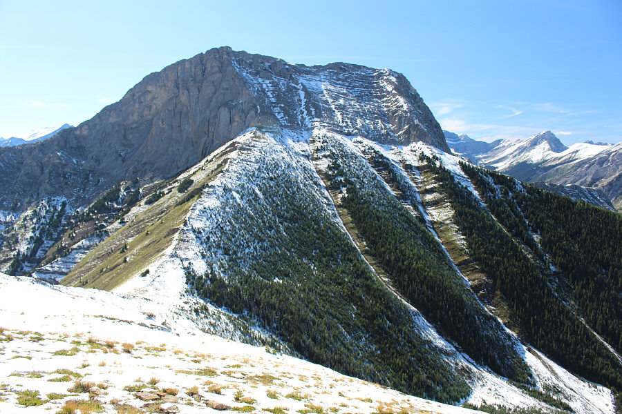
The south side of the Centre Peak presents no significant challenges.
Can you spot Bob behind the tree? Reminds me of the Monty Python sketch, "How Not To Be Seen"! 
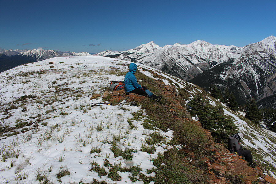
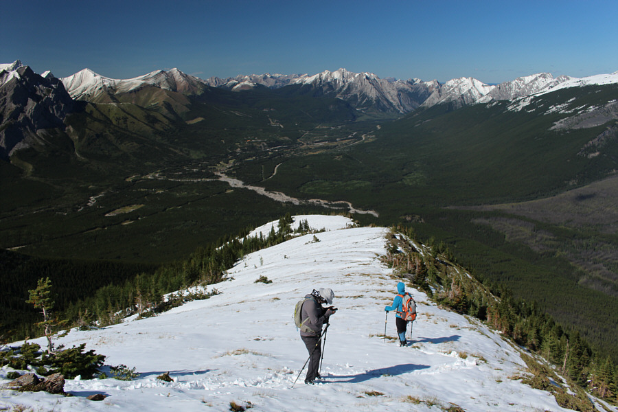
Everyone takes a break at the top of the Centre Peak (2432 metres).

 The worst part of the scramble up Fisher Peak is getting out of the valley bottom and up onto the long northwest ridge.

Here is a more comprehensive view of Fisher Peak.  The South Peak of the Mackay Hills is visible at lower right.


And in case you're wondering, that's Mount Joffre in the distance at far right. 
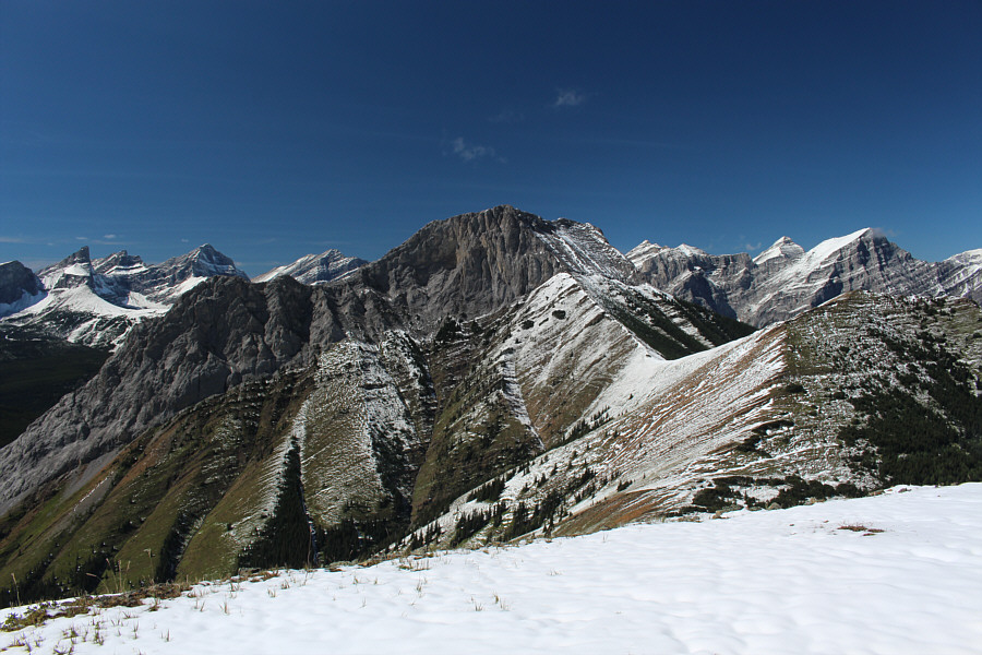
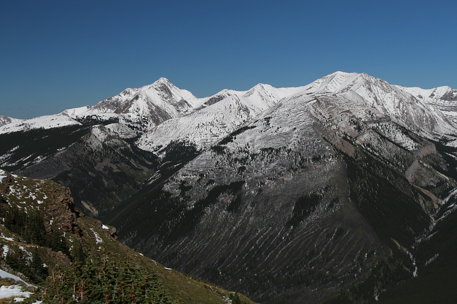
The north end of the rugged Opal Range is visible to the south.
The Wedge doesn't look nearly as striking from this angle. 
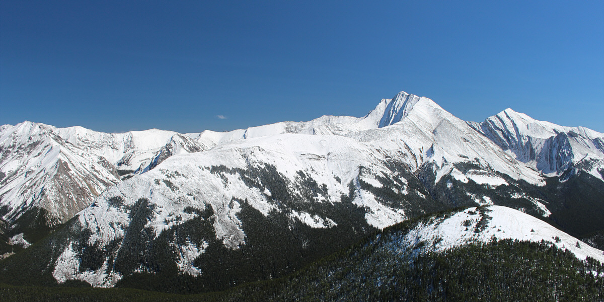
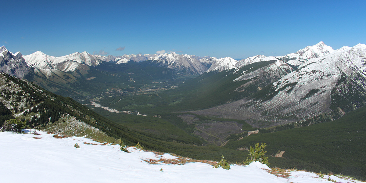
The Wedge dominates the view to the west.  At right in the foreground is Mackay's Mountain.

I still haven't bagged any of these peaks except for Mount Allan.

The view to the north includes Mount Allan and Mount Collembola at far left, Skogan Peak and Mount Lorette at centre, and Kananaskis Peak at far right.


Keep an eye out for bits of coal here and there. 
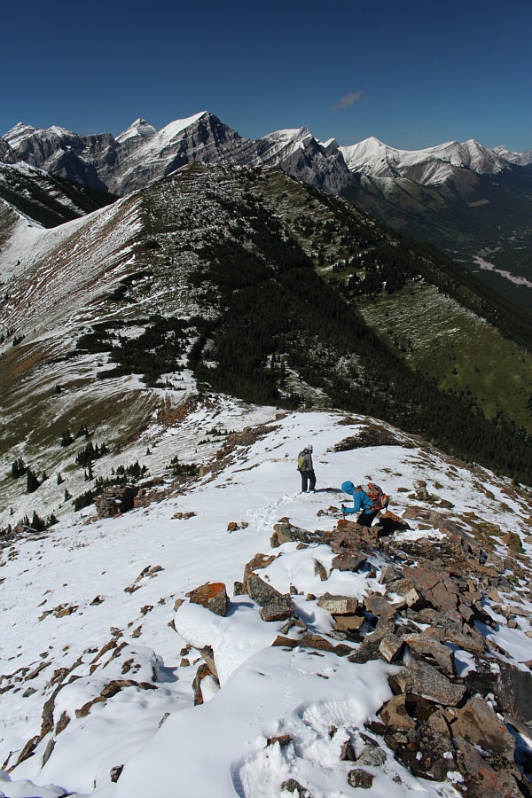
Marko and Amelie descend the connecting ridge to Mackay's Mountain.
Nothing difficult here; keep walking! 
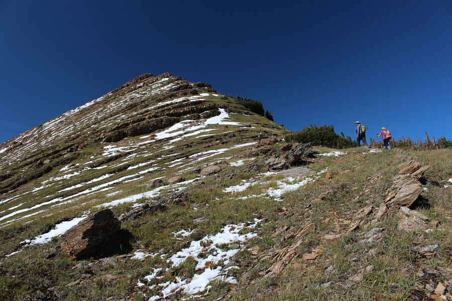
Bob, Marko and Amelie climb up the southeast ridge of Mackay's Mountain.
Very pleasant hiking here! 
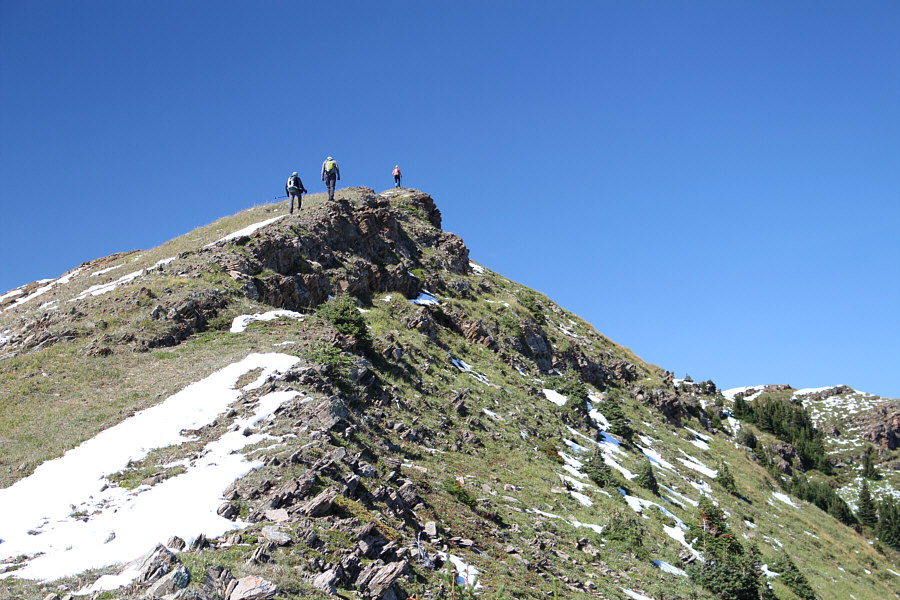
The group is almost at the top.

It's all downhill from here, both literally and figuratively!

Sonny, Bob, Amelie and Marko pose on the summit of Mackay's Mountain (2424 metres).

I should climb Mount Lougheed one of these days... Mount Bogart is visible between the two summits of Mount Kidd.  Also visible at right is Mount Lougheed including its prominent 4th Peak (Wind Mountain).
Mount Collembola is another peak I should climb someday... Here is a closer look at Mount Allan and the double bump of Mount Collembola.
Yet more peaks I haven't got around to climbing! Kananaskis Peak and Mount McDougall round out the view to the north.
Going back that way is not an option...at least, not yet! Here is another look back at Fisher Peak and the Centre Peak (right foreground) of Mackay Hills.
If I were to do it over again, I'd choose the climb to the base of the cliffs. Two of Gill Daffern's optional descent routes from Mackay Hills can be seen here: the climb to the base of the cliffs on the Wedge and the traverse across forest and gullies lower down.
Abandon all hope, ye who enter here! Marko and Amelie start down the north end of Mackay's Mountain.
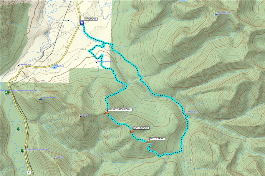
It's all Raff's fault! Total Distance:  23.6 kilometres
Round-Trip Time:  10 hours 41 minutes
Net Elevation Gain:  929 metres

GPX Data