BOU AVENUE
South Mist Hills
On 4 October 2015, Bob Spirko invited me to join him and Zora Knezevic for a hike up South Mist Hills in the Highwood region of Alberta's Kananaskis Country.  The hike is described in Gillean Daffern's latest edition of Kananaskis Country Trail Guide.  With a recent dump of snow in the mountains and a fickle weather forecast, I did not hold out high hopes for this trip, but I figured that I would at least get out for some exercise instead of staying at home playing Clash of Clans on my computer.  As Zora drove us to the Mist Creek trailhead, the skies were completely cloudy, and I began to wonder if Clash of Clans was not a better option on this day.  Nevertheless, we geared up on the side of the highway and set off up Mist Creek trail.  Fresh snow made for some wet and muddy conditions, but the trail was still easy to follow.  Just as Daffern describes, we turned right at the junction with Mist Ridge trail and followed it to yet another junction where we turned right again to follow an exploration road.  By this point, everything was covered by several centimetres of fresh snow, and it looked like mid-winter conditions.  The overcast sky only served to dampen the mood even more although we could see glimpses of the sun trying to break through the cloud cover.  By the time we reached the col between the east and west hills, our enthusiasm for this trip had waned considerably.  With little to see, we decided that we should, at the very least, tag the summit of the east hill, the highest of the South Mist Hills.  As we climbed up the east hill, we were pleasantly surprised to find ourselves climbing above the cloud cover into brilliant sunshine.  On the summit of the east hill, we were treated to that rare sight of being on an island surrounded by a sea of clouds.  The snow-covered Misty and Highwood Ranges added immensely to the grandeur.

After a prolonged stay at the summit of the east hill, we reluctantly descended back to the col and then climbed up the shorter west hill.  The summit of the west hill barely rose above the prevailing mist, and as a result, the views from this summit were not nearly as far-reaching as that of the east hill.  From there, we opted for completing a loop by descending the southeast ridge but deviated slightly from the route described by Daffern.  We picked up a trail slightly to the east of the ridge crest, but this trail eventually peters out above a steep, grassy slope.  At this point, the sky had cleared enough for us to see where we were headed, and we simply made a beeline for the valley bottom.  Snow made the grassy slope treacherously slippery, but we managed to work our way down to the forest below where we finally intersected Picklejar Creek trail.  The easy hike back to the highway was only interrupted when we had to do a bit of route-finding where the trail and its namesake trailhead had been washed away by the 2013 floods.  The walk back along the highway to Zora's car was very pleasant under sunny skies.

Despite the inauspicious start, this turned out to be a memorable hike which I will always think about every time I fire up Clash of Clans on my computer!  Be sure to check out Bob's trip report.
Birdy num num! 
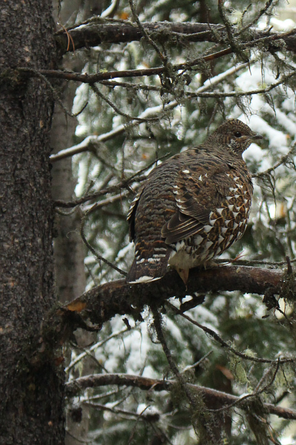
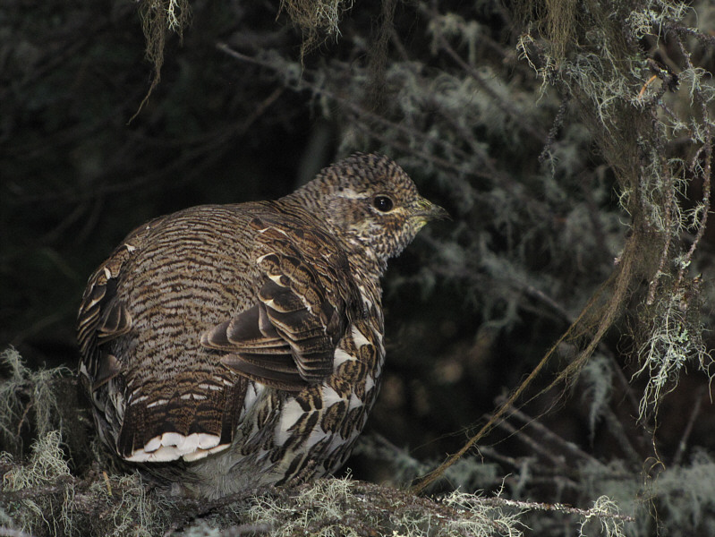
A spruce grouse perches warily on a tree branch (this photo is remarkably similar to one that I took in 2012 near Bluerock Mountain).
Ski season already? 
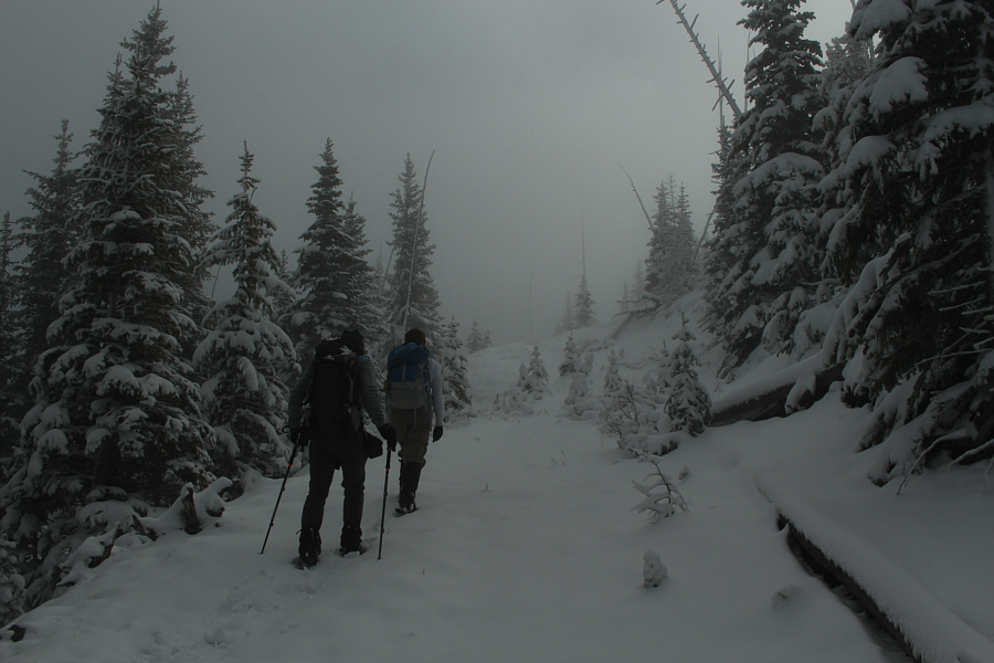
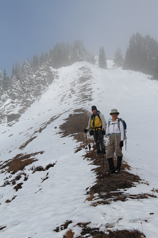
Bob and Zora hike up the snow-covered road.
Very bizarre! These trees are tilted across the road at uncannily the same angle.
Go left, go right, or go home? 
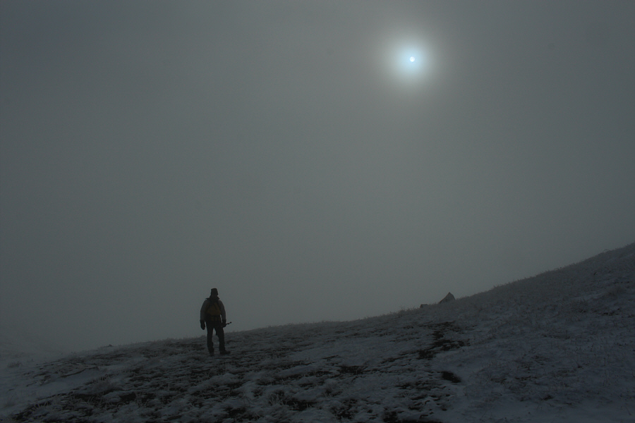
Bob stands at the col between the west and east hills.
Eh? Who ordered the sun?? Zora and Bob climb up the slope of the east hill.

 Glad I came out today!

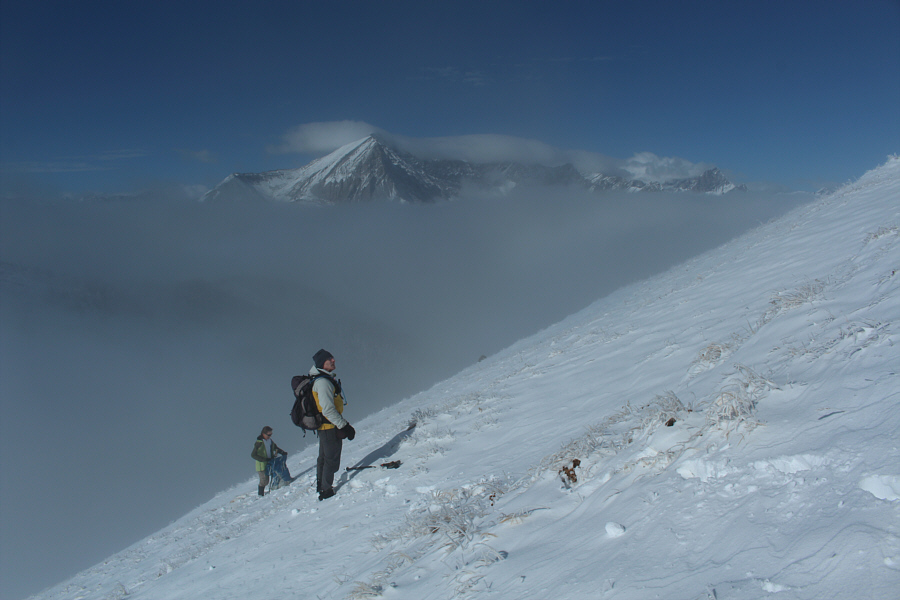
Sonny, Zora and Bob bask in the sunshine on top of the east hill (2457 metres).


Picklejar Lakes are in that valley to the left. 
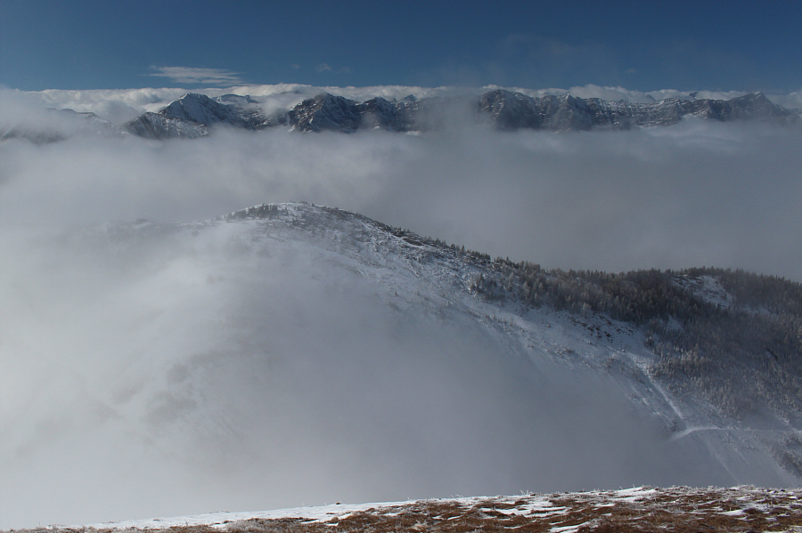
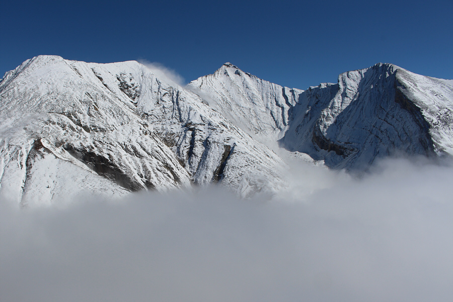
Mist fills the valleys surrounding Lineham Peak (centre).
Going up the lower west hill would be a bit anticlimactic now, n'est-ce pas? The mist lifts to reveal the west hill.  The approach road can also be seen at bottom right.

 Wow. Just wow.

Mist Mountain anchors the Misty Range to the northwest.


With a hat like that, Zora should be fishing! 
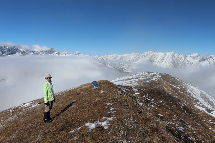
Zora enjoys the far-reaching views on this day from the top of the east hill.
Might have to pay this peak a visit in the near future... Unofficially-named Highwood Peak (centre) is the highest point in the Highwood Range.
Yep, anticlimactic. Mist Mountain is barely visible from the top of the west hill (2397 metres).
Wish I had brought skis! Bob and Zora make their way down the southeast ridge of the west hill.
Probably not the best descent route, but it works! Zora carefully descends a steep slope en route to Picklejar Creek.
It's amazing what the flood did to the asphalt! 
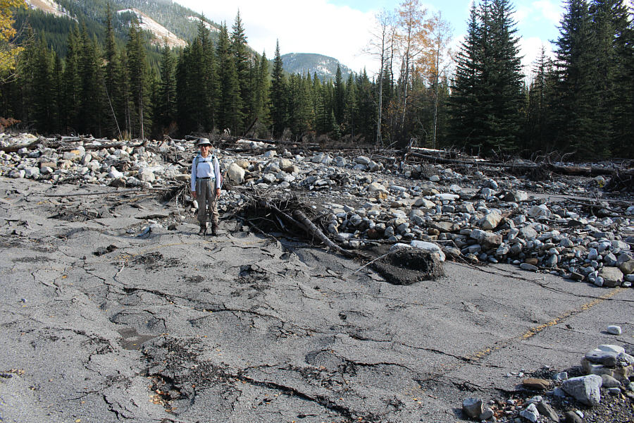
Zora stands on what used to be the parking lot for the Picklejar Creek trailhead.  The trailhead was obliterated by the epic floods of 2013.
Not sure if this trailhead will ever be repaired... 
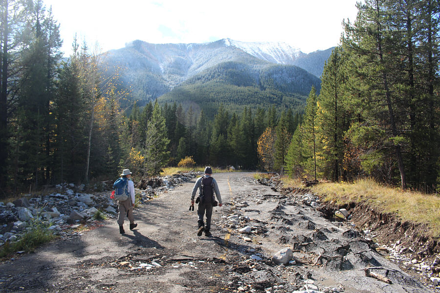
Zora and Bob hike out the damaged access road for the Picklejar Creek trailhead.
At least I think it's just a memorial; otherwise, Zora is standing on the guy's crotch! 
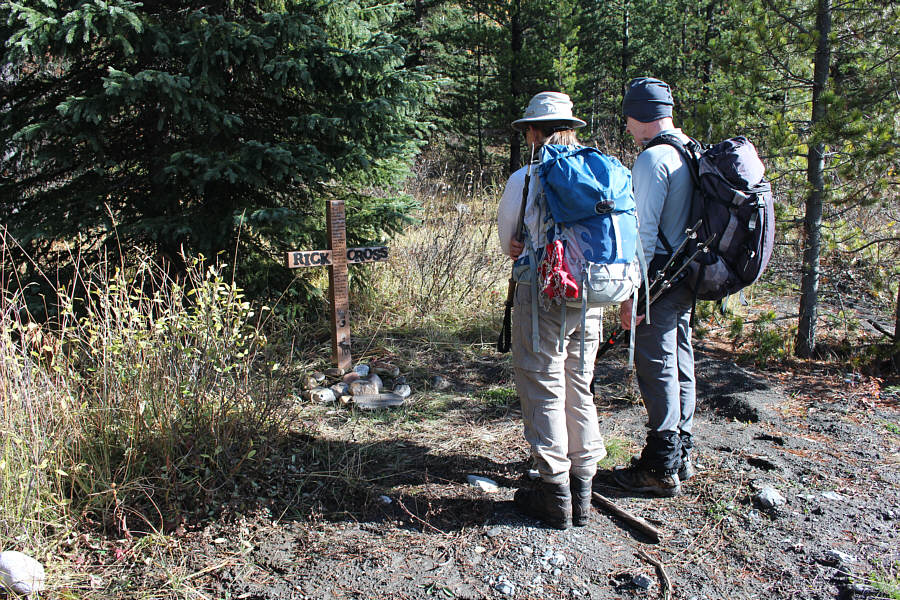
Zora and Bob solemnly stand in front of a memorial for a hunter who was killed by a grizzly bear in the area in 2014.
On the road again, just can't wait to get on the road again... Zora and Bob hike back along the highway to their starting point.  The west hill is still partially shrouded in clouds at right.
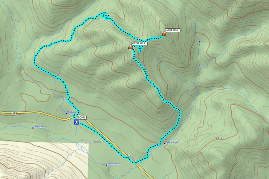
A most memorable outing! Total Distance:  11.4 kilometres
Round-Trip Time:  5 hours 25 minutes
 Total Elevation Gain:  ~829 metres

GPX Data