BOU AVENUE
Syncline Mountain
I was admittedly a bit hesitant when Marta
Wojnarowska invited me to go on a camping trip for the weekend of 25-26
July 2015. I have done my fair share of camping and backpacking in
the past, but as I have gotten older, the appeal of sleeping outside on
the ground (or inside my car) has waned considerably for me. Still,
the prospect of bagging some peaks with Marta over the weekend proved
irresistible, and we decided to head to the Castle Crown Wilderness in
southwest Alberta to attempt Syncline Mountain on the first day and
possibly Barnaby Ridge on the second day. Joining us at the last
minute was Marta's friend, Aga Sokolowska, an avid mountaineer whose
original plan to climb elsewhere was postponed due to the unsettled
weather forecast. Speaking of the weather forecast, it looked
promising for the Pincher Creek area when we headed out from Calgary
early in morning of 25 July 2015.
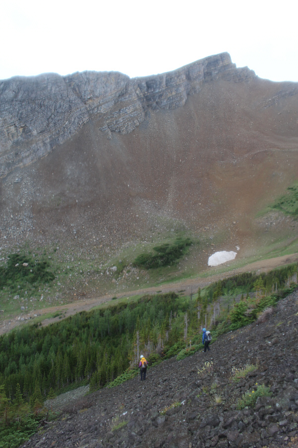
Following directions from Andrew Nugara's
More Scrambles in the Canadian Rockies, we parked on the side of the
highway about 1.3 kilometres south of the bridge over Suicide Creek and
headed west into the forest aiming for Syncline Mountain's northeast
ridge. Even as we gained the ridge, rain clouds from the west
brought showers over us, and we paused briefly to wait out the
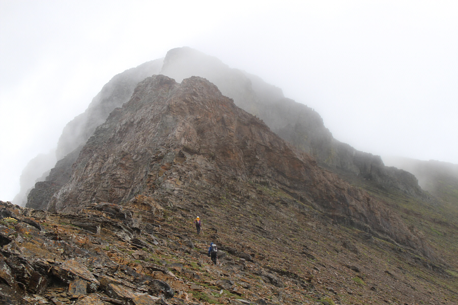
fast-moving storm. Once we resumed climbing, we quickly worked our
way up the relentlessly steep ridge and passed through the weakness in
the rock band guarding the summit block as described by Nugara. An
easy plod soon had us on the summit of the first peak of Syncline
Mountain.
After a short break, we descended the ridge
to the southwest and traversed along the north side of the impressive
pinnacles separating the first and second peaks. A few steep
drop-offs required careful down-climbing, but overall, I thought the
traverse was both easy and very enjoyable. We took another short
break beyond the pinnacles before tackling the tedious but
straightforward rubble slope leading to the top of the second peak.
When we reached the summit of the second peak, the weather started to
deteriorate again, and we all descended slightly and huddled under
Marta's tarp to wait out more rain. At this point, we were still a
bit unsure about where Nugara's route goes between the second and third
peaks since his description to head southwest seems counterintuitive.
Once the rain abated a bit, we took another look over the edge of the
summit ridge, and sure enough, we found Nugara's "steepish scree gully".
Descending this gully was tricky because of all the loose rocks funneling
down it. The rain had also made the rocks slick, and when I
momentarily lost my footing at one point, I snapped one of my hiking
poles. Thankfully, that was the only casualty on our descent of the
gully although I came close to nailing Aga with a dislodged rock near the
bottom.
Goat trails made traversing below the summit
block of the second peak quite easy, and we soon reached the col
separating the second and third peaks. By now, the rain had
returned and was coming down steadily with no signs of letting up anytime
soon. However, we were now committed to bagging the third peak
since we had already come this far. We started up the south ridge
of the third peak but eventually veered to climber's right to circumvent
a couple of big cliff bands. Another steep but easy plod brought us
to the summit of the third peak. Because of the wind and rain, we
retreated slightly from the summit before taking another short break to
re-fuel.
From the top of the third peak, we descended loose rubble
into the cirque enclosed by the three peaks of Syncline Mountain.
For the next several hours, we bushwhacked down the valley trying to stay
as close to Suicide Creek as much as possible. Just as Nugara
describes, some, nay, a lot of the bushwhacking was "downright nasty".
Between the rain and the wet undergrowth, we were all thoroughly soaked. Despite my occasional bellyaching, Aga and Marta remained unflappable
despite the seemingly endless thrash through the forest. We all
felt immense relief though when we finally came upon the ATV trail as
promised by Nugara. There are one or two confusing junctions along
the sometimes overgrown ATV trail, but we essentially took what we felt
was the most direct route back to the highway. Near the bottom, the
ATV trail crosses Suicide Creek and seemingly heads in the opposite
direction from where we started. Uncertain about where the trail
was taking us, we elected to simply follow the creek out to the highway.
This entailed some more nasty bushwhacking, but at least it was
short-lived. When I popped out of the bushes at the bridge over
Suicide Creek, I was dismayed to see two roads--one on each side of the
creek--emanating from the forest I had just left behind. Wet and
tired, the three of us quietly marched the final 1.3 kilometres along the
highway back to
my car.
After changing into some dry clothes, we
drove past the Castle Mountain ski resort and pitched our camp just
across the bridge over West Castle River. We cooked and ate a quick
dinner before retiring for the night. We all slept quite well, but
rainy weather the next
morning scuttled any desire to ascend Barnaby Ridge. Instead, we
packed up and went to visit a couple of gliding clubs near Cowley and Okotoks before heading home.
Be sure to check out both
Aga's and
Marta's photos.
 |
Aga and Marta wade through some cow
parsnip at the beginning of the trip. |
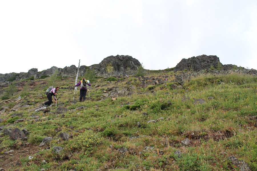
 |
The trees start to thin out as Marta
and Aga climb higher up the ridge. |
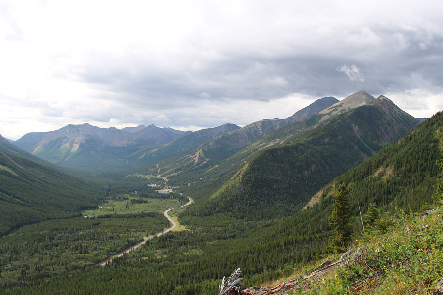 |
West Castle Ski Resort is visible to
the south. Mount Haig (dark) is just visible behind
Gravenstafel Ridge at right. |
 |
This gnarly tree trunk has seen better
days. |
 |
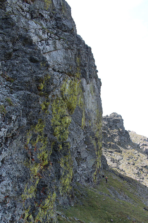
Aga and Marta approach the weakness in
the rock band guarding the summit block. |
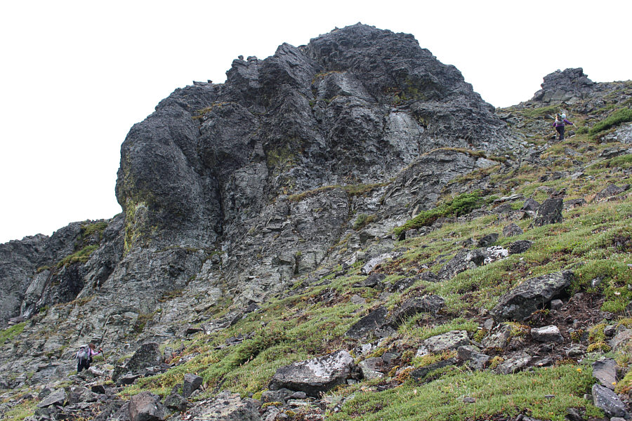 |
Here is a closer look at the left side
of weakness. |
 |
Aga ascends easy slopes not far below
the first summit. |
 |
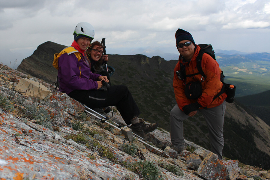
Sonny, Aga and Marta stand on the
first summit (2445 metres) of Syncline Mountain. |

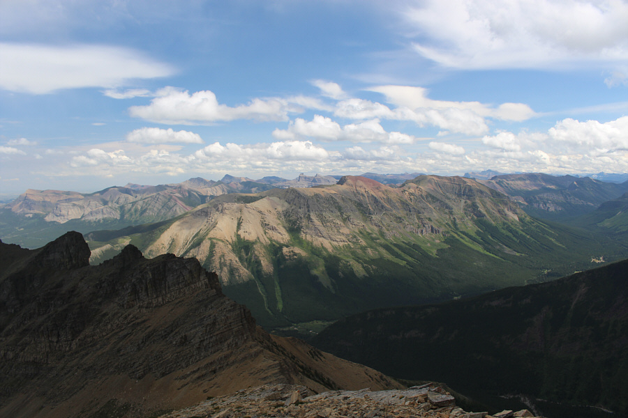
This is the view of the second and third peaks of
Syncline Mountain from the first summit.
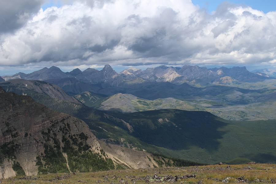 |
Mount Darrah (left of centre) is the
most recognizable peak to the northwest. |
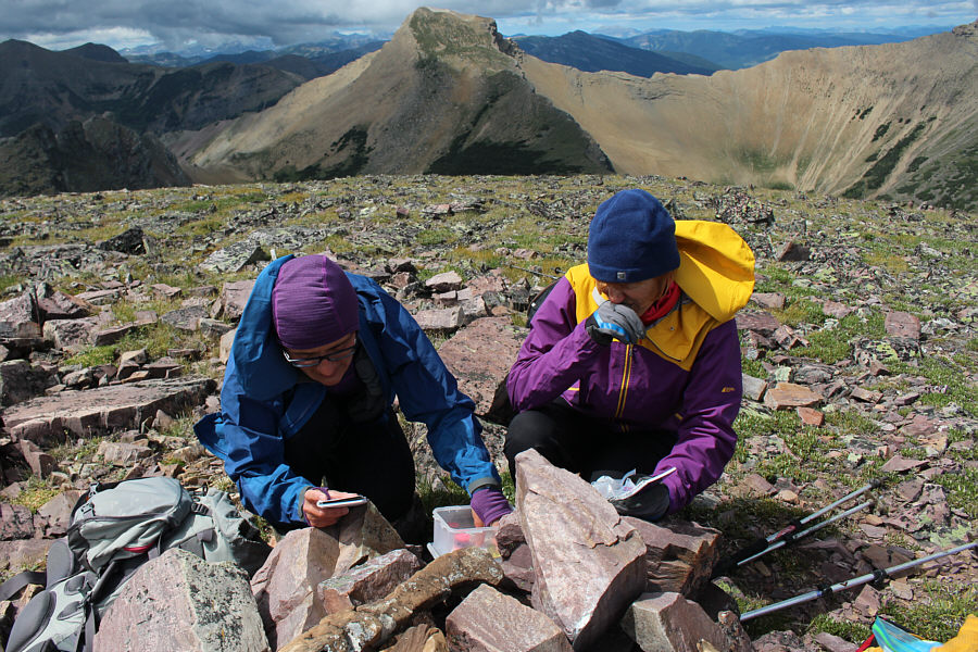 |
Aga and Marta check out the contents
of the geocache at the first summit. |
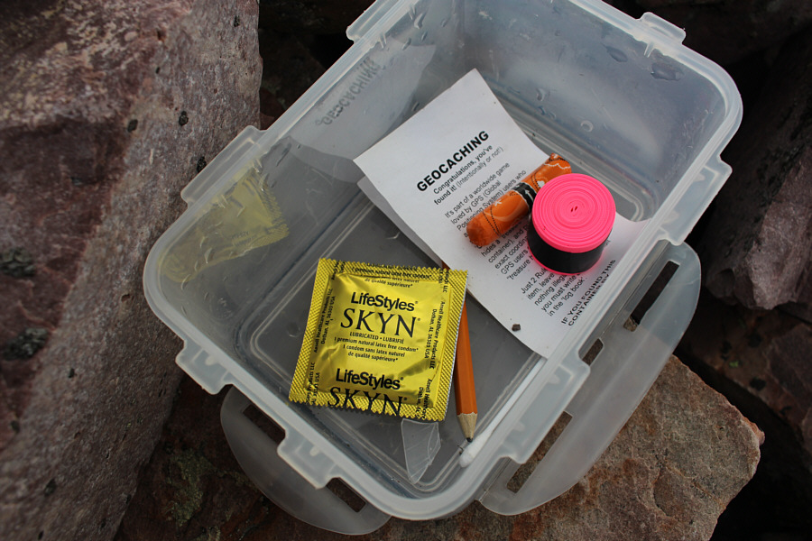 |
The contents of the geocache are
somewhat unique. |
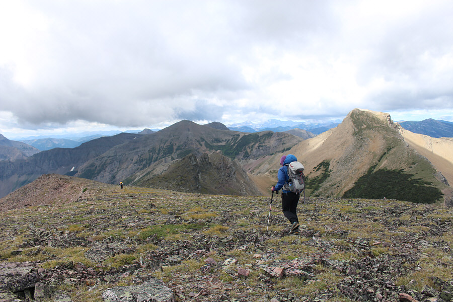 |
Marta and Aga make their way toward
the second peak (far right). |
 |
Here is a look back at the first peak
from the start of the traverse. |
 |
Aga and Marta pause at the base of one
of the pinnacles along the connecting ridge between the first and
second peaks. |
 |
Goat tracks make parts of the traverse
easier. The second peak looms beyond. |
 |
Marta and Aga scramble in tandem. |
 |
Aga down-climbs a short drop-off. |
This is looking back at the first peak and the
pinnacles from the end of the traverse.
 |
Marta and Aga slog up rubble on the
second peak. |
 |
Marta, Aga and Sonny take a break on
the second summit (2477 metres) of Syncline Mountain. |
 |
This is looking back at the first peak
from the summit of the second peak. |
 |
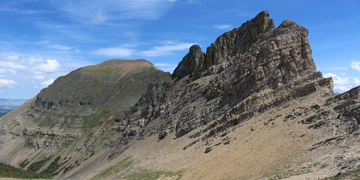
Southfork Mountain and Barnaby Ridge
lie to the southeast. |
 |
A connecting ridge leads southwest to
St. Eloi Mountain (left of centre). |
 |
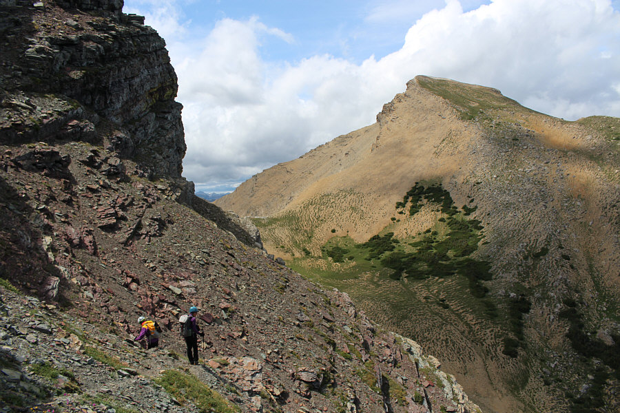
Marta and Aga try to figure out how to
get down to the col in order to ascend the third peak which is
visible behind them. |
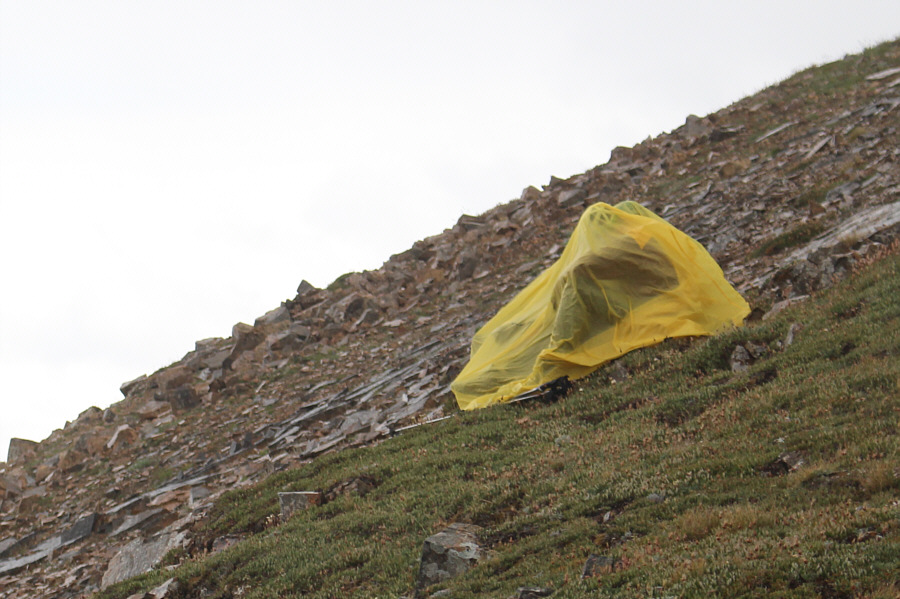 |
Marta and Aga huddle under Marta's
tarp to wait out the rain. |
 |
Aga and Marta descend the "steepish
scree gully" as described by Nugara. |
 |
Marta and Aga traverse below the
summit block of the second peak en route to the third peak. |
 |
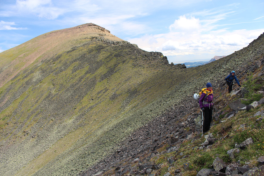
Marta and Aga stop for another short
break at the col below the second peak. |
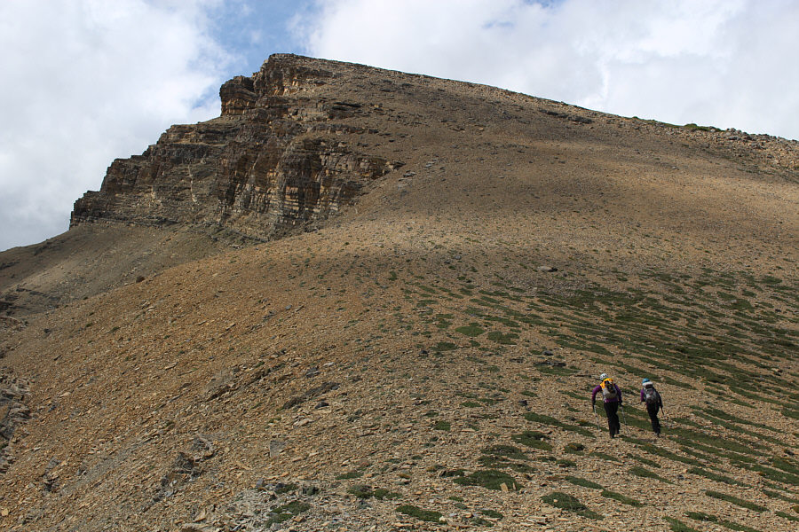
 |
The two cliff bands ahead are easily
circumvented to climber's right. |
 |
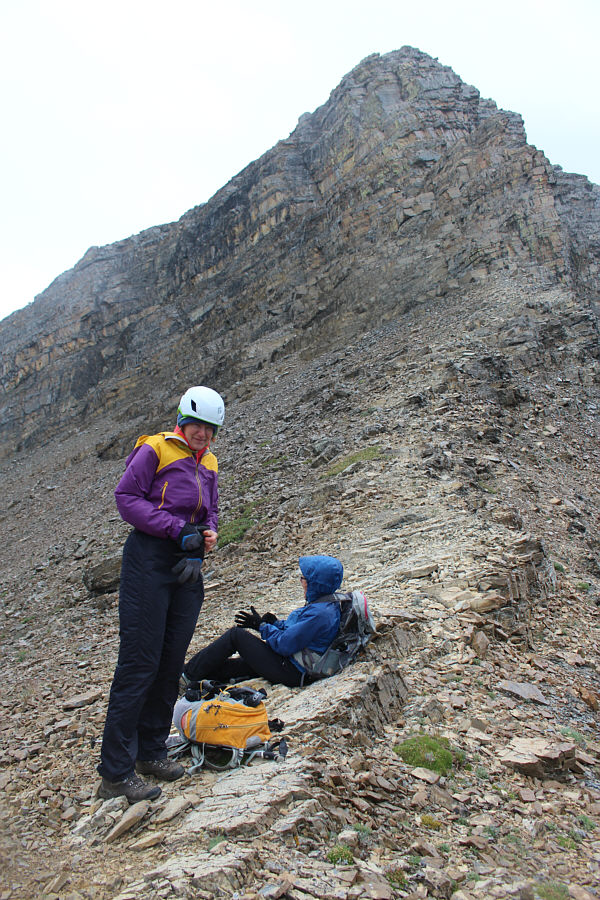
Marta and Aga are still smiling after
reaching the third summit (2535 metres) of Syncline Mountain. |

Here is a look back at the second peak from the third
summit.
 |
Marta and Aga descend into the cirque
enclosed by the three peaks of Syncline Mountain. |
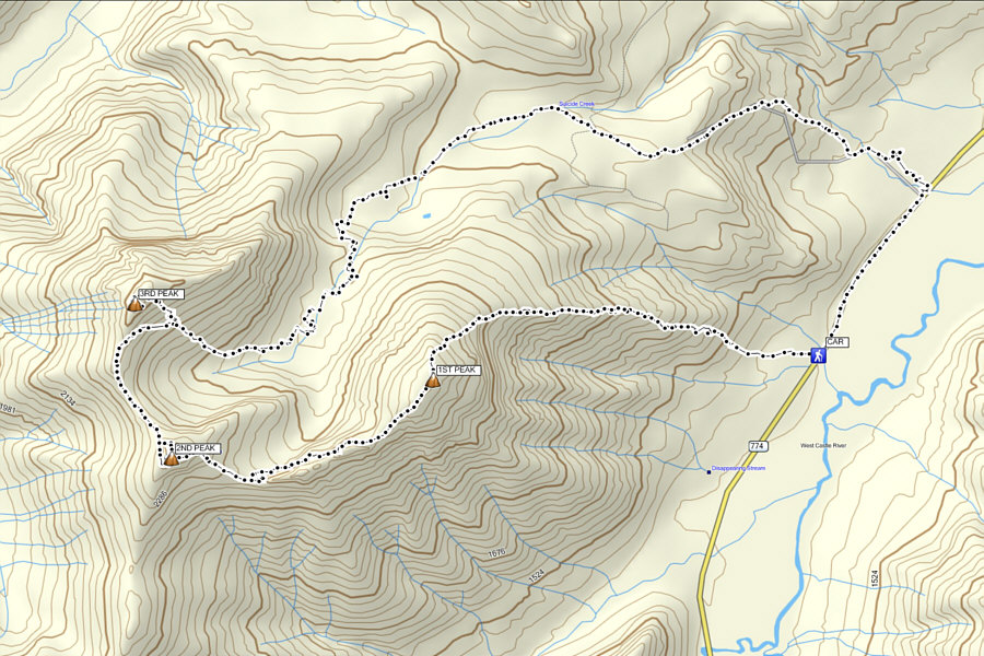 |
Total
Distance: ~14.0 kilometres
Round-Trip Time: 12 hours 29 minutes
Cumulative Elevation Gain: ~1420 metres |