BOU AVENUE
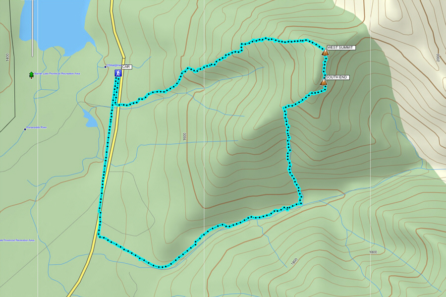
Mount Baldy West Ridge
A fantastic weather forecast on 1 April 2016
prompted me to head out to Alberta's Kananaskis Country after work to get
in a quick evening scramble. I originally had plans to ascend
GR338442 as described in Andrew Nugara's More Scrambles In The
Canadian Rockies, but at the last minute, I switched my objective to
the west ridge of Mount Baldy which is also described in the same
guidebook. After parking at the pullout beside O'Shaughnessy Falls,
I followed Nugara's directions by walking about 300 metres south to an
obvious rocky drainage emanating from the forest on the east side of the
highway. As promised by Nugara, I found a fairly good trail which
led me without fuss to tree line and the start of the scrambling along
the west ridge. The first serious obstacle is distinguished by a
single piton hammered into the rock face. I was tempted at first to
grab the piton and ascend straight up, but I quickly backed down due to a
lack of good holds on the face. As Nugara mentions, the correct way
to get around this obstacle is by heading to climber's left, but the
exposure here is a bit daunting. Not having done any exposed
scrambling in awhile, I took my time testing all my holds before
committing to them, but I eventually cleared this first obstacle which
was as much a psychological hurdle as a physical one. Now warmed
up, I tackled the rest of the west ridge with renewed vigor and also some
urgency since daylight was fading fast. I enjoyed the scrambling
immensely, and just as Nugara states, there is always easier terrain to
be found just beyond what looks like a drop-off or a dead end.
The sun had pretty much disappeared behind
the mountains to the west by the time I reached the cairn at the top of
the ridge. From there, I hiked over the summit of the west peak and
continued along the connecting ridge to the southernmost high point of
Mount Baldy. I opted to drop down the forested slope to the south
to try and intersect the Baldy Pass trail. I stayed fairly close to
an obvious drainage here although it was often easier to descend the
flanking slopes rather than the drainage itself. When I reached the
creek bed at the valley bottom, the Baldy Pass trail was not immediately
obvious to me in the dark. The creek bed was still easy enough to
hike despite some lingering snow patches, and I eventually stumbled onto
the trail further downstream. The walk out to the highway and then
back to O'Shaughnessy Falls seemed to take much longer than expected, but
I was entranced throughout by a clear sky full of stars.
I am not one to repeat ascents, but the
west ridge of Mount Baldy is one that I would consider re-climbing given
the short approach and the fact that I still need to go back and bag the
east peak. Any takers?
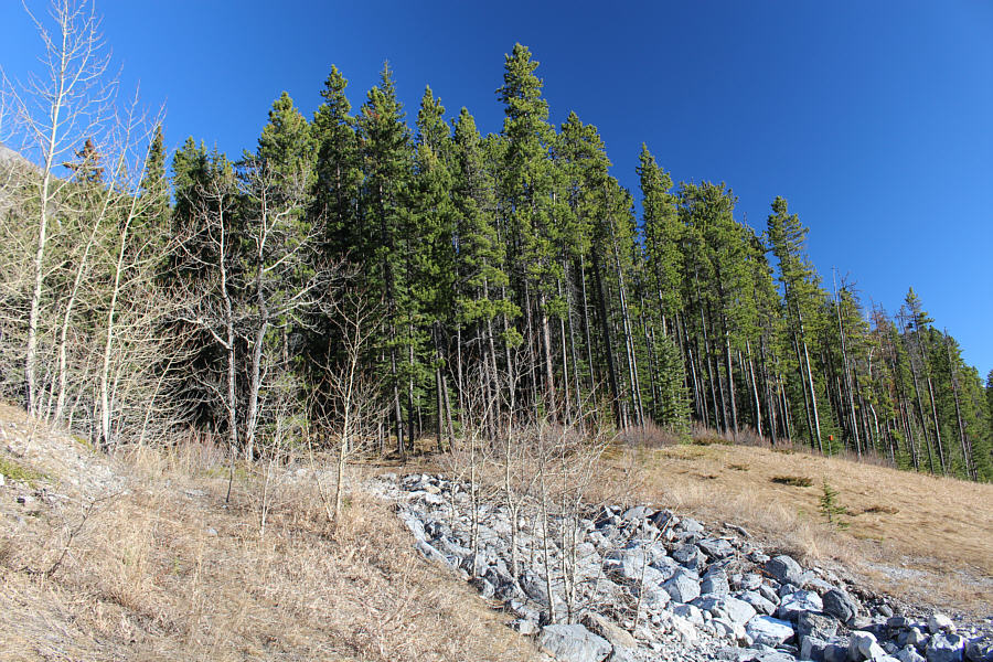 |
The approach trail starts on the left
side of this rocky drainage. |
 |
A clearing low down grants this
foreshortened view of the west ridge. |
 |
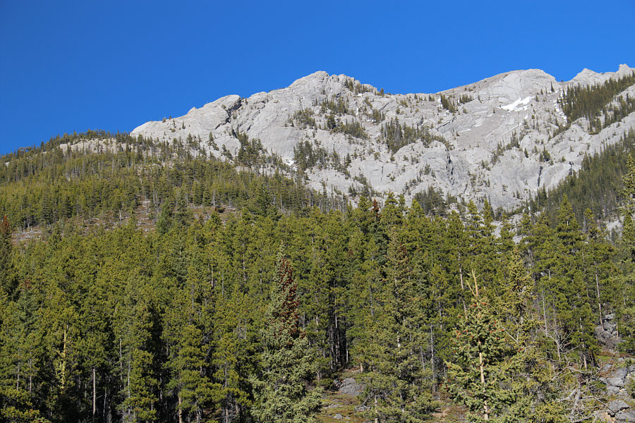
Rock slabs abruptly appear above tree
line. |
 |
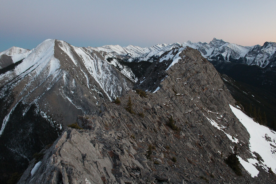
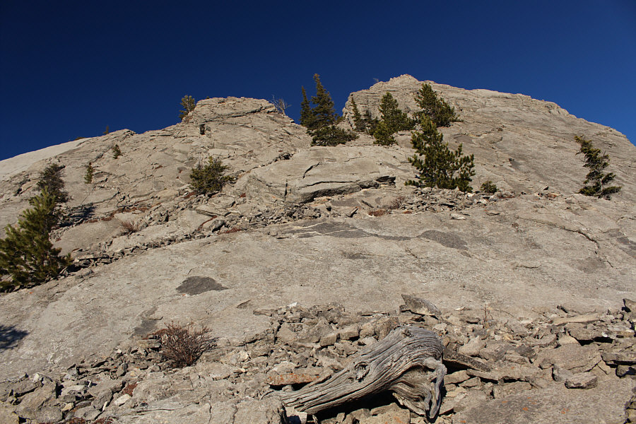
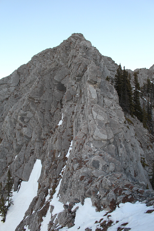
Daylight begins to fade on the west
ridge. The lower half of the normal ascent route for Mount
Baldy's main peak is visible beyond the slabs. |
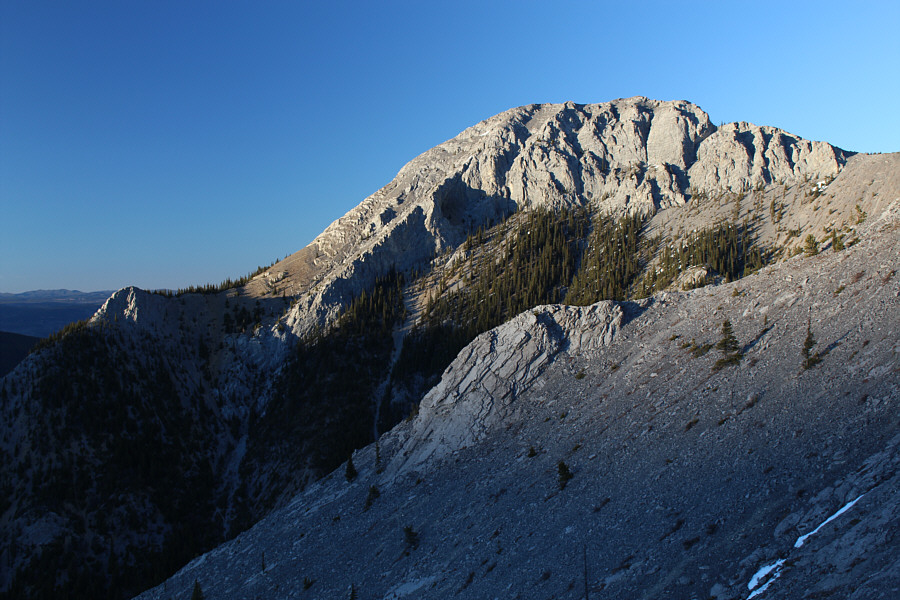 |
The main peak of Mount Baldy is still
bathed in sunlight. |
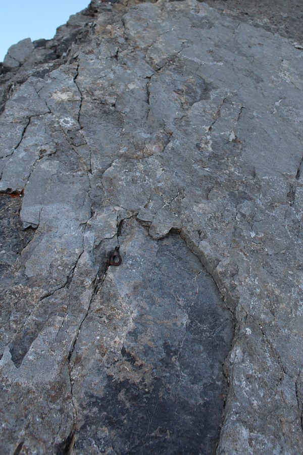 |
A piton marks the start of the
difficult scrambling section on the ridge. The "easiest" way up
this section is via an exposed traverse to the left. |
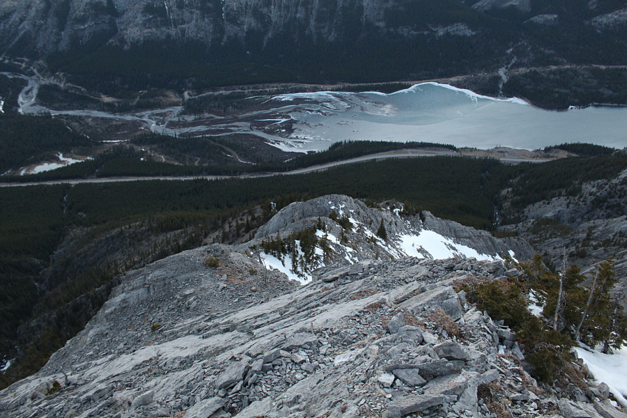 |
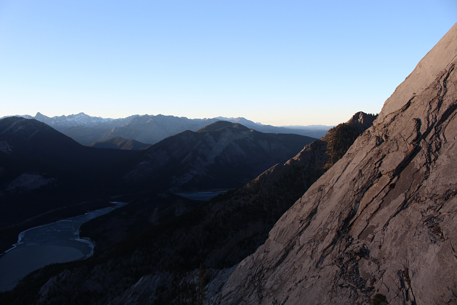
This is looking down the west ridge
toward Barrier Lake. |
 |
The crux is an intimidating sight. |
 |
This is looking down at a narrow and
exposed ledge (on the slab in the foreground) which Sonny just
traversed. |
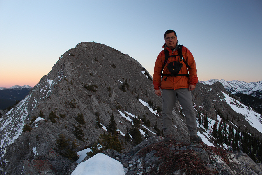 |
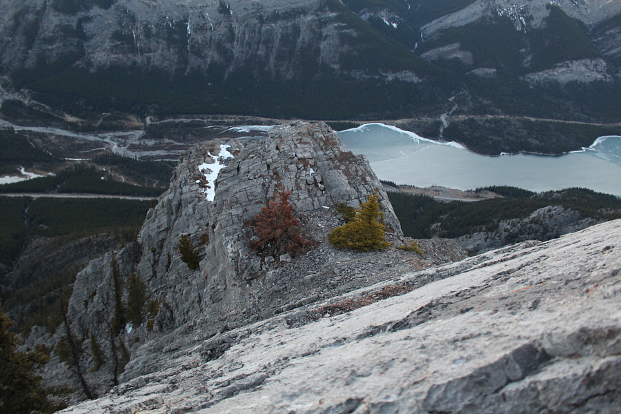
Past all major difficulties, Sonny
tops out on a bump not far from the west peak (behind him). |
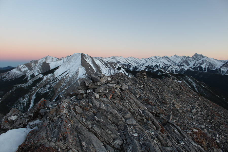 |
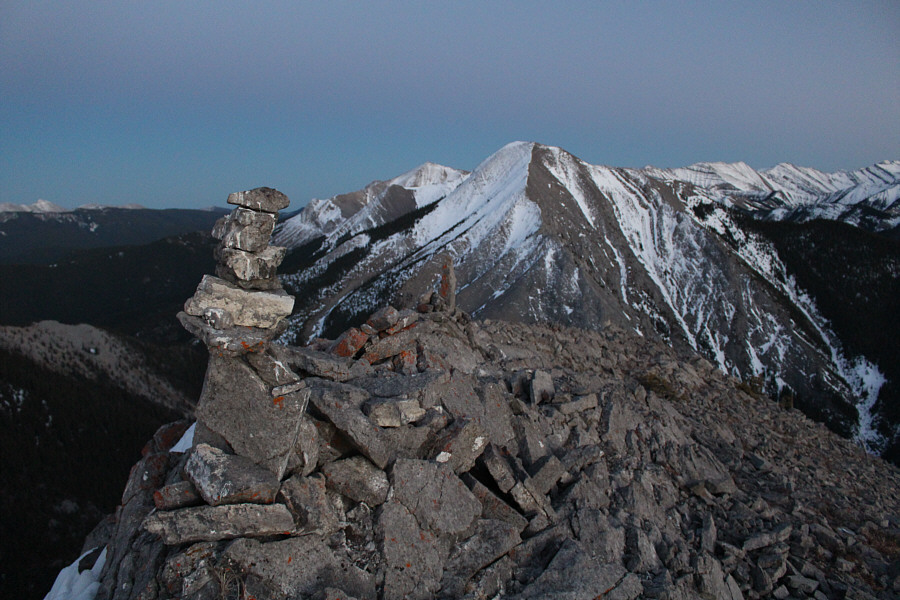
A couple of cairns adorn the
2174-metre summit of Mount Baldy's west peak. |
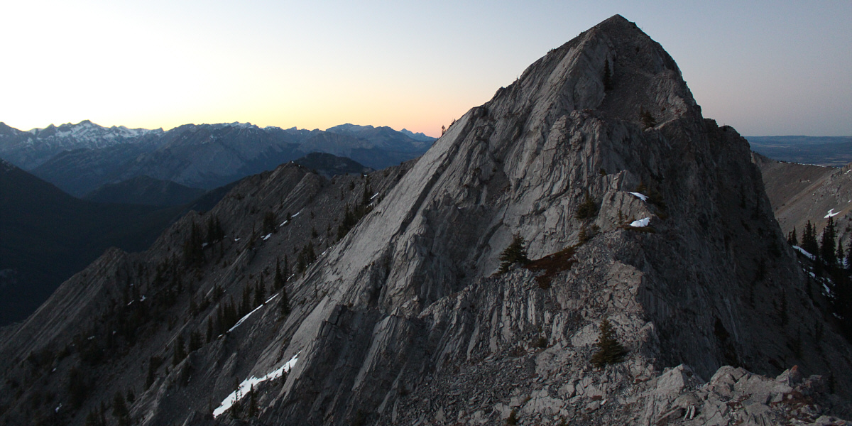
Here is a look back at the west peak of Mount Baldy
from the ridge to the south. The west ridge is also visible at
left.