BOU AVENUE
Mont Saint-Hilaire

On the morning of 11 June 2016, I drove north from Saint-Jean-sur-Richelieu, Quebec to the town of Mont-Saint-Hilaire to spend the day with some friends from Calgary.  Aga Sokolowska and Dorota Sokolowska were in the early stages of a two-month long road trip across Canada, and they were joined by Daniel Dufresne who flew into Montreal from Calgary the day before.  They were all staying with friends of Daniel's (Natasha, Eric and their two children) in Mont-Saint-Hilaire, and we all decided to go for a quick hike up the Montreal suburb's namesake mountain.  Most of Mont Saint-Hilaire is owned by McGill University which operates a nature reserve on the mountain.  Mont Saint-Hilaire is comprised of several forested peaks which surround a natural lake, Lac Hertel.  The most popular hikes in the area lead to several of the peaks in the western half of Mont Saint-Hilaire (admission fee of $6 per adult) while the eastern half is closed to public access.

Since it was the weekend, Mont Saint-Hilaire was understandably crowded as we elbowed our way up a couple of peaks--Rocky and Dieppe--in the northwestern part of the mountain.  All the trails here are generally wide and not too steep, and there are signs everywhere to point people in the right direction.  We did not linger for long at either peak because of rainy weather and hordes of people.  In fact, we probably spent more time at the information centre near the trailhead as Aga, Dorota, and Daniel shopped for maple syrup and maple butter.  We subsequently returned to Natasha's and Eric's house to enjoy a barbeque lunch, and afterward, we all headed to Montreal to see the Cirque du Soleil show known as Luzia.  After the show, Natasha and Eric took their children home while Aga, Dorota, Daniel and I capped off our day by wandering for about three kilometres up Boulevard St-Laurent to get some smoked meat sandwiches at the famous Schwartz's Deli.
Nice model! 
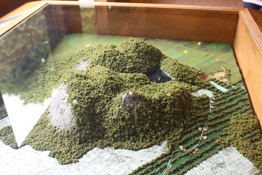
A model of Mont Saint-Hilaire can be found inside the information centre near the trailhead.
A good place for a walk in any weather. 
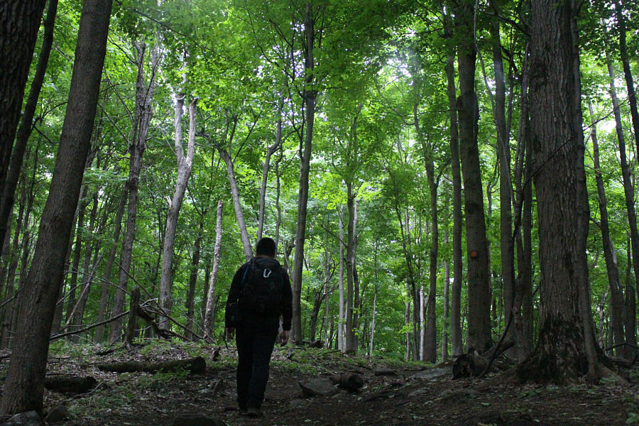
The trees of Mont Saint-Hilaire provide a protective canopy from both the sun and rain.
The only thing that would make Aga happier is if she was on skis! Aga is happy to be climbing again even on a small mountain.
It's Aga and Aga 2.0! 
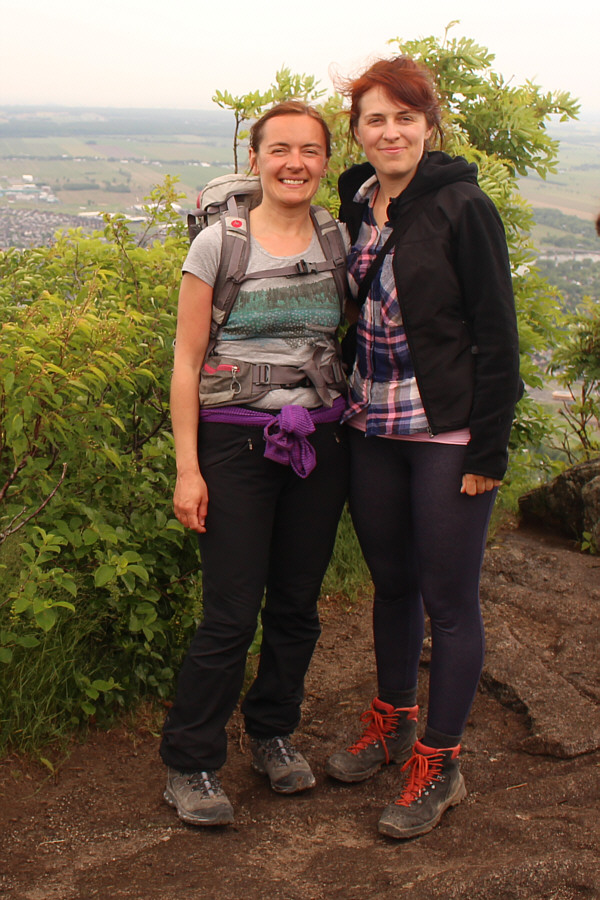
Aga and Dorota stand together near the summit known as Rocky (403 metres).
A nice place to linger... 
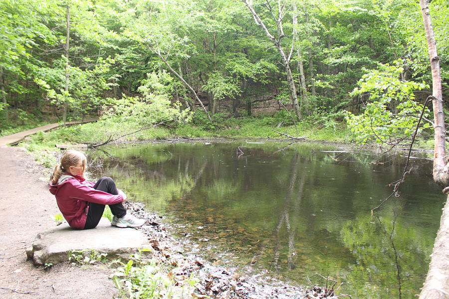
Étang Dieppe is a good spot for sitting and reflection.
Wow, some hands-on scrambling! 
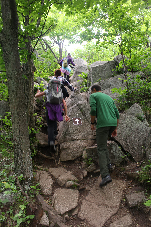
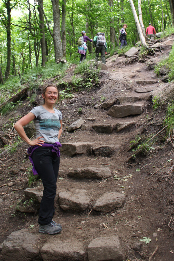
The trail to Dieppe summit is quite rocky near the top.
If you have a sharp eye, you should be able to spot Montreal's Olympic Oval in the distance. 
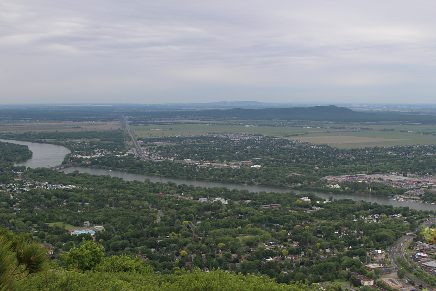
A clearing near the top of Dieppe grants this view of Riviere Richelieu.
Yep, the elevation doesn't quite match up, but I probably didn't stay long enough for my GPS to get a stable reading. A sign marks the summit known as Dieppe (378 metres).
Not a place to find solitude especially on the weekend... Total Distance:  9.3 kilometres
Total Time:  2 hours 45 minutes
Total Elevation Gain:  368 metres

GPX Data

The next day, 12 June 2016, I drove south to Lake Placid, New York with plans to climb Mount Marcy.  Unfortunately, a steady rain at the trailhead killed any motivation to carry out these plans, and I dejectedly turned around and drove back to Canada.  The weather was much better north of the border, and at the last second, I decided to return alone to Mont Saint-Hilaire for some unfinished business.  After paying $6 again to enter the nature reserve, I first visited Lac Hertel which was eerily deserted.  Granted, I had arrived late in the afternoon when most other visitors would have gone home, but it was still nice to enjoy a bit of solitude here.  After visiting the lake, I headed up Pain De Sucre (Sugarloaf) to tag the true high point of Mont Saint-Hilaire. That was followed by a visit to Burned Hill, probably the least interesting of all the peaks of Mont Saint-Hilaire.  After that, it was time to go home.
Well, at least it's not raining here...yet! Here is a more comprehensive view of Mont Saint-Hilaire from the south.
It seems that much more magical when there aren't a zillion people present... 
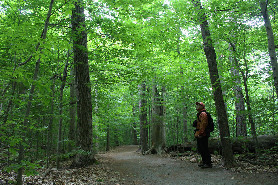
A day later, Sonny is still awed by the greenery of the forest.
No swimming allowed even though there is a sandy beach! 
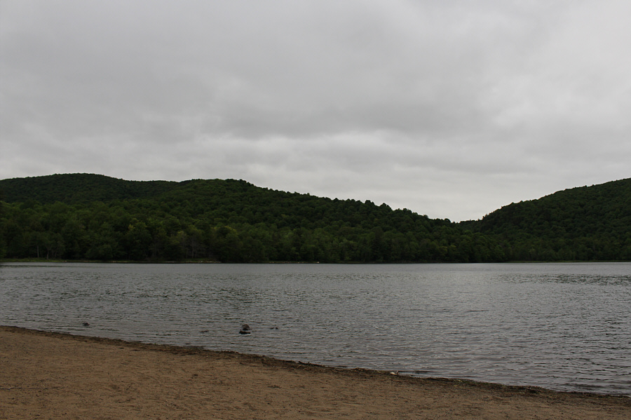
Lac Hertel is a natural lake in the middle of Mont Saint-Hilaire and was formed by glacial erosion.
I actually backed down and scrambled up without using the rope...just for the record! 
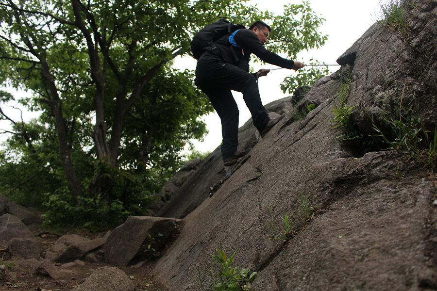
Sonny tries out the fixed climbing rope just below the summit of Pain De Sucre.
It's nice to see a familiar peak! ;-) 
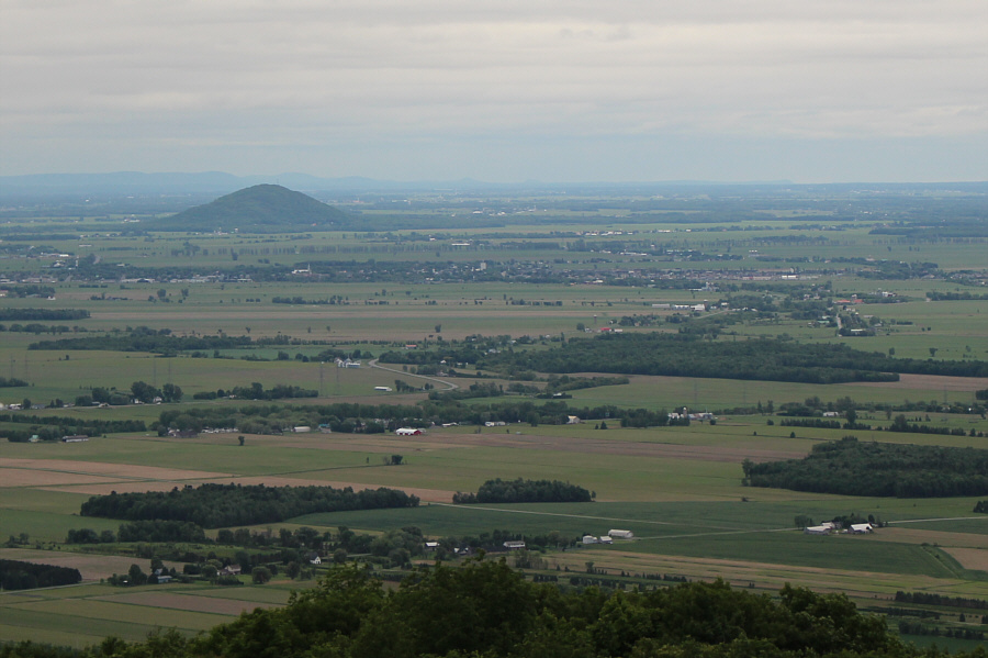
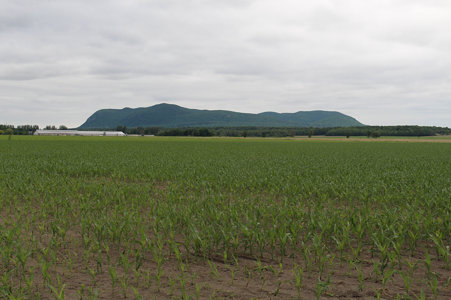
Mont Saint-Grégoire is the most recognizable landmark to the south.
This is my true summit pose... Sonny kneels on top of Pain de Sucre (413 metres), the true summit of Mont Saint-Hilaire.
Here comes the rain... 
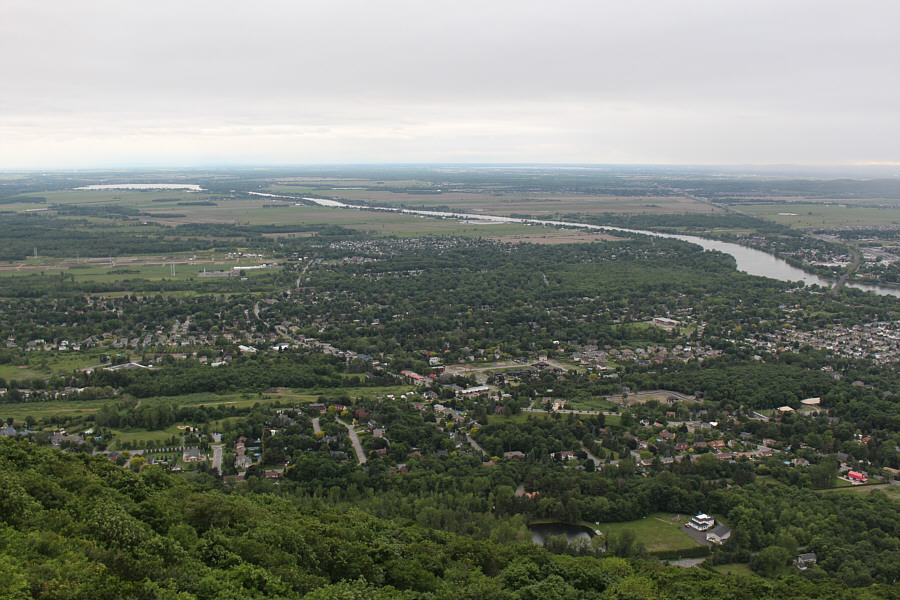
The widening of Riviere Richelieu at upper left is known as Bassin de Chambly.
Despite the rain, it is mostly dry under the forest canopy. Sonny hikes the trail leading to the summit known as Burned Hill.
Why did I waste my time coming here?? Sonny is not impressed with the viewless summit known as Burned Hill (307 metres).
Sucks! This is the actual view from a signed viewpoint just below Burned Hill.
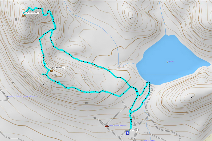
I'm glad I tagged the true summit, but I doubt I shall ever return. Total Distance:  6.9 kilometres
Total Time:  2 hours 8 minutes
Total Elevation Gain:  341 metres

GPX Data