BOU AVENUE
Mount Darrah
Straddling the Continental Divide between British Columbia and Alberta south of Crowsnest Pass, Mount Darrah is a striking peak that I have had my eye on for quite a long time.  From almost every angle, the peak looks impregnable, and route beta is virtually non-existent on the Internet other than the late Rick Collier's report on Bivouac.com for which I do not have access.  At a party a few years ago, I asked Rick about the scramble route for Mount Darrah, and due to time constraints, he could only give me the cryptic answer, "It's complicated."

From studying topo maps and photos, I deduced that the most reasonable route would be an approach from the east via logging roads followed by an ascent of the north ridge.  Coincidentally, that was the route beta given to Rafal (Raff) Kazmierczak when he contacted me and suggested making an attempt.  Raff received a crude KML track from a friend who had climbed Mount Darrah in 2016, and although the track was not necessarily precise, it was still useful for negotiating the maze of logging roads on the approach as well as for route-finding on the upper mountain.  Somewhat surprisingly, Raff's friend mentioned that it had taken him only about 7 hours to complete the trip, and anticipating a relatively short day, Raff suggested that I meet him at the Tim Horton's in Blairmore, Alberta at 7:30 AM on 23 July 2017.  Raff was a bit late arriving at the Tim Horton's as he had gotten only about 4 hours of sleep after a marathon ascent of another peak the previous day.  Since we both brought mountain bikes for the approach to Mount Darrah, it was easier to drive both our vehicles to the trailhead which is located about 15 kilometres south of Blairmore along the well-maintained Lyons Creek (Sartoris) road (access via 16 Avenue and 131 Street in East Blairmore).

Looks easy enough from here...LOL!

Mount Darrah is readily visible from Lyons Creek road.


From the parking area (0.0 km), we rode the obvious double-track westward and soon crossed Goat Creek on what looked like a shiny new bridge (0.35 km).  Beyond the bridge, we climbed gradually at first and then more steeply as we approached the first important junction (2.42 km).  We turned right at this point to take a slightly overgrown shortcut trail which quickly intersected another double-track (2.54 km).  Turning right again, we settled into a generally pleasant ride which was occasionally interrupted by some big mud holes.  We eventually descended to the second important junction at a crossroads with Goat Creek road (5.1 km) and made a hard left turn here.  Shortly after, we left the Goat Creek road and veered right (5.6 km) onto an overgrown road with a locked gate.  This gate can easily be circumvented by anyone on foot.
You can drive a bit further up the logging road, but it's really not worth it. Raff gets his gear ready at the trailhead.
A surprisingly nice bridge--there must be some regular traffic coming through here. 
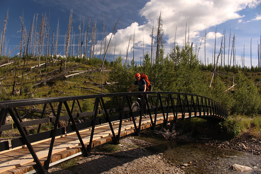
Raff rides across the bridge over Goat Creek.
It would really suck to have to walk this! 
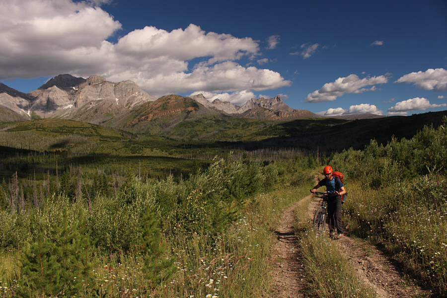
Most of the logging road approach is very pleasant to ride.

Photo courtesy of Rafal Kazmierczak

Hardcore mountain bikers are laughing right now! A few sections of the road require some pushing.
Once we turned onto the overgrown road leading into the basin below Mount Darrah's northeast face, we encountered more and more deadfall which eventually forced us to abandon our bicycles and continue on foot up the valley.  Where the road turns abruptly northward, we left it and bushwhacked a bit to reach semi-open slopes leading to the headwall guarding Mount Darrah's north ridge.  Studying the headwall on approach, we picked out a feasible ascent route up a mix of slabs and dirt.  This route turned out to be quite steep, and some of the slabs felt a bit exposed to climb up.  Raff even donned climbing shoes to aid his ascent.
A chainsaw could make it easier to bike further up this road... 
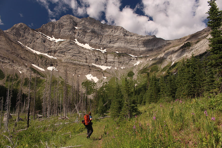
Raff hikes along the overgrown road into the basin below the northeast face of Mount Darrah.
There may be other ways up, but this one works for us! 
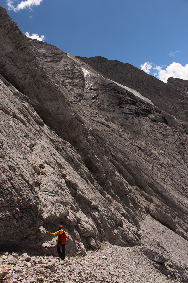
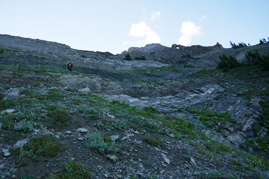
After leaving the road, Raff approaches the headwall guarding the north ridge of Mount Darrah.  His approximate route up the headwall is indicated.
Good route-finding is a must here! Steep slabs abound on the headwall.
With few holds here, it's all about the friction! 
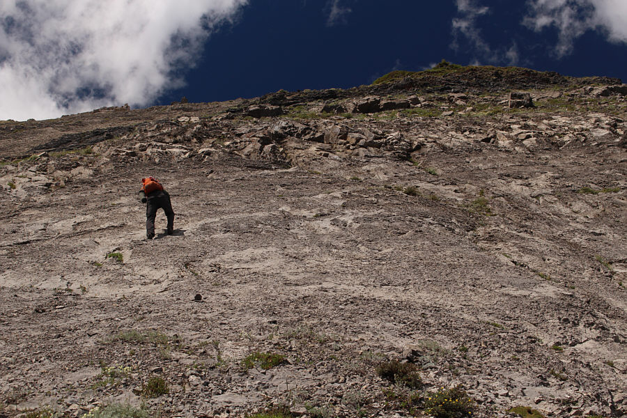
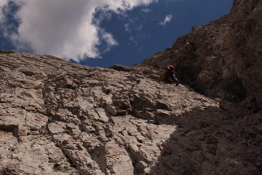
With his rock climbing shoes on, Raff dances up this slab.
Time to take a deep breath...or two...or three... Raff (right) is nearly at the crest of Mount Darrah's north ridge.
Upon reaching the crest of Mount Darrah's north ridge, we left some extraneous gear behind before resuming our ascent.  We climbed up the north ridge for a short distance before making a descending traverse across the northwest face in order to circumvent some Class 5 terrain on the ridge crest.  We had some route-finding issues here as we tried to reconcile where we were headed with the KML track we were following.  At one point, we were using friction holds to ascend a steep gully which Raff rated as Class 5 terrain, and later on, we almost considered going up a big sketchy wall to gain the northwest ridge.  The correct route is nothing more than Class 3 scrambling up slabs and rubble, but this section takes longer than expected.  We eventually regained the crest of the north ridge albeit only briefly to scramble up a somewhat exposed ledge.  We then traversed westward onto the face and groveled up some more loose rubble to a false summit.
It's the only logical place to go! 
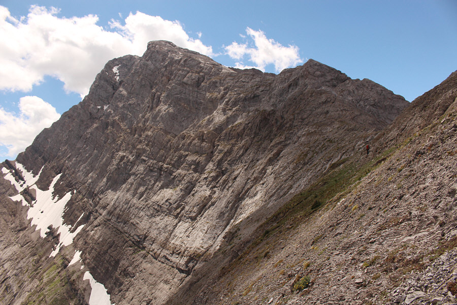
After briefly climbing up the north ridge, Raff traverses toward the northwest face.
Keep going down and be patient here...real patient! 
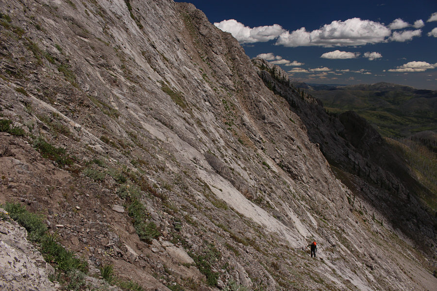
Raff descends a scree ramp looking for an easy way back up to the ridge.
Not good when you start relying on friction to keep from slipping down the mountain! Raff encounters increasingly difficult terrain after prematurely turning up this gully.
This part is a long uphill grind. Steep slabs and rubble make up much of the northwest face.
Actually, this was more enjoyable than the slab and rubble lower down. 
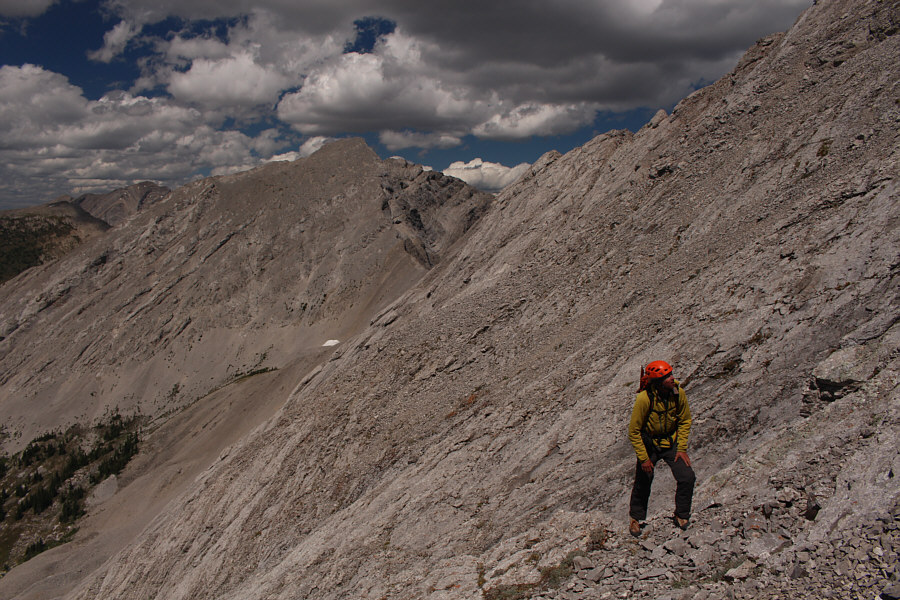
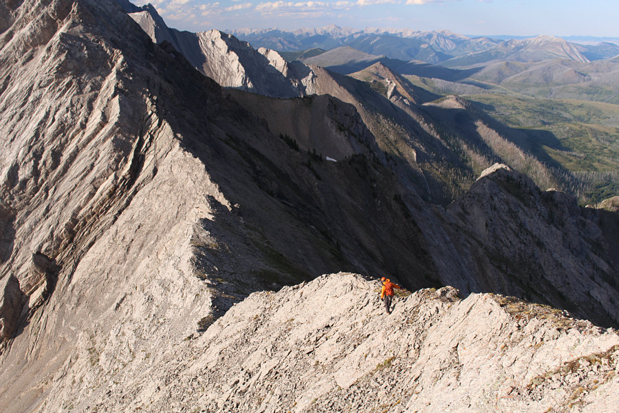
Raff finds himself on some exposed terrain on the crest of the north ridge.
The connecting ridge to the true summit looked very daunting, and sure enough, as I began the traverse, the level of exposure on the knife edge reached epic proportions.  One particular awkward section had me clinging for dear life over the abyss of the east face, and Raff appeared ready to pull the plug here just as I reached more solid footing.  Having already made it across this extremely exposed section, I was fully committed to go for the true summit.  While Raff pondered his next move, I continued to scramble along the summit ridge which still had a few more exposed sections to deal with.  Throughout all this, there was a blustery wind which constantly threatened to knock me off-balance and certainly did not make things any easier.  When I finally topped out on the true summit of Mount Darrah, I turned around and was surprised to see Raff down-climbing the steep west side of the connecting ridge.  He had apparently discovered a route to bypass the extremely exposed section, and after traversing for a bit below the crest, he climbed back up to the summit ridge and finished the ascent in a flurry.
Raff: Why can't THIS be the true summit?? 
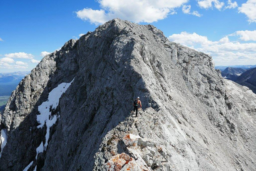
Standing on the false summit, Raff appears less than thrilled about the connecting ridge to the true summit.
Watch that drop-off on the left...and on the right as well!! Sonny wastes no time to tackle the connecting ridge.

Photo courtesy of Rafal Kazmierczak


Trust me; it gets worse... The initial down-climb from the false summit is tricky.
Doing my best impression of Alex Honnold... 
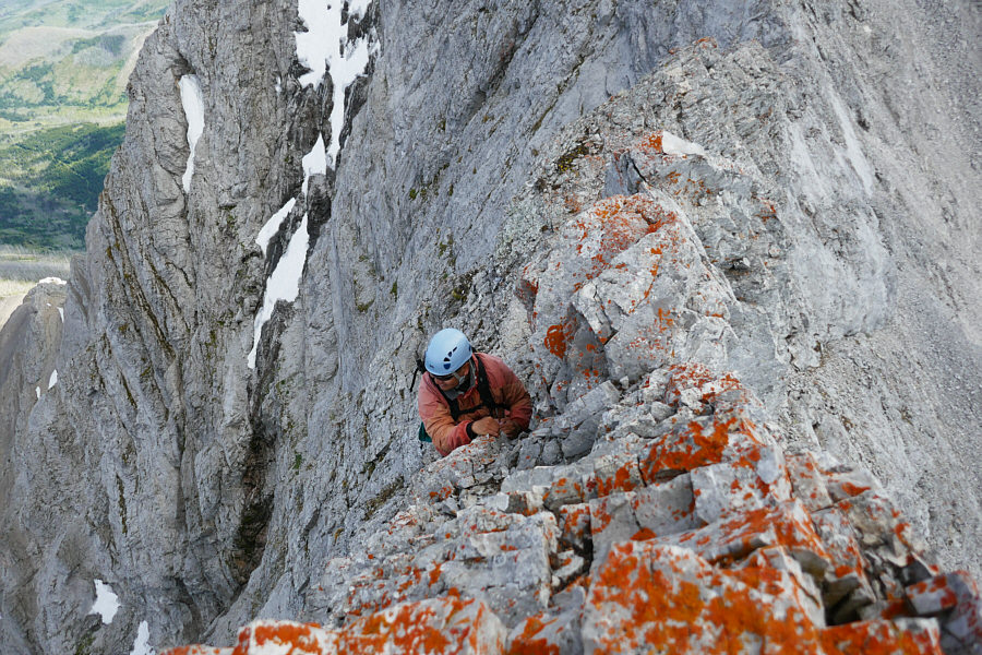
Sonny works his way around an awkward gendarme along the ridge.  The exposure here is terrifying.  Not visible are the wind gusts blowing over the ridge.

Photo courtesy of Rafal Kazmierczak

Still some work left to do... 
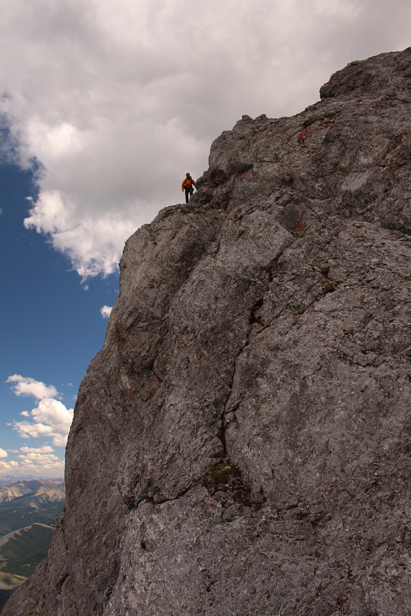
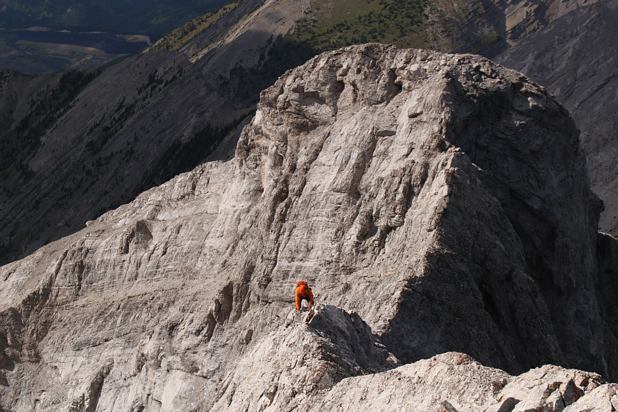
Sonny continues up the exposed summit ridge.

Photo courtesy of Rafal Kazmierczak

I'm not sure why, but Raff was climbing like a madman here! Raff works his way up the summit ridge.  The false summit is visible behind him.
The summit register was placed by Rick in 1993, and the next entry was in 2012 by an old acquaintance, James Yearous.  Since 2012, Mount Darrah has seen, on average, one ascent per year which is still remarkably high given the paucity of route beta and the complexity of the climb.  Our ascent alone took nearly 8 hours, and while it would have been nice to savour our accomplishment with an extended break on the summit, we both felt some urgency to start descending given the lateness of the day.
Hat head! 
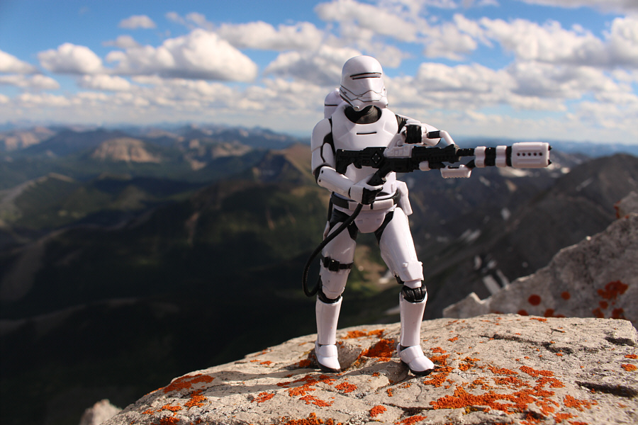
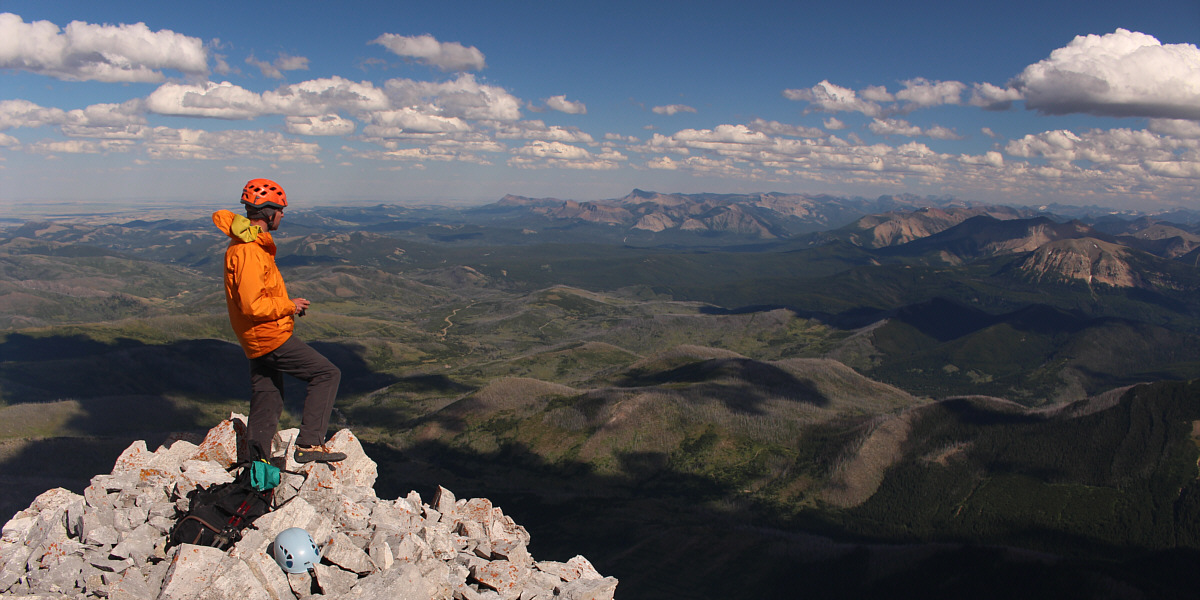
Sonny and Raff stand atop Mount Darrah (2757 metres).
Some of these unnamed peaks might even be unclimbed... 
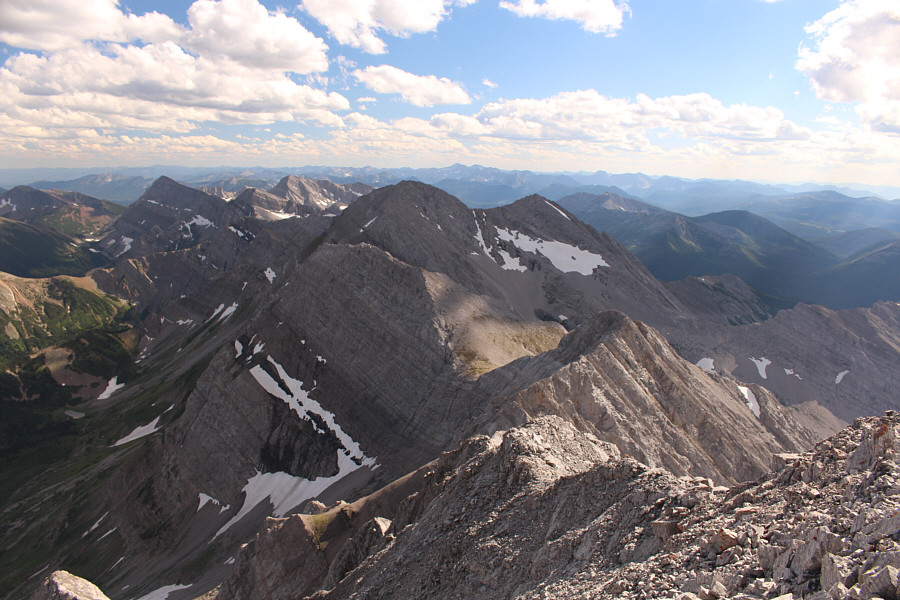
This is the view to the south along the Continental Divide.
There are rumours that the mine may shut down in a few years. Coal Mountain and the associated Corbin Mine are distinct landmarks to the west.  Some fascinating information about the ghost town of Corbin can be found at ghosttownpix.com and at BIGDoer.com.
There are some other peaks here that are of interest to me... 
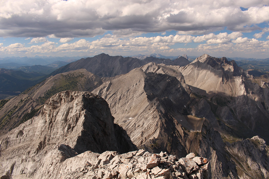
This is the view to the north along the Continental Divide.  The big shadowy peak to the left is Mount Ptolemy.

I think you've climbed everything you can see that way, Raff!

Most of the area to the southeast is comprised of the newly appointed Castle Wildland Provincial Park.


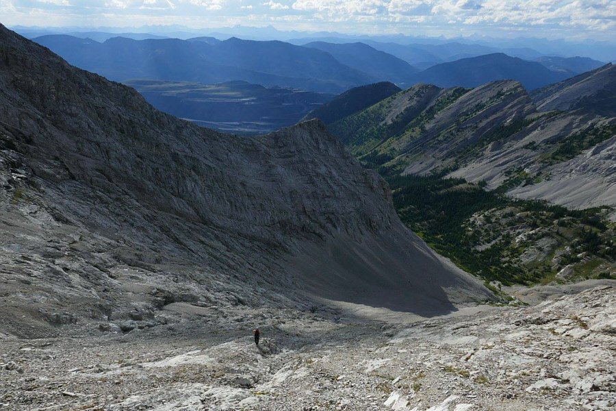
On descent, I followed Raff down a scree face on the northwest side of the summit and then traversed across slabs to a Class 4 chimney where he had initially descended from the connecting ridge.  In effect, we bypassed most of the difficulties on the connecting ridge though I still found parts of the lower traverse to be quite exposed.  Going back over the false summit, we carefully retraced most of our steps back to the top of the headwall.  While not as technically difficult as the summit ridge, the terrain here, consisting of mostly steep slabs and ankle-breaking rubble, proved to be both tedious and wearisome to descend.  Furthermore, both Raff and I were also running low on water and becoming dehydrated.  When we took a short break at the top of the headwall to try and fuel up with some food, I found it hard to choke down even a small chocolate bar.
I didn't like this scree slope at all and would have much preferred down-climbing the summit ridge. Raff descends a steep scree slope just below the summit.
Less sketchy than the ridge, but this is still a no-slip zone! Raff's bypass route below the crest of the connecting ridge still has some exposure.  The Class 4 chimney to regain the ridge is at centre in the photo.
Excellent scrambling here! Raff climbs up the Class 4 chimney to get back onto the connecting ridge.
Much easier to climb up than come down. Raff climbs back up the false summit.
Good spot for base jumping! This rock step on the north ridge has a definite airy feel to it.
Another no-slip zone...yawn. Sonny carefully descends an exposed ledge on the north ridge.

Photo courtesy of Rafal Kazmierczak

If access via the Corbin Mine wasn't problematic, the valley below might make for a better approach. Sonny works his way down the slabs and rubble of the northwest face which is steeper than it looks here.

Photo courtesy of Rafal Kazmierczak

At one point during our ascent, we actually considred gaining the northwest ridge in the background. Behind Raff are some of the bigger features on the northwest face.
We are feeling pretty tired at this point... Raff drops down the last part of the north ridge before the top of the headwall.
Despite his exhaustion, Raff did a great job of leading us down the headwall safely, and once we regained the logging road in the basin, we were able to refill our water bottles at a nearby creek.  By the time we retrieved our bicycles, the sun had already set, and much of our ride out was in growing darkness.  Unfortunately, I had neglected to bring my regular eye glasses and had to ride part of the way back wearing my prescription sunglasses which made everything appear darker than it really was.  It eventually became too dark to see anything with my sunglasses, and I took them off while donning my headlamp.  Although my vision was blurry, I could still make out the double-track we were riding on, and a few minor spills aside, I managed to ride the rest of the way back to our cars without serious injury.
Still very steep here! Sonny hikes down the headwall.  A natural arch is visible higher up to the right.

Photo courtesy of Rafal Kazmierczak

It's so nice to walk horizontally again! 
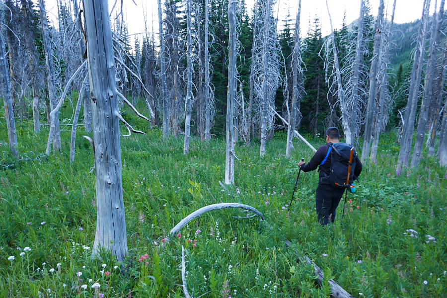
Back on flatter terrain in the basin, Sonny picks his way through an old burn.

Photo courtesy of Rafal Kazmierczak

I wear my sunglasses at night... 
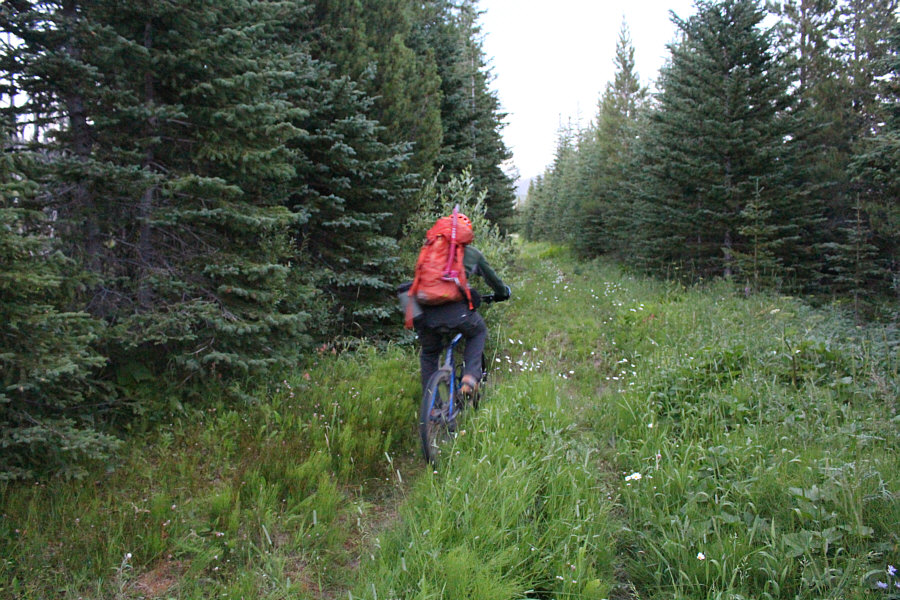
Raff begins riding back to the trailhead shortly after retrieving his bicycle.  The ambient light is actually much darker than it appears in the photo.
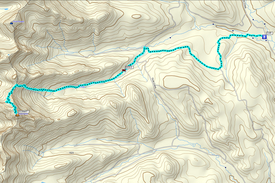
After packing up our bicycles and changing into fresh clothes, Raff and I both drove back to Blairmore where we had to settle for some hot dogs from Mac's for dinner since everything else was closed.  We both subsequently drove back to Calgary separately, but Raff stopped somewhere along the way for a quick nap and made it home about an hour after me.  When we are no longer sleep-deprived, I hope to get together again with Raff for a more fitting dinner to celebrate our epic ascent of Mount Darrah.
7 hours round-trip?? I call bullshit!!! Total Distance:  25.4 kilometres
Round-Trip Time:  13 hours 38 minutes
Net Elevation Gain:  1247 metres

GPX Data