BOU AVENUE
Mount Furlong

After spending the previous night at the hostel in East Glacier, Montana, Eva B., John Bence, Marta Wojnarowska, Zosia Zgolak and I drove to the south end of Glacier National Park to ascend Mount Furlong on 21 May 2017.  The mountain itself is actually located outside the park in Great Bear Wilderness, but easy access and a convenient trail up the west ridge make Mount Furlong an attractive peak-bagging objective.

Starting from Bear Creek trailhead (south side of US Highway 2 about 7.8 km southwest of turnoff to Devil Creek campground or 6.4 km southeast of the bridge over Middle Fork Flathead River), we walked past a vault toilet before crossing to the south side of Bear Creek on a good bridge.  The trail seemingly goes in circles for the first kilometre or so as it takes a rather convoluted route around a short hill before dropping down to cross Edna Creek.  Shortly after the creek crossing, we turned left at a signed junction for Edna Creek trail and began climbing steadily up through the forest.  Snow patches became more abundant as we gained elevation, and we eventually lost the trail completely under a persistent blanket of snow.  Fortunately, the snow was supportive enough to walk on, and route-finding was not too difficult on the upper part of the west ridge.  We steered clear of a few massive cornices along the summit ridge, but otherwise, the final climb to the top was straightforward.

Because of the fantastic weather, we hung out at the top for well over an hour before reluctantly retracing our steps for the descent.  The snow was a real boon on this day as we plunge-stepped most of the upper mountain and much of the west ridge.  While the remainder of our hike out was uneventful, there were still some minor annoyances at the end including the short climb after re-crossing Edna Creek and the convoluted path near the trailhead.  These annoyances were all but forgotten once we returned to East Glacier to get some ice cream.
Bear Creek was a raging torrent. 
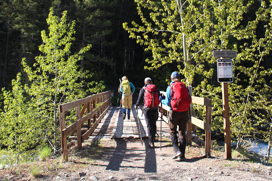
Marta, John and Eva cross Bear Creek on a good bridge.
Actually, Edna Creek was also a bit of a raging torrent! 
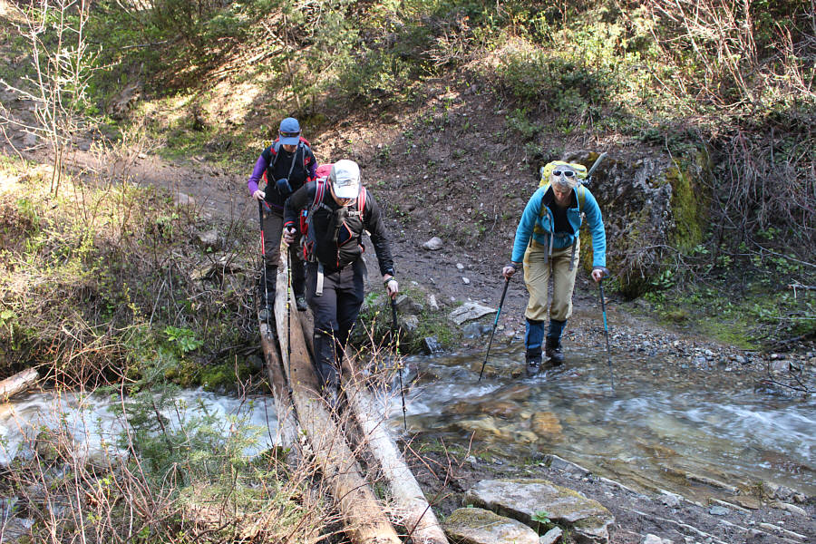
Eva, John and Marta cross Edna Creek on a not-so-good bridge.
The trail is easy to follow even through the snow since it stays pretty straight all the way up. 
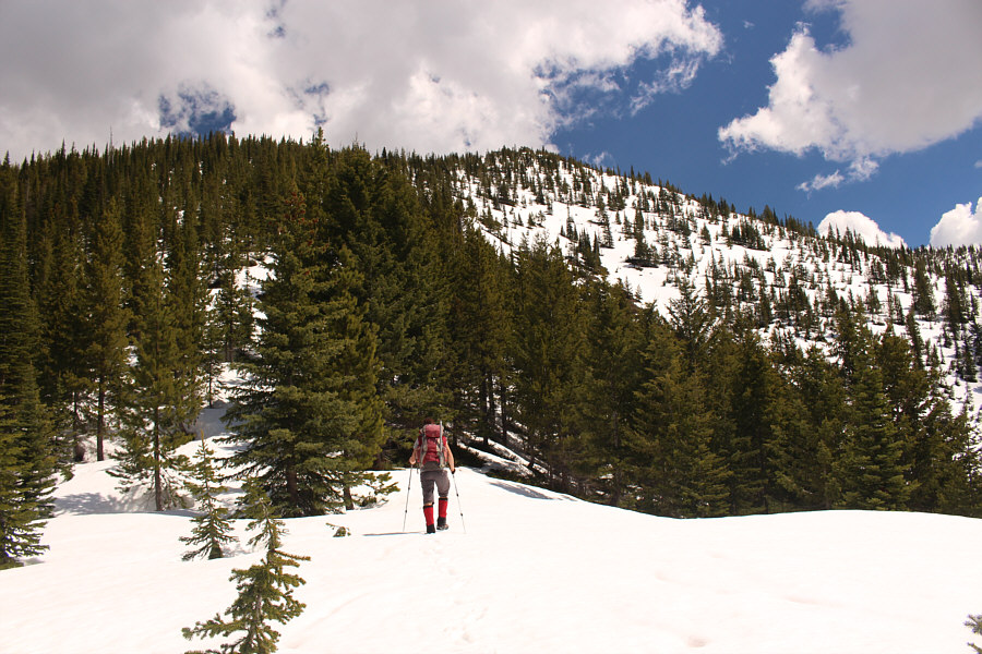
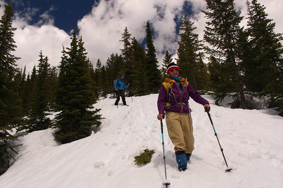
Marta, Zosia, Eva and John follow the trail across a snow-covered slope.
Boy, were we ever lucky to have good snow conditions!

Zosia makes her best guess as to where the trail goes up the ridge.

Can you spot Zosia up ahead? 
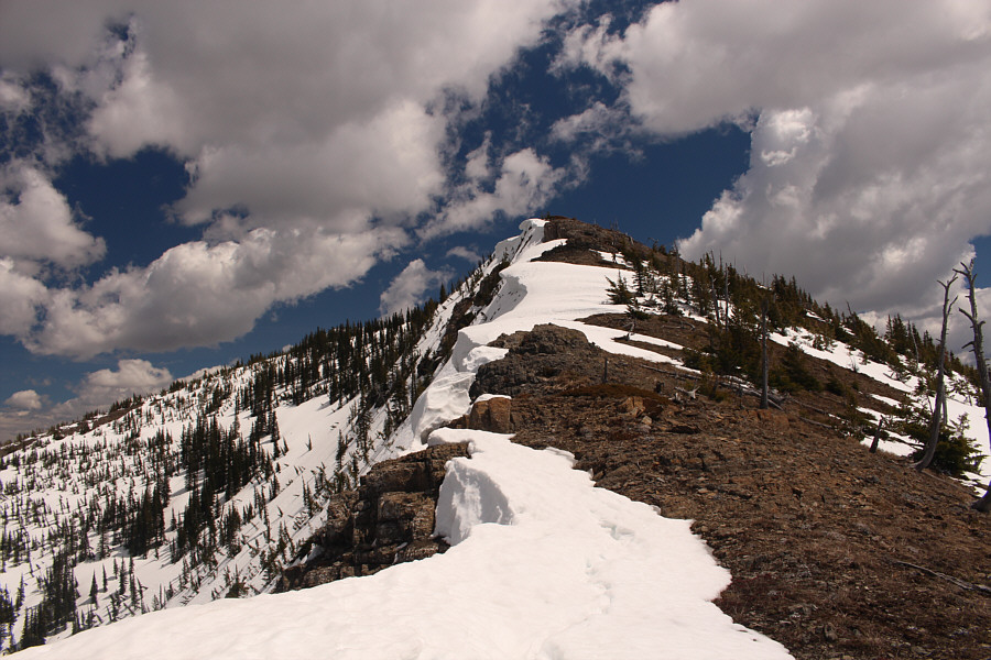
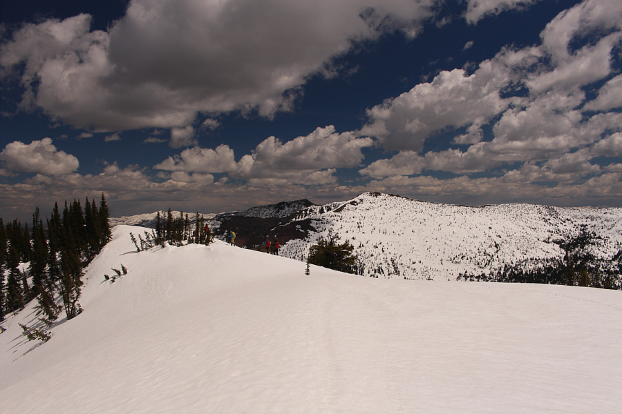
The west ridge of Mount Furlong is partially clear of snow.
Can someone go stand on one so that I can take a picture? 
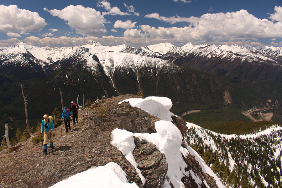
Marta, Eva and John pass some lingering cornices on the west ridge.
I was standing on the actual summit when I took this photo. 
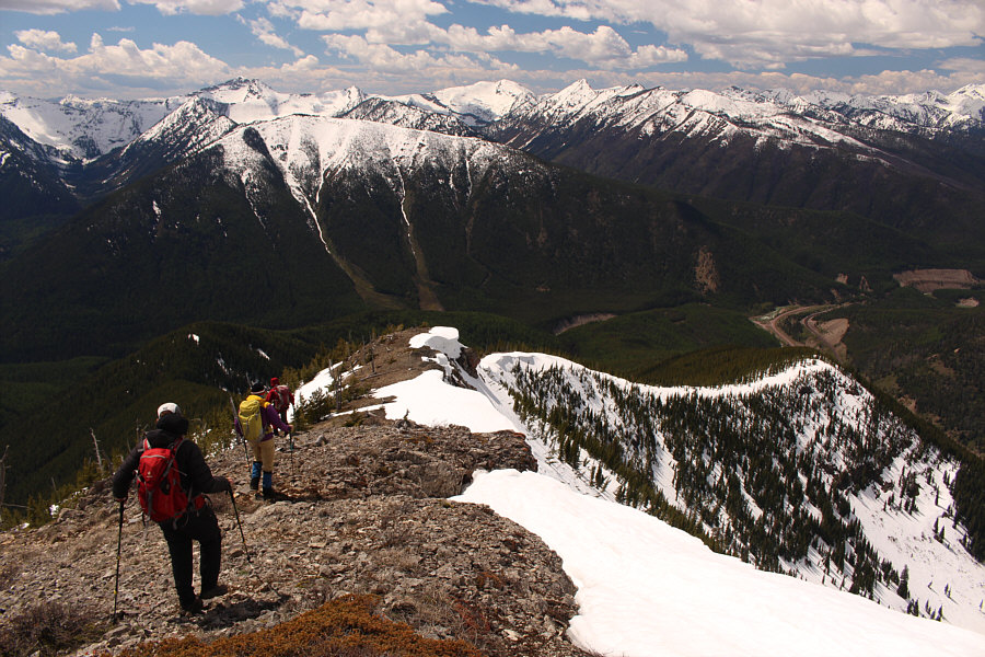
The group wanders along the summit ridge of Mount Furlong.  Devils Hump is the snowy peak in the distance.
These lakes are probably quite difficult to access. 
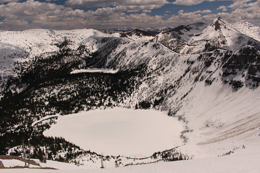
Two snow-covered lakes sit in Tranquil Basin to the east of Mount Furlong.
Lotsa interesting obscure mountains down here! 
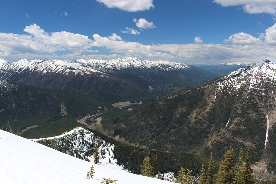
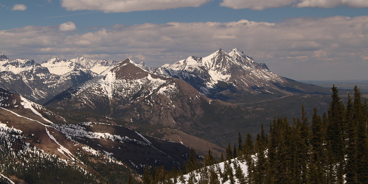
The peaks of Great Bear Wilderness can be seen to the northwest.  The big peak in the distance at centre is Great Northern Mountain.
Scramble the bunny but not Santa Claus! 
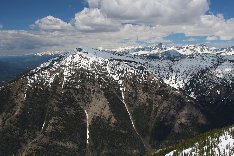
Across the valley to the north is Running Rabbit Mountain which is within Glacier National Park.  Sticking up like a sore thumb on the right horizon is Mount Saint Nicholas.

Looking pretty cool in our sunglasses!

Sonny, Zosia, Eva, John and Marta stand on the summit of Mount Furlong (2252 metres).


I will return to get Little Dog and Summit soon...I hope!

Visible to the northeast are Elk Mountain (left of centre) and the double peaks of Little Dog Mountain and Summit Mountain.


Looks like a nice toboggan run down the west ridge! John, Marta and Zosia descend the west ridge.
Almost as good as skiing! Eva and Marta plunge-step down the snowy ridge.
Everyone is starting to think about ice cream... The hike back to the trailhead is pleasant and easy.
Unfortunately, my strawberry ice cream was a bit tasteless. 
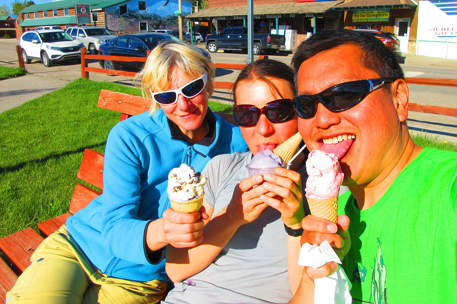
Marta, Zosia and Sonny enjoy ice cream at a little park in East Glacier.

Photo courtesy of Zosia Zgolak
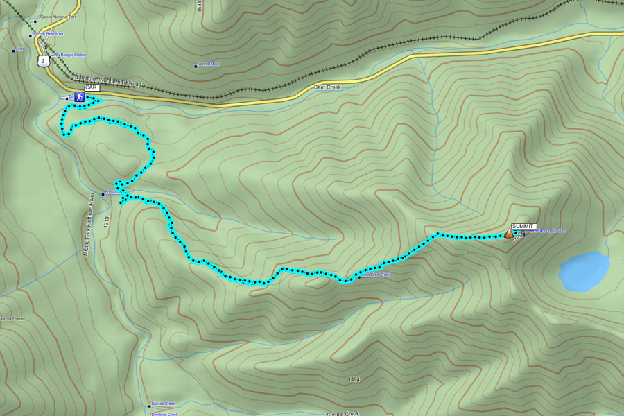
Maybe a bit too early for this peak. The lakes in Tranquil Basin are apparently stunning when they are not snow-covered. Total Distance:  14.9 kilometres
Round-Trip Time:  7 hours 55 minutes
Net Elevation Gain:  1072 metres

GPX Data