BOU AVENUE
Great Northern Mountain

Great Northern Mountain is the highest peak in the Great Bear Wilderness located south of Montana's Glacier National Park.  I first noticed this conspicuous peak from the summit of Mount Furlong, and afterward, I was happy to learn that there is a fairly straightforward non-technical route up its northwest ridge as described in summitpost.org.  Since Zosia Zgolak and I were in the area for the long weekend, we decided to pay a visit to Great Northern Mountain on 6 August 2017.

After starting the day with breakfast at Hungry Horse Dam, we drove to the trailhead for Great Northern Mountain as follows:

From Highway 2 at Martin City, Montana, look for the "EAST SIDE HUNGRY HORSE RESERVOIR" sign and turn east onto Old US 2.  Shortly after, veer right onto Central Avenue and drive through the heart of Martin City.  Central Avenue eventually turns into East Side road which has a good 2WD gravel surface.  About 24.3 kilometres after turning off from Highway 2, make a sharp hairpin left turn onto a narrower road (still okay for 2WD) and drive for another 800 metres to a large pullout on the left just before a decommissioned bridge over Hungry Horse Creek.

Surprisingly, there were already several cars in the pullout when we arrived at the trailhead.  As it turns out, Great Northern Mountain is a much more popular hiking objective than I had expected, and we would later encounter at least six separate parties on the mountain ranging from solo hikers (some with dogs) to a huge group of young children with their parents (and more dogs).  Walking across to the north side of the decommissioned bridge, we immediately turned right into a smaller pullout and found the start of the trail.  Hungry Horse Creek can be accessed from this pullout and is essentially the only reliable water source along the entire route besides Stanton Glacier near the summit.
Not what comes to mind whenever "glory hole" is mentioned... Hungry Horse Reservoir stretches away to the southeast beyond the "glory hole" (spillway) at Hungry Horse Dam.  The glory hole is the highest of its kind in the world.

Photo courtesy of Zosia Zgolak


Almost as impressive as the Hoover Dam with a lot less tourists! Hungry Horse Dam is 172 metres high and 645 metres long.  Its width ranges from 98 metres at its base to 10 metres at its top.
Steep already! 
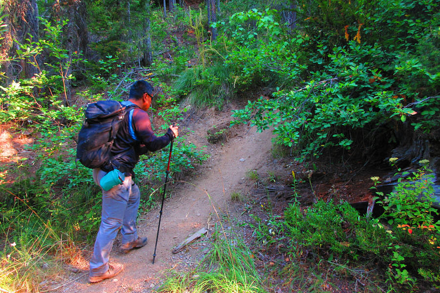
Sonny finds the start of the trail near Hungry Horse Creek.

Photo courtesy of Zosia Zgolak

If there was an award for the World's Most Brutally Steep Trail, the one for Great Northern Mountain would win hands down.  There are virtually no switchbacks or flat spots along the initial stretch of trail which climbs relentlessly straight up the steep slope, gaining nearly 800 vertical metres over a distance of about 2.5 kilometres.  Even Vancouver's infamous Grouse Grind is not this steep!  The one consolation was that we had more than half of the elevation gain behind us already when we finally broke out of the forest and onto the ridge crest.  Continuing along the trail, we easily hiked over or around several bumps along the ridge before reaching the first of several false summits on the upper mountain.  The remainder of the ascent is a bit more complicated than a simple walk-up.  The trail braids in a few places here, and some route-finding is necessary to avoid more difficult terrain.  The crux is a short but exposed Class 3 step right on the ridge crest.  While this step can be quite challenging to non-scramblers, young children and dogs apparently climb it with little difficulty.
Brutally and unrelentingly steep. Zosia grinds her way up the steep trail.
Zosia is an expert huckleberry-picker! 
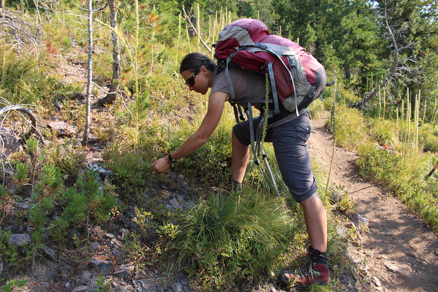
Zosia finds some relief from the steep hiking by picking huckleberries.
Gee, the summit looks awfully far away... 
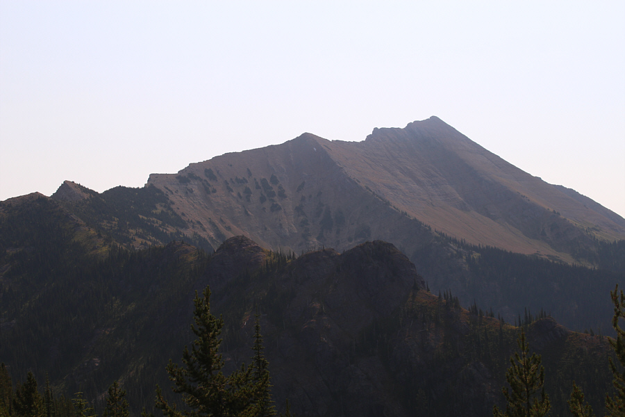
Here is one of the first clear views of Great Northern Mountain from its northwest ridge.
Yummy! 
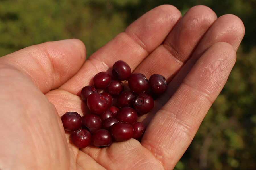
Sonny holds a handful of ripe huckleberries.
Zosia still looks fresh after climbing about 800 metres over a distance of 2.5 kilometres! Part of Hungry Horse Reservoir is visible from the northwest ridge.
Up, down, up, down, up, down...getting seasick yet? 
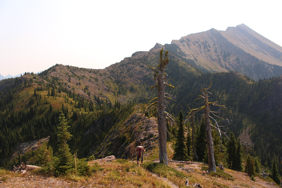
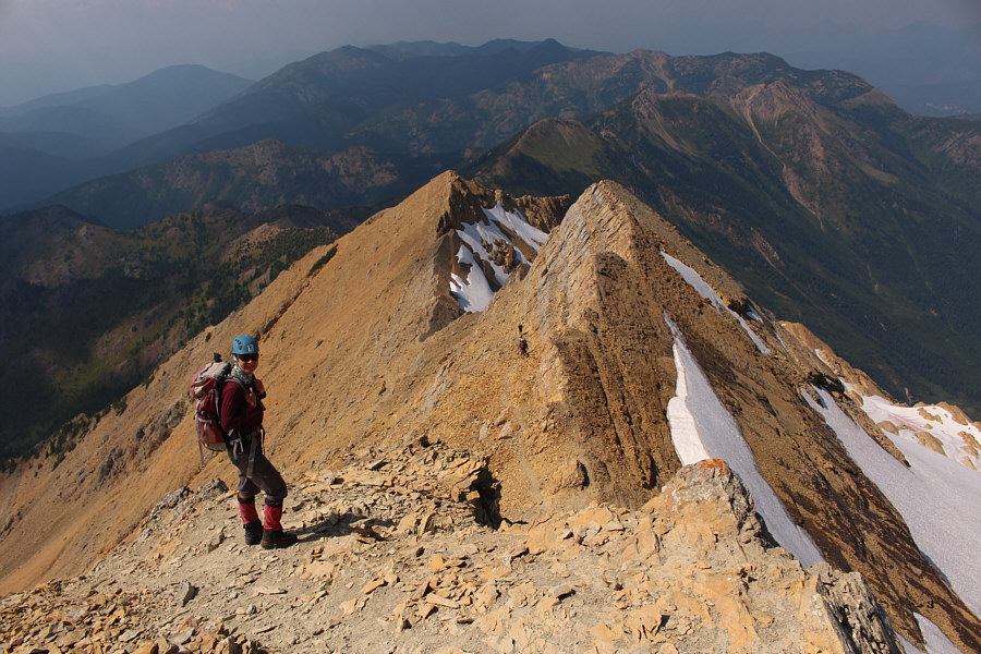
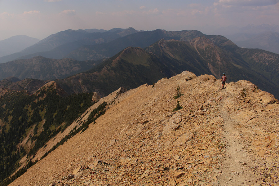
The northwest ridge undulates a fair bit along its entire length.
Stimson's southeast ridge looks like it's in great shape... 
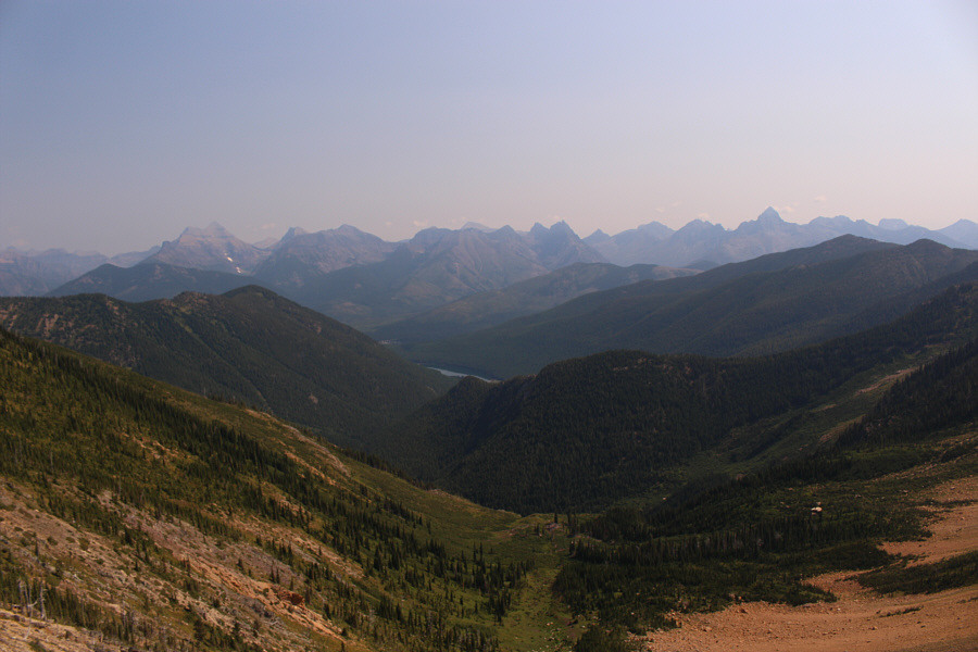
This is looking northeast toward some of the peaks in the southern end of Glacier National Park.  Visible at left is Mount Stimson, the second highest peak in the park.  The striking peak to the right is Mount Saint Nicholas.  The strip of blue at centre is Stanton Lake.
If the mild exposure bothers you here, you might not want to continue going up... 
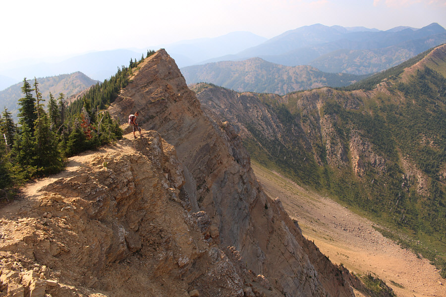
Further up the ridge, the trail skirts rather close to some significant drop-offs.
HARDCORE!!! This intrepid skier bivouacked on the summit the previous night and skied some turns on the Stanton Glacier earlier in the morning before hiking out.
Zosia just walked by and missed a natural arch to the left (not visible in this photo). 
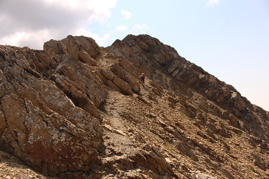
Zosia approaches the first false summit that requires some hands-on scrambling.
Keep in mind though that dogs make it up this peak! Some of the scrambling on the upper mountain is more challenging than expected.
The strenuous ascent and warm temperatures took their toll on us, and both Zosia and I were feeling fatigued by the time we staggered onto the summit of Great Northern Mountain.  We were fortunate to have the summit all to ourselves initially, and consequently, we took an extended break here to eat, drink and relax.  I actually dozed off a few times while sitting and chatting with Zosia and sometimes even with food still half-chewed in my mouth!  Later on, we were joined on the summit by about a half dozen children, three adult chaperones and a very energetic dog.  The resulting circus-like atmosphere made it hard for me to doze off again.

That knob behind us looks just as high if not higher, but we're standing on the gazetted summit.

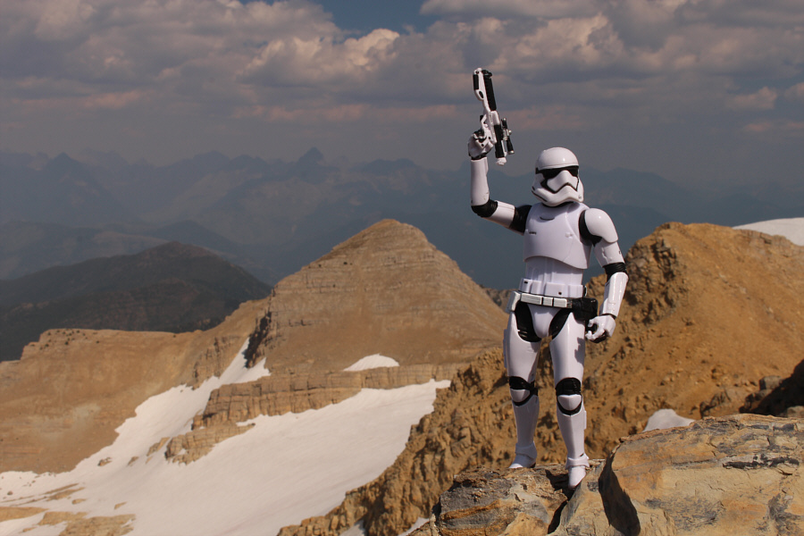
Sonny and Zosia stand on the summit of Great Northern Mountain (2649 metres).


Not sure if I really wanna come back to climb Grant... To the southeast is Mount Grant (right).
This glacier is quickly disappearing! 
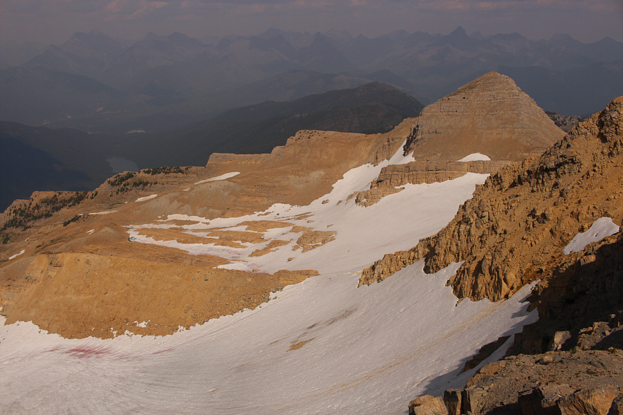
Part of Stanton Glacier can be seen on the north side of Great Northern Mountain.
After spending about 75 minutes on the summit, Zosia and I began our descent.  Some care and attention are needed to safely descend the crux and negotiate the maze of braided trails on the upper mountain, but once we got past the first false summit, we were able to relax and settle into a long but uncomplicated plod down the rest of the northwest ridge.  As if we had not suffered enough though, the hot afternoon sun was becoming increasingly unbearable and threatened to fry our heads.  We found some relief from the occasional breeze or trying to stay in whatever shade we could find on the ridge.  Our water supply was still okay, but I was really craving something cold to drink.  We eventually found more shade when we re-entered the forest, but because of a lack of wind, the air there was just as stifling.  Worst of all was the bone-jarring descent of the World's Most Brutally Steep Trail--a truly soul-sucking experience.  Fortunately, a cold splash and dunk in Hungry Horse Creek near the trailhead did wonders for reviving our spirits, and when we were thoroughly refreshed, we subsequently drove to a secluded bay along Hungry Horse Reservoir to enjoy a well-deserved dinner.
It's about a 3-hour descent to the trailhead from here... Zosia starts to head back down the northwest ridge.
She actually missed the arch on the way up. 
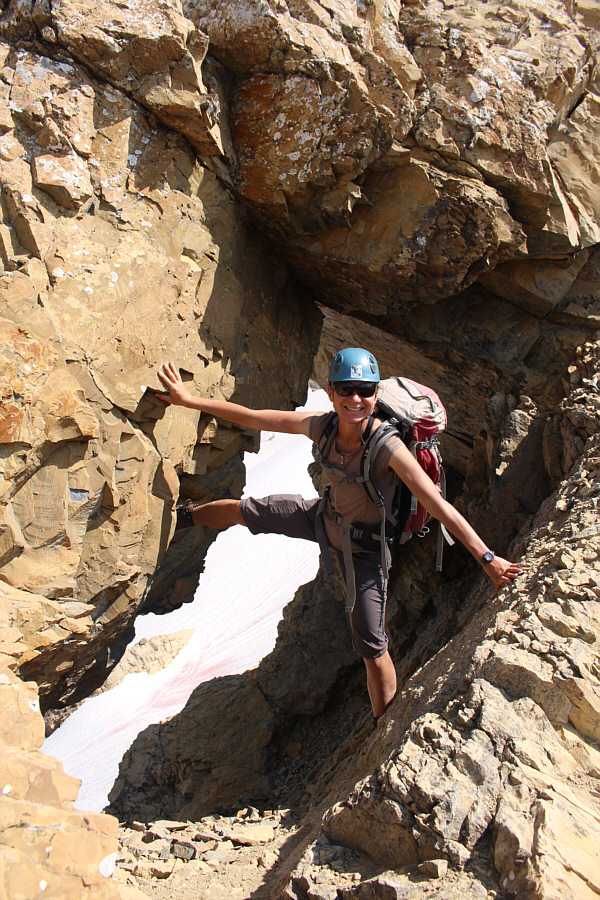
Zosia has some fun at a natural arch along the ridge.
Was this worth hauling ski and bivy gear all the way up here? Hmmm... 
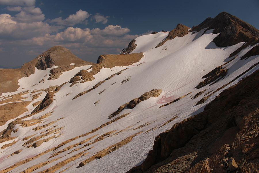
Here is a more comprehensive view of Stanton Glacier.  Note the ski tracks.
Dreaming of an ice-cold beer right now... Past all technical difficulties, Zosia continues down the northwest ridge.
It wouldn't take much for some parts of the trail to collapse here... 
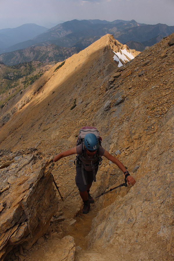
Zosia carefully walks along an exposed section of the trail.

Getting baked by the sun!

Here is a last look at the west face of Great Northern Mountain.


The red chair belongs to a couple of kayakers who allowed us to eat dinner at their campsite. They actually left their dog with us while they went out kayaking! 
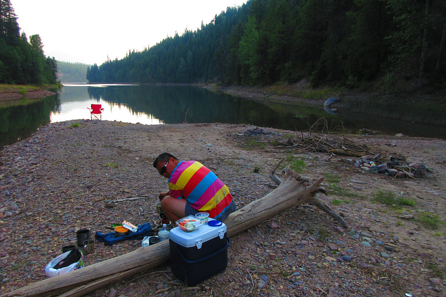
Sonny cooks dinner beside where Hungry Horse Creek empties into Emery Bay of Hungry Horse Reservoir.

Photo courtesy of Zosia Zgolak


The upper mountain is more than just a walk-up, and the lower section in the forest is simply brutal...both ways! Total Distance:  13.2 kilometres
Round-Trip Time:  9 hours 45 minutes
Net Elevation Gain:  1382 metres

GPX Data