BOU AVENUE
Camel's Hump West
On our way to Castlegar, British Columbia (BC) on 30 December 2018, Zosia
Zgolak and I stopped near Kootenay Pass to ski up a ridge unofficially
known as Camel's Hump West. A route description can be found at
BackcountrySkiingCanada.com. The route starts at an access road next
to a chain-up area on the north side of Highway 3 about 5.3 kilometres
east of Kootenay Pass. Since the chain-up area is frequently used
by large trucks (a sign here forbids parking for more than an hour), it
is better to park a little further east at another pullout on the south
side of the highway.
After carefully crossing the highway to the chain-up area, we strapped on
our skis and proceeded up the access road which runs briefly through the
forest before intersecting a wide power line/pipeline right-of-way.
Turning westward, we followed the right-of-way which climbs almost
imperceptibly up the valley. Although we were able to follow some
old tracks, a recent fresh dump of snow ensured that we (or rather,
Zosia) would be breaking trail for the entire ascent. A few
kilometres up the valley, the right-of-way turns southward and splits in
two--one for the power line and one for the buried pipeline. The
two rights-of-way run parallel to each other for about half a kilometre
before the pipeline splits for good to ascend Wolf Ridge to the west.
We essentially stuck with the power line until it, too, turned westward,
and at this point, we began a steep grunt up a forested slope to gain the
southwest ridge of Camel's Hump West. Zosia was heroic in breaking
a trail through fresh, untracked powder all the way up to the ridge
crest, and even though I was following behind in her tracks, I still had
a hard time keeping up with her. Upon reaching the ridge crest, we
turned northeast and had no difficulties climbing at a more moderate
angle up to the heavily corniced high point.
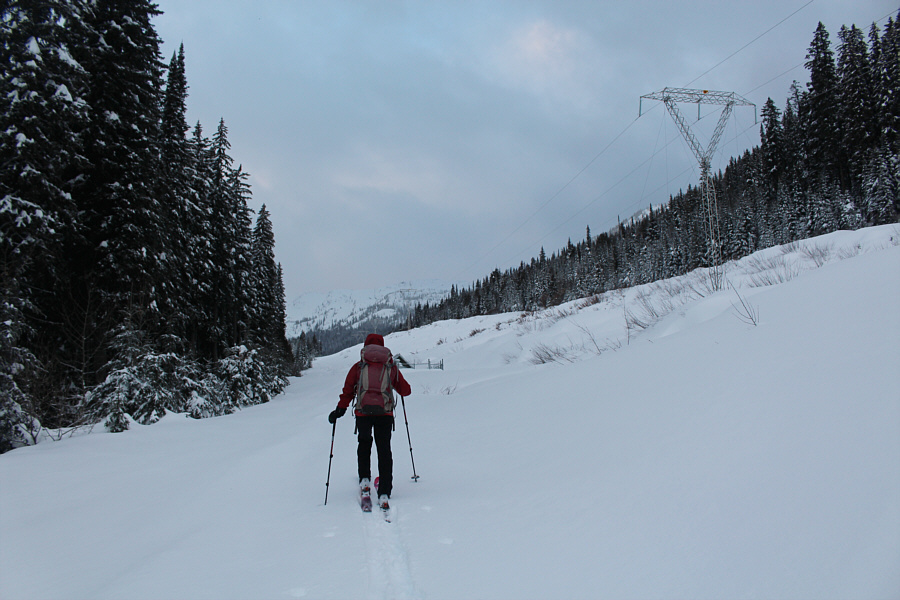 |
Zosia starts the long approach by
following the power line. |
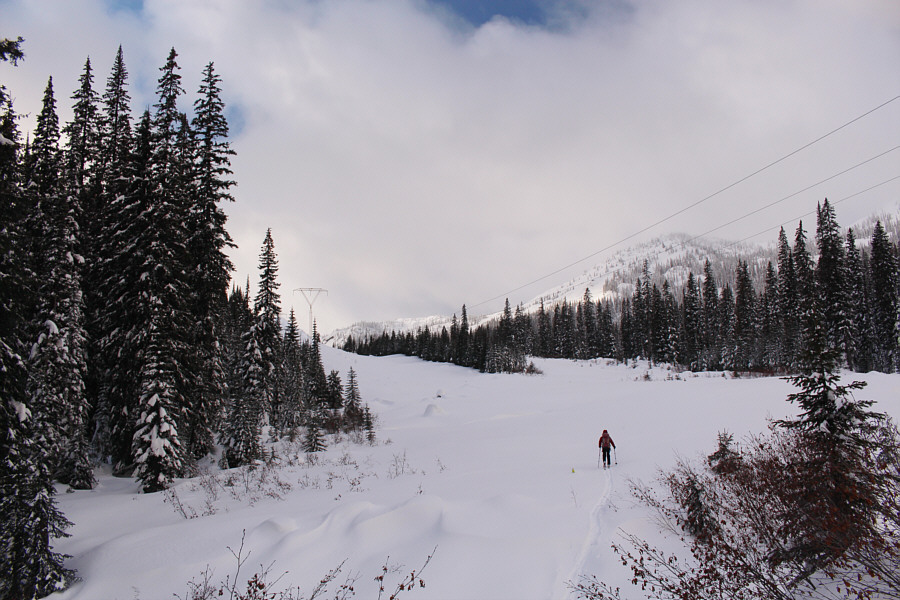 |
The power line turns south here while
the natural gas pipeline right-of-way splits off to the right.
The pipeline right-of-way runs parallel to the power line for the
next half a kilometre or so. |
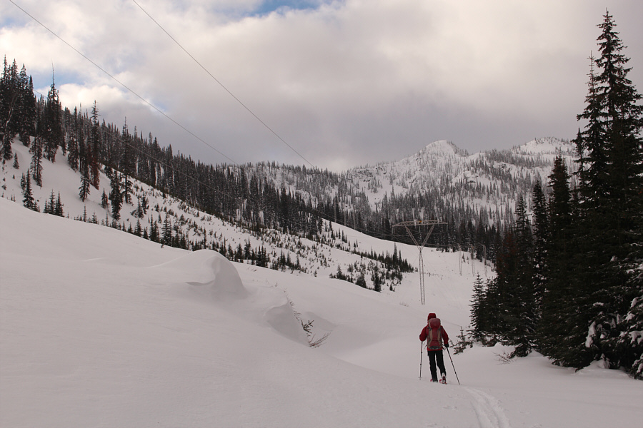 |
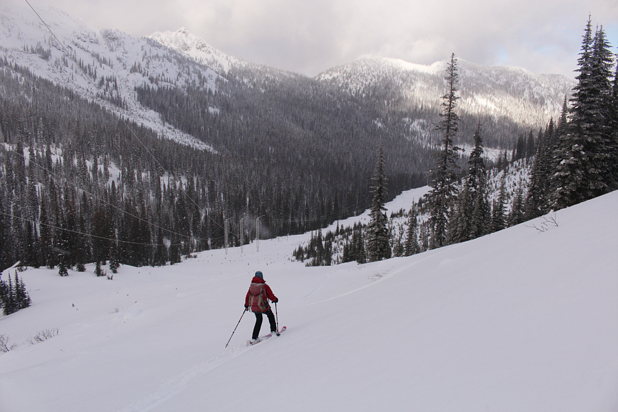
After following the pipeline
right-of-way for awhile, Zosia skis back under the power line which
begins to rise near the head of the valley. |
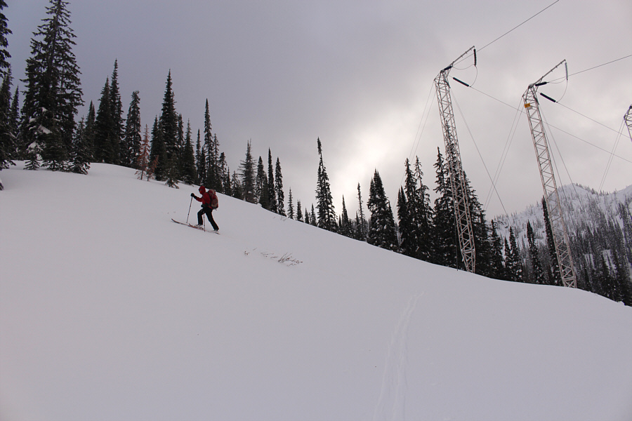 |
Zosia begins to climb more steeply as
she turns away from the power line. |
 |
Zosia does a heroic job of breaking
trail all the way up to the ridge crest. |
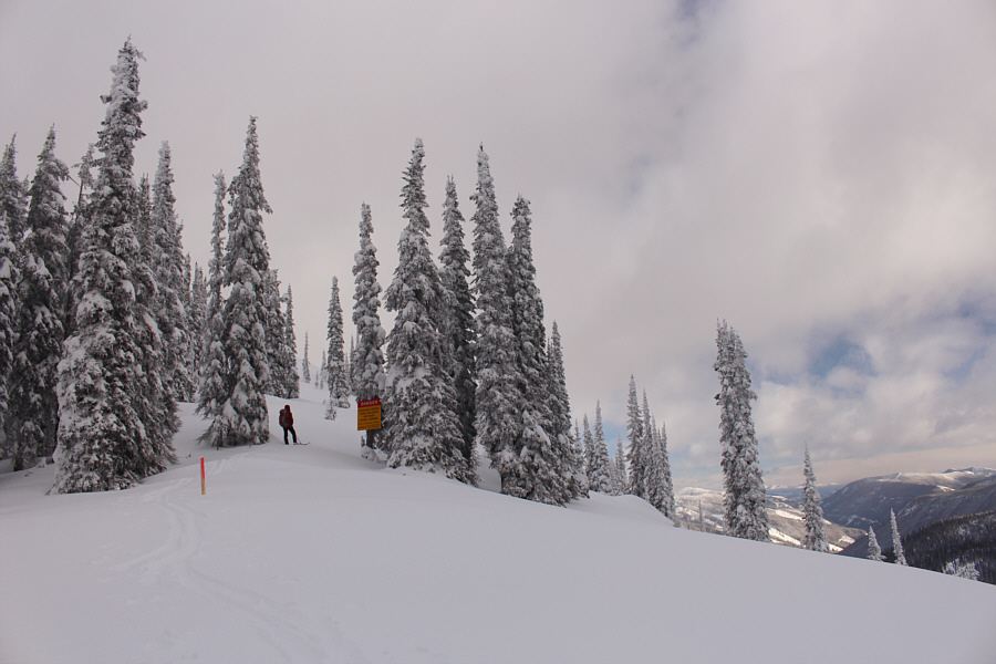 |
On the ridge leading to Camel's Hump
West, Zosia pauses to read a warning sign about the potential for
avalanche control activities on the slopes to the right. As
such, these same slopes are off-limits to the public. |

Zosia approaches the top of Camel's Hump West.
Behind her, Kootenay Pass is at the top of the "S" in the highway.
Cornice Ridge
is also visible at right.
 |
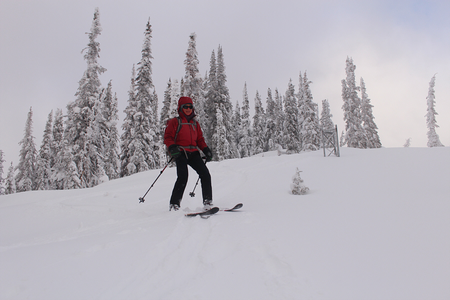
Zosia and Sonny stand on the high point of Camel's Hump West (2056
metres). |
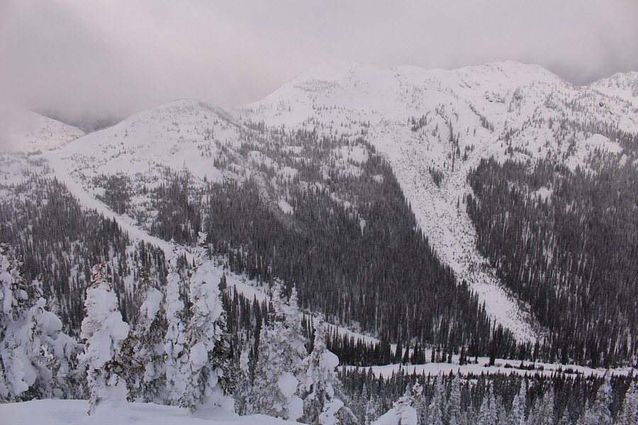 |
A pipeline right-of-way gives easy access to Wolf Ridge to the northwest. |
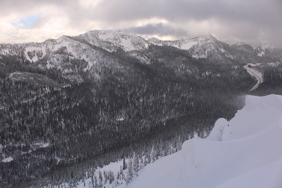 |
To the south, The Crags (left of
centre) and Baldy Rocks (right) are a couple more ski objectives to
consider for the future. |
After taking a short break on top, we removed our skins and skied back
down the way we came. As tempting as it was to ski the open south slopes
directly back to the highway, this area is off-limits during winter
because the BC Ministry of Transportation routinely does avalanche
control work here. Regardless, we had more than enough fun skiing down
the bumpy ridge and the steep forested slope, and all too soon, we were
back at the power line and retracing our tracks down the right-of-way. Despite muddling through some long flat stretches and a couple of short
uphill sections, we never had to put our skins back on and easily cruised
back to the highway on our own broken trail.
Back at my car, we packed up and drove to Kootenay Pass where we stopped
briefly to take a few photographs of our ski objective before resuming
our journey to Castlegar.
 |
Zosia skis down the same ridge that
she climbed up. |
 |
The powder skiing in the trees is
fantastic on this day. |
 |
Zosia skis back down under the power
line. |
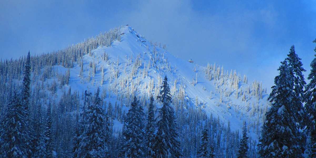
In this view from Kootenay Pass, some other skiers can
be seen on the high point of Camel's Hump West. Some avalanche
control equipment is also visible just below the high point and on the
right-hand ridge.
Photo courtesy of Zosia Zgolak
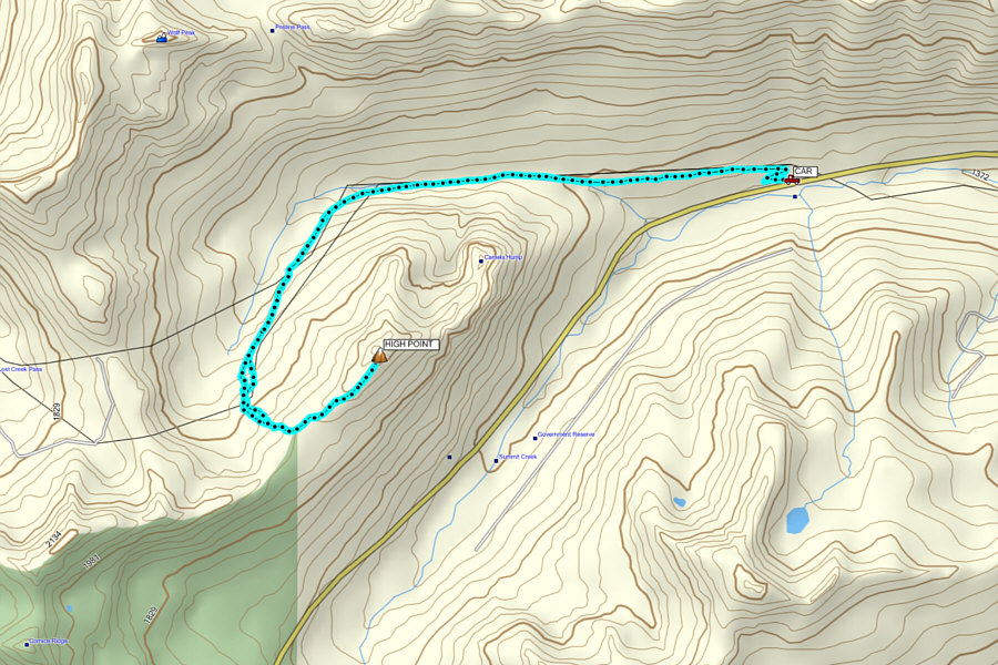 |
Total
Distance: 11.1 kilometres
Round-Trip Time: 5 hours 45 minutes
Net Elevation Gain: 630 metres
GPX Data |